Enjoy a North Yorkshire Walk Featuring the River Ure and Cover Bridge Inn
Begin your North Yorkshire walk by parking in the centre of Middleham. You’ll find ample space on the cobbled areas known as the ‘Town Wastes’, located in Market Place. Middleham’s town centre has everything you might need on your walk: cafés, a village store, pubs, and public toilets, which are tucked away down a narrow alley beside the left-hand side of the Richard III Hotel.
Start your walk from the old stone cross in the middle of Market Place. The cross stands on four steps and is accompanied by an interpretation board, which provides helpful information about the town layout. From the cross, head uphill along the road, passing a red telephone box and a wall sign for Middleham Castle. Continue in this direction towards Swine Cross. At Swine Cross, turn left and walk up to Middleham Castle.
Walk past the front of the castle and turn right onto a tarmac road, which soon becomes a stone track. This is a public footpath to Cover Banks and forms part of the Six Dales Trail. For a short detour, you can visit William’s Hill Ring & Bailey by taking a footpath on the right, crossing fields uphill.
Continue heading south along the Six Dales Trail for around two-thirds of a mile. The route follows the edge of several fields and crosses the racehorse gallops used by local stables. Eventually, the path drops down into a wooded valley. At the bottom, turn left onto a narrow path, which soon merges with a broader public footpath running alongside the River Cover. Keep the river to your right and follow the trail, ignoring any paths branching left uphill. Yellow footpath markers appear occasionally to confirm you’re on the right route.
After about three-quarters of a mile, you’ll reach stepping stones across the River Cover. Do not cross—keep straight on, maintaining your route along the Six Dales Trail. If in doubt, stay on the path closest to the river. A little over half a mile further, the path meets the A6108.
Turn right onto the main road, following signs for Masham and Ripon. Walk past the Cover Bridge Inn, turn right, and continue across the bridge. Immediately after crossing, turn left onto a public footpath, still following the Six Dales Trail. This well-defined trail runs alongside the River Ure, now on your left.
Follow this lovely riverside path for just over a mile and a half. The path eventually ends at a fence. Go through the gate on your right and follow the public footpath signs for the Six Dales Trail until you meet the A6108 again. Turn left onto the road, once more following the Six Dales Trail, and continue towards Jervaulx Abbey.

Pass Jervaulx Hall on your left. Soon after, you’ll reach the entrance to Jervaulx Abbey Tearooms on your right, which you may wish to visit. If not, turn left through the metal gates into Jervaulx Park. Follow the path to a crossroads. If you’d like to explore the abbey, go straight ahead. Otherwise, turn right and follow the broad tarmac track across the park.
Walk through the park for just over half a mile. Just before a large pond, turn right onto a track that leads to a large stone house. Cross the cattle grid to exit the park. Cross the main road and go through a small gate on the opposite side, staying on the Six Dales Trail. A sign points towards the Brymor Ice Cream Parlour.
The footpath avoids the roadside by skirting the left-hand edge of fields. Soon you’ll reach the top of the lane leading to the parlour. Continue straight across the lane and over a stile, keeping to the Six Dales Trail. Walk along the edge of a large field and cross a tall wooden stile. From here, follow the faint path diagonally uphill to the right, where it meets a bridleway.
This bridleway is part of the Six Dales Trail and follows the line of a shallow ditch. It climbs steeply up a grassy slope. Eventually, you’ll reach a small wooden gate in the field corner. To the right is a public footpath, but you should turn left, staying on the bridleway. Go through a larger metal gate and continue straight uphill along the track.
The track leads to a minor road beside Ruskill Bank Farm on the eastern edge of Ellingstring. Turn right and follow the road into the village. Walk all the way through Ellingstring, passing the Wesleyan Methodist Chapel on your left and School House on your right. At a property called Green Corner, turn right onto a public bridleway.

This enclosed bridleway leads to a tarmac lane. You won’t be able to turn right, as it leads to a private house called Mellwood. Don’t continue straight on either. Turn left onto the lane, then immediately right onto a public footpath that cuts diagonally downhill across fields. Cross three large fields as you descend, with High Newstead Farm visible to your right.
In the third field, aim for the bottom right-hand corner. Exit the field and cross the road. Follow the lane leading towards Hammer Farm. On the approach to the farm, a sign asks walkers to take a diversion around the farm. This is simple: turn left and follow the quarry track uphill. At the top, turn right onto a public footpath and descend once again.
Continue downhill for about half a mile, passing Thirsting Castle Lodge on your right. Carry on down the quiet country lane for a further third of a mile to walk through Waterloo Farm. The road then continues for another half mile, curving right and descending into Low Thorpe on the approach to East Witton.
At the end of the lane, enter the village and turn left. Make your way up the main street to the top (west) end of East Witton. Leave the village by a narrow, single track road, passing a house called Windsong on your right. Soon after, turn right onto a public footpath across fields, signposted to Hullo Bridge—not Middleham.
Cross several fields to reach West Field Lane and continue straight ahead. This wide stone track narrows to a hedge-lined path before entering woodland. Waymarkers guide the route through the trees. On leaving the woods, follow a grassy path for about half a mile beside several small fields. Cross Red Beck Gill using a wooden footbridge and head diagonally across a large field to a gate in the far-right corner.
Keep straight on and drop down into the valley to reach Hullo Bridge. Cross the bridge and walk straight uphill with a dry-stone wall on your right. As the wall bends left, go through a gate on your right and follow a waymarked path diagonally across the next field. At the top, turn right and follow the road downhill into Middleham.
A narrow path runs beside the road, bringing you past the rear of Middleham Castle. This joins the Six Dales Trail once again. Turn left to return to the heart of the town and complete your North Yorkshire walk.
North Yorkshire Walk: Maps and Tools
Visit either the OS Maps website or the Outdooractive website to view this walking route in greater detail. Both platforms offer a range of features, including the ability to print the route, download it to your device, and export the route as a GPX file. You can also watch a 3D fly-over and share the route on social media. Additionally, this page includes a printable version of the walk in PDF format. Plus there is a supporting video, available for you to watch on YouTube.
North Yorkshire Walk: Distance, Duration, Statistics
Distance: 12 miles
Distance: 19½ kilometres
Duration: 5½ hours
Ascent: 1105 feet
Ascent: 337 metres
Type: Circular walk


Walking in the Yorkshire Dales with 43 Circular Routes
AD This Cicerone guidebook includes 43 circular walks exploring valleys, hills, and moors between Kirkby Stephen and Pateley Bridge. With OS maps, local highlights, and routes ranging from 3–11 miles, it is a year-round companion for walkers of all abilities.
Recommended Ordnance Survey Map
The best map to use on this walk is the Ordnance Survey map of Northallerton & Thirsk, reference OS Explorer 302, scale 1:25,000. It clearly displays footpaths, rights of way, open access land and vegetation on the ground, making it ideal for walking, running and hiking. The map can be purchased from Amazon in either a standard, paper version or a weatherproof, laminated version, as shown below.
About Middleham
Middleham is a historic market town and civil parish in the district and county of North Yorkshire. It’s located in Wensleydale, on the southern side of the valley, where the River Cover meets the River Ure. There has been a settlement here since Roman times, and the town appeared in the Domesday Book of 1086 under the name Medelai. My North Yorkshire walk begins right in the heart of Middleham’s town centre.
Although there’s no firm evidence of a Roman-era village, archaeologists discovered a rural villa in the 19th century, approximately 300 metres east of the present-day castle. It stood in farmland just south of the road to Masham. A branch road from the Roman highway known as Dere Street ran nearby, crossing the valley through Wensley and leading to the Roman site of Virosidium at Bainbridge.
Before the Norman Conquest, the land was held by a man named Gilpatrick. In 1069, William the Conqueror granted it to his cousin, Alan Rufus, who built a wooden motte-and-bailey castle above the town. By the time of the Domesday survey, Alan had handed control to his brother Ribald. The original earthworks remain visible today at William’s Hill. Alan also constructed the castle at Richmond.
Work on the stone-built Middleham Castle began in 1190. My North Yorkshire walk passes by this iconic site. The castle later came into the hands of the Neville family, Earls of Westmorland, through marriage to a female descendant of Ribald. Known as the ‘Windsor of the North’, it played a major role in national politics. Richard Neville, the 16th Earl of Warwick, owned the castle when his cousin Richard, Duke of Gloucester—later Richard III—arrived in 1462 to begin his knightly training.
During the Wars of the Roses, both Edward IV and Henry VI were held prisoner at the castle. Richard took full control in 1471 following Warwick’s death at the Battle of Barnet. He ruled the North on behalf of his brother, Edward IV, and used Middleham as his base. In 1472, Richard married Anne Neville, Warwick’s daughter. Their son Edward was born at the castle around 1473 and died in 1484. Richard III was killed the following year at the Battle of Bosworth, the last reigning King of England to die in battle.
Under Richard’s rule, Middleham became a thriving market town and regional hub. In 1389, the Lord of Middleham Manor received permission to hold a weekly market and an annual fair on the feast of St Alkelda the Virgin. Two market areas remain today. The lower, larger space features Middleham Market Cross, which now carries a decorative iron cross in a Celtic style. The upper area, known as Swine Market, centres on the remains of the 15th-century Swine Cross and a flight of steps. One end shows a worn carving of a reclining animal, while the other may once have featured a sculpted capital.
Many buildings in the older parts of town date back to before 1600. The old rectory still includes some medieval details. By 1607, Middleham was significant enough to host a royal court serving the forest of Wensleydale. The town and nearby lands stayed in Crown hands from Richard III’s reign until Charles I sold the manor to the City of London around 1628. In 1661, the manor was sold to Thomas Wood of Littleton, and it has remained privately owned ever since. Although the weekly market faded in importance, the livestock fair continued until the early 20th century. Today, livestock trading takes place in nearby Leyburn.
Modern-day Middleham is best known for horse racing. It’s home to several training yards and the Middleham Trainers’ Association. Isaac Cape, the town’s first known racehorse trainer, started work here in 1765. Today’s trainers include Mark Johnston, Jedd O’Keeffe, James Bethell, and Ben Haslam. Racing is the town’s biggest employer, followed by tourism. Although the castle was dismantled in 1646, its massive stone keep—built by Robert Fitz Ralph in the 1170s—still stands, along with the 13th-century chapel and 14th-century gatehouse.
Middleham remains a lively place with a strong community spirit. You’ll find pubs, a village shop, a fish and chip shop, a tearoom, bed and breakfast accommodation, a primary school and nursery, and a community venue known as the Middleham Key Centre. The photograph shows the Richard III Hotel. The neighbouring building once housed a tearoom called The Nosebag. It’s now a Racing Welfare office offering support and advice to hundreds of stable staff based in and around the town.
If you’re looking to combine local history with scenic walking, this North Yorkshire walk from Middleham makes for a fascinating and rewarding day out.
North Yorkshire Walk: My Photos
My North Yorkshire walk begins in the heart of Middleham, where I park in Market Place, on the cobbled area known as the ‘Town Wastes’. These cobbles stretch around Swine Cross and cover much of the west end of the town. A sign explains that parking here is free, though donations towards local upkeep are appreciated. Middleham is a leading centre for racehorse training, home to over 500 thoroughbreds stabled at 15 establishments in and around the town. Most mornings, they’re a regular sight heading up to the gallops on Low Moor. I’m fortunate to spot a few myself—always a thrill.

Grisport Unisex Adult Peaklander Hiking Boots
AD The Grisport Unisex Adult Peaklander Hiking Boots are crafted in Italy with a durable waxed leather upper, Spotex breathable lining, and a reliable Track-on rubber sole. Waterproof and weighing just 1120g, they offer comfort, resilience, and dependable performance on demanding trails.
At the centre of the market square stands a simple stone cross, raised on four steps. It has symbolised honest dealing since the 14th century. Middleham’s Market Place hosted regular fairs from 1388, when a charter was granted by Richard III, until the 1930s. Though it presents today as a largely Georgian market town, Middleham’s roots go deeper. Roman artefacts have been uncovered, but it’s the mediaeval period—and the town’s ties to Richard III—that bring it lasting fame.

Next to the cross, I find an interpretation board that helps me get my bearings. From here, I follow the road towards the castle. It passes a classic red telephone box and a wall sign pointing clearly to Middleham Castle.

Grisport Unisex Adult Peaklander Hiking Boots
AD The Grisport Unisex Adult Peaklander Hiking Boots are crafted in Italy with a durable waxed leather upper, Spotex breathable lining, and a reliable Track-on rubber sole. Waterproof and weighing just 1120g, they offer comfort, resilience, and dependable performance on demanding trails.
Before reaching the castle, I arrive at what I believe is called Swine Market—a lovely spot just a minute from Market Place. Another interpretation board displays a map and highlights several local features, including Jubilee Fountain, the Old School, and the Methodist Church.

Jubilee Fountain was built to commemorate Queen Victoria’s Golden Jubilee, funded by public subscription. It’s a striking structure, completed at a cost of £150 and once fed by water from the upper Dales. Although it still functions, it was turned off at the request of local residents—the slightest breeze would soak passers-by.


Fifty Walks Across the Beautiful North York Moors National Park
AD Discover 50 routes across the North York Moors, from short easy strolls to challenging high-level hikes. With OS maps, route descriptions, and local highlights, it also includes the legendary 40-mile Lyke Wake Walk, described in four accessible stages.
The Old School, built in 1869 in Victorian Gothic style, served the town’s children for many years. Its bell still hangs in the tower. Since its closure, the building has taken on several roles: a gallery, a tea room, and an arts and crafts workshop. It is now a private home.

Middleham’s Methodist Church reflects the strength of the Methodist tradition in the Dales. Enlarged in 1914, it stands diagonally opposite the original chapel, now a residence. The church closed for worship in February 2019 and has since been sold.

Fifty Walks Across the Beautiful North York Moors National Park
AD Discover 50 routes across the North York Moors, from short easy strolls to challenging high-level hikes. With OS maps, route descriptions, and local highlights, it also includes the legendary 40-mile Lyke Wake Walk, described in four accessible stages.
In Swine Market, I pause to admire Swine Cross, built in the 15th century. It commemorates the 1479 grant allowing Middleham to hold fairs during Whitsun and on the feast of Saints Simon and Jude. The grant came from the future Richard III. The cross has two pedestals: one carved with an animal—possibly a swine or a white boar, the emblem of the House of Neville, which held Middleham Castle. The other pedestal may show a mediaeval capital—the broad, carved stone at the top of a column, designed to distribute the weight above.

There’s much more to see here, and I’m tempted to linger. But this North Yorkshire walk is a long one, so I press on. The interpretation board also mentions Middleham Hall, Neville Hall, and several small green spaces known as Plantations—pockets of greenery that break up the otherwise grey limestone of the Georgian townscape.


Osprey Hikelite Unisex Backpack for Comfortable and Lightweight Hiking
AD The Osprey Hikelite backpack combines lightweight design with practical features, including a breathable mesh back panel, soft webbing straps, and stretch mesh water bottle pockets. With zipped storage and an organiser compartment, it is ideal for day hikes and outdoor use.
North Yorkshire Walk: Middleham Castle
Just around the corner, I reach Middleham Castle. Construction began in 1190, led by Robert FitzRandolph, 3rd Lord of Middleham and Spennithorne. Richard III spent much of his youth here, though little of his reign. The castle was intended to guard the route from Richmond to Skipton, though some believe an earlier site offered a better defensive position. After Richard’s death, the castle remained in royal hands until the 17th century, when it was allowed to fall into ruin. Many of its stones were repurposed for buildings in the village.

Entry to the castle is through a tall, 15th-century tower in the north-east corner. The original gate faced east, leading into an outer courtyard, but only the foundations survive. In the 14th century, this entrance was reinforced with an arch and turrets, and the walls were fitted with clever openings for defenders to fire upon attackers. While some sections have collapsed, much of the outer wall still stands, offering a clear sense of the original structure.

Osprey Hikelite Unisex Backpack for Comfortable and Lightweight Hiking
AD The Osprey Hikelite backpack combines lightweight design with practical features, including a breathable mesh back panel, soft webbing straps, and stretch mesh water bottle pockets. With zipped storage and an organiser compartment, it is ideal for day hikes and outdoor use.
At the heart of the site is the massive Norman keep—one of the largest in England. Rectangular in shape, it features thick stone walls and towers at each corner and halfway along each side. Inside, a dividing wall splits it into two levels. The ground floor contains two large vaulted chambers, while the upper floor holds grand halls with tall windows. The original entrance was via an external staircase to the first floor, typical for the time. A chapel was later added near the entrance. Today, a restored spiral stair in the south-east tower leads up to the battlements, offering sweeping views of the landscape and the earlier motte.

The 13th-century curtain wall surrounds the keep, creating a compact but heavily fortified structure. In the 15th century, the influential Neville family transformed the site into a grand residence. They added luxurious living quarters along the inner walls and connected these to the keep via elevated walkways. The ceiling above the great hall was raised to admit more light—or perhaps to add another storey. Though much of this has since crumbled, the castle remains an evocative ruin, full of history.


Peak Bagging Wainwrights with Routes to Complete All Fells
AD This comprehensive guide offers 45 circular routes linking all 214 Wainwright fells. With maps, GPX downloads, elevation profiles, and practical advice, it provides efficient yet inspiring ways to complete this classic Lake District challenge at your own pace.
Leaving the castle, I detour to a site shown on the Ordnance Survey map as William’s Hill Ring & Bailey. It marks the location of an earlier motte and bailey castle. These early fortifications typically featured a high mound with a wooden or stone keep and an enclosed bailey at its base, surrounded by ditches and timber palisades. Although long abandoned, the layout is still visible. The motte rises clearly, and the surrounding ditch is easy to trace. Even at just 180 metres, the views back to Middleham Castle and the countryside are superb.

Returning to the Six Dales Trail, I head south from Middleham and cross the gallops of Manor House Farm. These specially prepared tracks allow horses to build speed and stamina. In a town like this, they’re an essential feature of the landscape.

Peak Bagging Wainwrights with Routes to Complete All Fells
AD This comprehensive guide offers 45 circular routes linking all 214 Wainwright fells. With maps, GPX downloads, elevation profiles, and practical advice, it provides efficient yet inspiring ways to complete this classic Lake District challenge at your own pace.
The trail leads me down to the River Cover. A charming riverside path takes me past a series of broad, flat stepping stones that cross the river. I admire them from the bank, though I won’t be crossing today.

This stretch of my North Yorkshire walk is particularly delightful. The narrow trail hugs the riverbank, where the water flows slow and golden brown. The colour comes from the peat and organic matter washed downstream from the surrounding moorland. It’s a glorious day to be out walking.


Berghaus Hillmaster II GTX Men's High Rise Hiking Boots
AD The Berghaus Hillmaster II GTX men’s hiking boots feature a waterproof, breathable GORE-TEX membrane, a memory foam tongue and collar for a personalised fit, and a Vibram sole delivering exceptional grip, stability, and shock protection for confident performance on any terrain.
North Yorkshire Walk: The Cover Bridge Inn
I soon arrive at the Cover Bridge Inn, a historic coaching inn that has welcomed travellers for centuries. Once known as the Forresters Arms—and earlier, the Masons Arms—it stands beside the River Cover, just upstream of its confluence with the River Ure. This was once a key crossing point, connecting Richmond with Coverdale and the steep, winding route over Park Rash into Wharfedale.

The inn’s central T-shaped core likely dates from around 1670. This was a period of increased trade and movement along the drovers’ route through Coverdale. By 1695, the area was busy enough to sustain establishments like this one, offering rest, food, and ale to farmers, traders, and packhorse travellers. Inside, the atmosphere remains steeped in history. Low-beamed ceilings, worn stone floors, and wooden settles surround a crackling log fire. The Cover Bridge Inn is renowned for its welcome and fine selection of real ales, including local favourites such as Theakston’s Best Bitter, Old Peculier, Timothy Taylor’s Landlord, and Semer Water from the Wensleydale Brewery.

Berghaus Hillmaster II GTX Men's High Rise Hiking Boots
AD The Berghaus Hillmaster II GTX men’s hiking boots feature a waterproof, breathable GORE-TEX membrane, a memory foam tongue and collar for a personalised fit, and a Vibram sole delivering exceptional grip, stability, and shock protection for confident performance on any terrain.
Continuing my North Yorkshire walk, I follow the Six Dales Trail alongside the River Ure. It’s a magical stretch of countryside. The calm, glassy surface of the river mirrors the trees on the far bank and the clear summer sky above. Tall grasses and wildflowers ripple in the breeze, while the open pasture stretches away under the sheltering arms of an old oak. It’s peaceful, picturesque, and full of colour.

A large, cut tree trunk beside the river provides a perfect resting spot. Dry and sturdy, it’s just right for a quick sit-down. I pour a coffee from my flask, enjoy lunch, and take in the quiet beauty around me. After a short break, I’m ready to continue my North Yorkshire walk.


Kendal Mint Co Energy Gel with Citrus and Mint Flavour
AD Kendal Mint Co energy gels deliver 27g of fast-absorbing carbohydrates plus electrolytes and B vitamins for improved performance. Vegan, gluten free, and Informed Sport certified, these caffeine-free gels are refreshing, easy to digest, and ideal for running, cycling, and endurance.
The path leads further along the Ure until it’s eventually fenced off. I can’t continue along the riverside here, so I turn right through a gate. This leads me to the A6108 road and on towards Jervaulx Park.
Before entering the park, I make a short detour to the Jervaulx Abbey Tearooms. Unfortunately, I’ve come on a Wednesday, and the sign on the gate says they open Thursday to Sunday, from 10am to 4pm. The sign also suggests looking at their website for updates: https://www.jervaulxabbey.com/visit-us-tearooms. According to the site, the tearoom prides itself on homemade treats, excellent coffee, and warm hospitality. Set in a charming garden, it offers a cosy spot to relax after exploring the abbey. I make a mental note to return another day.

Kendal Mint Co Energy Gel with Citrus and Mint Flavour
AD Kendal Mint Co energy gels deliver 27g of fast-absorbing carbohydrates plus electrolytes and B vitamins for improved performance. Vegan, gluten free, and Informed Sport certified, these caffeine-free gels are refreshing, easy to digest, and ideal for running, cycling, and endurance.
Through Jervaulx Park, I follow a track, taking care not to continue too far along the main stony route towards Kilgrim Lane. Just before reaching a large pond, I turn right onto a secondary path, which leads to the main road at Masham Bank.

From the track across the park, I glimpse the ruins of Jervaulx Abbey. Founded in 1156 by Cistercian monks who had previously settled at Byland Abbey, it was built on principles of simplicity, hard work, and self-sufficiency. The monks farmed the land, grazed sheep, and played a key role in the early development of Wensleydale cheese. The abbey was dissolved in 1537 under Henry VIII’s sweeping religious reforms. Today, the ruins are privately owned but open to the public for a donation. It’s a peaceful, evocative site in the heart of the Dales. I’ve visited before, but time doesn’t allow a stop today.


Thermos Stainless King Flask for Travel and Daily Adventures
AD The Thermos Stainless King 470ml flask keeps drinks hot for 18 hours or cold for 24. With durable stainless steel, vacuum insulation, a serving cup, and a leakproof design, it is perfect for commutes, journeys, and outdoor adventures.
The exit from Jervaulx Park brings me to the A6108 at Masham Bank, where I cross a cattle grid beside a large stone house. On the other side of the road, a small gate leads onto a public footpath running parallel to the road. A signpost reads: “To High Jervaulx Farm, Brymor Ice Cream (on farm footpath to avoid road)”.

The footpaths and bridleways from Masham Bank require a bit of careful navigation, but I eventually make my way into the village of Ellingstring. Historically part of the wapentake of Hang East, Ellingstring was within Harrogate Borough from 1974 to 2023 and is now governed by North Yorkshire Council. In 2012, the parish population was estimated at just 80. First recorded in 1198 as Elingstrengge, the name combines the Old English Ella and the Old Norse strengr, meaning watercourse.

Thermos Stainless King Flask for Travel and Daily Adventures
AD The Thermos Stainless King 470ml flask keeps drinks hot for 18 hours or cold for 24. With durable stainless steel, vacuum insulation, a serving cup, and a leakproof design, it is perfect for commutes, journeys, and outdoor adventures.
As I pass through the village, I spot a classic red tractor—an old Massey Ferguson 135—parked proudly in a cottage garden. Its weathered paint, white canopy, and rusted metalwork, along with a number plate dating it to the mid-1970s, make it a textbook example of a well-loved working machine. It brings back fond memories of my own teenage years spent on a farm, driving one just like it.

At the western edge of Ellingstring stands School House, a fine stone building that once served as the village school. Now a private residence, it retains its original design and character, including the central bellcote over the front porch.
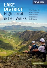
Lake District High Level and Fell Walks with Thirty Routes
AD This pocket-sized guide presents 30 routes on the Lake District’s highest fells, including Scafell Pike, Helvellyn, and Blencathra. With OS maps, colour photographs, and practical notes, it offers circular walks from 4–15 miles graded by difficulty.
North Yorkshire Walk: East Witton
From here, I set off on a three-mile route through the countryside. The terrain includes grassy paths, old stone bridleways, and quiet lanes. Eventually, I arrive in East Witton and begin walking west through the village. Situated at the mouth of Coverdale, East Witton lies near the confluence of the River Cover and the River Ure. The parish extends across lower Wensleydale and includes landmarks such as Braithwaite Hall and Jervaulx Abbey.

East Witton, originally just ‘Witton’, appears in the Domesday Book of 1086 as Witun. The name derives from Old English, meaning ‘wood settlement’, suggesting early links with timber-working. To distinguish it from West Witton, five miles further up the dale, the village became known as East Witton from the late 12th century. It was part of Richmondshire from 1974 to 2023 and is now under the administration of North Yorkshire Council.

Lake District High Level and Fell Walks with Thirty Routes
AD This pocket-sized guide presents 30 routes on the Lake District’s highest fells, including Scafell Pike, Helvellyn, and Blencathra. With OS maps, colour photographs, and practical notes, it offers circular walks from 4–15 miles graded by difficulty.
The earliest settlement centred on what is now Low Thorpe Lane, near the former church of St Martin in the Field. East Witton received a town charter in 1307 and briefly held a market, later relocated to Ulshaw during the Black Death. A short revival came in 1728. In the early 1800s, the Earl of Ailesbury rebuilt much of the village, keeping to the plot layout shown on a 1627 estate map.

The present-day church, built in 1809, stands near the eastern end of the village and replaced the older St Martin’s, now hidden among trees. A few gravestones remain there, including one for a pair of conjoined twins. The village green is a focal point, and three historic water taps can still be seen. These were in use until the late 1950s, when mains water was introduced from a new pumping station at Sowden Beck.


Super Sparrow Stainless Steel Insulated Water Bottle with Two Lids
AD The Super Sparrow stainless steel water bottle keeps drinks cold for 12 hours or hot for several. With a straw lid, bamboo cap, BPA-free construction, and durable 18/8 steel, it is ideal for sport, travel, work, and outdoor use.
Historically, the parish was divided into East Witton Town, including the village and Braithwaite, and East Witton Out, covering Jervaulx Park, Witton Moor, and Colsterdale. In 1866, these became separate civil parishes. Colsterdale was transferred to Healey in 1886 and later became a parish in its own right. In 2002, the two East Witton parishes were merged. The population has remained small: 258 in 2001, 246 in 2011, and around 240 in 2015.

From East Witton, I continue across open farmland and meadows in the direction of Hullo Bridge. Although it’s summer and some paths are a little overgrown, this stretch of my North Yorkshire walk is remarkably well maintained. The ground underfoot is mostly firm and pleasant. Ahead of me, in the distance, I spot Penhill—one of Wensleydale’s most recognisable landmarks.

Super Sparrow Stainless Steel Insulated Water Bottle with Two Lids
AD The Super Sparrow stainless steel water bottle keeps drinks cold for 12 hours or hot for several. With a straw lid, bamboo cap, BPA-free construction, and durable 18/8 steel, it is ideal for sport, travel, work, and outdoor use.
Nearing Hullo Bridge, I drop down close to the River Cover. The water is low, revealing a narrow channel carved into broad, flat slabs of exposed bedrock. It’s easy to see how the river has gradually sculpted the landscape, creating smooth ledges and chutes that guide its flow.

I cross the river using Hullo Bridge, a traditional single-arched stone bridge built from coursed stone. Its parapet walls curve gently and are capped with flat stones, typical of rural packhorse bridges. Though now part of a public footpath, its weathered surface suggests generations of use by carts and travellers.


Mountain Warehouse Merino Womens Long Sleeve V Neck Top
AD This Mountain Warehouse Merino top combines warmth, comfort, and practicality. Made with high-quality wool, it is naturally antibacterial, lightweight, and easy to pack. Designed for outdoor activities, it keeps you fresh and warm, and comes with a two-year warranty.
The final stretch of my North Yorkshire walk leads me past the south-facing walls of Middleham Castle. What a magnificent structure it is. Its soaring walls, stout buttresses, and rounded corner towers still command the landscape. Once both a stronghold and a noble home, the castle’s grandeur is undiminished, even in ruin. Before long, I’m back at the centre of town, where my journey ends.
