Explore Majestic Lake District Peaks and Valleys on the Causey Pike Walk
Your Causey Pike walk begins in the charming village of Braithwaite. From there, head east towards Newlands Beck Bridge, then journey south through farmland fields until you reach Little Braithwaite. Continue south along a minor road, skirting the forest-clad hill known as Swinside, until you arrive at the quaint hamlet also named Swinside.
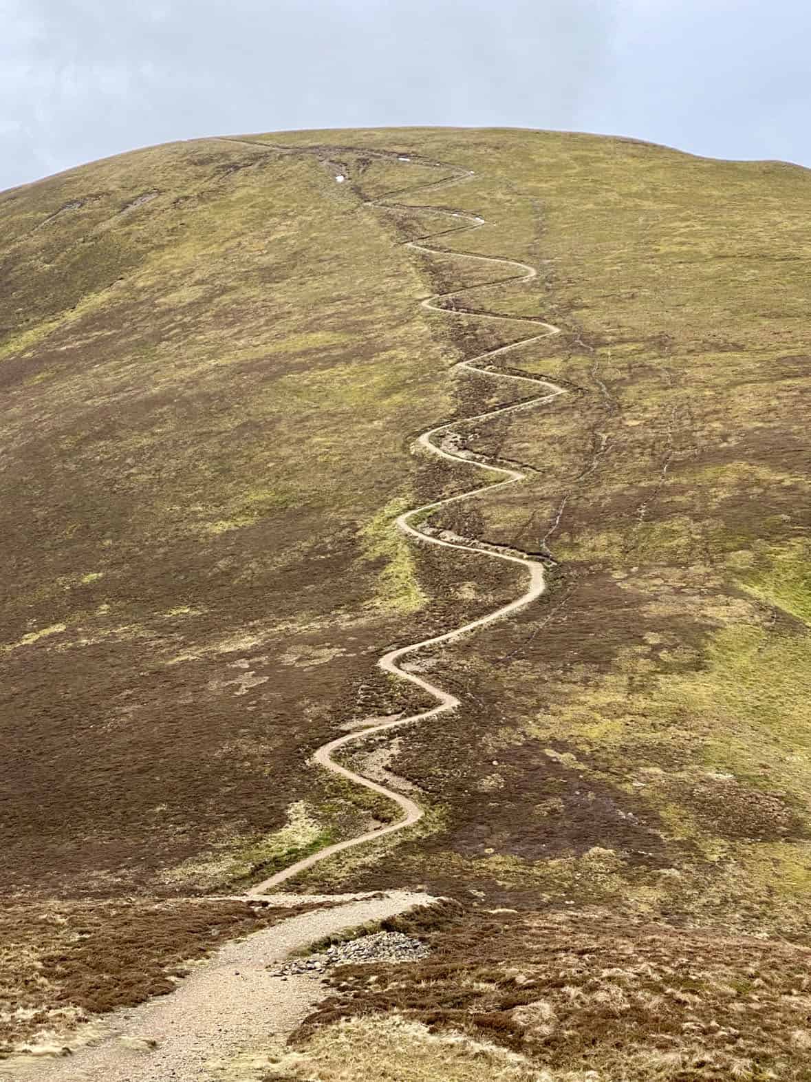
Press on south-west to the educational hub of the Newlands Centre at Stair, the start of your uphill trek. Ready yourself for a demanding ascent to the peak of Rowling End, a key segment of the Causey Pike walk. Venture west from Rowling End, crossing Sleet Hause, until you reach Causey Pike’s summit. This part involves a stimulating scramble, injecting some nervous excitement into your Causey Pike walk.
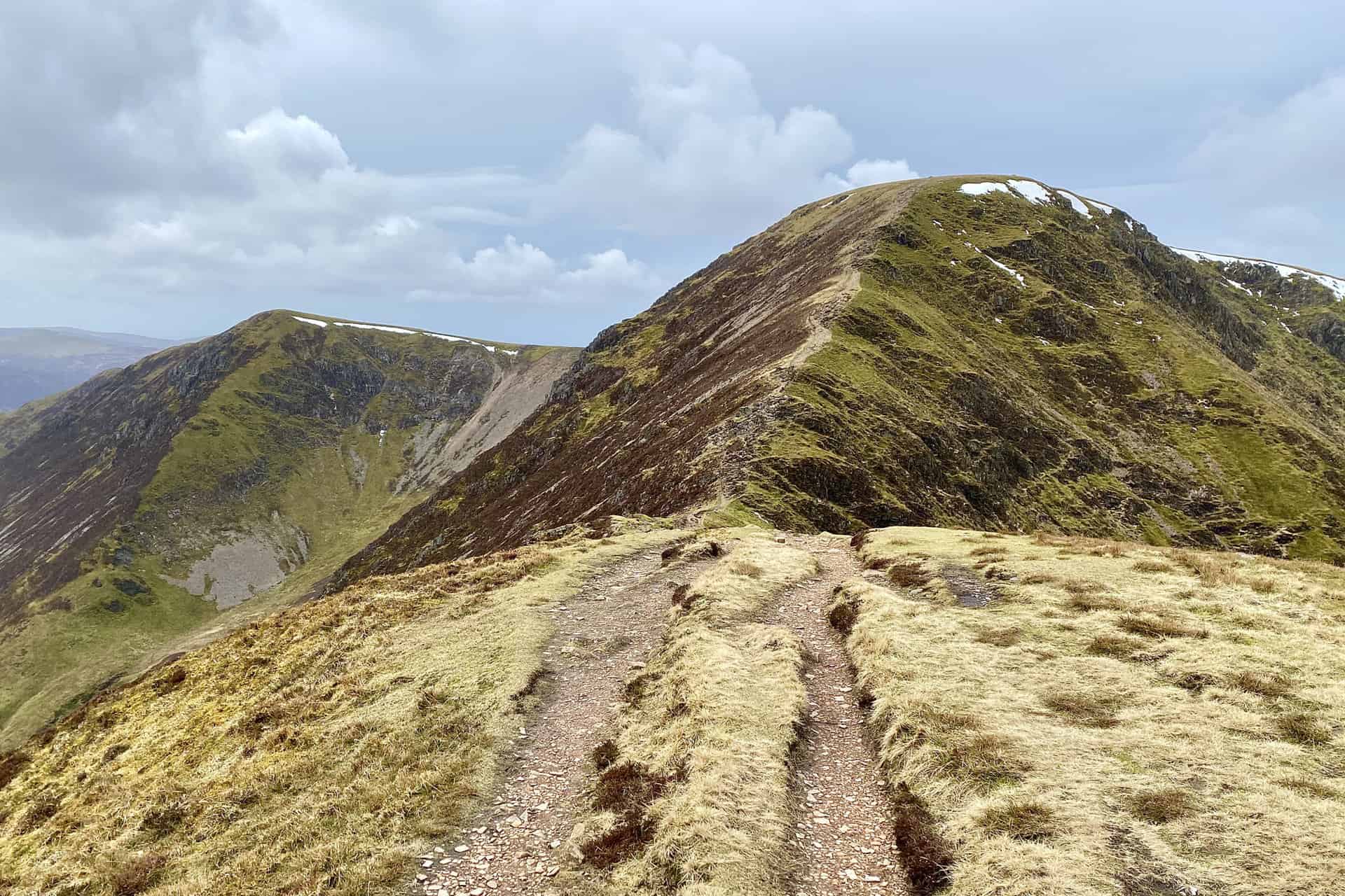
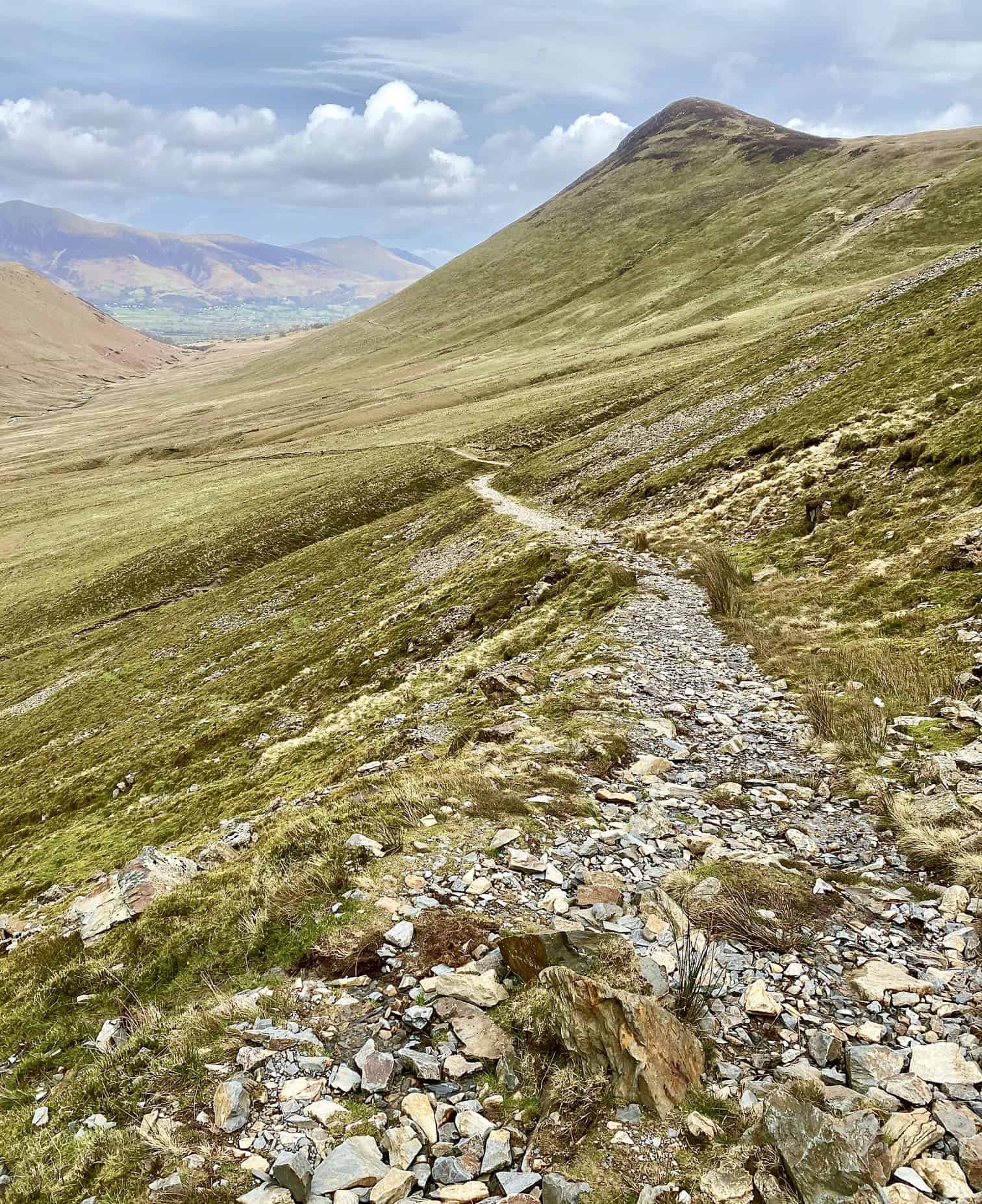
Carry on westward above Scar Crags, and follow the zig-zag track to reach Sail’s summit. Ascend Crag Hill via The Scar. Extend your Causey Pike walk by heading south-west to Wandope, with an optional detour across Whiteless Edge to the summit of Whiteless Pike. From there, you can enjoy breathtaking vistas of Buttermere and Crummock Water. Make your return across Wandope Moss to Coledale Hause, and down to the historic Force Crag Mine.
Conclude your 12-mile Causey Pike walk by heading north-east through the tranquil Coledale Beck valley, which brings you back to Braithwaite. While challenging in parts, this Causey Pike walk offers a delightful array of Lake District landscapes and vistas, making it a must-try for avid walkers.
Causey Pike Walk: Maps and Tools
Visit either the OS Maps website or the Outdooractive website to view this walking route in greater detail. Both platforms offer a range of features, including the ability to print the route, download it to your device, and export the route as a GPX file. You can also watch a 3D fly-over and share the route on social media.
Causey Pike Walk: Distance, Duration, Statistics
Distance: 12 miles
Distance: 19¼ kilometres
Duration: 6¾ hours
Ascent: 3713 feet
Ascent: 1132 metres
Type: Circular walk
About Causey Pike
Causey Pike is a distinctive Lake District fell located about 3½ miles south-west of Keswick town centre. Despite its relatively modest height of 637 metres (2090 feet), it is highly noticeable from the Derwent Water and Keswick area due to its prominent summit ‘nipple’. This feature makes it one of the most recognisable fells in the region. The fell is classified as the 119th highest Wainwright, as per the classification provided by Alfred Wainwright in his extensive Pictorial Guides to the Lakeland Fells. Specifically, Causey Pike is featured in Book Six: The North Western Fells. The panoramic views from the summit are extensive, offering impressive sights of Derwent Water, the Newlands Beck valley, as well as the Skiddaw, Blencathra, and Helvellyn mountain ranges. The fell’s Ordnance Survey grid reference is NY 218 208, and it is featured on the OL4 Explorer map and the 89 and 90 Landranger maps.
Recommended Ordnance Survey Map
The best map to use on this walk is the Ordnance Survey map of the Lake District North-Western Area, reference OS Explorer OL4, scale 1:25,000. It clearly displays footpaths, rights of way, open access land and vegetation on the ground, making it ideal for walking, running and hiking. The map can be purchased from Amazon in either a standard, paper version or a weatherproof, laminated version, as shown below.
Standard Version
Causey Pike Walk: My Photos
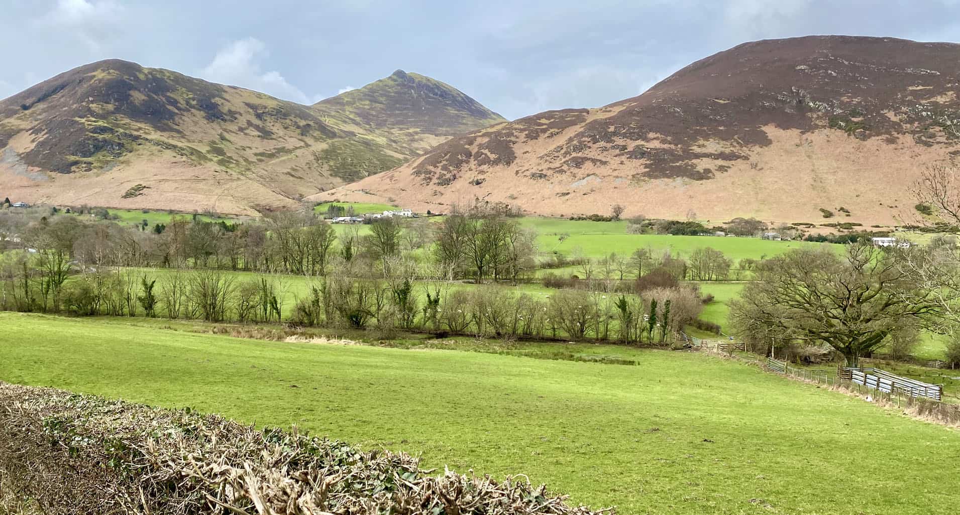
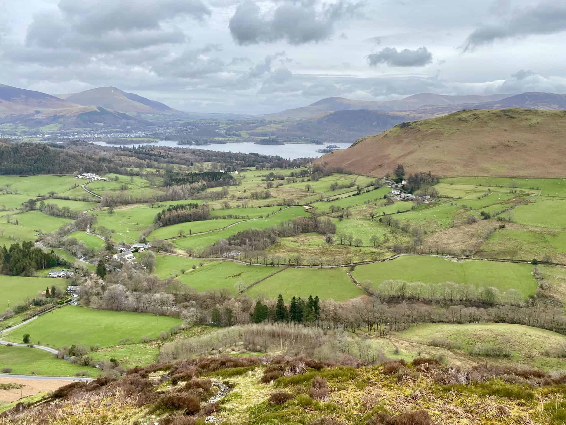
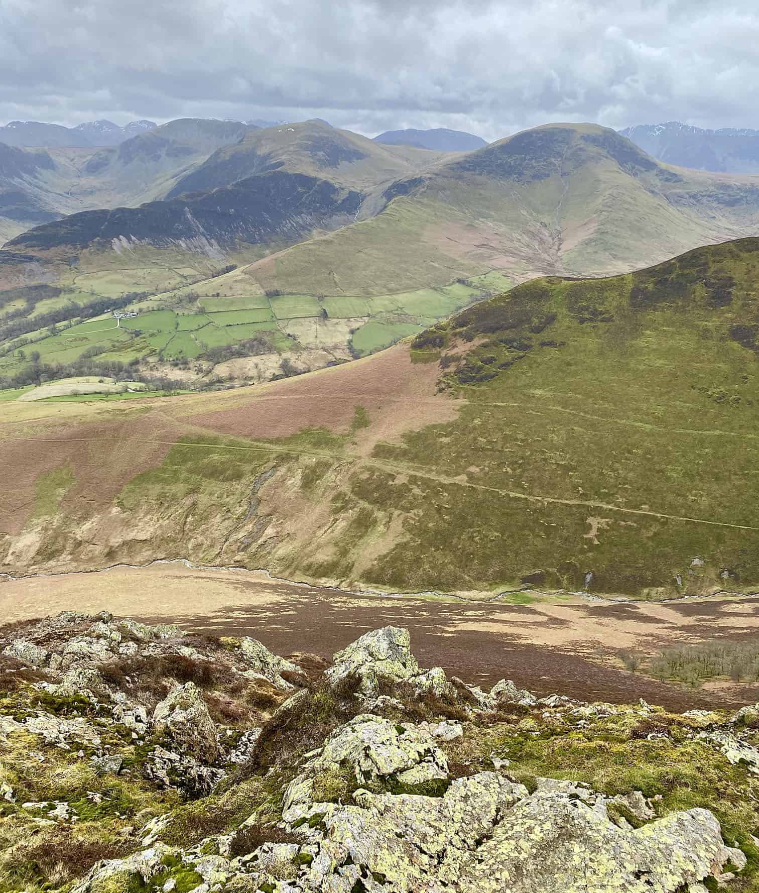
The view south from Swinside across the Newlands valley, soon after the start of the Causey Pike walk. The four highest peaks, from left to right, are Cat Bells, Maiden Moor, Dale Head and Hindscarth.
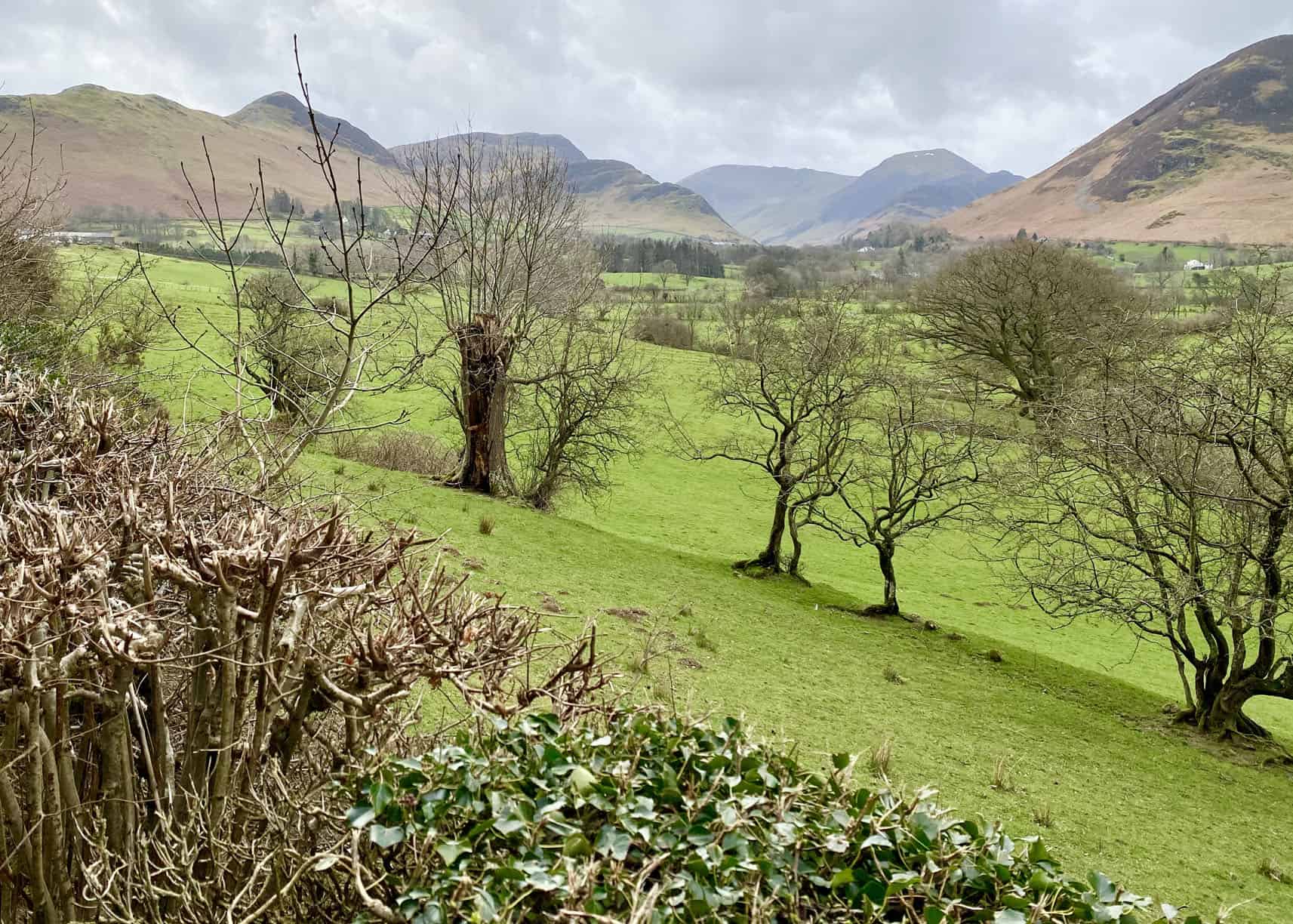
Looking south-west across the Newlands valley from Swinside. The three fells, from left to right, are Rowling End, Causey Pike and Barrow.
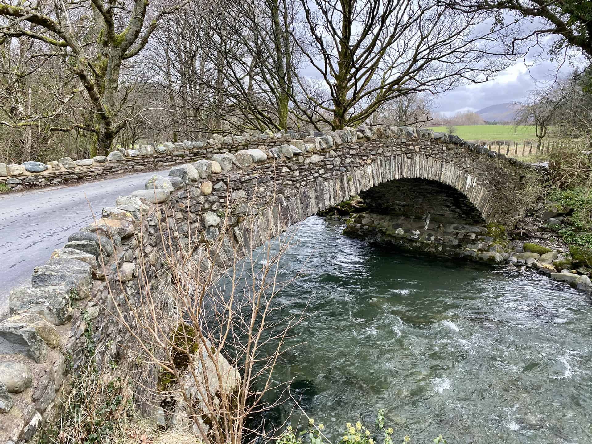
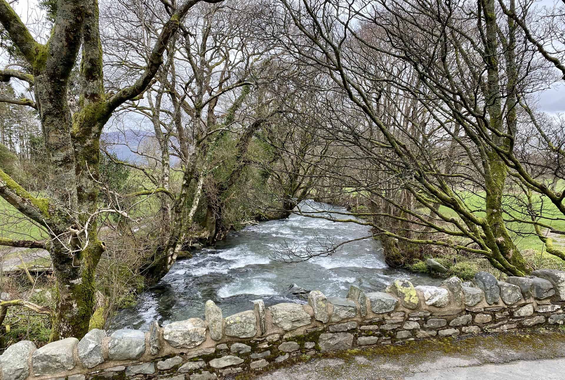
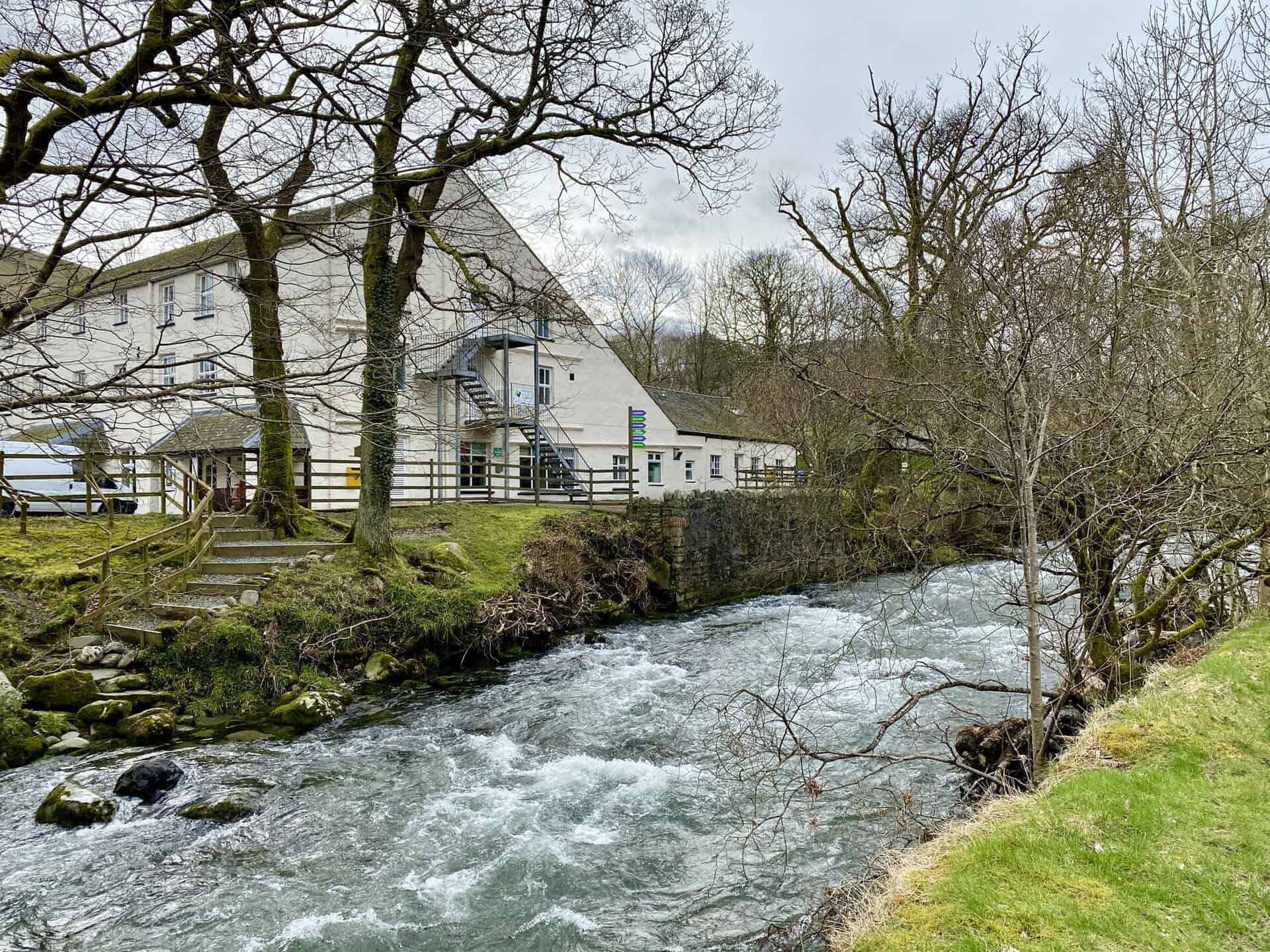
Road bridge across Newlands Beck at Stair.
The Newlands Adventure Centre in Stair.
Stonycroft Gill, which starts on the southern slopes of Outerside and flows east through the valley between Causey Pike and Barrow.
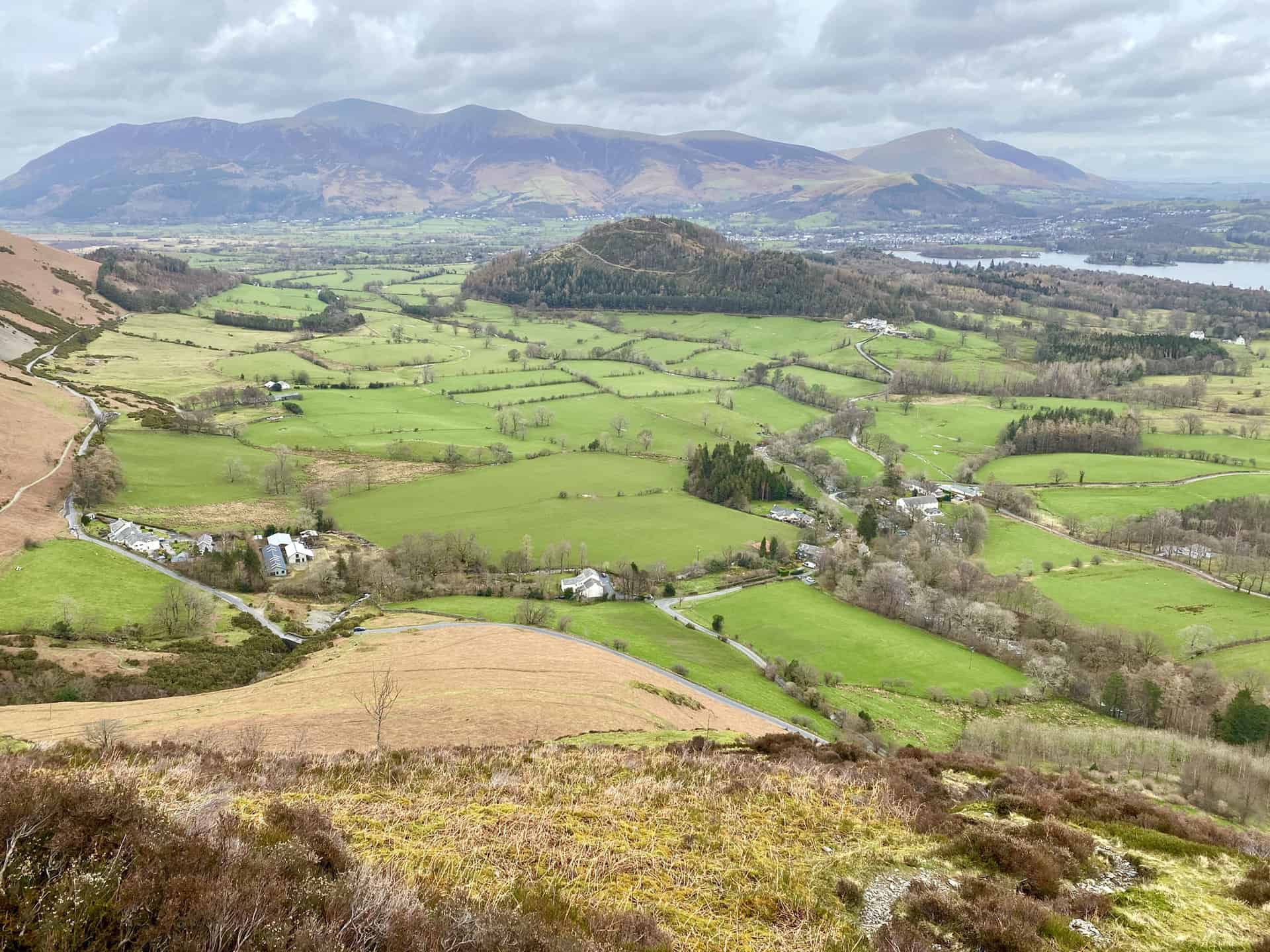
The view north-east from the flanks of Rowling End across the Newlands valley towards Derwent Water.
The view north from the slopes of Rowling End towards the Skiddaw range of mountains.
The view south-west from the summit of Rowling End, height 433 metres (1421 feet). The four highest peaks, from left to right, are High Spy, Dale Head, Hindscarth and Robinson.
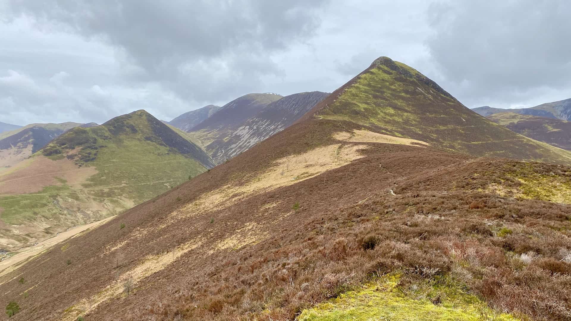
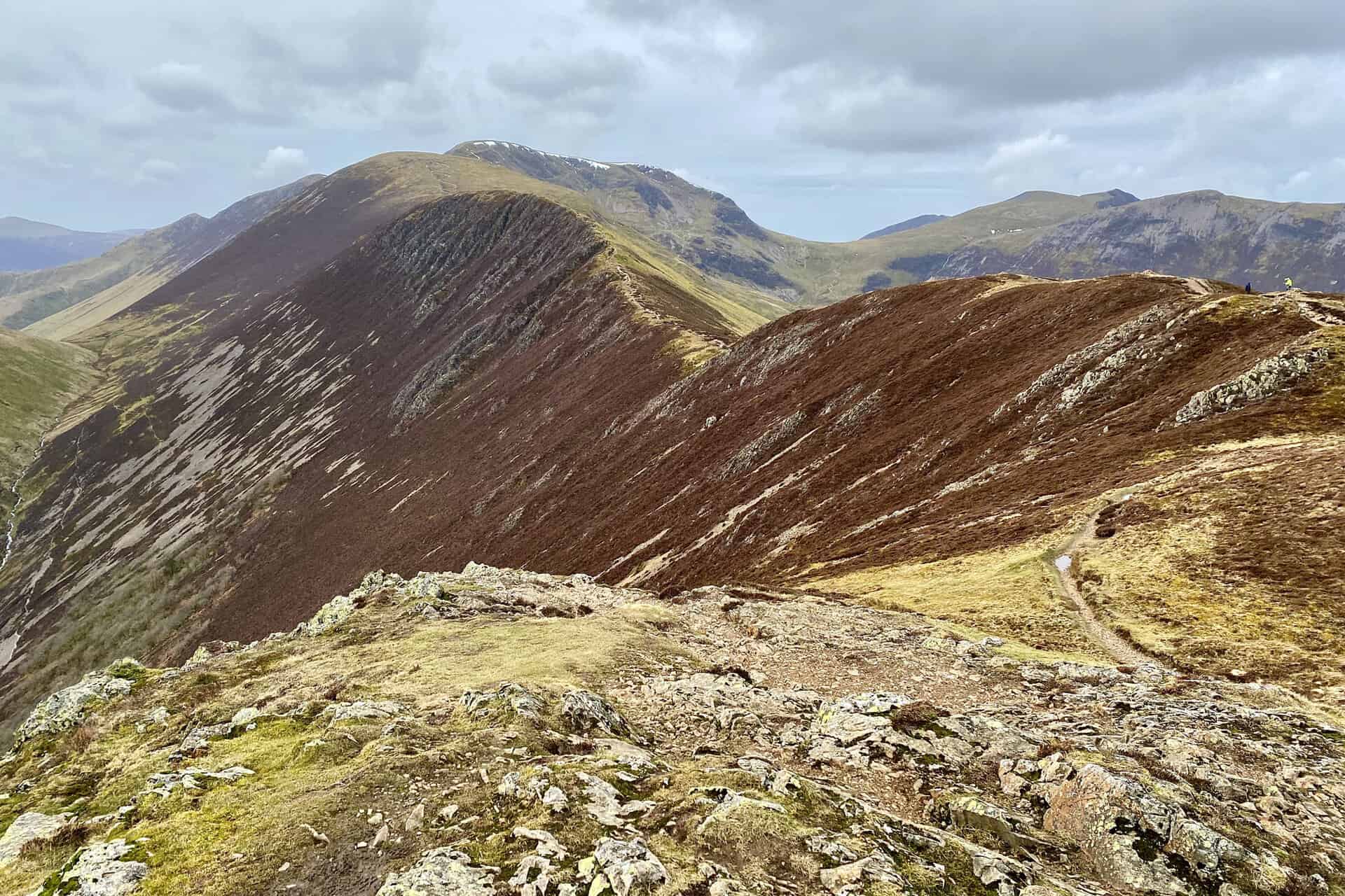
The route from Rowling End to Causey Pike, and it’s harder than it looks. The very last part of the climb to the Causey Pike summit is a bit of a scramble.
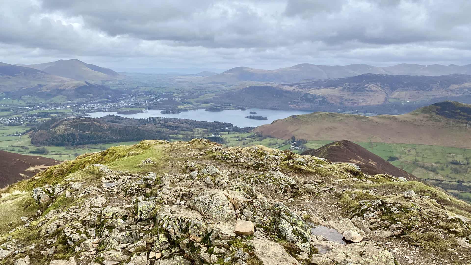
Derwent Water and Keswick as seen from the summit of Causey Pike, height 637 metres (2090 feet).
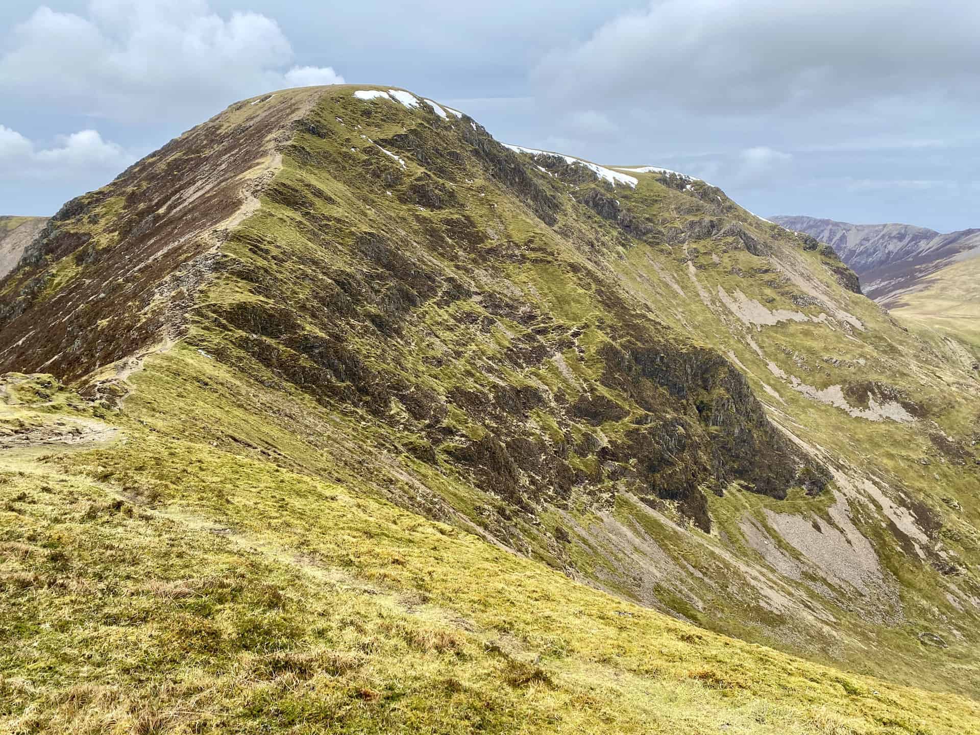
The path from Causey Pike across the Scar Crags ridge to Sail. Then it’s up to Crag Hill, the high peak in the centre of the picture partially covered in snow.
Looking south from Causey Pike towards Robinson and Hindscarth.
A quick look back at Causey Pike from the footpath above Scar Crags.
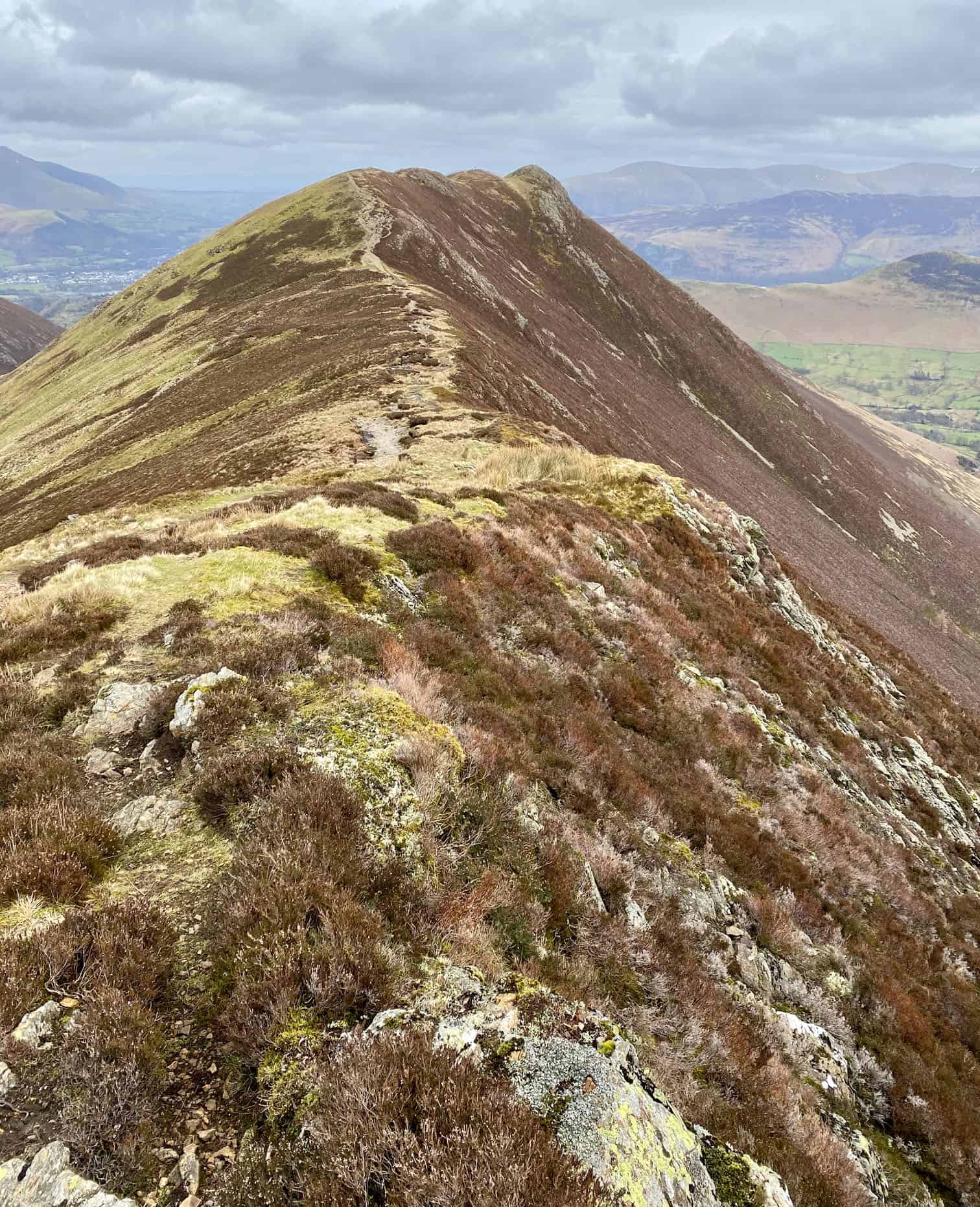
Looking south towards Robinson from the footpath above Scar Crags.
The zig-zag footpath to the top of Sail.
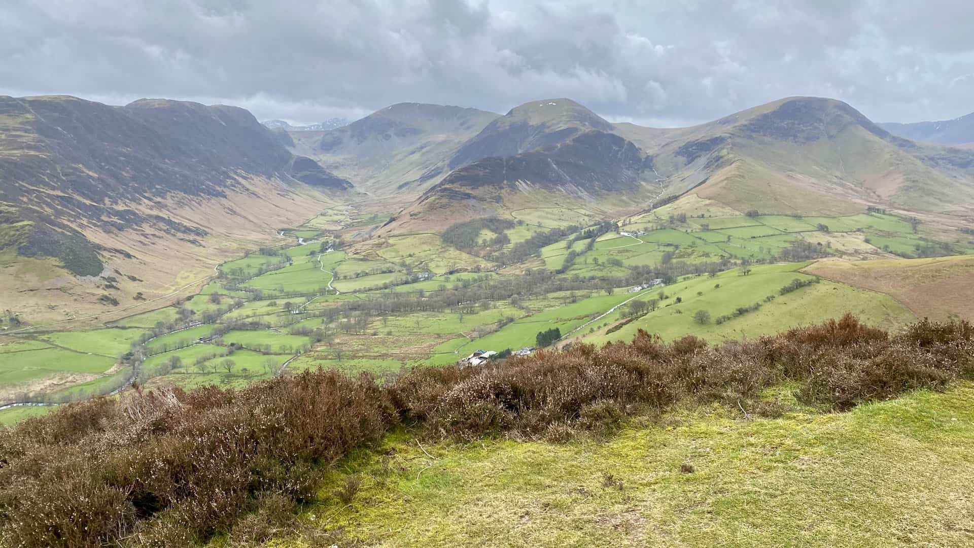
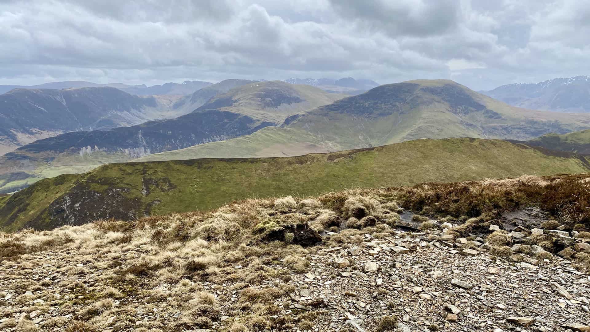
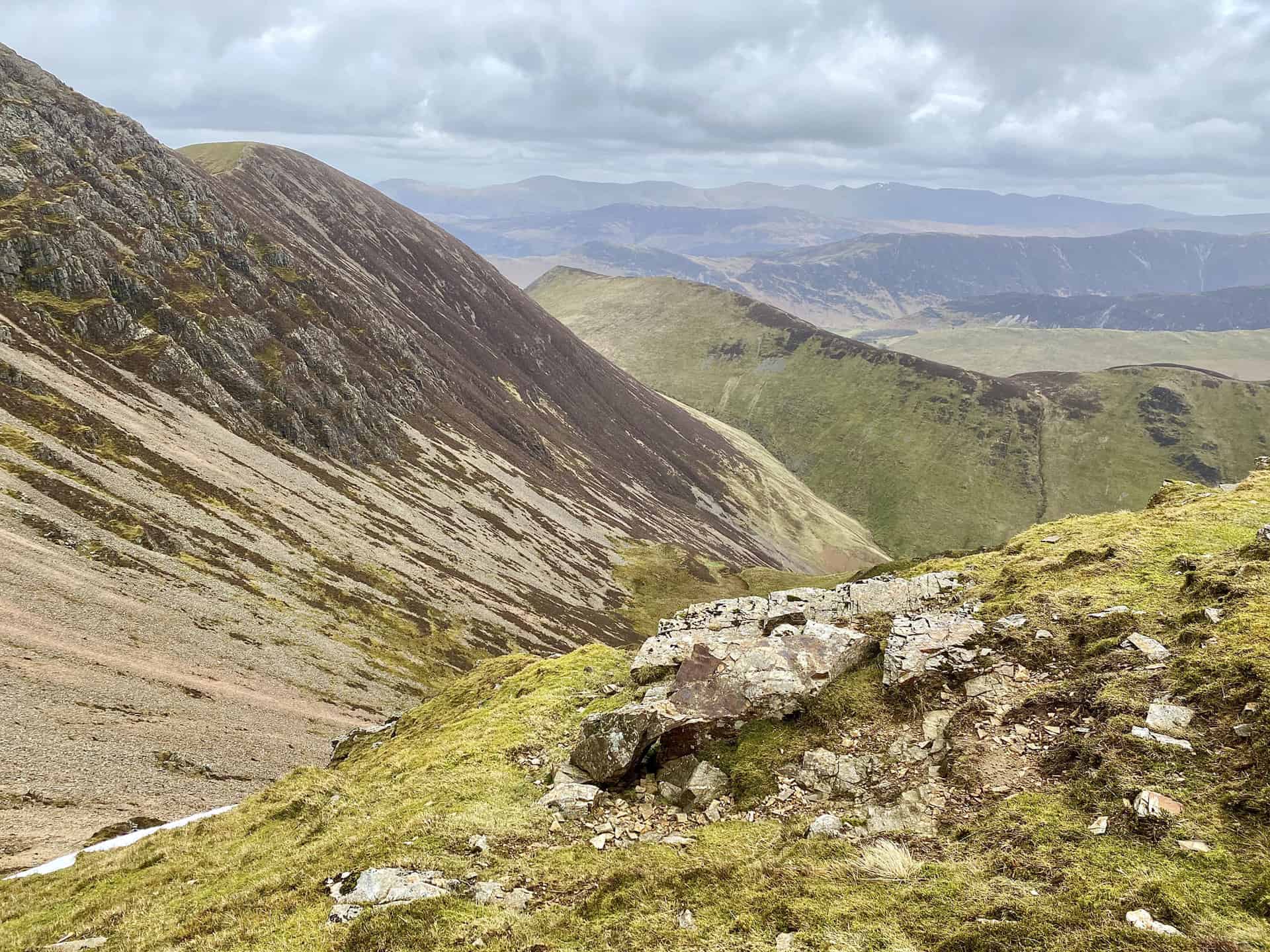
The route to Crag Hill from the summit of Sail, height 773 metres (2536 feet). To the left of Crag Hill is Wandope.
The north-eastern aspect of Crag Hill.
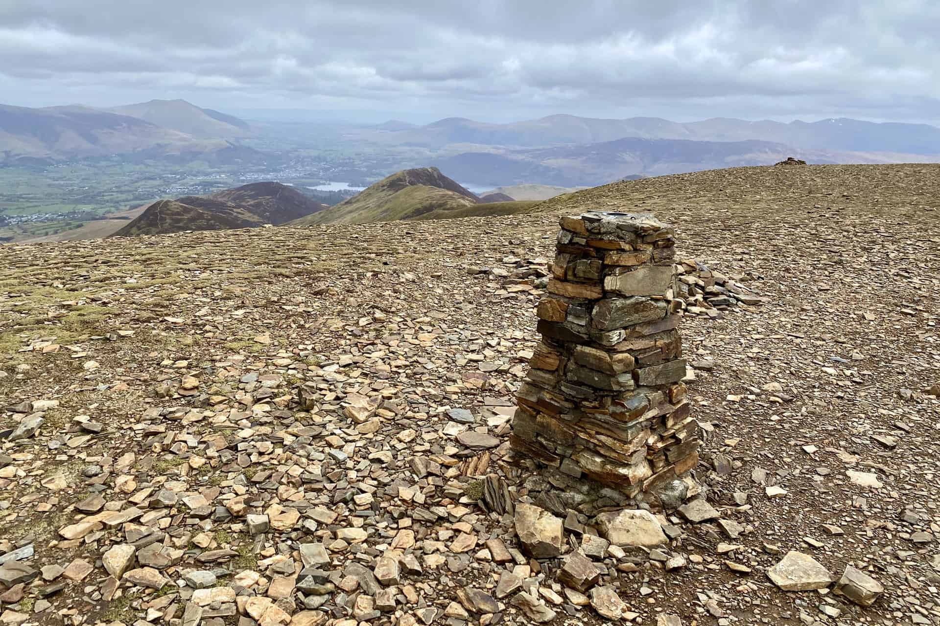
Triangulation pillar on Crag Hill summit, height 839 metres (2753 feet). This is roughly half way round the Causey Pike walk.
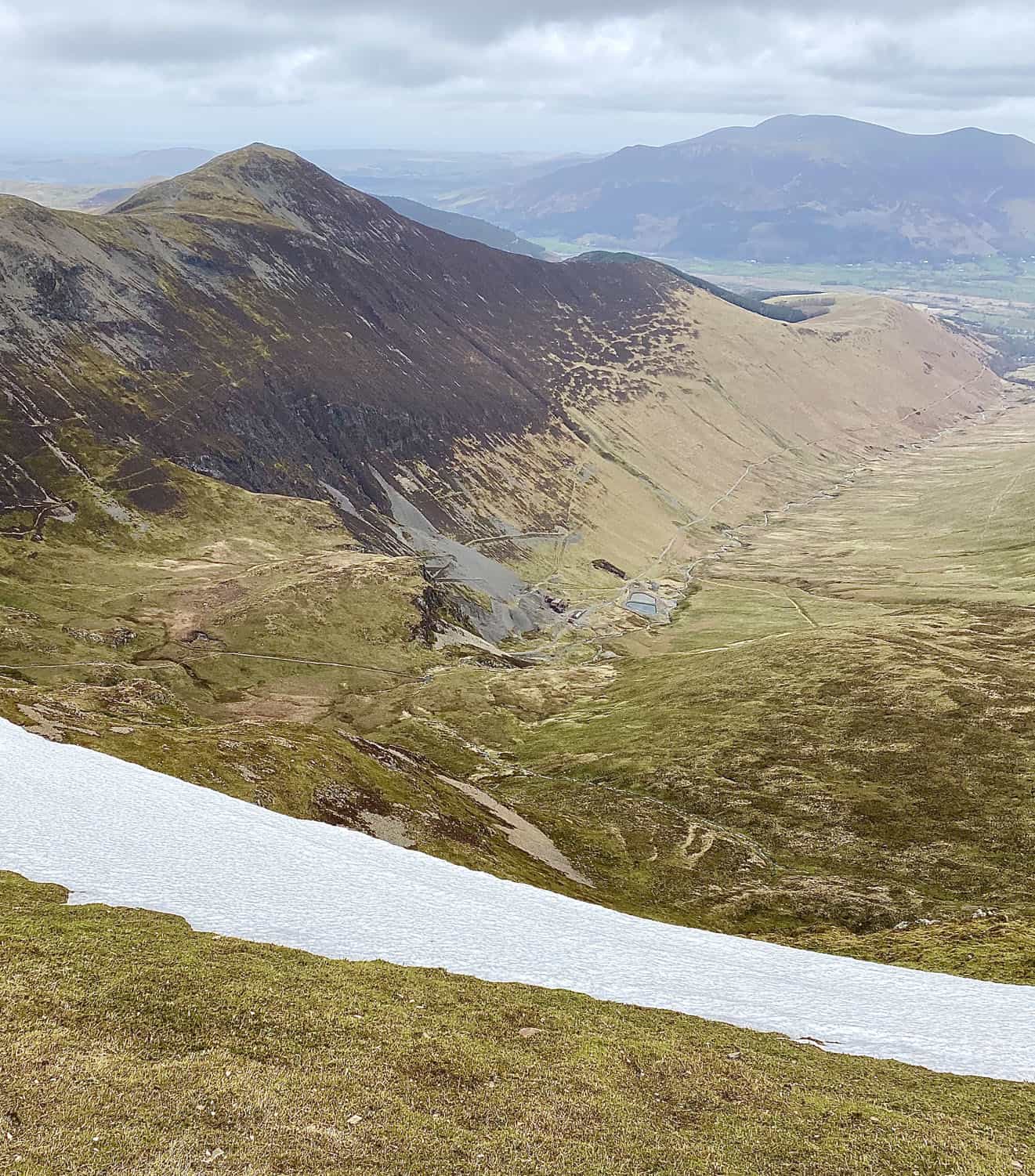
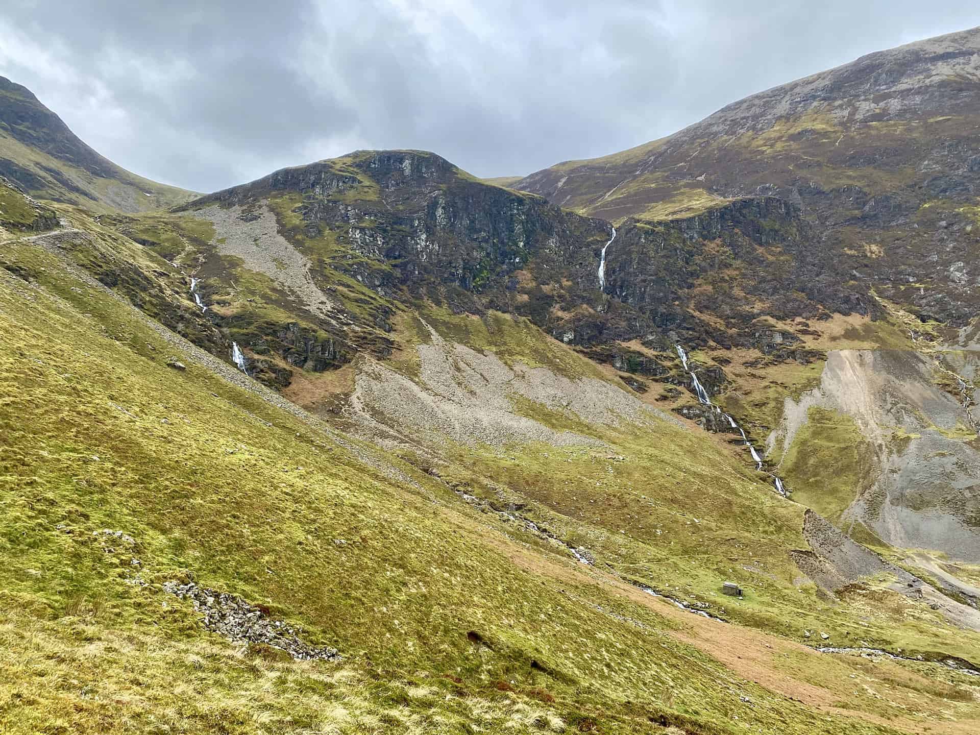
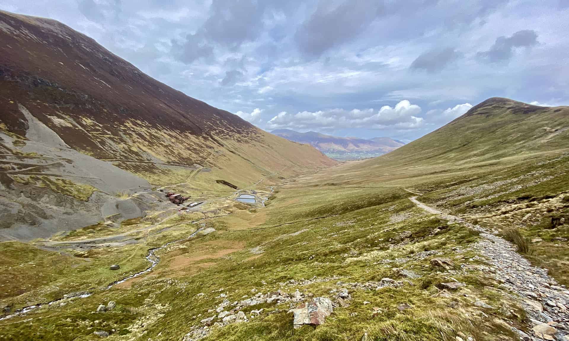
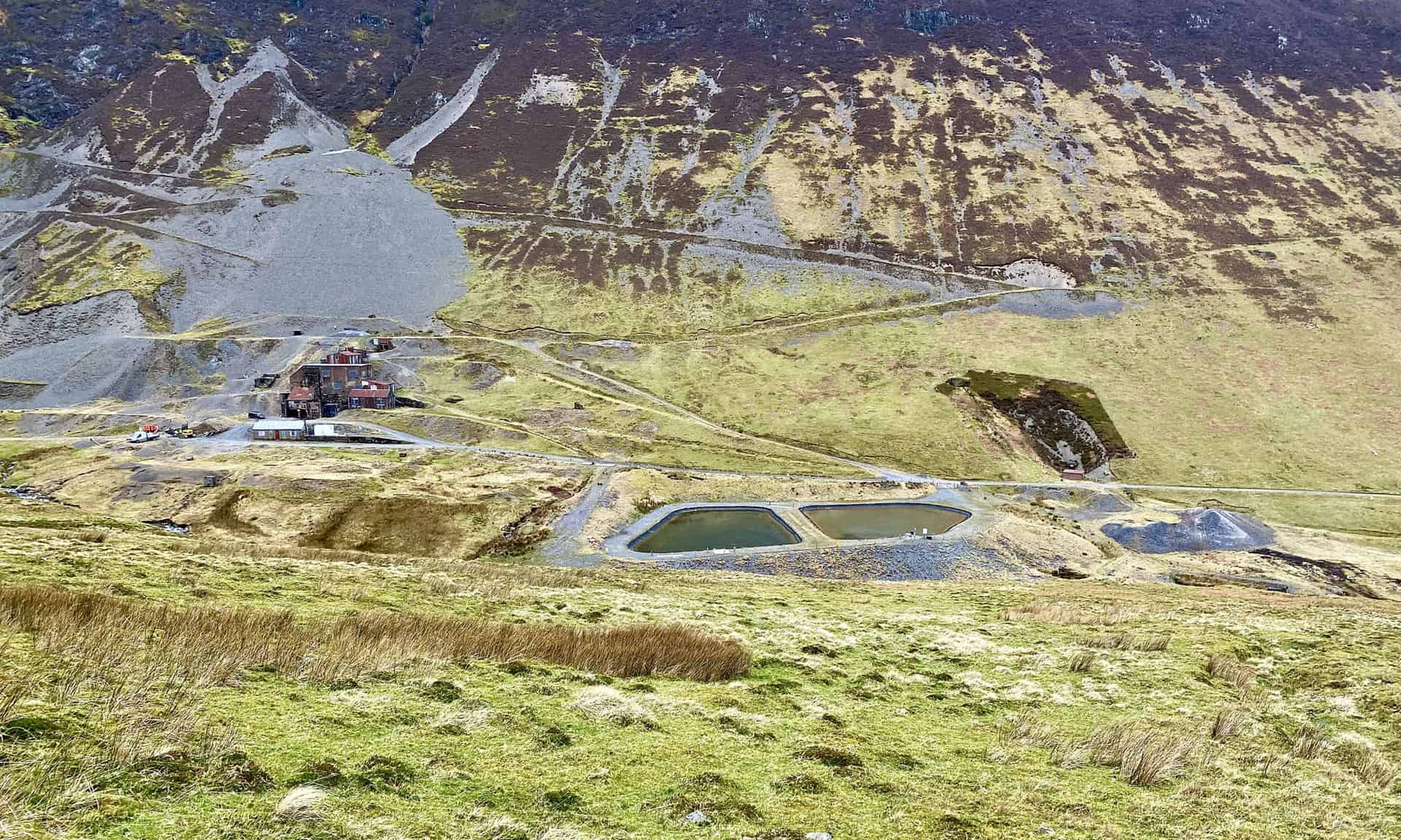
Grisedale Pike viewed from Crag Hill. Force Crag Mine lies at the foot of the mountain, and Coledale Beck flows through the valley.
The southern aspect of Crag Hill.
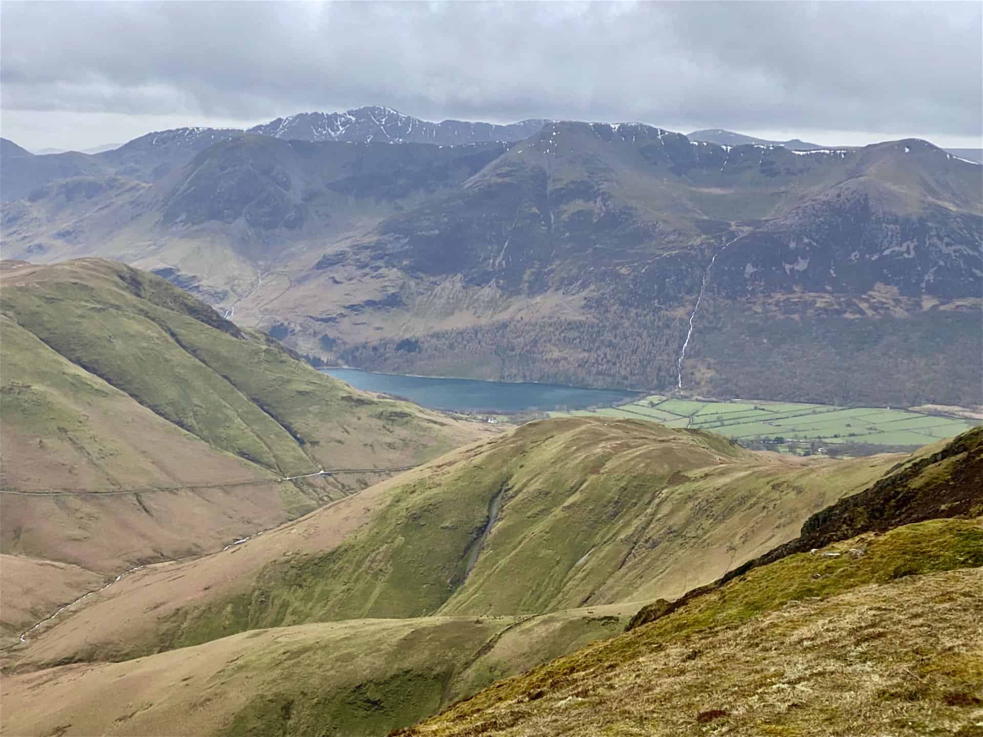
The view south from Wandope. The northern tip of Buttermere is visible in the valley below. The fells behind the lake include Red Pike, High Stile and High Crag.
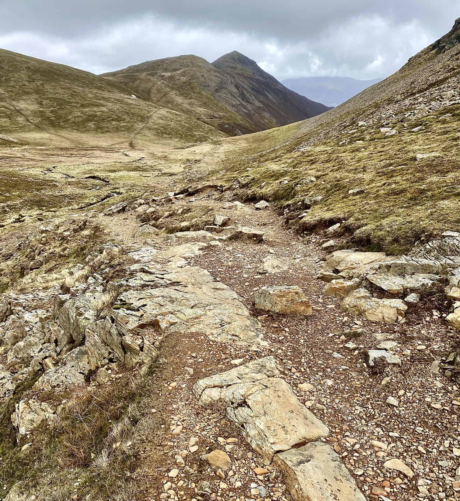
The view north-east towards Grisedale Pike, the pointed peak in the centre of the picture.
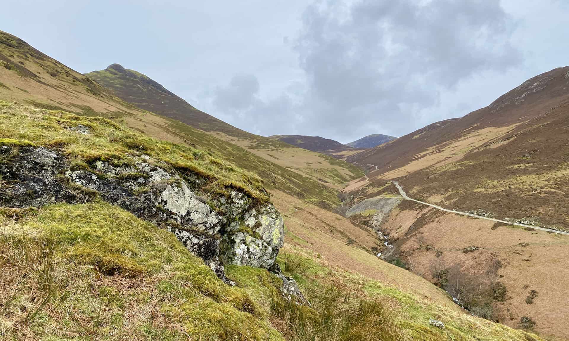
The winding path down to Force Crag Mine, and the shallow U-shaped valley between Grisedale Pike (left) and Outerside (right). Coledale Beck meanders its way along the valley floor to Braithwaite and joins Newlands Beck just west of the village.
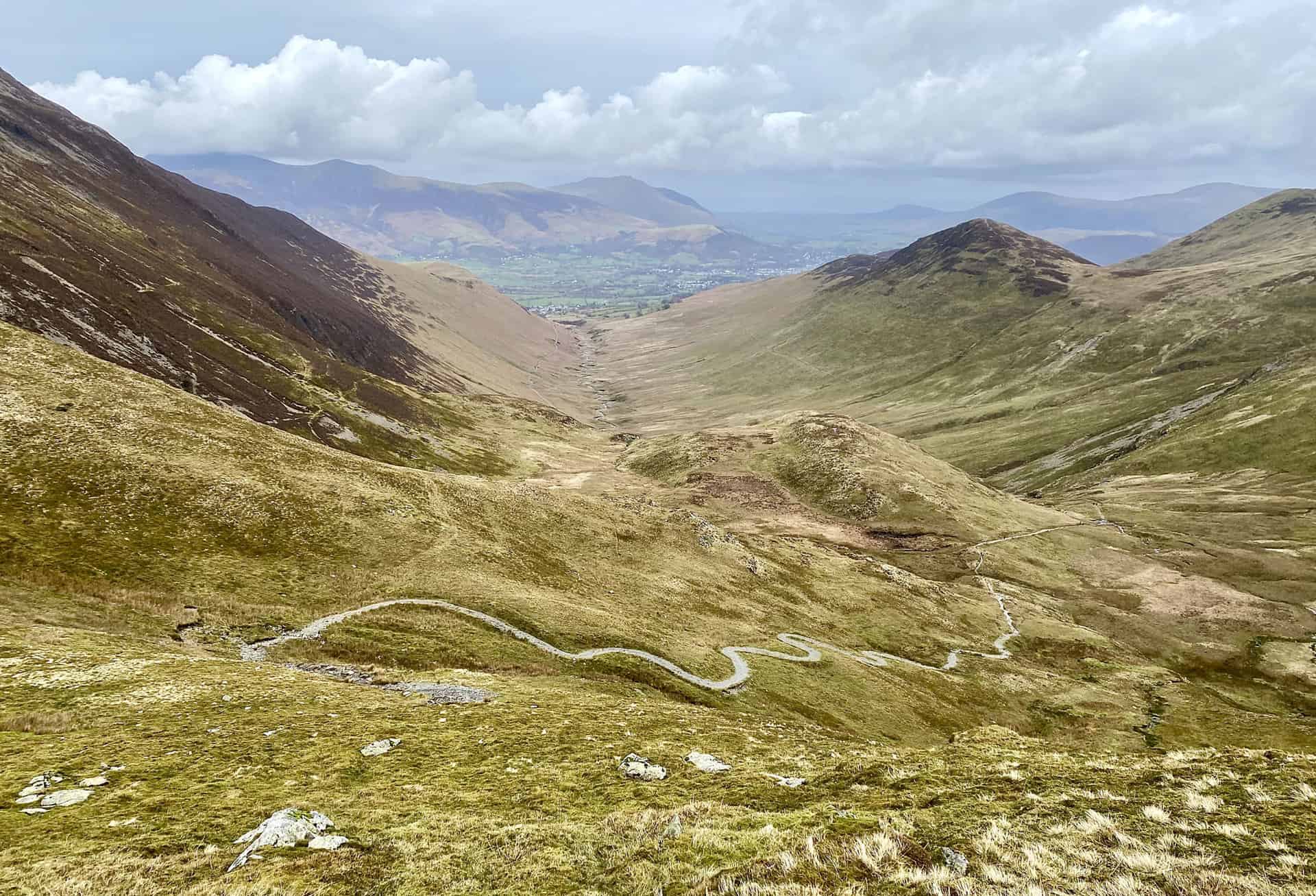
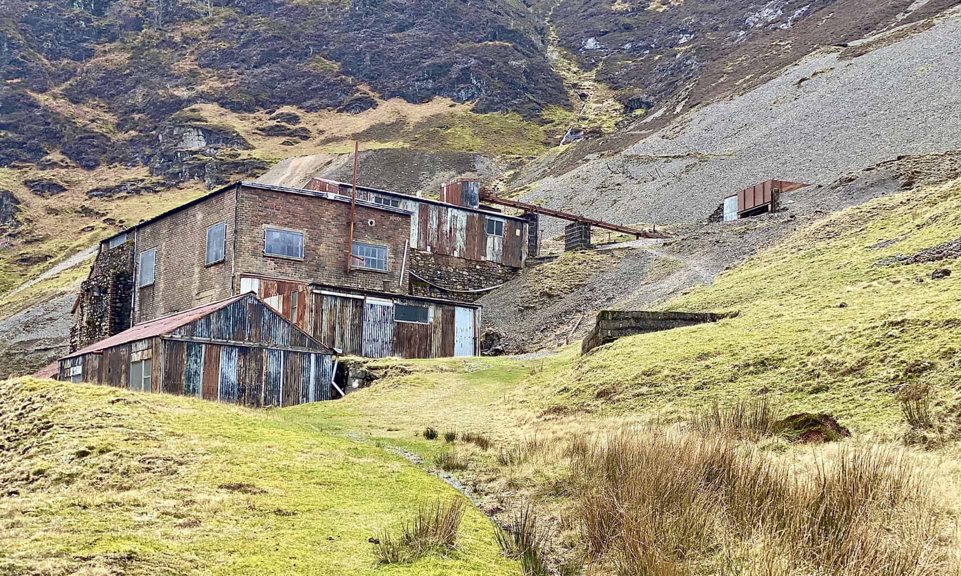
Heading down to Force Crag Mine, about three-quarters of the way round the Causey Pike walk.
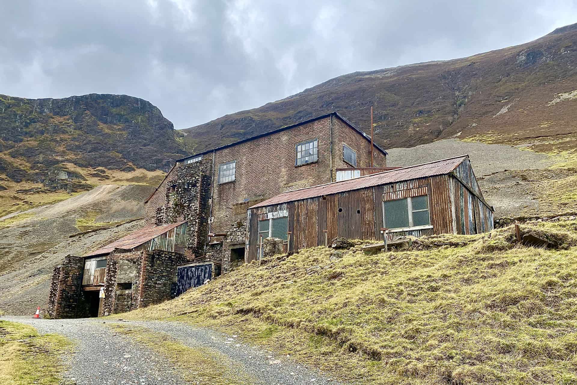
Force Crag, a highlight of this Causey Pike walk.
Force Crag Mine
Force Crag Mine is the last working mineral mine in the Lake District. Lead, zinc and barytes have been mined at the site for over 130 years. This particular mill was built in 1908-1909 and modified in 1940.
The National Trust acquired the mine and mineral rights in 1979. The mine ceased working in 1991 and was finally declared abandoned in 1992. The mill building was restored in 2004 and is now open for guided tours.
In 2001 Force Crag Mine was recognised as being of national importance and designated a Scheduled Monument by English Heritage.
As the last working mineral mine in the Lake District, Force Crag is a unique site. Scheduling has ensured the protection of the mill buildings and machinery, spoil heaps and remaining workings. The unusual variety of minerals found at Force Crag has led to the site being registered as a Site of Special Scientific Interest (SSSI).
Pollution from Force Crag Mine
Between 1835 and 1991 Force Crag was mined for lead, zinc and barytes. Like many abandoned mineral mines, ever since it closed it has been a source of pollution. This is due to metals in the water that drain from the underground mine workings and mine wastes. Zinc is the main cause of pollution, but cadmium and lead are also present in the water. These metals damage fish and river insects in Coledale Beck and have a negative impact on the chemistry of Newlands Beck and Bassenthwaite Lake.
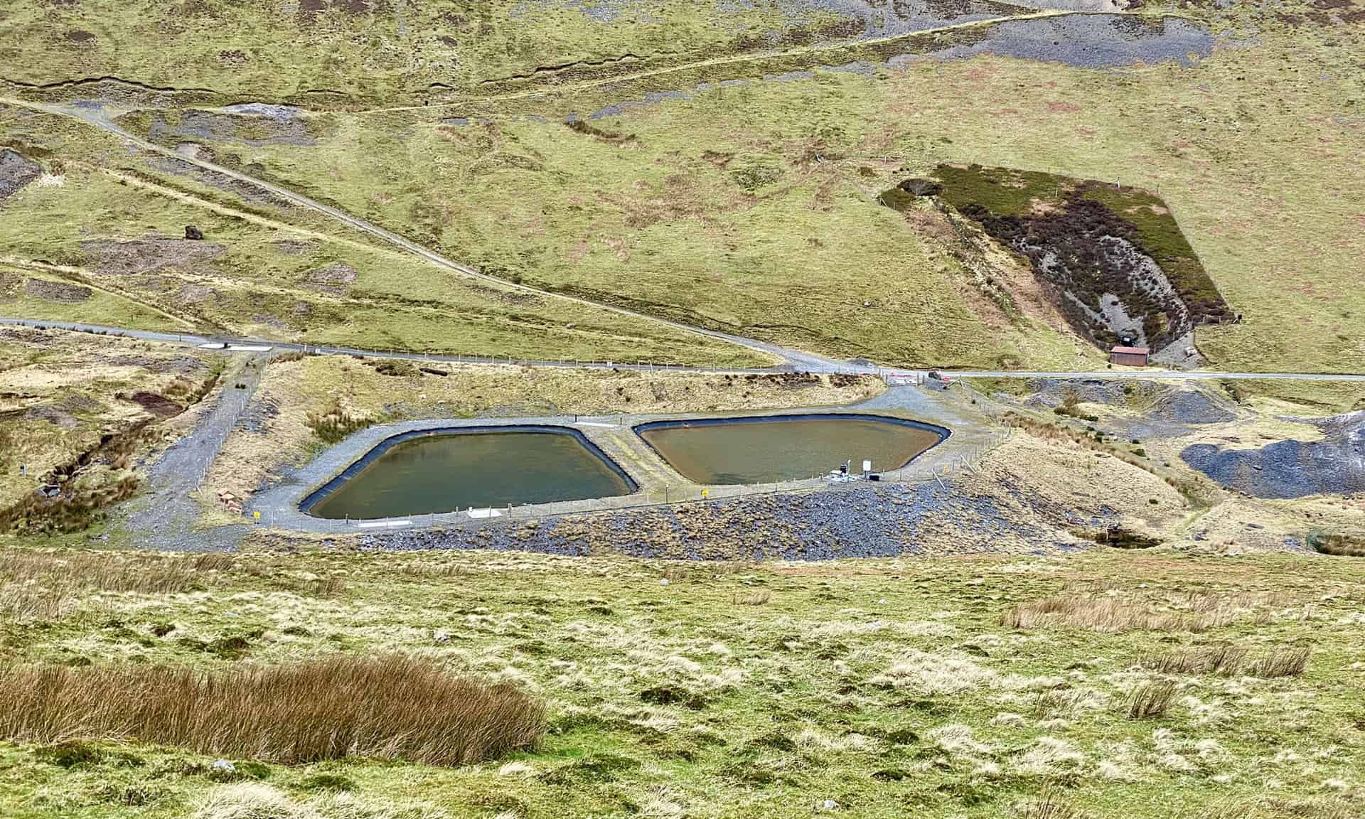
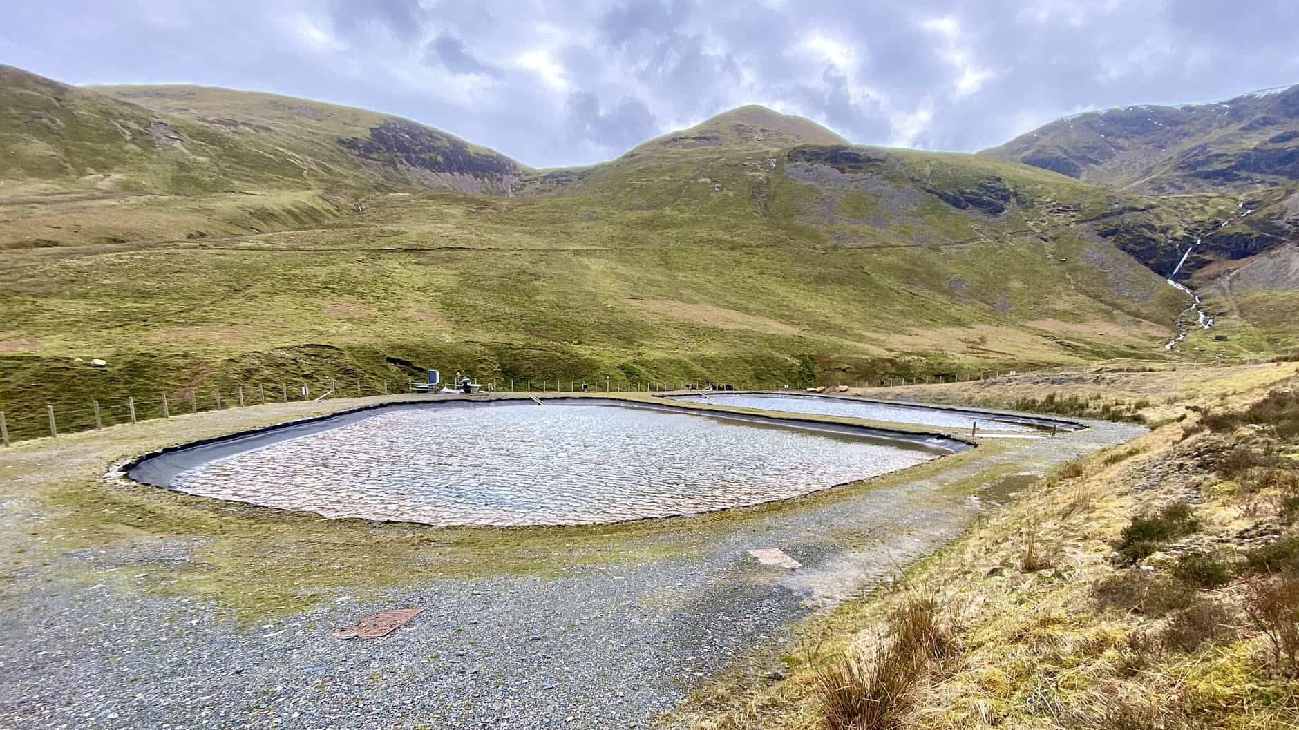
A partnership of experts from Newcastle University, the Coal Authority, the Environment Agency and the National Trust designed a solution that uses natural chemical and biological processes to remove the metals from the water. The initiative was funded by the Department for Environment, Food and Rural Affairs. Two vertical flow ponds were constructed below the mine in 2014. These ponds contain a compost treatment mix, which water from the abandoned mine flows through on its way downstream. Without any need for added chemicals or energy, reactions in the compost bind up most of the metals and prevent them from polluting Coledale Beck.
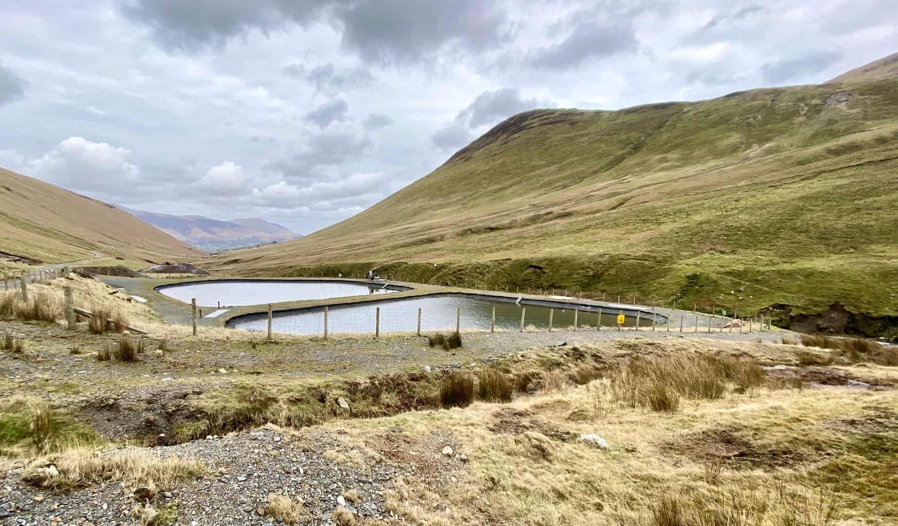
After just 12 months of operation the Force Crag treatment system prevented over half a tonne of zinc entering Coledale Beck, which is the equivalent weight of three car engines. The Force Crag treatment system is the first of its kind in the UK, but pollution from abandoned metal mines impacts up to 1000 miles of rivers in England. Results of monitoring at the Force Crag treatment system will help to design even more effective and sustainable mine water treatment systems elsewhere in the UK.
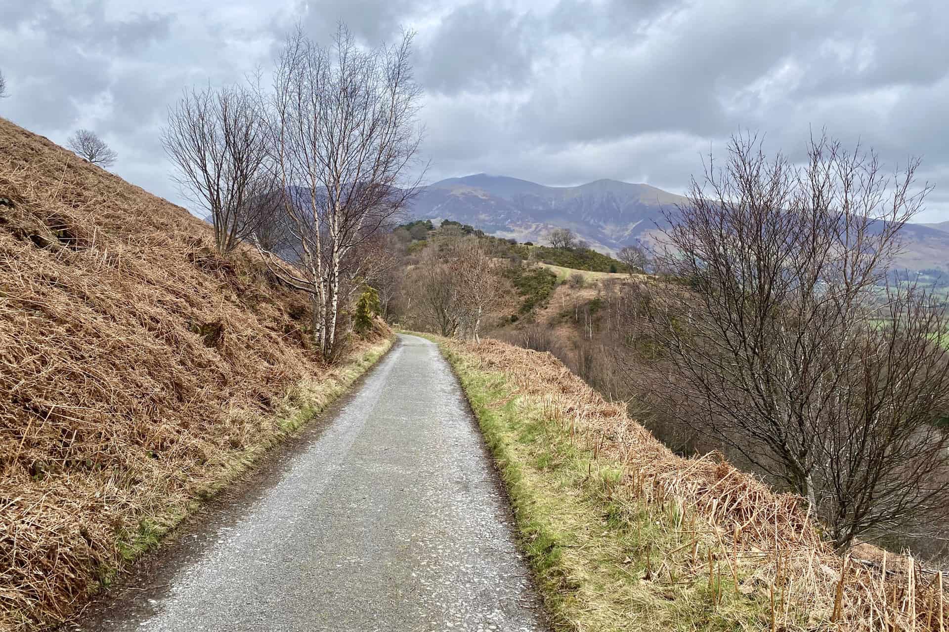
The track down to Braithwaite.
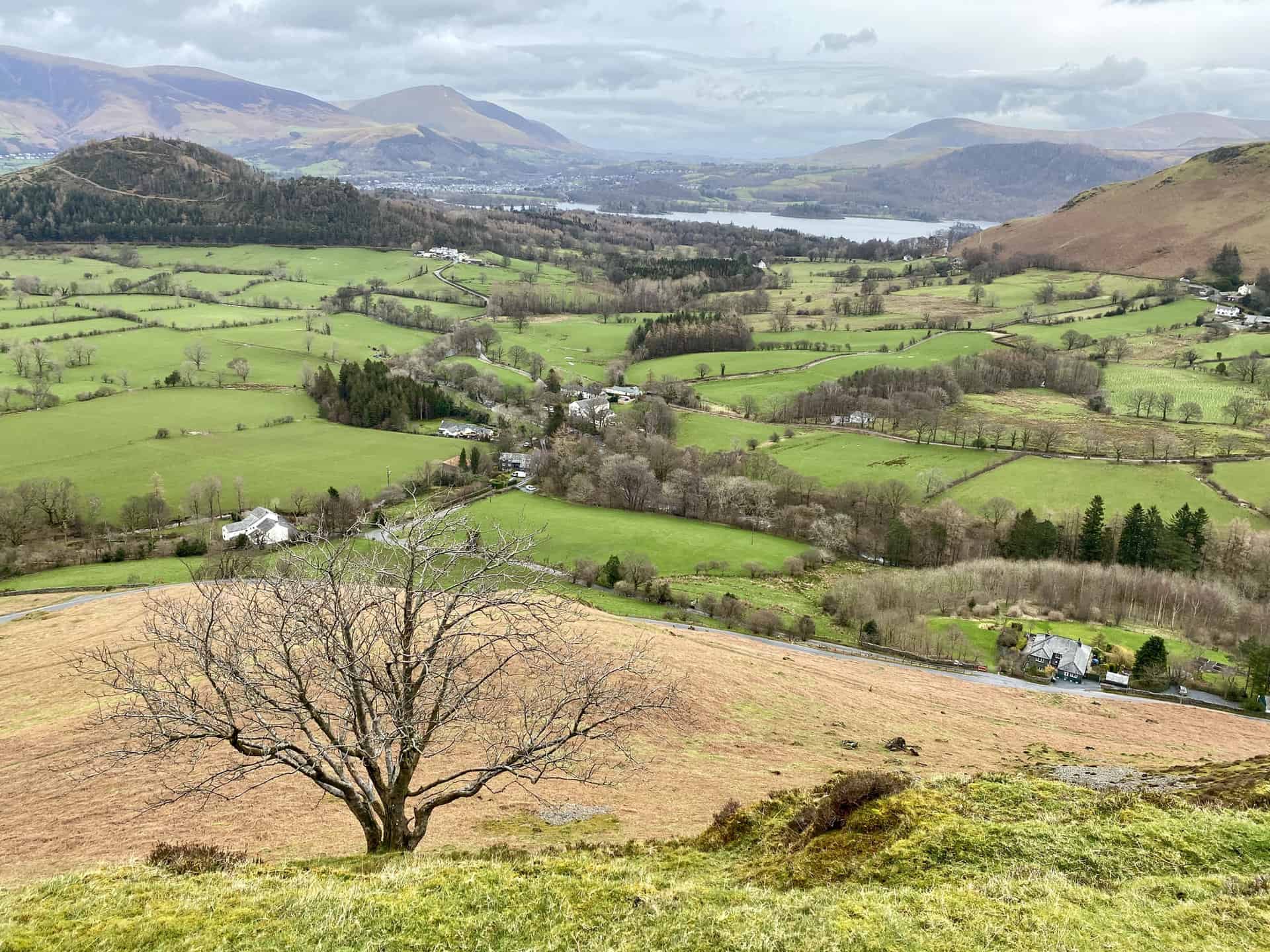
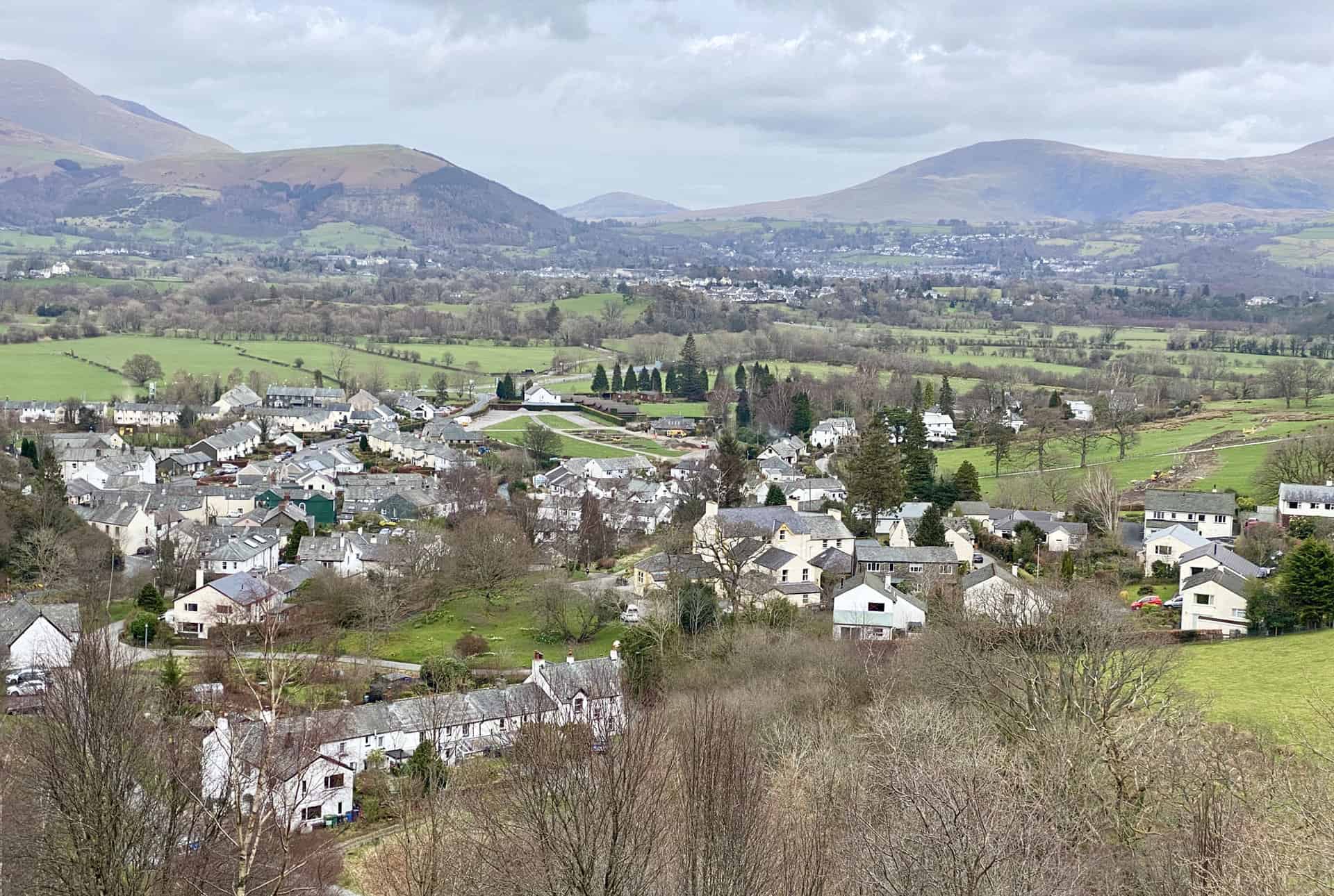
The village of Braithwaite at the end of the Causey Pike walk, with Portinscale and Keswick in the background.
Amazon’s Top Walking Boots: Four Standout Choices for Men and Women
For walking and hiking, the right boots are essential for both comfort and safety. While Amazon boasts a wide range, certain boots emerge as top-sellers. From those, here are four I personally favour. As an Amazon affiliate, I may earn a small commission from any purchases made through the links provided. This helps support the upkeep of this website. Rest assured, you won’t pay a penny extra, but your purchase will contribute to keeping my site running smoothly. Happy walking!

Berghaus Men’s Hillmaster II Gore-Tex Walking Boots
These fully waterproof leather walking boots feature a Gore-Tex lining, ensuring no water enters whilst allowing feet to breathe and stay cool. Made from full-grain leather, they promise unmatched durability and comfort. The boots come with memory foam tongues and cuffs that mould to your feet for a tailored fit, and the Vibram Hillmaster outsoles offer confidence on challenging terrains.

Salewa Men’s Mountain Trainer Mid Gore-Tex Walking Boots
Made from durable suede and abrasion-resistant textile, these men’s hiking boots are both lightweight and sturdy. The upper material is enhanced by a 360° full rubber sheath. Their dual-layer midsole with Bilight technology ensures ergonomic cushioning and grip, especially on extended hikes. The Vibram Wrapping Thread Combi outsoles allow a natural walking feel, and the Gore-Tex lining provides waterproofing, breathability, and optimal weather protection. Furthermore, the patented Salewa 3F system ensures flexibility, a secure heel grip, and a blister-free fit.

Berghaus Women’s Supalite II Gore-Tex Walking Boots
Specially designed for women, these hiking boots offer waterproofing and breathability, thanks to their Gore-Tex lining. Crafted from full-grain abrasion-resistant leather, they’re durable enough for the toughest hikes. The Supalite soles ensure stability and traction, and the EVA midsoles add comfort for extended walks.

Merrell Women’s Moab 3 Mid Gore-Tex Walking Boots
These hiking boots incorporate a Gore-Tex waterproof membrane, blending breathability with superior waterproof performance. The combination of pigskin leather and mesh on the uppers, along with the suede outer material, ensure durability and style. Enhancements include 100% recycled laces, webbing, and mesh lining. Additionally, bellows tongues, protective toe caps, and Vibram TC5+ rubber soles ensure protection and ease on any terrain.