Unforgettable Views Await on the Mellbreak Walk in the Lake District
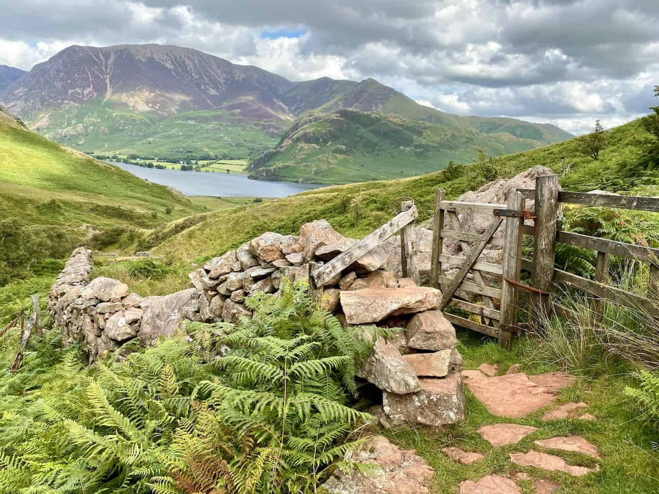
Begin your Mellbreak walk from the car park at Scalehill Bridge, which crosses the River Cocker near the northern edge of Crummock Water. Head south-west along the minor road towards Loweswater. Cross Church Bridge and continue south along the path beside Kirkgate Farm to arrive at the base of Mellbreak. Here, the ascent begins, taking you up a steep trail towards White Crag, before continuing to Mellbreak’s North Top.
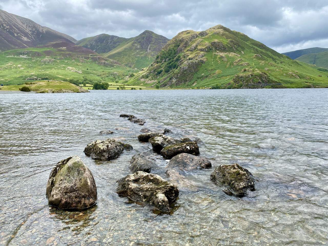
Next, proceed south along the ridge to reach Mellbreak South Top. The journey then leads you down towards Scale Force, a stunning waterfall on Scale Beck. This marks a perfect spot for a brief respite, to admire the natural beauty of the Lake District.
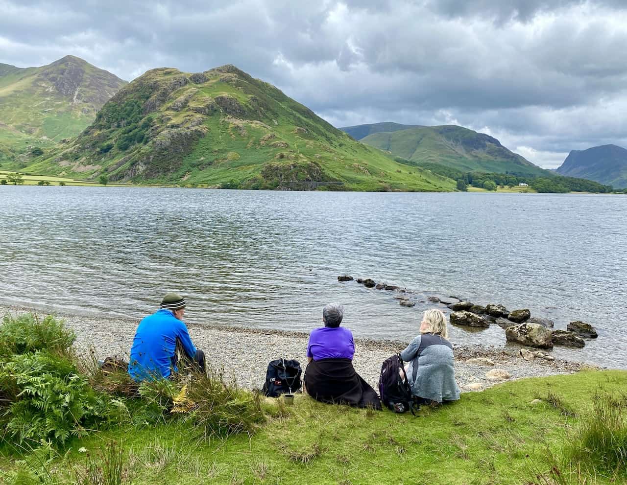
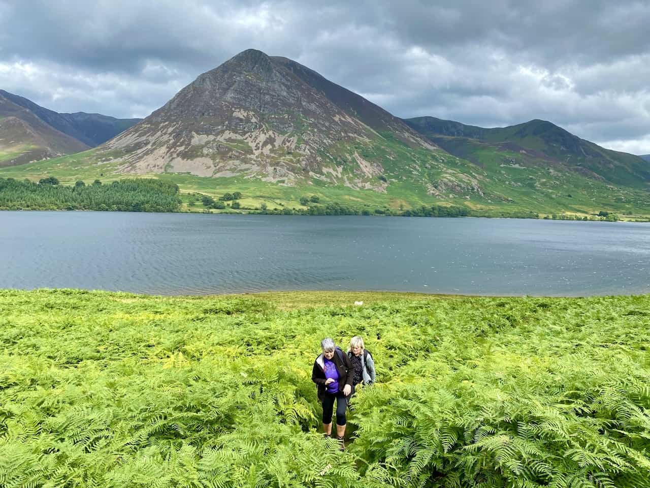
Afterwards, venture east along the trail that leads to the southernmost point of Crummock Water. Then, enjoy a leisurely stroll northwards along the lake’s western shore, covering a couple of miles of picturesque landscape. This segment offers expansive views across the water, making every step worthwhile.
To complete the circuit, turn inland towards Highpark. Follow the minor road past Muncaster House, leading you back to the starting point. This Mellbreak walk, spanning eight miles, offers a rewarding Lake District experience with its diverse scenery and captivating vistas throughout.
Mellbreak Walk: Maps and Tools
Visit either the OS Maps website or the Outdooractive website to view this walking route in greater detail. Both platforms offer a range of features, including the ability to print the route, download it to your device, and export the route as a GPX file. You can also watch a 3D fly-over and share the route on social media.
Mellbreak Walk: Distance, Duration, Statistics
Distance: 8 miles
Distance: 13 kilometres
Duration: 4¼ hours
Ascent: 2065 feet
Ascent: 629 metres
Type: Circular walk
About Mellbreak
A Distinctive Hill in the Lake District
Mellbreak is a notable hill located in the Lake District. It is unique in its isolation, even though it is surrounded by higher fells. This distinct hill is encircled on three sides by marshy land and bordered on the east by Crummock Water. Mellbreak and Crummock Water together create a striking partnership, with the hill’s sheer drops into the lake providing a popular backdrop for photographs. A Mellbreak walk offers a unique experience, capturing this stunning partnership and isolation.
The Mellbreak Etymology
The name ‘Mellbreak’ is a blend of words from different languages. The Celtic word ‘moel’ translates to ‘bare hill’, and the Old Norse term ‘brekka’ means a hill slope. This combination of terms perfectly encapsulates the hill’s bare slopes and its prominent position.
Geography and Features
Described by Alfred Wainwright and others as resembling an upturned boat, Mellbreak features north and south tops of similar height with a broad, flat depression in between. The eastern slopes of Mellbreak descend sharply to meet Crummock Water’s shore, featuring notable crags such as Low Ling Crag that extend into the lake. The hill’s southern boundary is delineated by Scale Beck and its tributary, Black Beck. Mellbreak boasts a third, significantly lower top, Scale Knott, which overlooks a steep-sided valley. The connection to Starling Dodd extends south-west from Scale Knott. To the west lies the marshy Mosedale valley, and Hen Comb sits parallel on the opposite side. The northern end of Mellbreak presents a dramatic rise, resembling a sand castle rising from a flat beach, with its steep, tiered crags forming a distinct profile. Engaging in a Mellbreak walk allows one to explore these geographical features up close.
Mellbreak’s Geology
Mellbreak is primarily composed of the laminated mudstone and siltstone of the Kirkstile Formation. It features an intrusion of basalt on the Crummock face, and around Scale Knott, the southern end showcases the Buttermere Formation, which consists of disrupted and folded mudstone, siltstone, and sandstone. Notably, there are two small iron trials on the hill, though neither extends more than a few feet.
Mellbreak Walk Summits
The summits of Mellbreak offer remarkable views, attributed to their isolation and relative height. While the South Top is marginally higher at 512 metres, the North Top, at 509 metres, is considered the better summit due to its rocky nature and positioning atop the north face crags. Both summits are marked with significant cairns, with the true summit’s cairn situated on grass. From both points, the vistas are expansive, with the Solway Firth visible from the North Top. The surrounding landscape, including Grasmoor and Rannerdale Knotts across the lake, presents a stunning spectacle, with the Helvellyn range also glimpsed in the distance.
Wainwright Ranking
In the list of Wainwrights, categorised by height, Mellbreak’s South Top is ranked 168th. It stands at 512 metres (1680 feet), with its location and other details catalogued as follows:
- Height rank: 168th
- Wainwright fell name: Mellbreak (South Top)
- Height in metres: 512
- Height in feet: 1680
- Grid reference: NY 148 186
- Explorer map: OL4
- Landranger map: 89
- Wainwright book: Western Fells
Recommended Ordnance Survey Map
The best map to use on this walk is the Ordnance Survey map of the Lake District North-Western Area, reference OS Explorer OL4, scale 1:25,000. It clearly displays footpaths, rights of way, open access land and vegetation on the ground, making it ideal for walking, running and hiking. The map can be purchased from Amazon in either a standard, paper version or a weatherproof, laminated version, as shown below.
Standard Version
Mellbreak Walk: My Photos
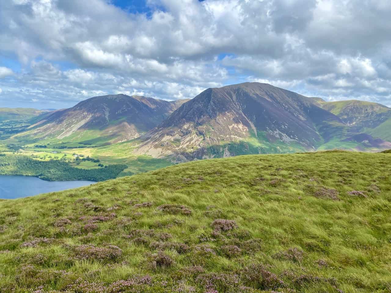
The view of Loweswater, Darling Fell and Low Fell from the northern flanks of Mellbreak.
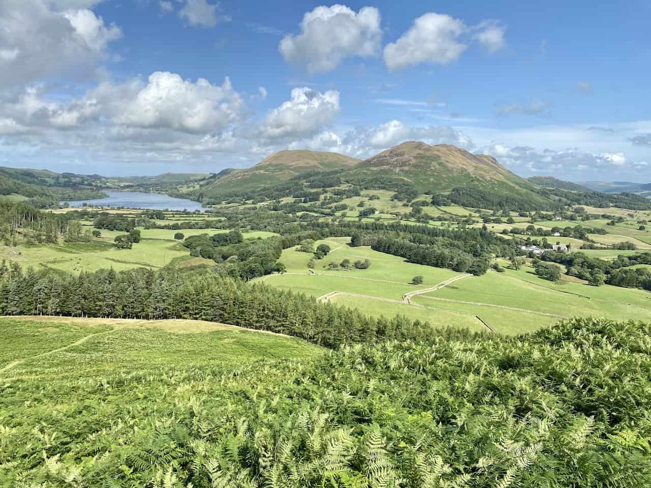
Carling Knott and Burnbank Fell on the south-western side of Loweswater.
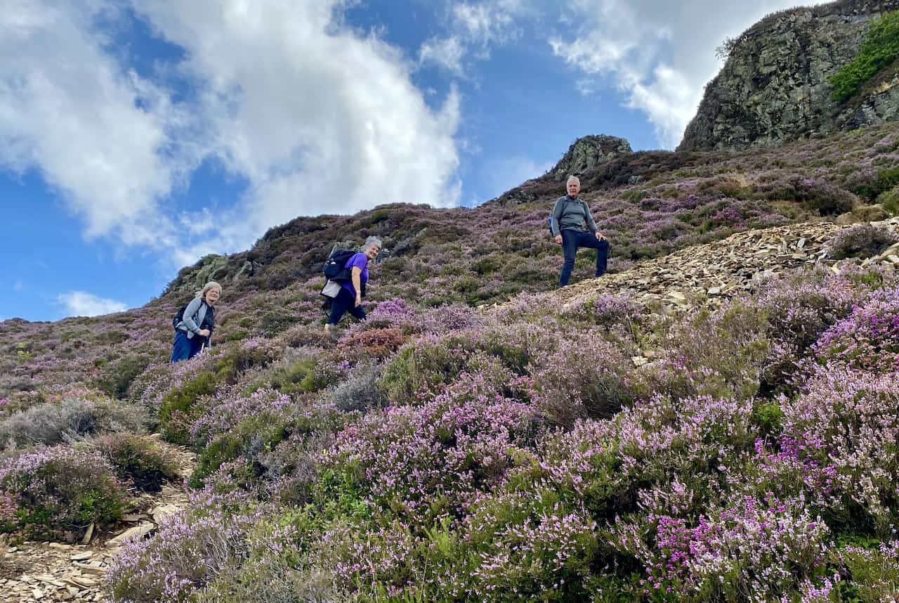
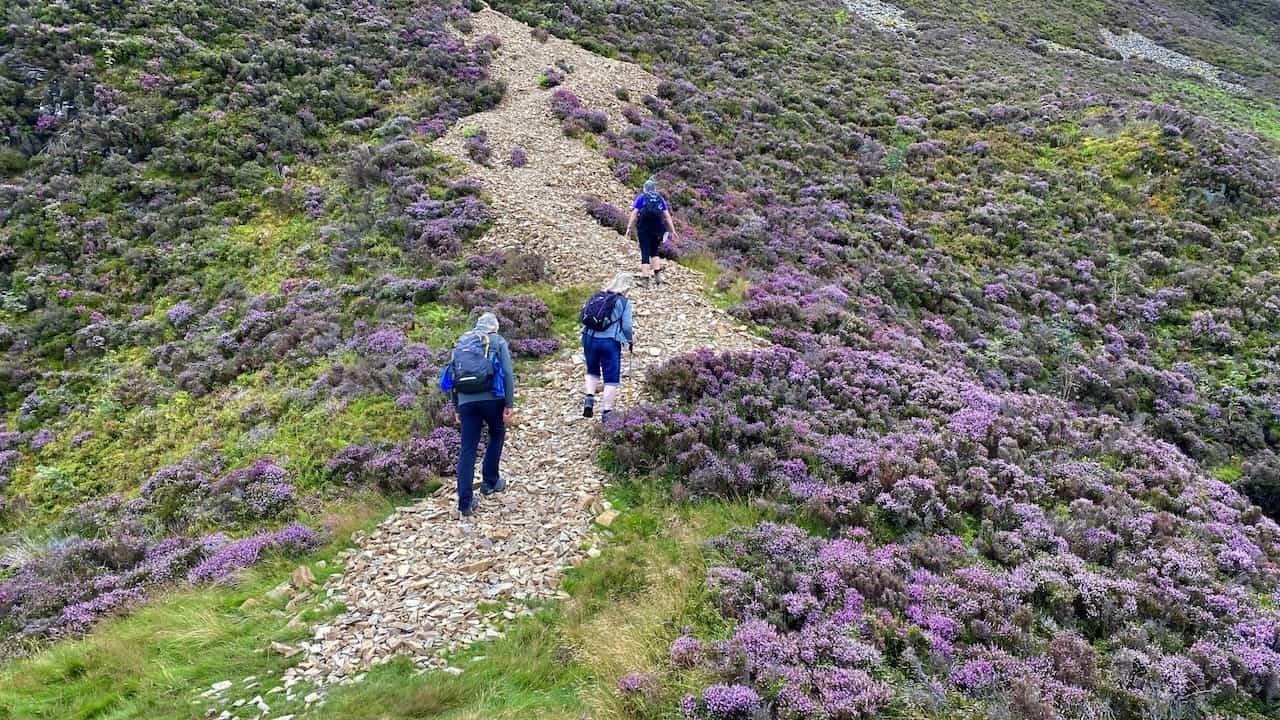
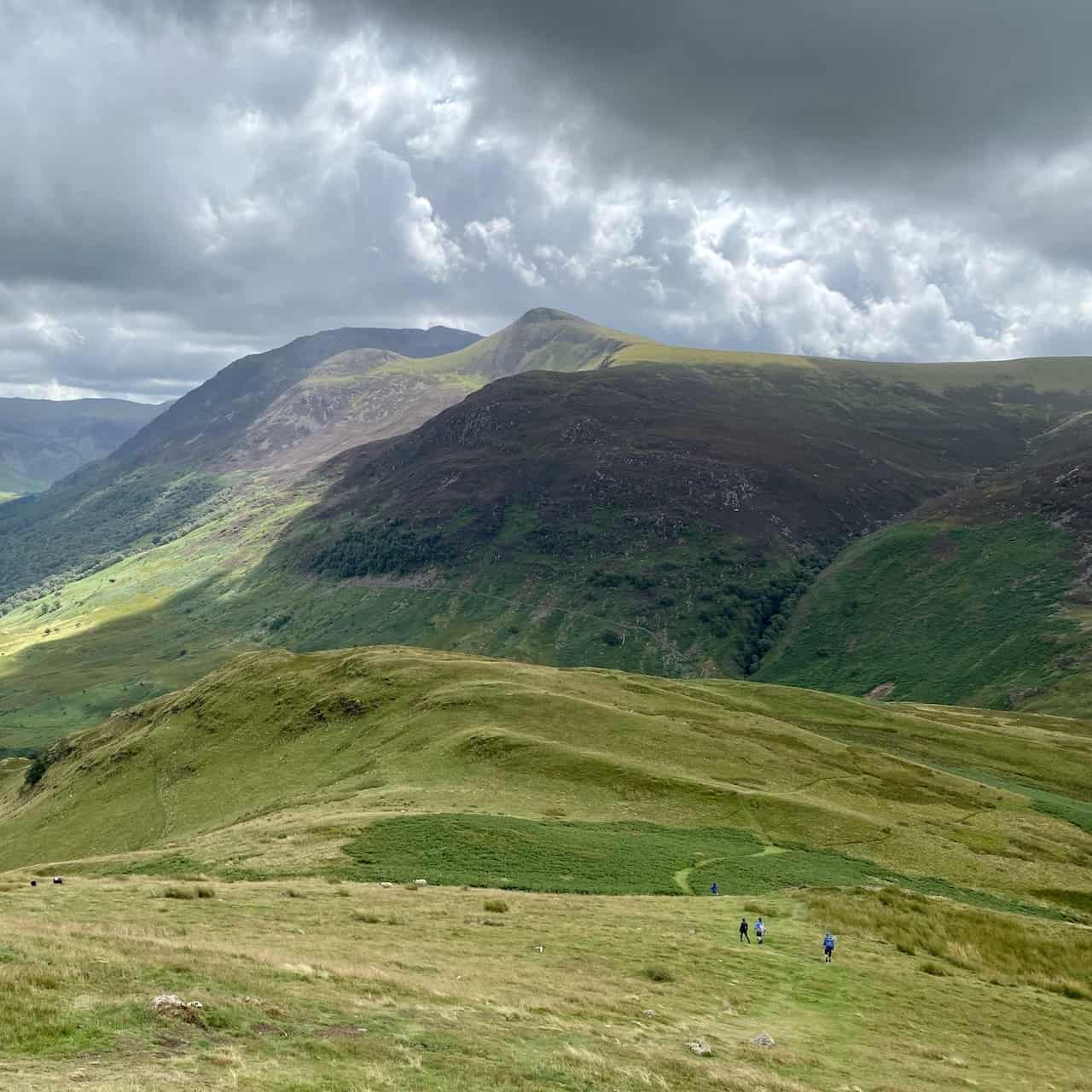
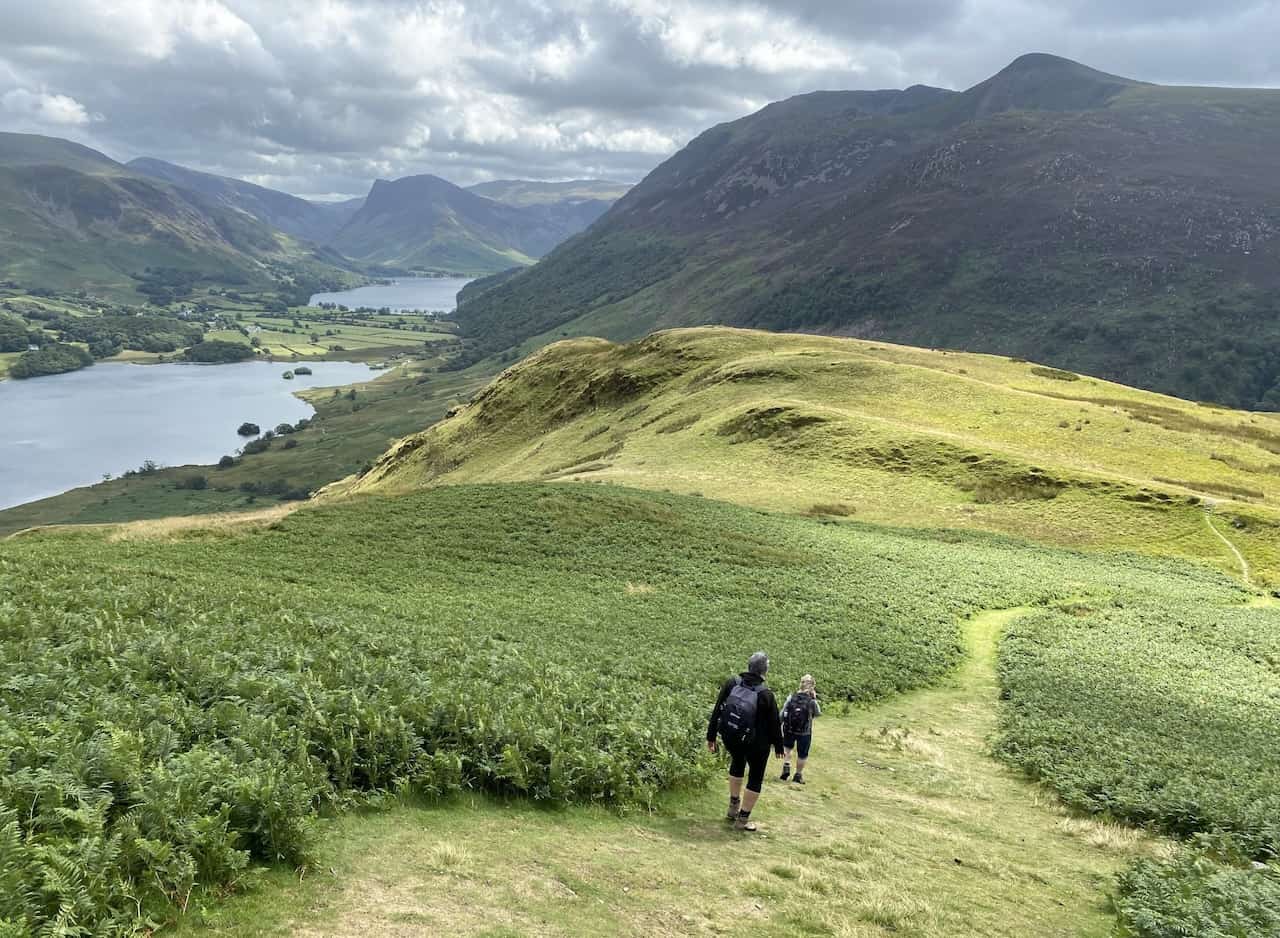
Lynn, Angy and Mike heading up towards White Crag.
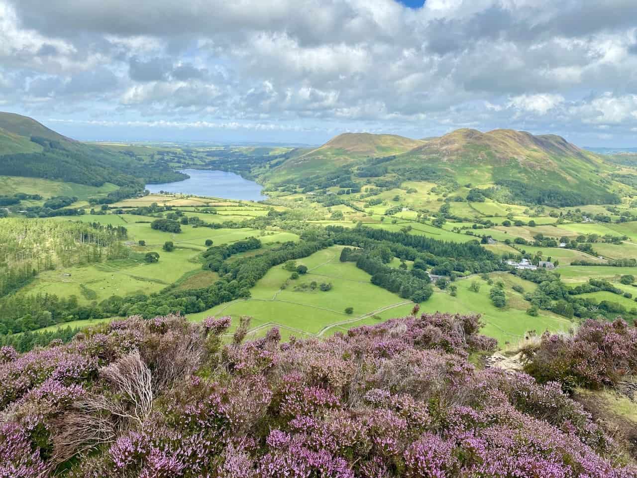
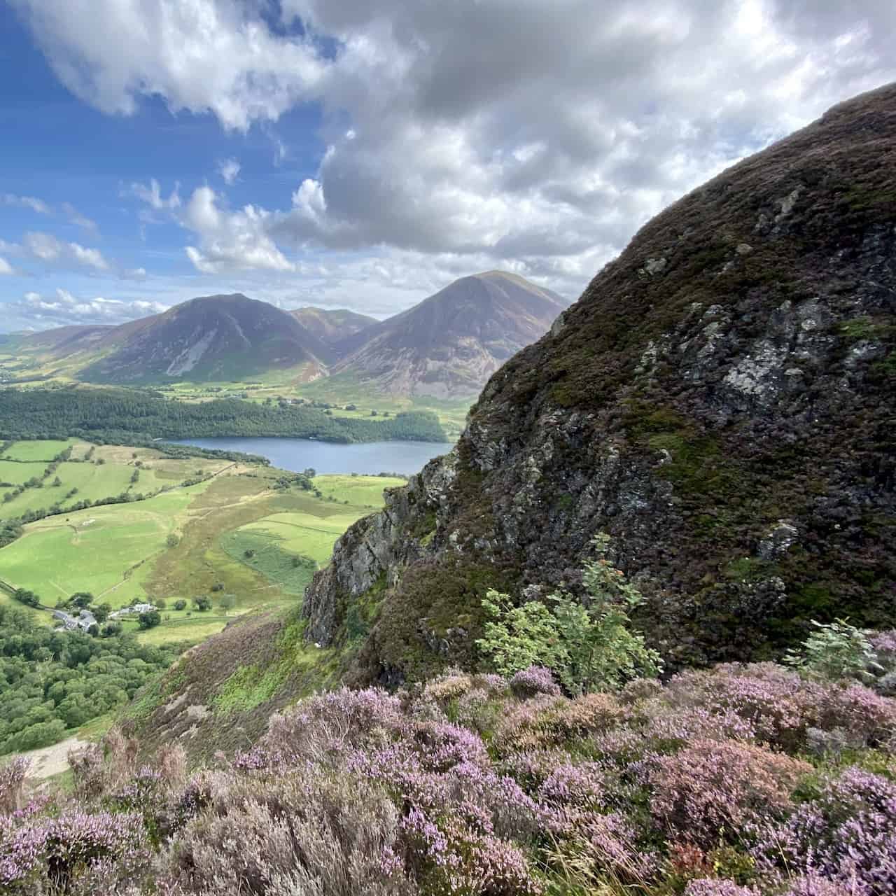
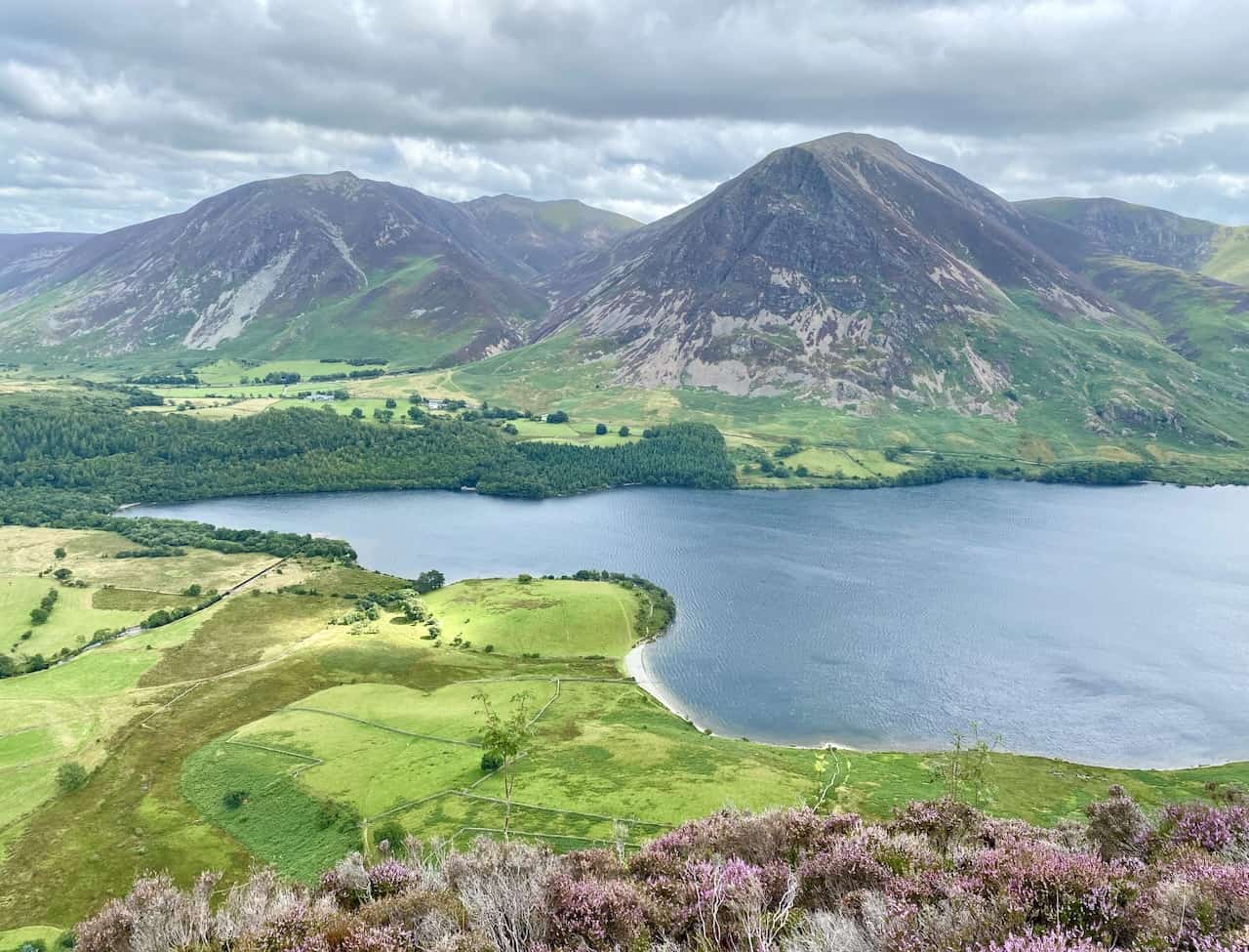
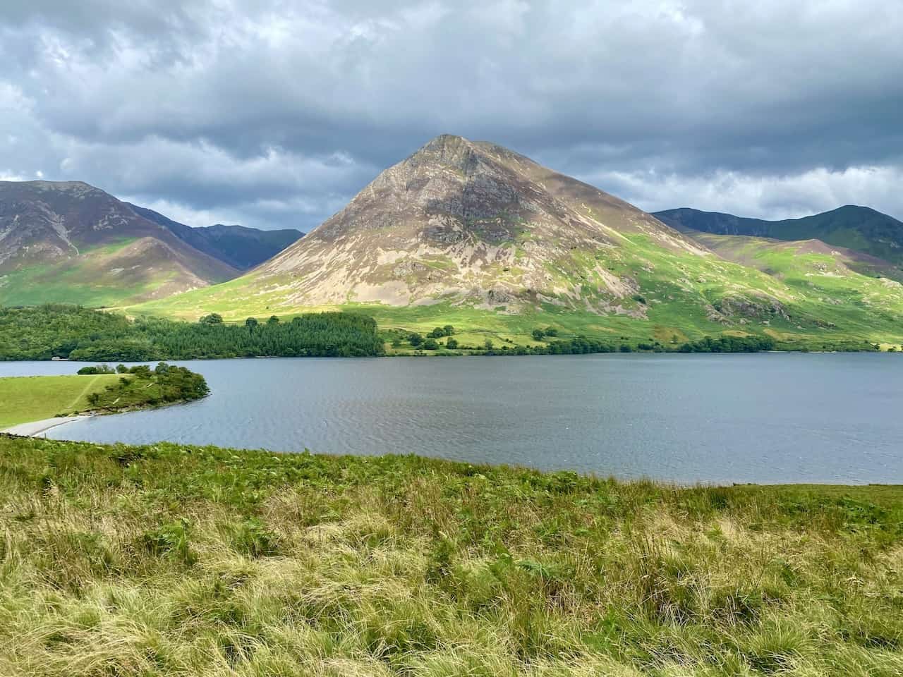
Crummock Water becomes visible during the climb with the peaks of Whiteside (left) and Grasmoor (right) in the background.
Loose scree covers the steep path to Mellbreak North Top and the slippery scramble is not easy.
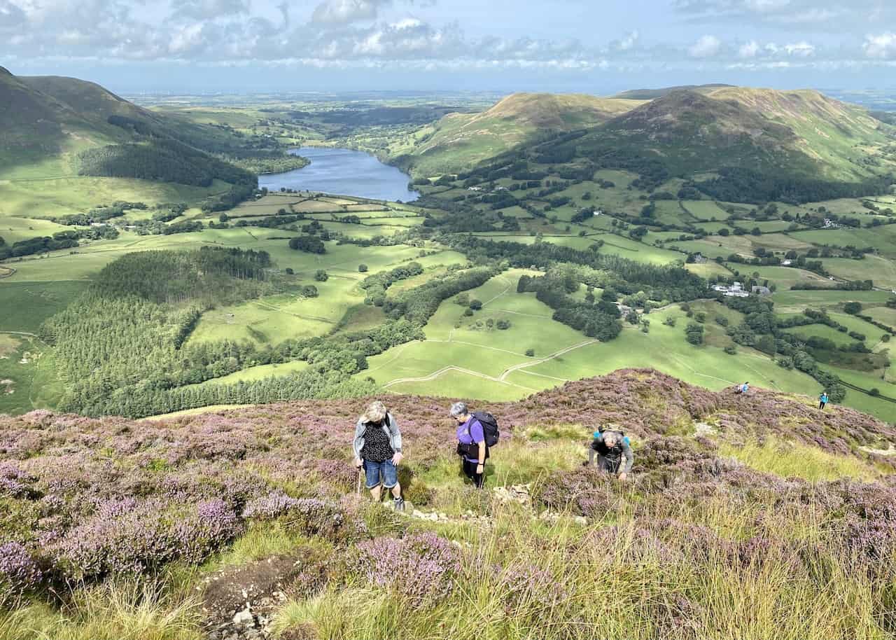
The ascent is difficult but the views during our Mellbreak walk are breathtaking. Looking north-west, Loweswater is surrounded by Low Fell, Darling Fell, Carling Knott and Burnbank, with the Solway Firth in the far distance.
To the east is Crummock Water backed by Whiteside, Grasmoor and Whiteless Pike, with mountains such as Hopegill Head, Grisedale Pike and Robinson visible further away.
Grasmoor and Whiteside as seen from Mellbreak North Top. Our Mellbreak walk is providing spectacular views.
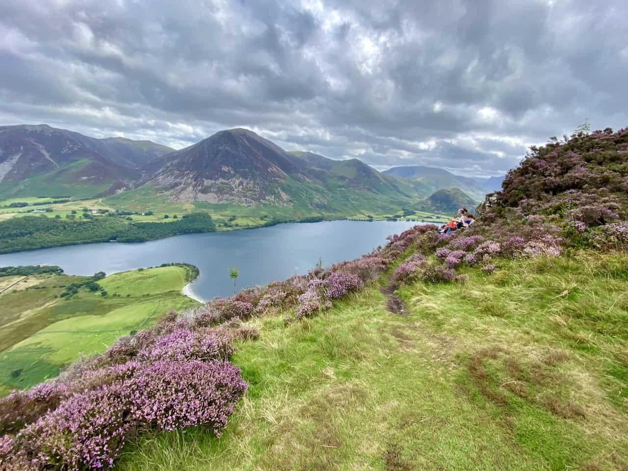
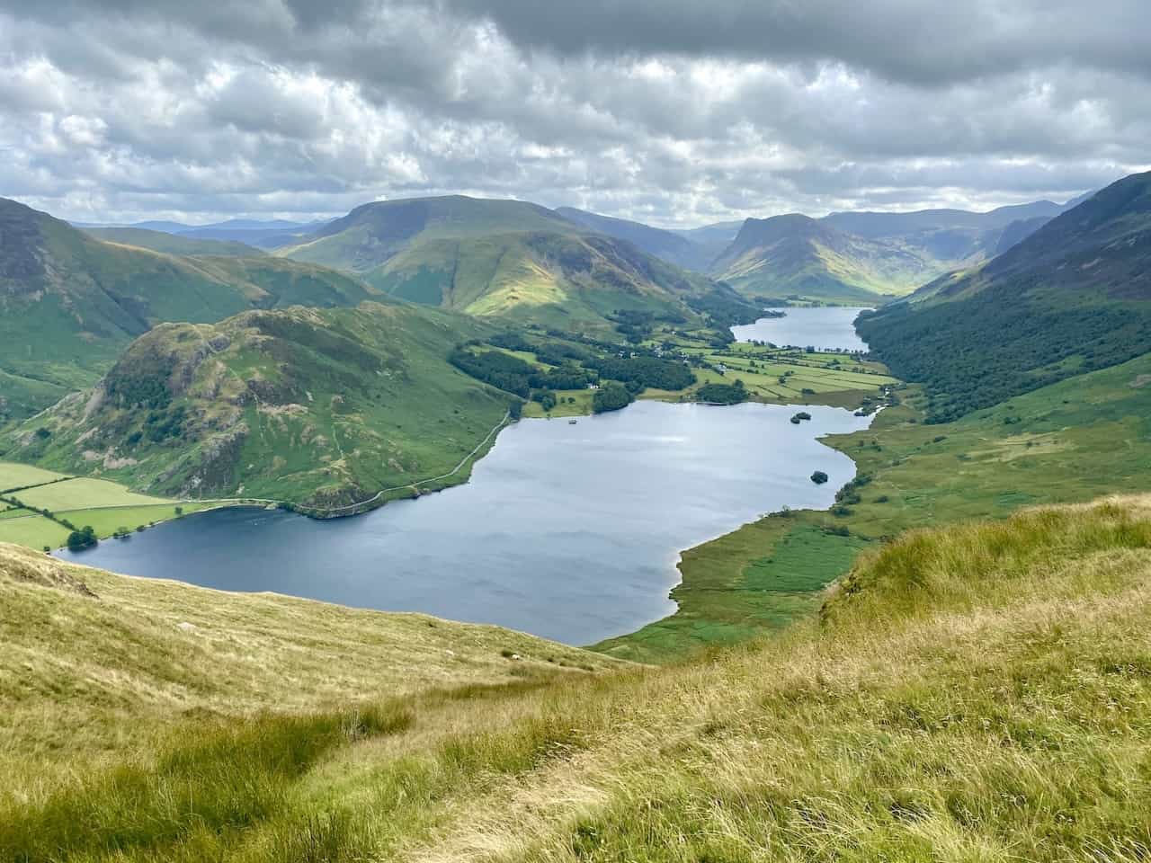
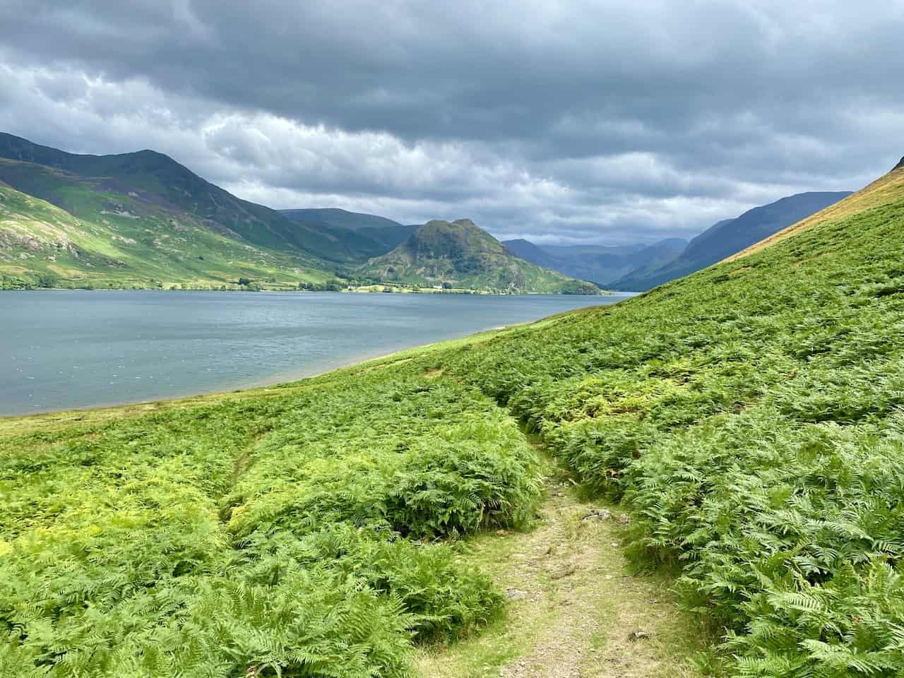
The view from Mellbreak South Top south-east to Buttermere. Behind the lake is Fleetwith Pike and to the right is the high ridge linking Red Pike, High Style, High Crag and Hay Stacks.

A little further along and both Crummock Water and Buttermere become fully visible. The small hill in the foreground on the left is Rannerdale Knotts, renowned for its splendid bluebell coverage in May.
Red Pike is lit by the sun’s rays; the other hills and mountains are in shadow.
Lynn and Angy descend Mellbreak on an easy-going grassy path.
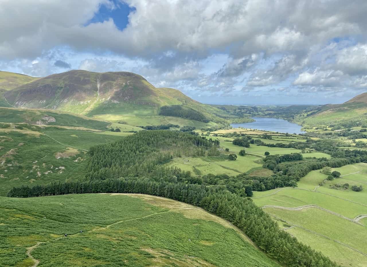
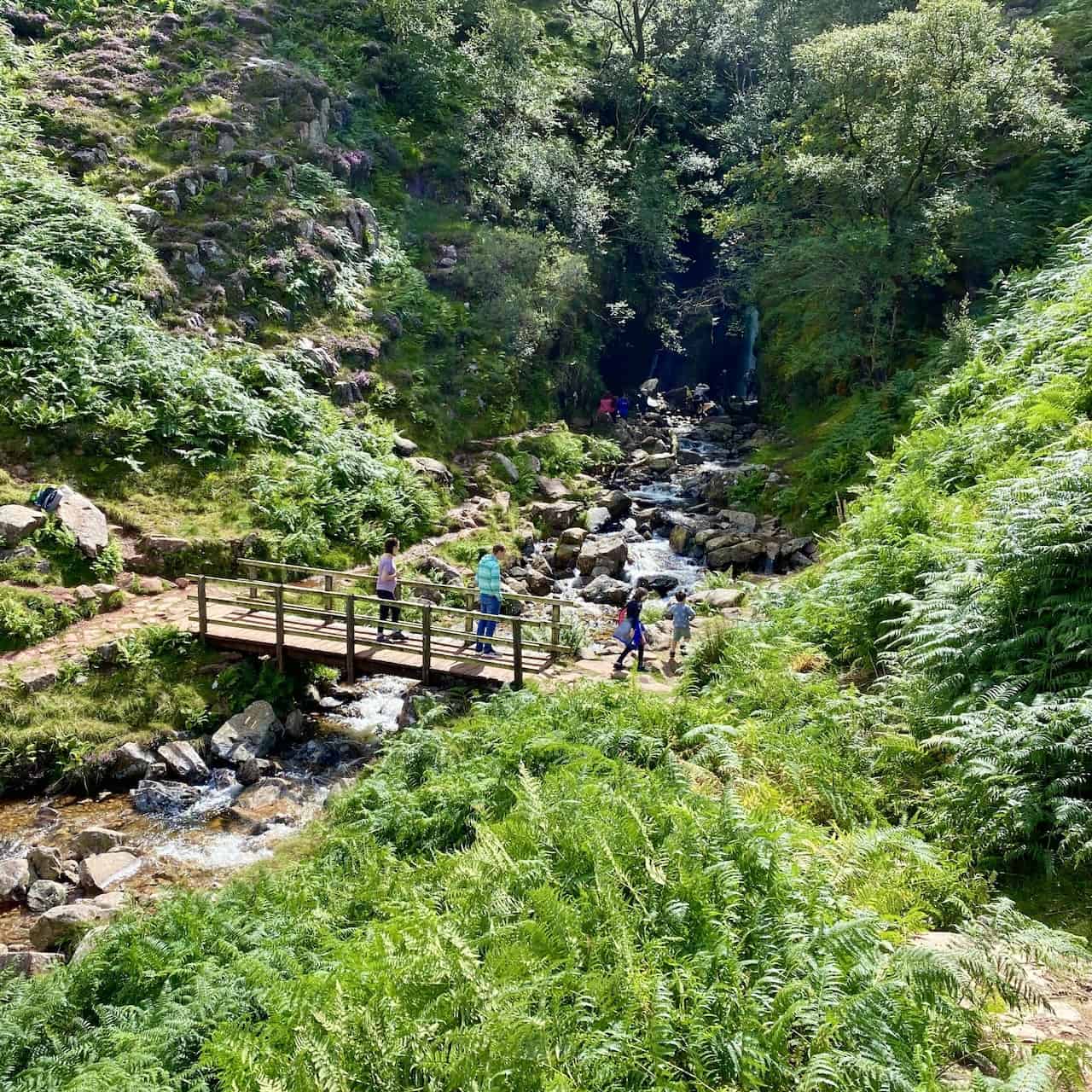
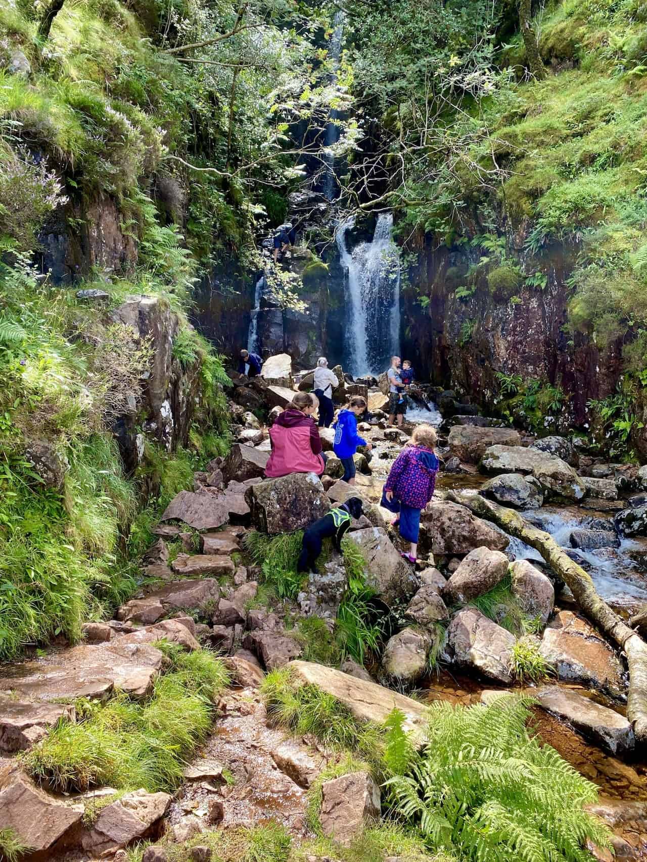
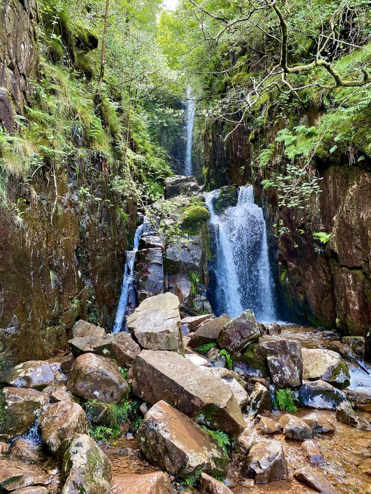
Scale Force created by Scale Beck. A path runs uphill parallel to the beck and eventually leads to Red Pike, but that walk is for another day.
The route from Scale Force down to Crummock Water. We’re almost halfway through our Mellbreak walk.
Crummock Water and Rannerdale Knotts. Whiteless Pike is the pointed fell behind Rannerdale Knotts.
The mighty Grasmoor, height 852 metres (2795 feet).
The view back to Rannerdale Knotts from the north-east slopes of Mellbreak.
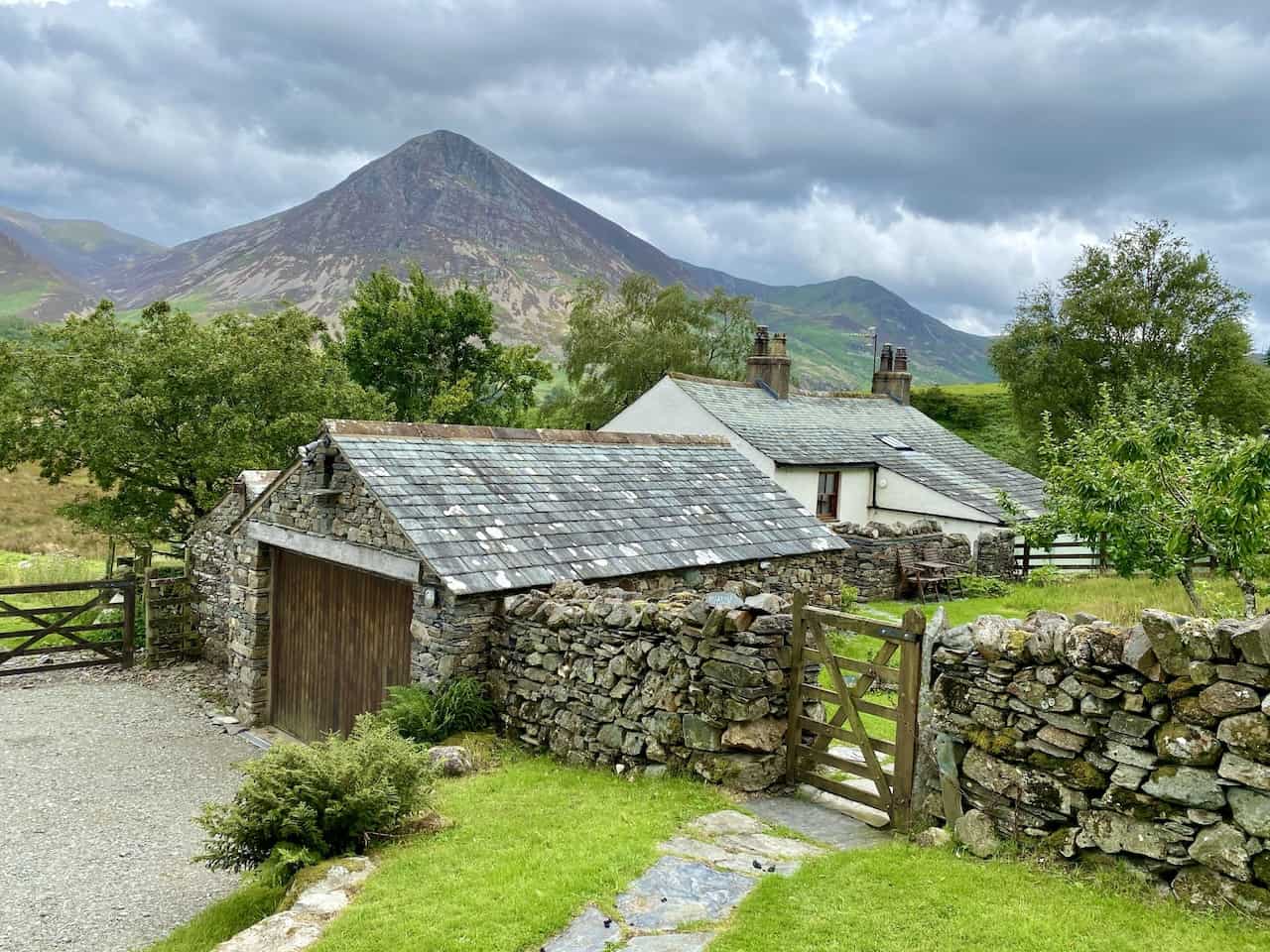
The picturesque setting of Highpark, with Grasmoor and Whiteless Pike in the background. Our Mellbreak walk is almost complete.
Highly Rated Osprey Hiking Backpacks for Outdoor Enthusiasts
Osprey’s reputation for crafting high-quality hiking backpacks is well-established, offering a range of options that cater to both men and women. The following four backpacks stand out for their excellent sales and customer ratings on Amazon, making them a top choice for outdoor enthusiasts seeking reliability and comfort. As an Amazon affiliate, I may earn a small commission from any purchases made through the links provided. This helps support the upkeep of this website. Rest assured, you won’t pay a penny extra, but your purchase will contribute to keeping my site running smoothly. Happy walking!

Osprey Tempest 20 Women’s Hiking Backpack
The Tempest 20 stands out as the ideal solution for day-hiking, biking, or peak-bagging, tailored specifically for women. It features a panel-loading design for ease of access, complemented by an internal zippered mesh pocket with a key clip for secure storage. Unique to this model are the Stow-on-the-Go trekking pole and LidLock bike helmet attachments, enhancing its versatility. Side stretch mesh pockets, along with an easy-access, expandable stretch mesh harness pocket, offer ample storage. Additionally, it includes a blinker light attachment (light not included) and a large stretch mesh front panel pocket for extra carrying capacity.

Osprey Talon 22 Men’s Hiking Backpack
Designed for the active adventurer, the Talon 22 provides an optimal panel-loading design suitable for day-hiking, biking, or peak-bagging. Key features include dual-zippered panel access to the main compartment and a tuck-away ice ax attachment with a bungee tie-off. It boasts a top panel zippered slash pocket for quick access items and lower side compression straps for load management. An external hydration reservoir sleeve and dual-zippered fabric hipbelt pockets enhance hydration and storage, while a large stretch mesh front panel pocket increases its utility for various activities.

Osprey Tempest 30 Women’s Hiking Backpack
The Tempest 30, designed with a women’s-specific fit, is a streamlined top-loader ideal for both extensive day trips and light-and-fast overnight adventures. It includes a fixed top lid with an external zippered slash pocket and an under-lid zippered mesh pocket with a key clip for organised storage. The pack features a tuck-away ice ax attachment with a bungee tie-off, dual upper and lower side compression straps for load adjustment, and an external hydration reservoir sleeve. For added convenience, it offers an easy-access, expandable stretch mesh harness pocket and dual-zippered fabric hip-belt pockets.

Osprey Talon 33 Men’s Hiking Backpack
The Talon 33 is engineered for dynamic movement, making it the perfect streamlined top-loader for committed day trips or light-and-fast overnight excursions. It features top load access to the main compartment for easy packing and retrieval. The backpack is equipped with a large stretch mesh front panel pocket, Stow-on-the-Go trekking pole attachment, and stretch mesh side pockets for versatile storage options. Additionally, an easy-access, expandable stretch mesh harness pocket and dual-zippered fabric hip-belt pockets offer convenient storage solutions for essential gear.