ADVERTISEMENT
Take the Ard Crags Walk for Stunning Views of Crummock Water and Buttermere
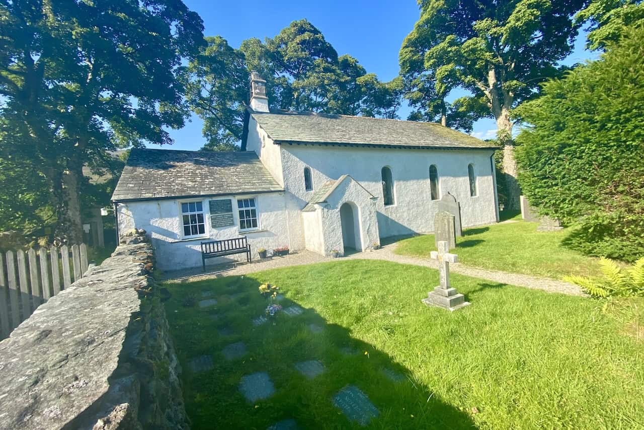
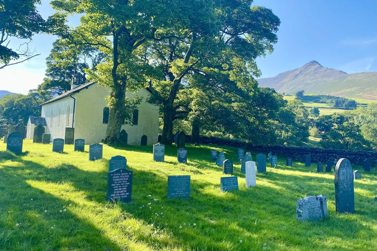
This Ard Crags walk begins in the charming village of Little Town, nestled in Newlands within the stunning Lake District. You’ll find parking just south of Little Town, next to Chapel Bridge, which crosses the serene Newlands Beck. Once parked, cross the bridge and stroll west along the minor road, enjoying the sight of Newlands Church on your right.
After about half a mile, veer south-west towards Low High Snab. Follow the picturesque path south-west through the valley, keeping Scope Beck as your companion. Soon, you’ll reach a delightful reservoir near the head of the valley, an ideal spot to pause, relax, and enjoy a coffee or some refreshments amidst the tranquil surroundings.
ADVERTISEMENT
Next, embark on an invigorating climb uphill in a south-westerly direction. Though the path may be unclear at first, it becomes more defined as you ascend. Your goal is to conquer the summit of Robinson. From Robinson, descend the mountain’s steep western slopes and traverse Buttermere Moss to arrive at High Snockrigg. Be sure to visit the cairn here for breathtaking views over Crummock Water and Buttermere.
Continue your adventure by heading north-east downhill to the road at Newlands Hause. If you’re feeling energetic, take a brief detour to marvel at the Moss Force waterfall. Cross the road and embark on a steep climb to Knott Rigg. Once at the top, continue south-east along the ridge to Ard Crags. This relatively level section offers stunning views into the valleys on either side, making it a delightful part of the walk.
ADVERTISEMENT
After savouring the views from Ard Crags, follow the path east and descend to Aikin Knott. Continue your descent until you reach the minor road between Birkrigg and Gillbrow. From the road, wander through the charming farm at Gillbrow and make your way down to the footbridge, crossing the peaceful Keskadale Beck.
The path will lead you back to the track near the start of your journey. Head east past Newlands Church, retracing your steps to the car park. This 8-mile Ard Crags walk in the Lake District offers an exhilarating adventure, filled with fantastic views and beautiful scenery that will leave you refreshed and inspired.
Ard Crags Walk: Maps and Tools
Visit either the OS Maps website or the Outdooractive website to view this walking route in greater detail. Both platforms offer a range of features, including the ability to print the route, download it to your device, and export the route as a GPX file. You can also watch a 3D fly-over and share the route on social media.
Ard Crags Walk: Distance, Duration, Statistics
Distance: 8¼ miles
Distance: 13¼ kilometres
Duration: 5 hours
Ascent: 3159 feet
Ascent: 963 metres
Type: Circular walk
ADVERTISEMENT
Recommended Ordnance Survey Map
The best map to use on this walk is the Ordnance Survey map of the Lake District North-Western Area, reference OS Explorer OL4, scale 1:25,000. It clearly displays footpaths, rights of way, open access land and vegetation on the ground, making it ideal for walking, running and hiking. The map can be purchased from Amazon in either a standard, paper version or a weatherproof, laminated version, as shown below.
Standard Version
About Ard Crags
Ard Crags is a fell in the Lake District in Cumbria. It is situated in the Newlands Beck valley, just off the minor road between Keswick and Buttermere. The Ordnance Survey records the fell’s altitude at 581 metres (1906 feet), significantly more than the approximate 570 metres (1860 feet) that Alfred Wainwright attributed to it in his 1964 Pictorial Guide to the North Western Fells. Ard Crags is close to higher fells like Causey Pike and Eel Crag, and it can be easily overlooked. However, from certain points in the Rigg Beck or the Newlands area, it presents a clearly defined and eye-catching pyramidal shape.
Ridge and Terrain
A long high ridge sweeps east from Whiteless Pike, via Wandope, Crag Hill, Sail, and Causey Pike, crossing from Buttermere to Stair. Running parallel to the south is a lower ridge, tenuously connected at Sail. This lower ridge consists of Knott Rigg and Ard Crags, which has a narrow and airy character. Ard Crags forms the eastern half of this ridge, rising between Keskadale and the side valley of Rigg Beck. It is sometimes referred to as Aikin Knott, named after the rash of rock on the ridge’s nose.
Geological Features
The Ard Crags ridge is part of the Buttermere Formation, an olistostrome of disrupted, sheared, and folded mudstone, siltstone, and sandstone. The narrow ridge, which forms part of the Ard Crags walk described on this page, is covered with heather, and its summit is marked by a small cairn. The view from the summit is restricted to the north and west by the higher Eel Crag to Causey Pike ridge. The best feature of the view is the aerial perspective of the Newlands Beck valley. Scafell Pike can be glimpsed 8 miles away through a gap in the hills to the south.
Wainwright Classification
In Alfred Wainwright’s list of 214 Lake District fells, Ard Crags is ranked 137th in height, standing at 581 metres (1906 feet). The grid reference for Ard Crags is NY 206 197, and it is featured on the OS Explorer map OL4 and the OS Landranger maps 89 and 90. Detailed information about Ard Crags can be found in Wainwright’s North Western Fells book.
Ard Crags Walk: My Photos
Heading south-west along the footpath through the Scope Beck valley.
ADVERTISEMENT
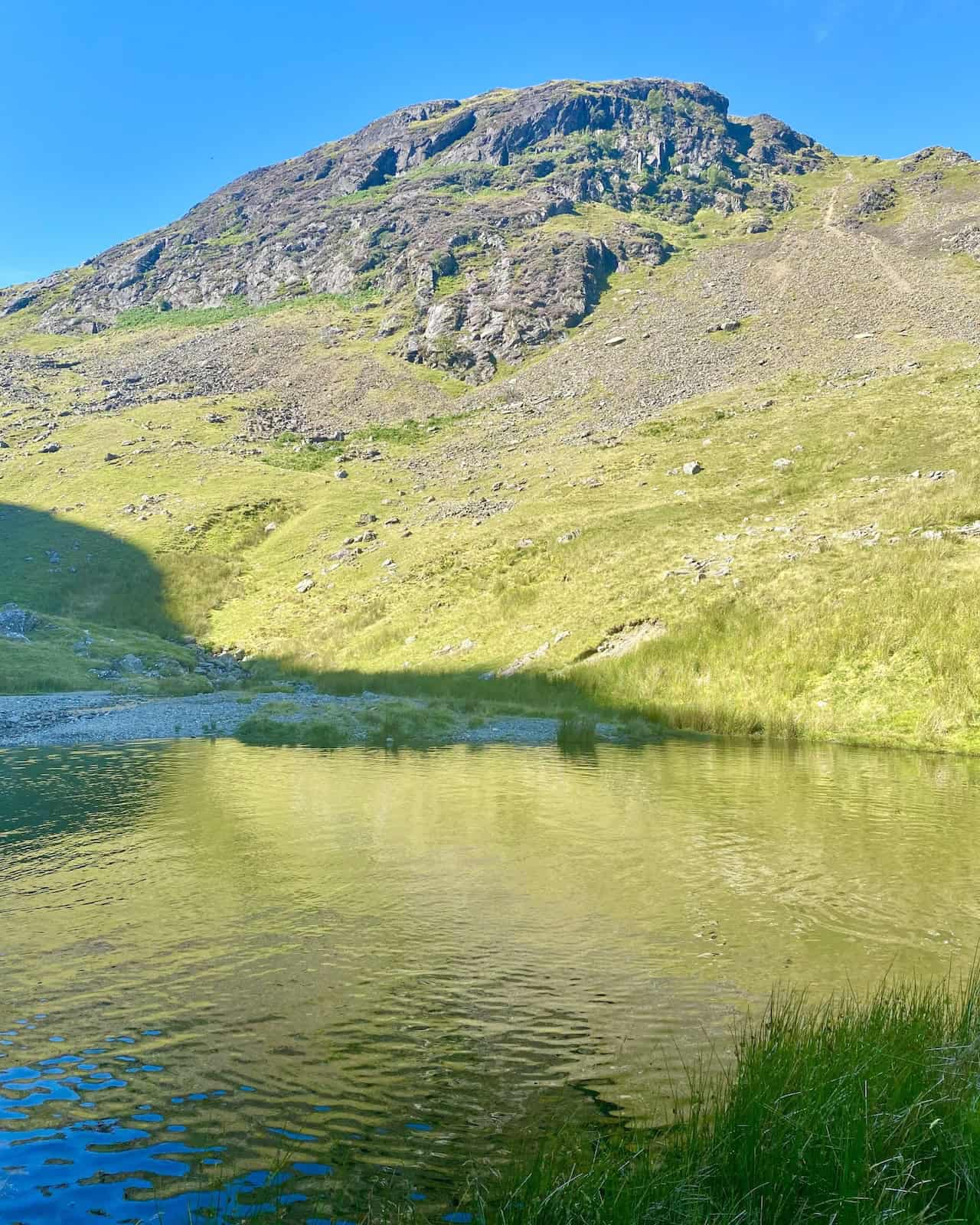
A small, unnamed reservoir beneath Blea Crags.
ADVERTISEMENT
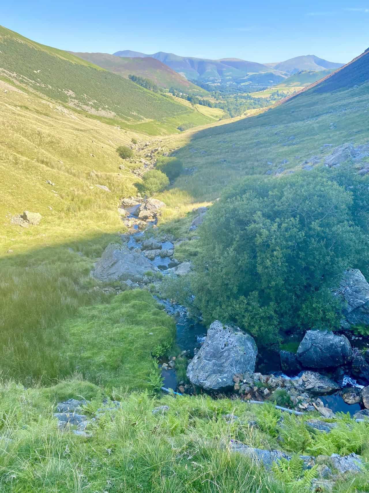
The view from the reservoir back down the Scope Beck valley, with the Skiddaw and Blencathra mountain ranges in the far distance.
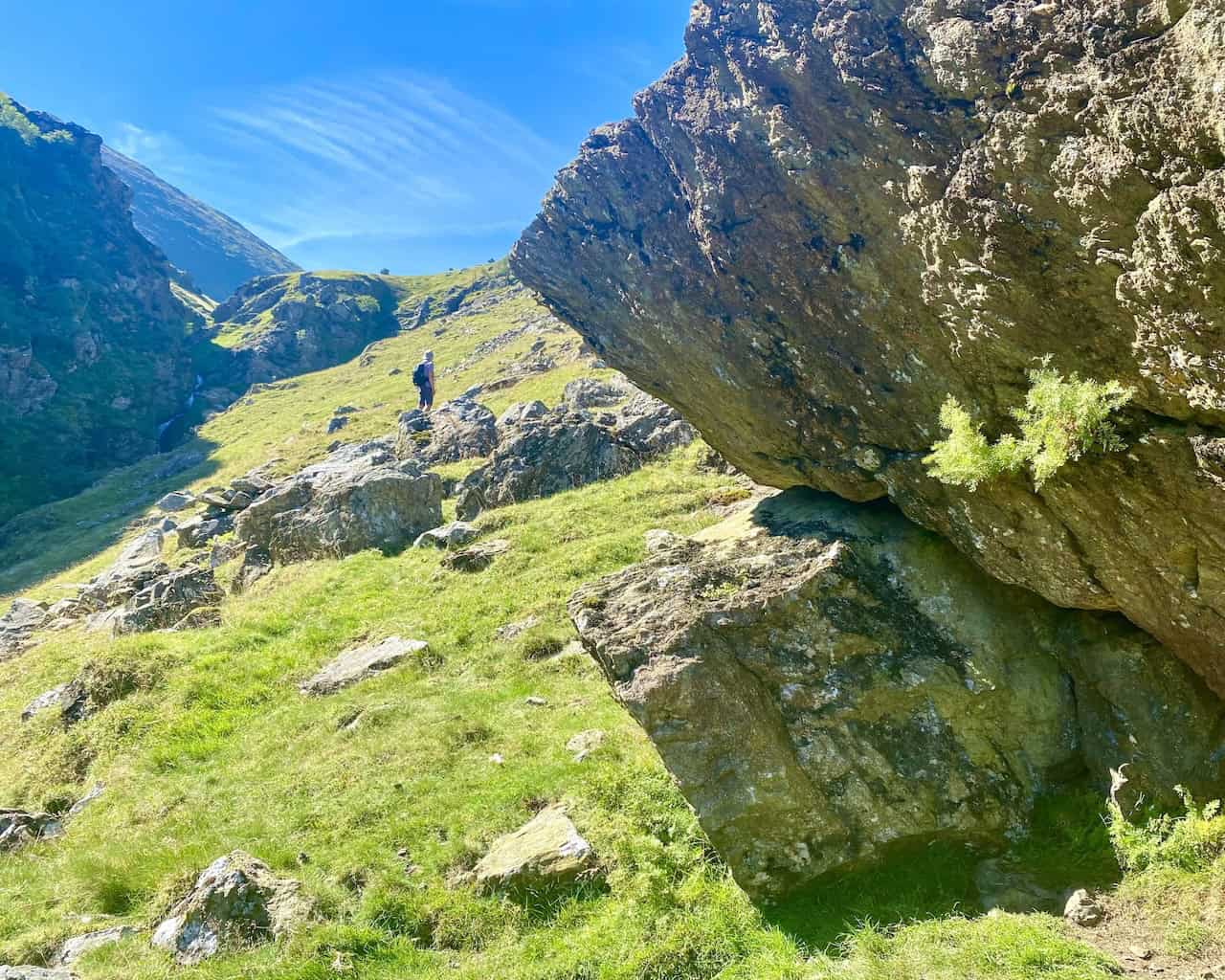
The first section of the path from the reservoir to Robinson steepens, becomes less defined and eventually just disappears.
ADVERTISEMENT
More fantastic views of the valley and reservoir as we reach higher ground.
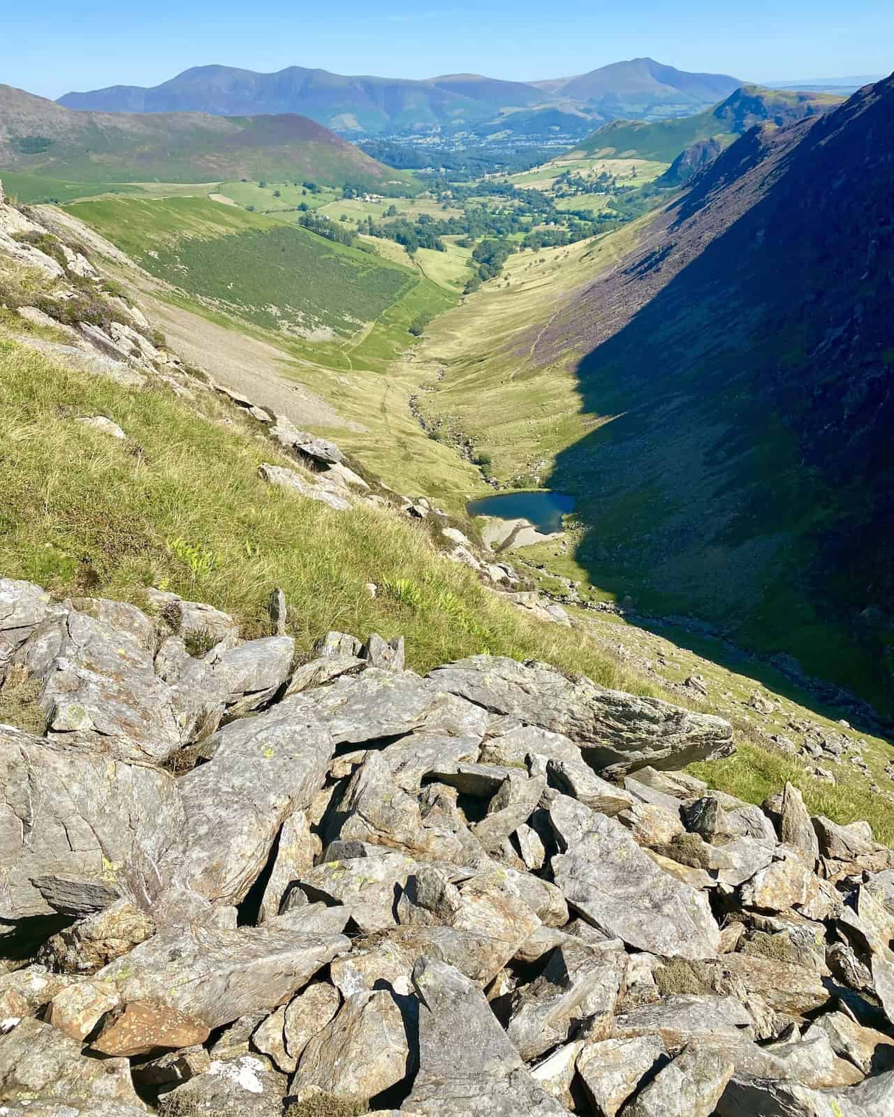
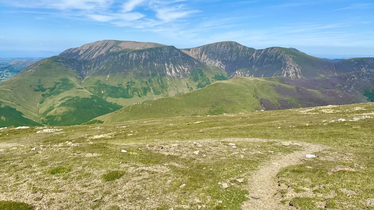
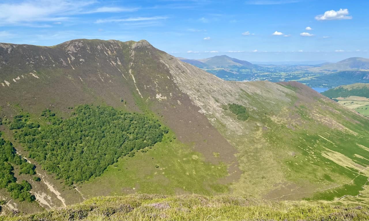
The view north-west towards Knott Rigg and some of the Lake District’s north-western fells, such as Whiteless Pike, Wandope and Crag Hill.
ADVERTISEMENT
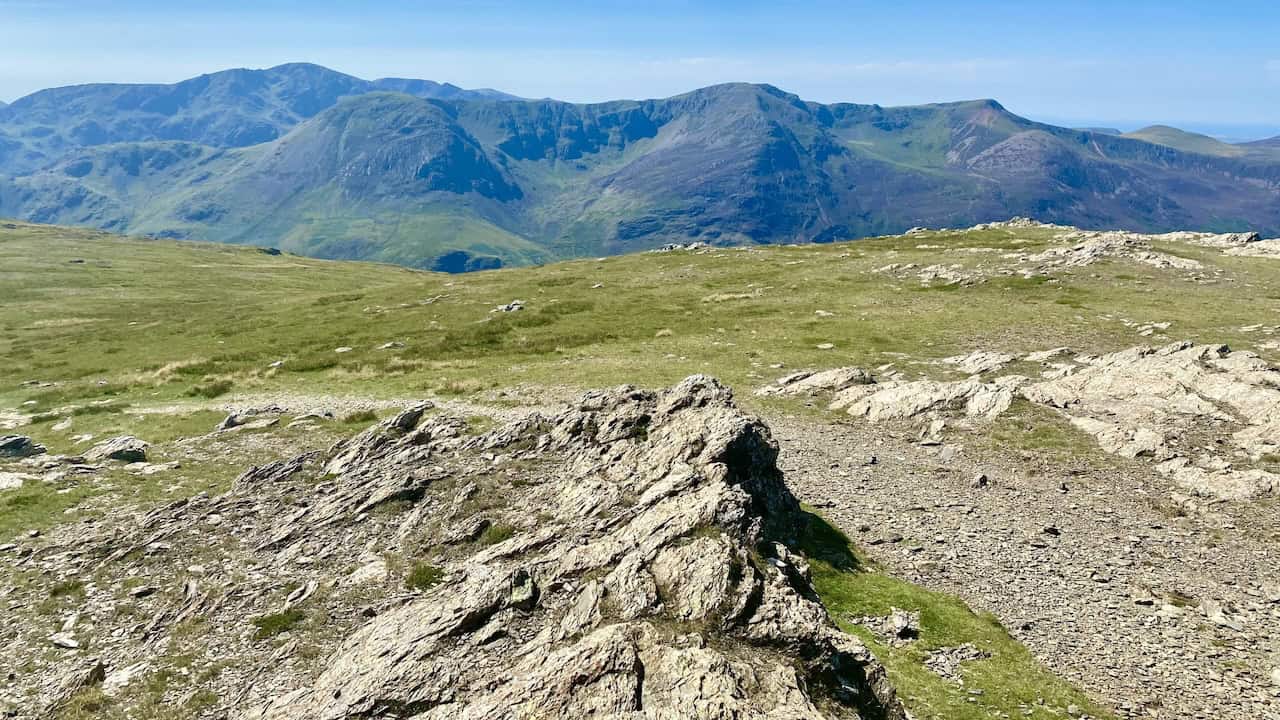
The view south from the Robinson plateau close to its summit. In the far distance on the horizon are the mountains in the Scafell Pike region, like Sca Fell, Scafell Pike, Great Gable, Ill Crag and Great End.
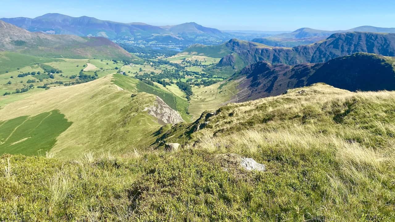
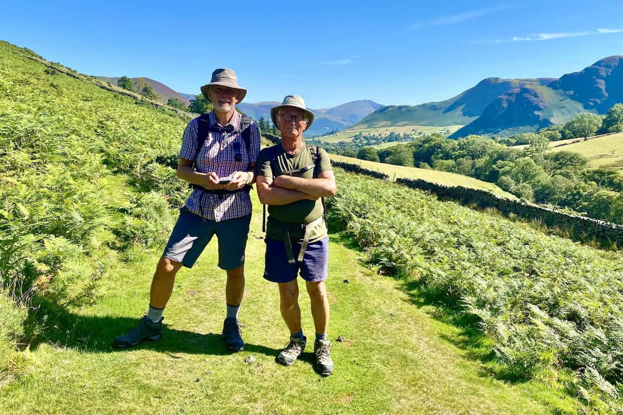
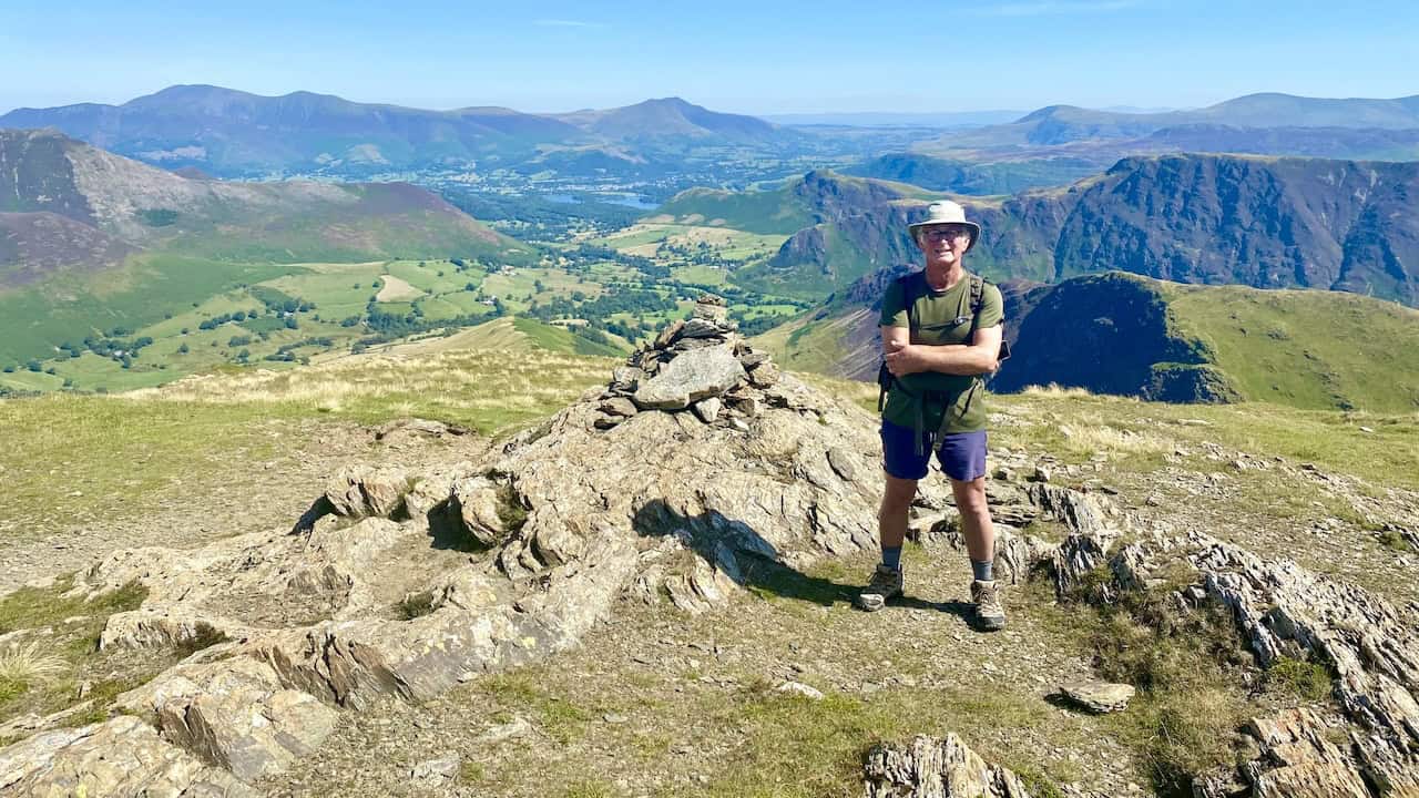
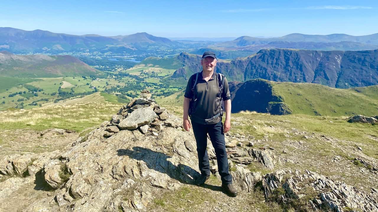
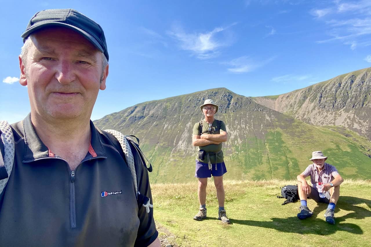
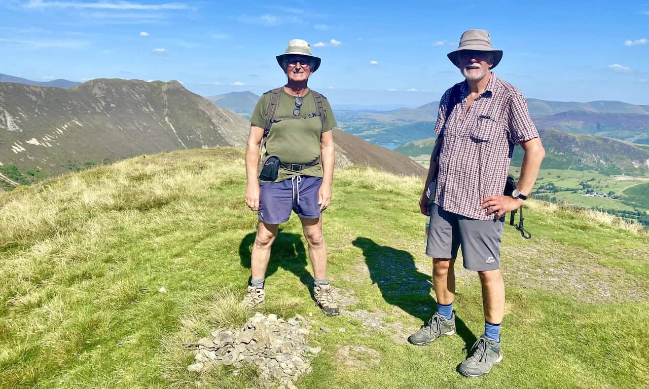
Keith and I at the cairn near the north-east edge of the Robinson plateau. From this height Keswick and Derwent Water are easily visible.
ADVERTISEMENT
The amazing layered effect of the mountains as seen from the top of Robinson during our Ard Crags walk.
Keswick and Derwent Water with Blencathra behind, viewed from Robinson.
ADVERTISEMENT
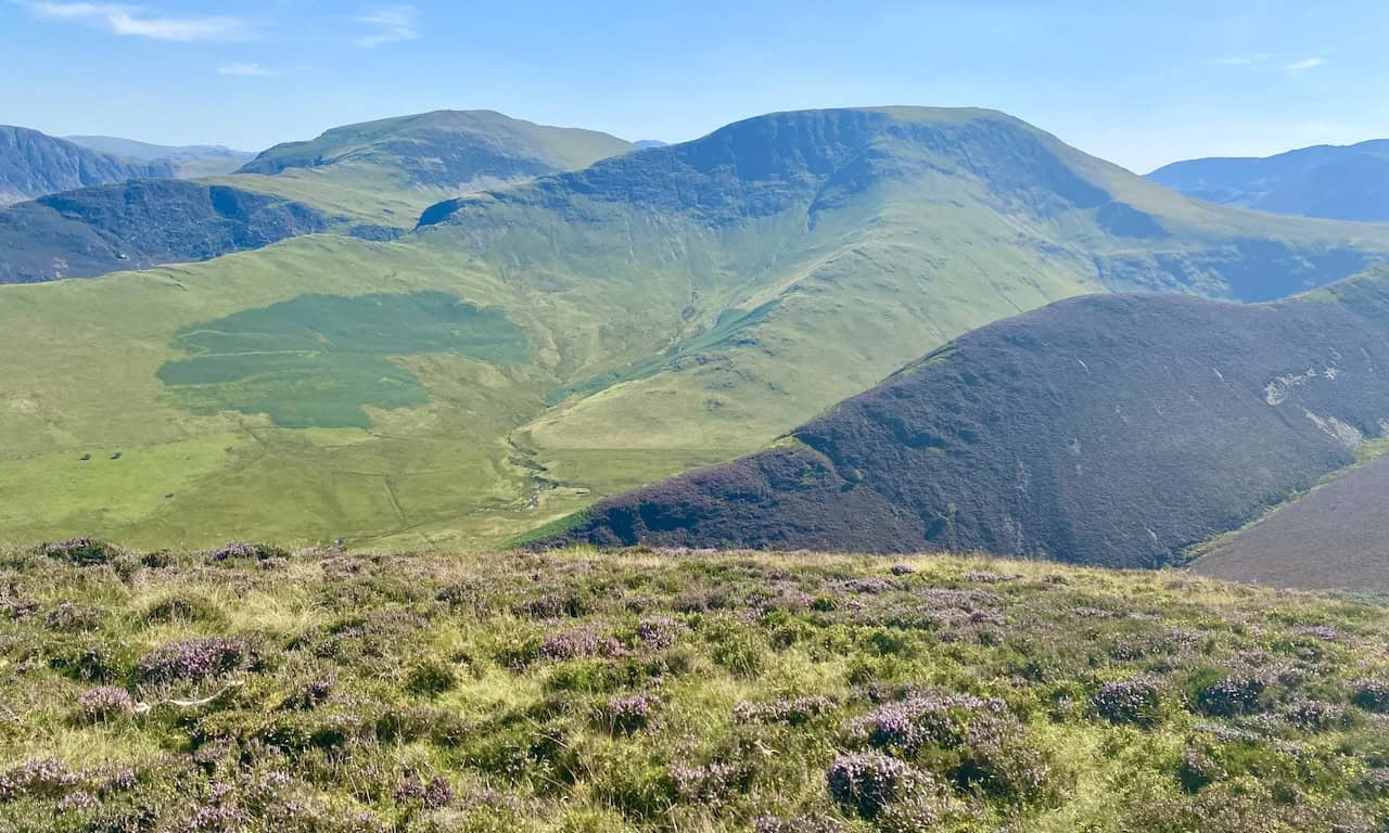
Great views of Whiteless Pike, Wandhope, Grasmoor, Crag Hill and Sail.
The Robinson summit, height 737 metres (2418 feet).
ADVERTISEMENT
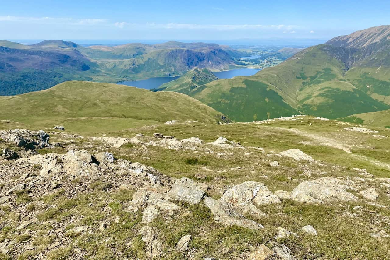
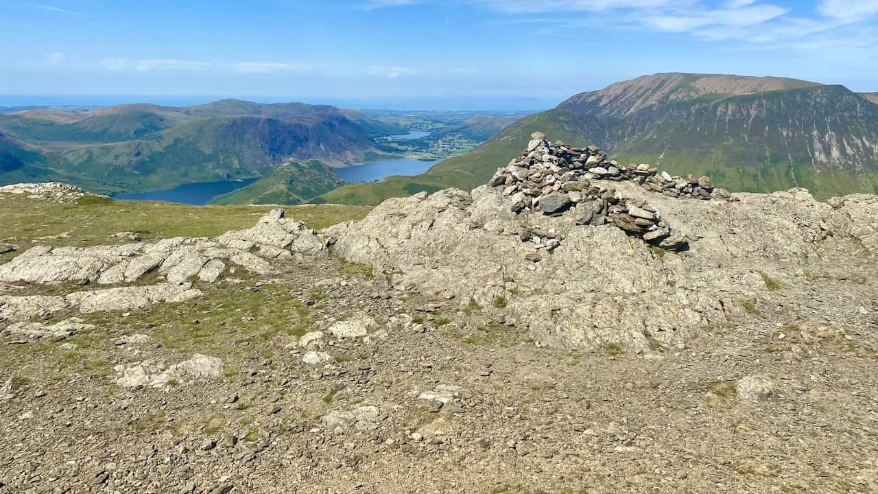
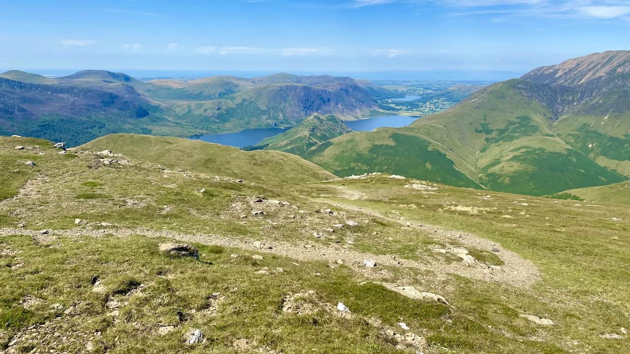
Looking north-west from Robinson down to Crummock Water and, further away, Loweswater during our Ard Crags walk.
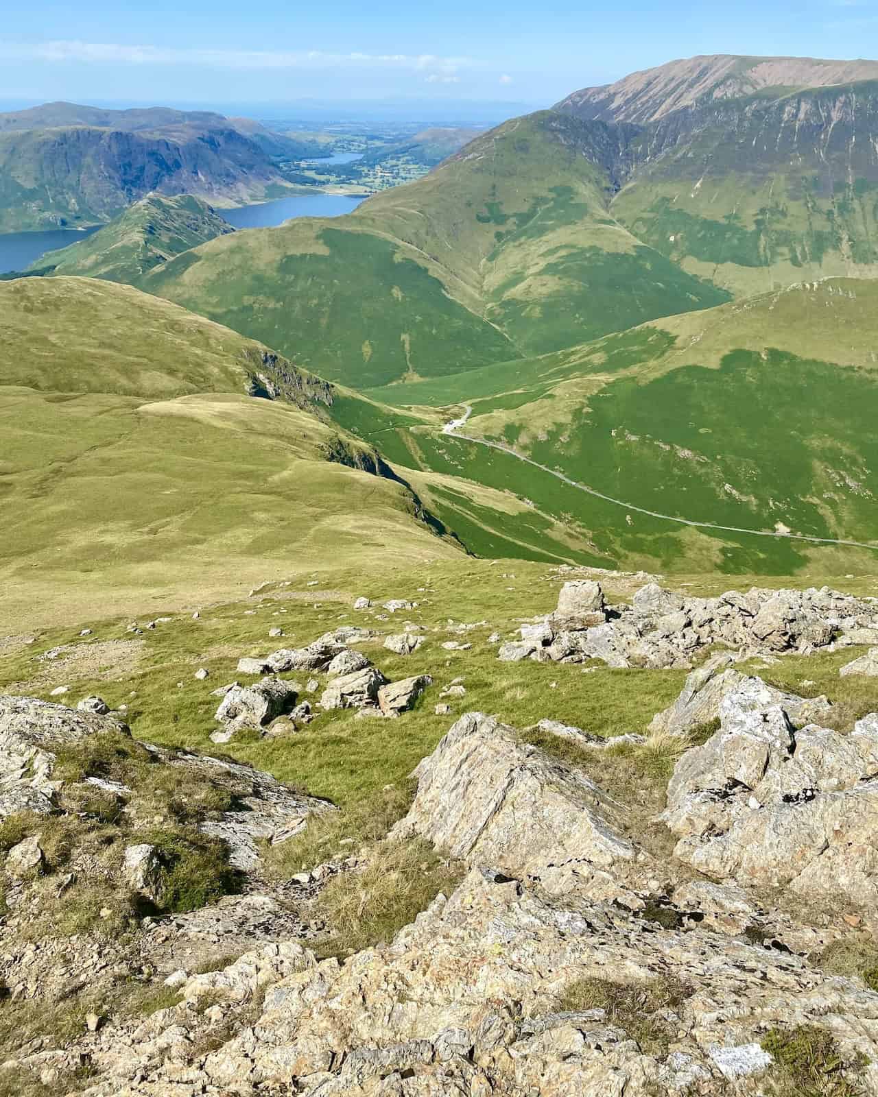
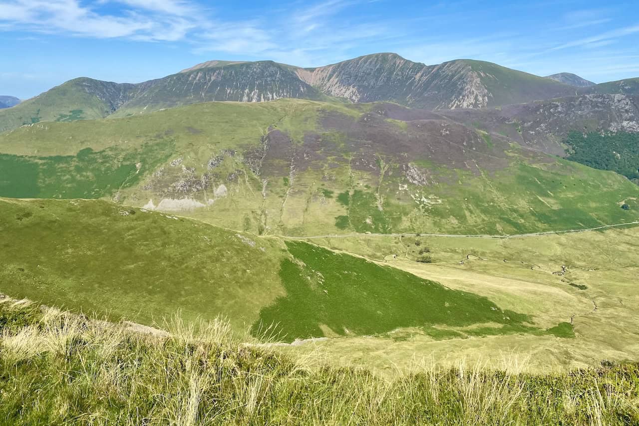
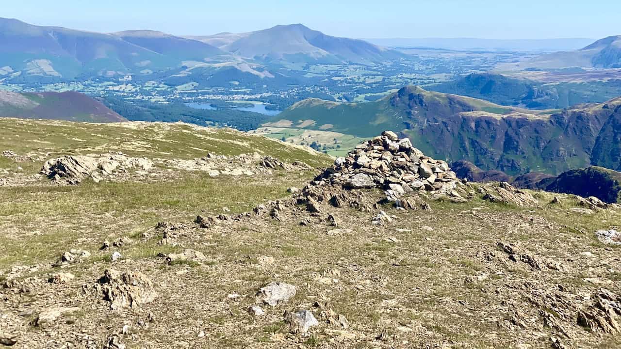
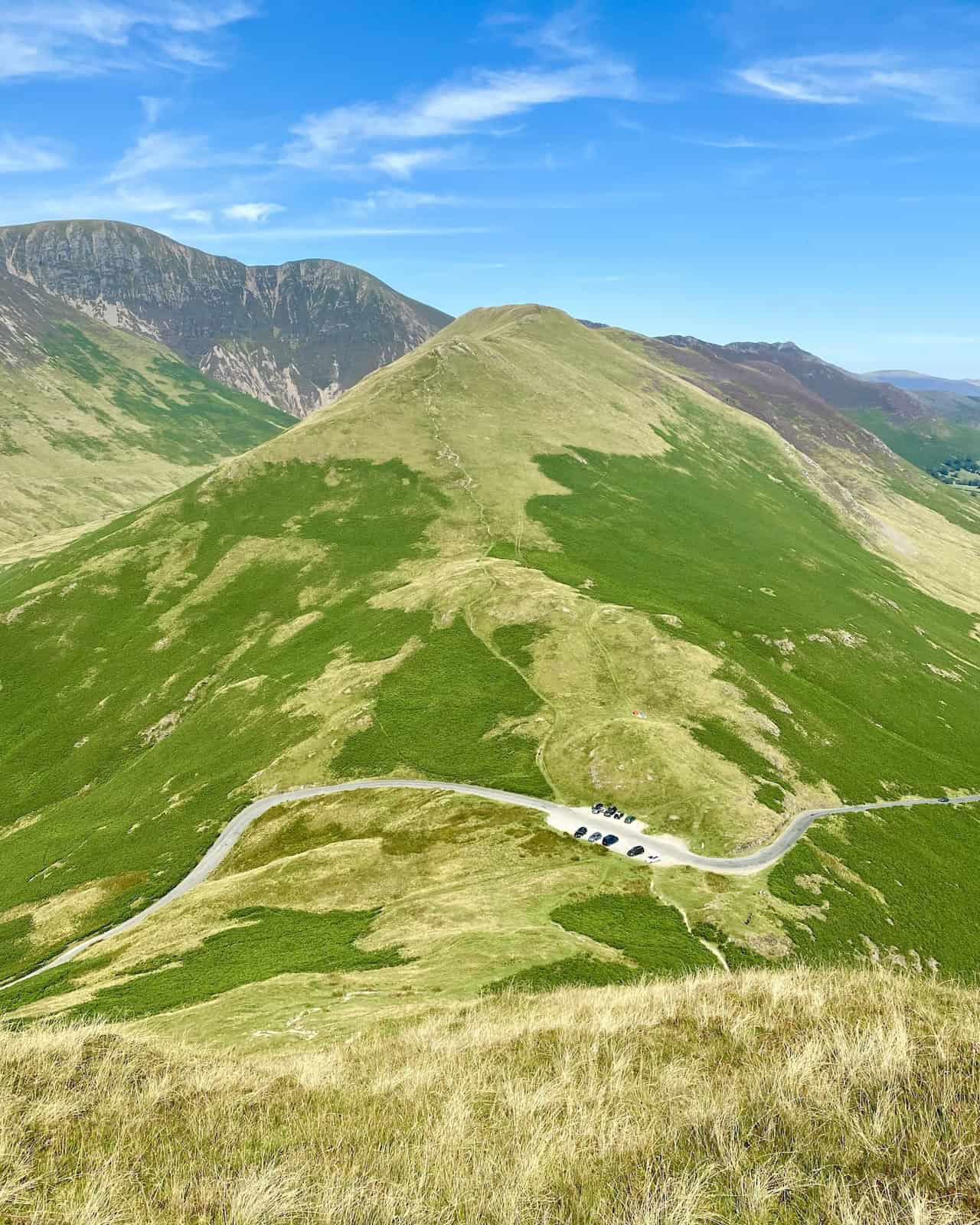
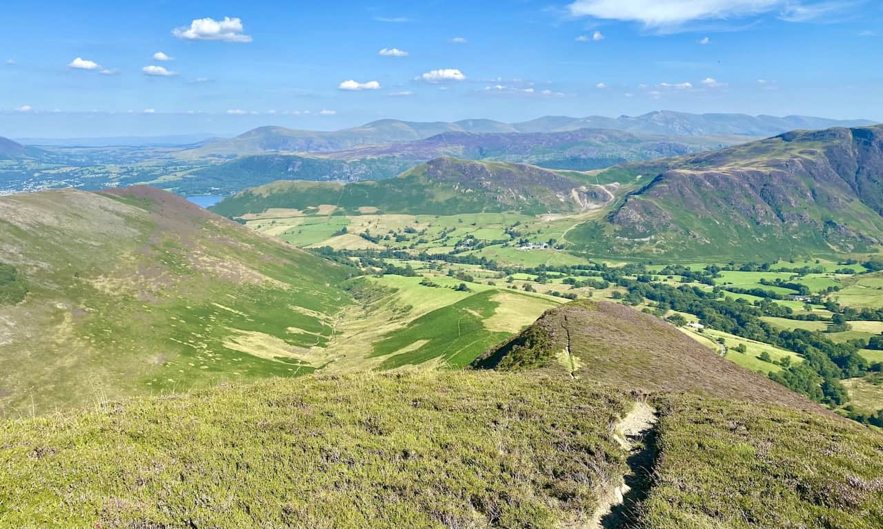
From the path descending High Snockrigg, the view down to the Newlands Hause car park and the route up to Knott Rigg, our next destination.
ADVERTISEMENT
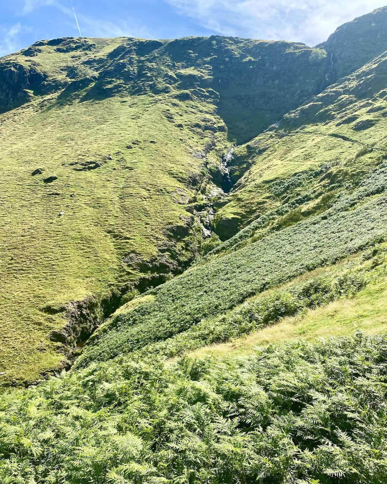
Moss Force (Waterfall) and Moss Beck at Newlands Hause, which is roughly the halfway point of our Ard Crags walk.
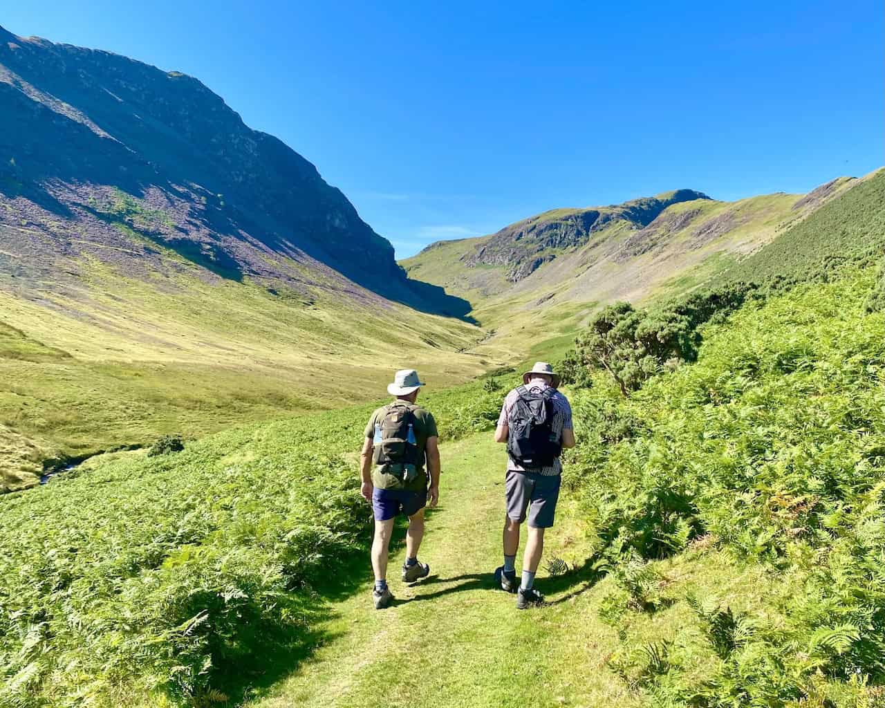
The route to the top of Knott Rigg, a more relaxing part of our Ard Crags walk.
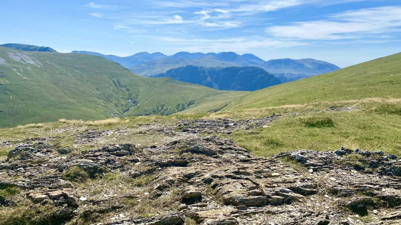
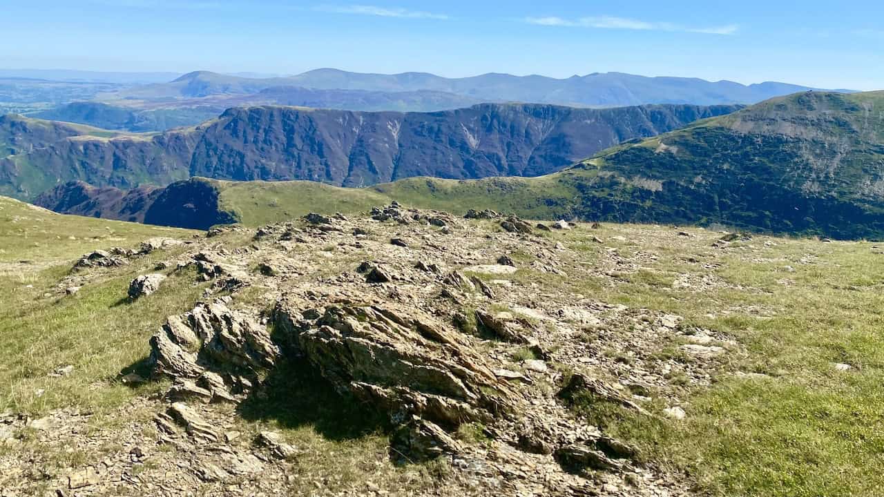
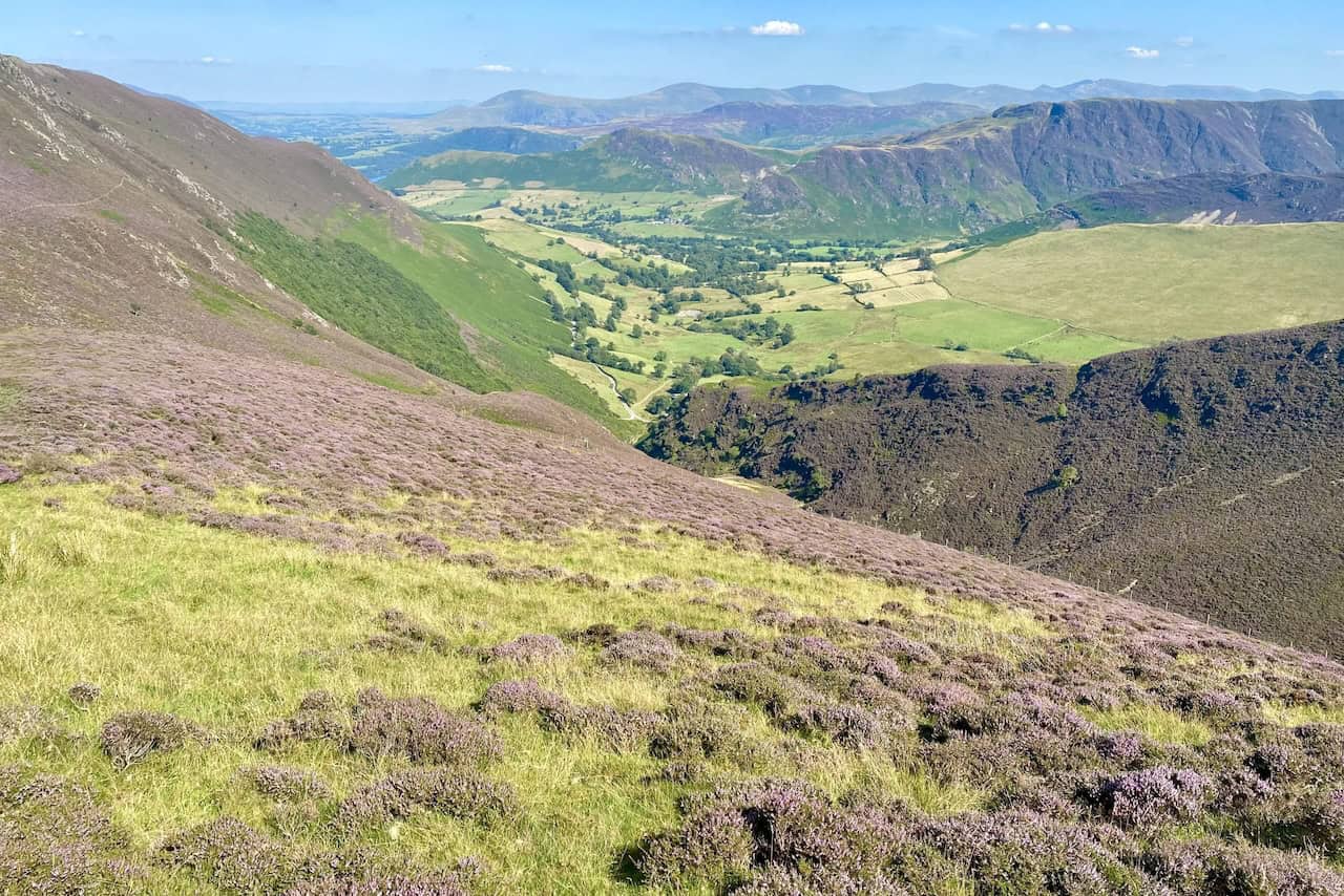
Looking back towards High Snockrigg and Newlands Hause, with the mountain range including Red Pike, High Stile and High Crag in the background.
ADVERTISEMENT
On the summit of Knott Rigg, height 556 metres (1824 feet).
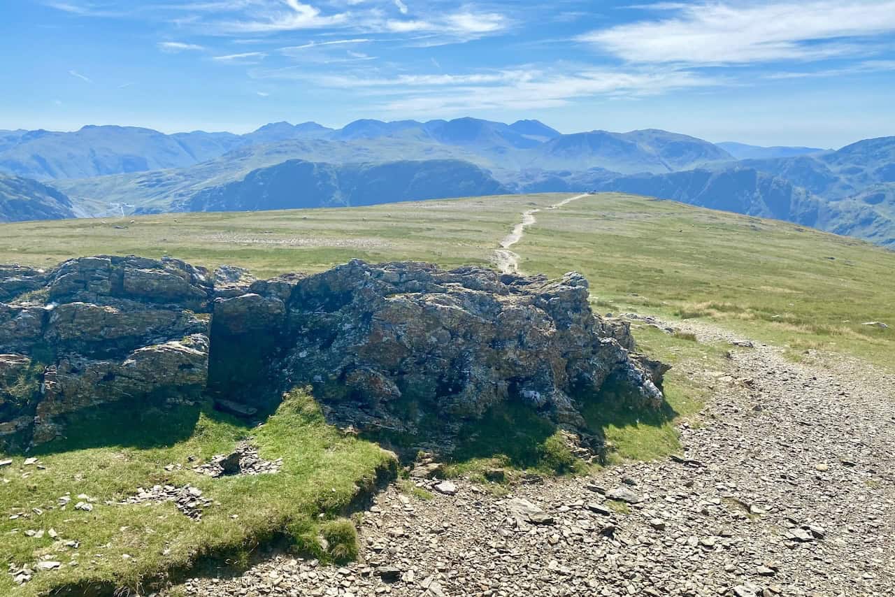
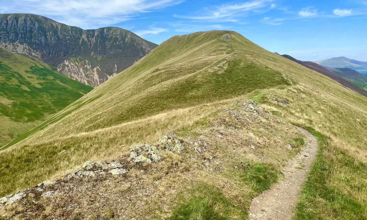
The path from Knott Rigg across the ridge to Ard Crags.
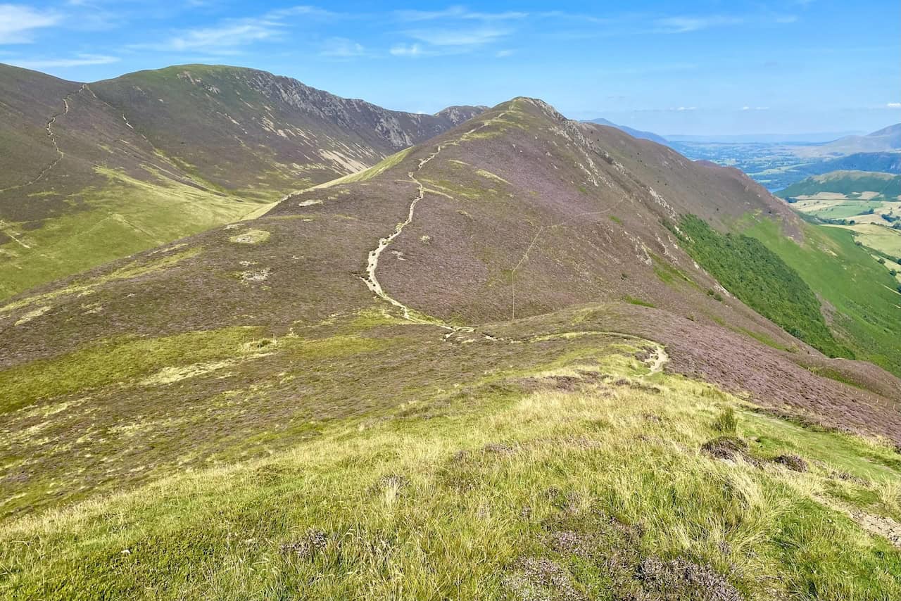
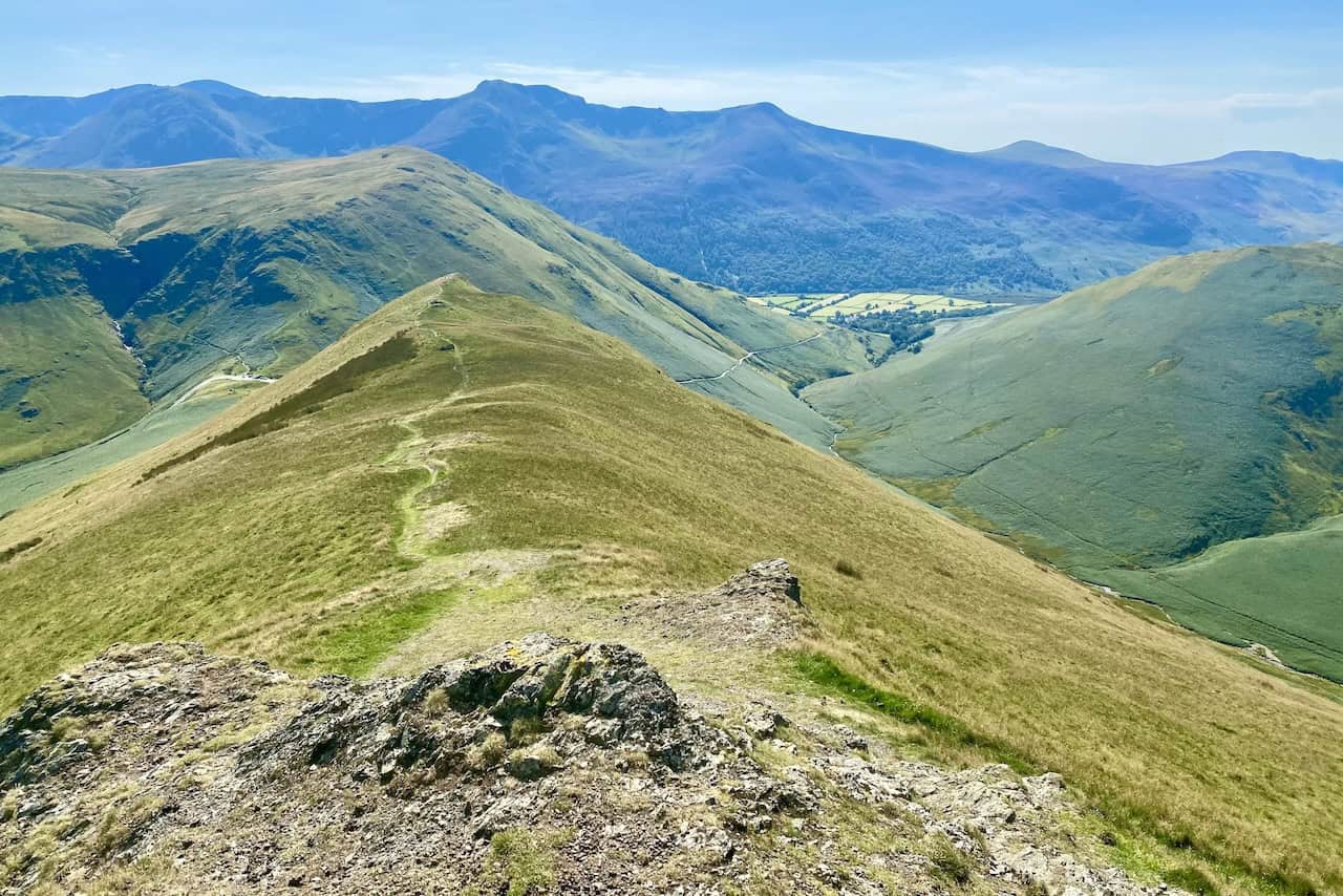
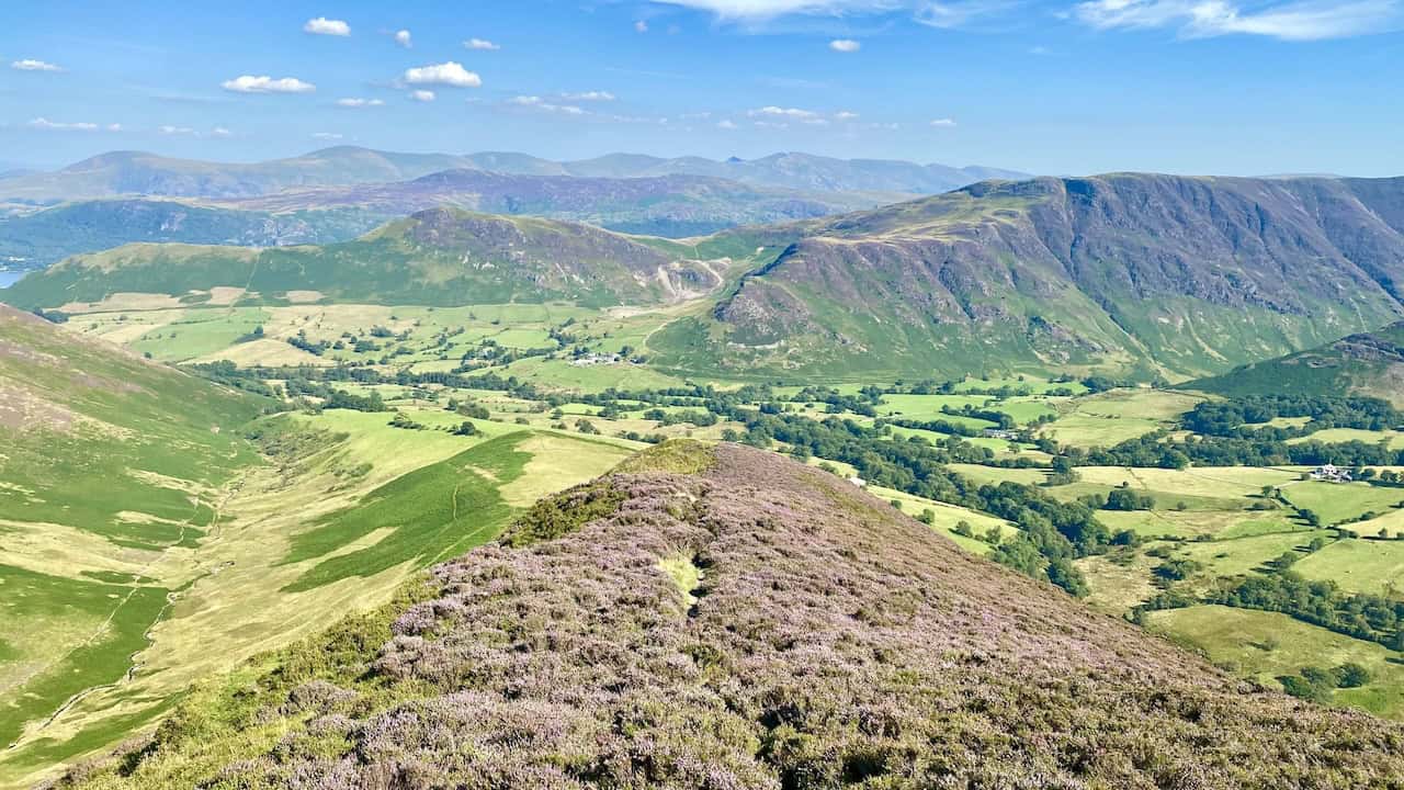
Looking down upon Newlands from the Knott Rigg / Ard Crags ridge.
The south-easterly view towards Robinson, with Hindscarth just behind it to the left, seen during our Ard Crags walk.
ADVERTISEMENT
The Ard Crags summit, height 581 metres (1906 feet).
The view of Causey Pike, easily recognisable by its nipple-shaped top.
The superb views during the descent of Aikin Knott including, on the horizon, the long range of mountains from Clough Head to Fairfield.
ADVERTISEMENT
Grade 2 listed, 16th-century Newlands Church just outside the hamlet of Little Town. Attached to the church is a former school. The plaques on the wall read as follows:
NEWLANDS SCHOOL
BUILT BY THE PARISHIONERS
1877, CLOSED 1967
THIS STONE WAS PLACED HERE
IN GRATEFUL MEMORY OF
DOROTHEA POTTS
HEADMISTRESS
1943-1962
NEWLANDS SCHOOL
RESTORED 2000
AND DEDICATED AS A PLACE FOR
QUIET AND REFLECTION BY
IAN, LORD BISHOP OF CARLISLE
ON 9TH APRIL 2000
ADVERTISEMENT