Complete Guide to the Dales 30 Mountains in the Yorkshire Dales National Park
The Dales 30 refers to a list of 30 mountains in the Yorkshire Dales National Park, all classified as Hewitts. Hewitts are hills in England, Wales, and Ireland that are over 2000 feet (609.6 metres) in height and have a prominence or drop of more than 30 metres (98.4 feet). This classification combines imperial and metric thresholds.
The interactive map below displays these Hewitts using Google My Maps. Click or tap any diamond on the map to reveal the mountain’s name, rank (by height), area of the Yorkshire Dales, height (in metres and feet), prominence, the Ordnance Survey Explorer and Landranger maps it appears on, the OS grid reference, and latitude and longitude coordinates. Additionally, you will find the mountain’s Database of British and Irish Hills (DoBIH) classification, a link to more details on the DoBIH website, and a link to the mountain’s location on the Streetmap website.
The Hewitt Classification
The Hewitt classification was introduced by Alan Dawson in his 1992 book, The Relative Hills of Britain. Dawson originally referred to these peaks as ‘Sweats’, an acronym for ‘Summits – Wales and England Above Two Thousand’, before settling on the term Hewitt. In 1997, the English Hewitts and Welsh Hewitts were published in a series of booklets edited by Dave Hewitt. The Irish Hewitts followed in 1998. This classification aimed to address a criticism of the 1990 Nuttall classification by requiring hills to have a relative height of at least 30 metres (98 feet), which the International Climbing and Mountaineering Federation defined in 1994 as a threshold for an ‘independent’ peak.
In 2010, Dawson replaced the Hewitts with Simms, a fully metric equivalent requiring a minimum height of 600 metres (1969 feet) and a prominence of 30 metres (98 feet). Despite this, Dawson continues to maintain the Hewitt list.
The Database of British and Irish Hills (DoBIH)
The Database of British and Irish Hills (DoBIH) website was created 25 years ago as Statistical Topics in Hillwalking, catering to those interested in statistics related to British hills and mountains. The DoBIH was founded in 2001 by Graham Jackson and Chris Crocker to provide a comprehensive and up-to-date resource for British hillwalkers.
The Dales 30 Book by Johnny Smith
In the British Isles, the general requirement for a mountain is a height of 2000 feet with a prominence of more than 30 metres (98.4 feet) in each direction. The Dales 30 mountains all meet these criteria and are located within the Yorkshire Dales National Park. This collection of peaks was popularised by author Johnny Smith in his book, The Dales 30: A Guide to the Mountains of the Yorkshire and Cumbrian Dales. The book is a marvellous 132-page, full-colour guide to these mountains.
In much the same way that Alfred Wainwright immortalised the Lake District’s fells through his iconic hand-drawn guides, Johnny Smith has brought the Dales 30 to life. His book includes descriptions of the best routes to each peak, alternative routes for variation, and the author’s personal insights into each mountain. These are complemented by high-quality, full-colour photography that captures the essence and beauty of the Yorkshire and Cumbrian Dales.

Complete List of Yorkshire Dales National Park Hewitts
Below is a list of all the Dales 30 mountains in height order. The details include each mountain’s name, rank (by height), height (in metres and feet), OS Explorer map, OS Landranger map, OS grid reference, DoBIH classification, a link to the DoBIH website, and a link to the Streetmap website.
| Name | Rank (Height) | Height (Metres) | Height (Feet) | OS Explorer Map | OS Landranger Map | OS Grid Reference | DoBIH Classification | DoBIH Website | Streetmap Website |
|---|---|---|---|---|---|---|---|---|---|
| Whernside | 1st | 736 | 2415 | OL2 | 98 | SD 73893 81545 | Ma, Sim, Hew, N, CoH, CoU, CoA | Whernside | Whernside |
| Ingleborough | 2nd | 724 | 2375 | OL2 | 98 | SD 74125 74587 | Ma, Sim, Hew, N | Ingleborough | Ingleborough |
| Great Shunner Fell | 3rd | 716 | 2349 | OL19, OL30 | 98 | SD 84862 97288 | Ma, Sim, Hew, N | Great Shunner Fell | Great Shunner Fell |
| High Seat | 4th | 709 | 2326 | OL19 | 91, 92 | NY 80207 01244 | Hu, Sim, Hew, N | High Seat | High Seat |
| Wild Boar Fell | 5th | 708 | 2323 | OL19 | 98 | SD 75802 98798 | Ma, Sim, Hew, N | Wild Boar Fell | Wild Boar Fell |
| Great Whernside | 6th | 704 | 2310 | OL30 | 98 | SE 00205 73912 | Ma, Sim, Hew, N | Great Whernside | Great Whernside |
| Buckden Pike | 7th | 702 | 2303 | OL30 | 98 | SD 96061 78787 | Ma, Sim, Hew, N | Buckden Pike | Buckden Pike |
| Pen-y-ghent | 8th | 694 | 2277 | OL2 | 98 | SD 83854 73383 | Ma, Sim, Hew, N | Pen-y-ghent | Pen-y-ghent |
| Great Coum | 9th | 687 | 2254 | OL2 | 98 | SD 70087 83584 | Ma, Sim, Hew, N | Great Coum | Great Coum |
| Swarth Fell | 10th | 681 | 2234 | OL19 | 98 | SD 75574 96666 | Sim, Hew, N | Swarth Fell | Swarth Fell |
| Plover Hill | 11th | 680 | 2231 | OL2, OL30 | 98 | SD 84925 75207 | Sim, Hew, N | Plover Hill | Plover Hill |
| Baugh Fell | 12th | 678 | 2224 | OL19 | 98 | SD 74089 91646 | Ma, Sim, Hew, N | Baugh Fell | Baugh Fell |
| The Calf | 13th | 676 | 2218 | OL19 | 98 | SD 66745 97044 | Ma, Sim, Hew, N | The Calf | The Calf |
| Lovely Seat | 14th | 675 | 2215 | OL19, OL30 | 98 | SD 87905 95044 | Hu, Sim, Hew, N, sMa | Lovely Seat | Lovely Seat |
| Calders | 15th | 674 | 2212 | OL19 | 98 | SD 67071 96001 | Sim, Hew, N | Calders | Calders |
| Great Knoutberry Hill | 16th | 672 | 2205 | OL2 | 98 | SD 78866 87159 | Ma, Sim, Hew, N | Great Knoutberry Hill | Great Knoutberry Hill |
| Rogan’s Seat | 17th | 672 | 2205 | OL30 | 91, 92 | NY 91924 03055 | Ma, Sim, Hew, N | Rogan’s Seat | Rogan’s Seat |
| Dodd Fell Hill | 18th | 668 | 2192 | OL2, OL30 | 98 | SD 84100 84583 | Ma, Sim, Hew, N | Dodd Fell Hill | Dodd Fell Hill |
| Fountains Fell | 19th | 668 | 2192 | OL2, OL30 | 98 | SD 86417 71586 | Ma, Sim, Hew, N | Fountains Fell | Fountains Fell |
| Sails | 20th | 667 | 2187 | OL19 | 98 | SD 80826 96571 | Sim, Hew, N | Sails | Sails |
| Simon Fell | 21st | 651 | 2136 | OL2 | 98 | SD 75465 75181 | Sim, Hew, N | Simon Fell | Simon Fell |
| Yockenthwaite Moor | 22nd | 643 | 2110 | OL30 | 98 | SD 90904 81099 | Sim, Hew, N | Yockenthwaite Moor | Yockenthwaite Moor |
| Fell Head | 23rd | 640 | 2100 | OL19 | 97 | SD 64964 98190 | Sim, Hew, N | Fell Head | Fell Head |
| Yarlside | 24th | 639 | 2096 | OL19 | 98 | SD 68569 98532 | Ma, Sim, Hew, N | Yarlside | Yarlside |
| Gragareth | 25th | 628 | 2060 | OL2 | 98 | SD 68887 79312 | Sim, Hew, N, CoU, CoA | Gragareth | Gragareth |
| Darnbrook Fell | 26th | 624 | 2047 | OL30 | 98 | SD 88459 72783 | Sim, Hew, N | Darnbrook Fell | Darnbrook Fell |
| Randygill Top | 27th | 624 | 2047 | OL19 | 91 | NY 68713 00038 | Hu, Sim, Hew, N | Randygill Top | Randygill Top |
| Drumaldrace | 28th | 614 | 2014 | OL2, OL30 | 98 | SD 87359 86709 | Sim, Hew, N | Drumaldrace | Drumaldrace |
| Birks Fell | 29th | 610 | 2001 | OL30 | 98 | SD 91879 76368 | Ma, Sim, Hew, N | Birks Fell | Birks Fell |
| Calf Top | 30th | 610 | 2000 | OL2 | 98 | SD 66450 85624 | Ma, Sim, Hew, N | Calf Top | Calf Top |

Walking in the Yorkshire Dales with 43 Circular Routes
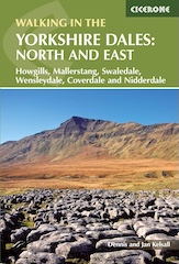
AD This Cicerone guidebook includes 43 circular walks exploring valleys, hills, and moors between Kirkby Stephen and Pateley Bridge. With OS maps, local highlights, and routes ranging from 3–11 miles, it is a year-round companion for walkers of all abilities.
Dales 30 Mountains: The Cumbrian Pennines
Below is a list of the five Dales 30 mountains located in the Cumbrian Pennines region of the Yorkshire Dales National Park, listed in height order. The OS Maps Website column includes a live link to the location of each mountain on the OS Maps website.
| Name | Rank (Height) | Height (Metres) | Height (Feet) | OS Explorer Map | OS Landranger Map | OS Grid Reference | DoBIH Classification | OS Maps Website |
|---|---|---|---|---|---|---|---|---|
| High Seat | 4th | 709 | 2326 | OL19 | 91, 92 | NY 80207 01244 | Hu, Sim, Hew, N | High Seat |
| Wild Boar Fell | 5th | 708 | 2323 | OL19 | 98 | SD 75802 98798 | Ma, Sim, Hew, N | Wild Boar Fell |
| Swarth Fell | 10th | 681 | 2234 | OL19 | 98 | SD 75574 96666 | Sim, Hew, N | Swarth Fell |
| Baugh Fell | 12th | 678 | 2224 | OL19 | 98 | SD 74089 91646 | Ma, Sim, Hew, N | Baugh Fell |
| Sails | 20th | 667 | 2187 | OL19 | 98 | SD 80826 96571 | Sim, Hew, N | Sails |
Grisport Unisex Adult Peaklander Hiking Boots
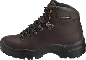
AD The Grisport Unisex Adult Peaklander Hiking Boots are crafted in Italy with a durable waxed leather upper, Spotex breathable lining, and a reliable Track-on rubber sole. Waterproof and weighing just 1120g, they offer comfort, resilience, and dependable performance on demanding trails.

Dales 30 Mountains: The Howgill Fells
Below is a list of the five Dales 30 mountains located in the Howgill Fells region of the Yorkshire Dales National Park, listed in height order. The OS Maps Website column includes a live link to the location of each mountain on the OS Maps website.
| Name | Rank (Height) | Height (Metres) | Height (Feet) | OS Explorer Map | OS Landranger Map | OS Grid Reference | DoBIH Classification | OS Maps Website |
|---|---|---|---|---|---|---|---|---|
| The Calf | 13th | 676 | 2218 | OL19 | 98 | SD 66745 97044 | Ma, Sim, Hew, N | The Calf |
| Calders | 15th | 674 | 2212 | OL19 | 98 | SD 67071 96001 | Sim, Hew, N | Calders |
| Fell Head | 23rd | 640 | 2100 | OL19 | 97 | SD 64964 98190 | Sim, Hew, N | Fell Head |
| Yarlside | 24th | 639 | 2096 | OL19 | 98 | SD 68569 98532 | Ma, Sim, Hew, N | Yarlside |
| Randygill Top | 27th | 624 | 2047 | OL19 | 91 | NY 68713 00038 | Hu, Sim, Hew, N | Randygill Top |
Grisport Unisex Adult Peaklander Hiking Boots
AD The Grisport Unisex Adult Peaklander Hiking Boots are crafted in Italy with a durable waxed leather upper, Spotex breathable lining, and a reliable Track-on rubber sole. Waterproof and weighing just 1120g, they offer comfort, resilience, and dependable performance on demanding trails.
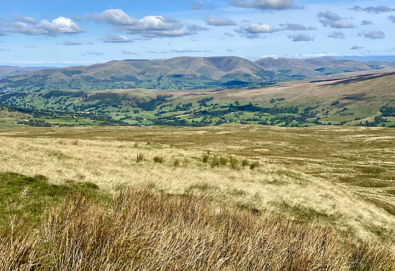
Dales 30 Mountains: The Northern Dales
Below is a list of the six Dales 30 mountains located in the Northern Dales region of the Yorkshire Dales National Park, listed in height order. The OS Maps Website column includes a live link to the location of each mountain on the OS Maps website.
| Name | Rank (Height) | Height (Metres) | Height (Feet) | OS Explorer Map | OS Landranger Map | OS Grid Reference | DoBIH Classification | OS Maps Website |
|---|---|---|---|---|---|---|---|---|
| Great Shunner Fell | 3rd | 716 | 2349 | OL19, OL30 | 98 | SD 84862 97288 | Ma, Sim, Hew, N | Great Shunner Fell |
| Lovely Seat | 14th | 675 | 2215 | OL19, OL30 | 98 | SD 87905 95044 | Hu, Sim, Hew, N, sMa | Lovely Seat |
| Great Knoutberry Hill | 16th | 672 | 2205 | OL2 | 98 | SD 78866 87159 | Ma, Sim, Hew, N | Great Knoutberry Hill |
| Rogan’s Seat | 17th | 672 | 2205 | OL30 | 91, 92 | NY 91924 03055 | Ma, Sim, Hew, N | Rogan’s Seat |
| Dodd Fell Hill | 18th | 668 | 2192 | OL2, OL30 | 98 | SD 84100 84583 | Ma, Sim, Hew, N | Dodd Fell Hill |
| Drumaldrace | 28th | 614 | 2014 | OL2, OL30 | 98 | SD 87359 86709 | Sim, Hew, N | Drumaldrace |
Fifty Walks Across the Beautiful North York Moors National Park
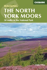
AD Discover 50 routes across the North York Moors, from short easy strolls to challenging high-level hikes. With OS maps, route descriptions, and local highlights, it also includes the legendary 40-mile Lyke Wake Walk, described in four accessible stages.

Dales 30 Mountains: Upper Wharfedale
Below is a list of the four Dales 30 mountains located in the Upper Wharfedale region of the Yorkshire Dales National Park, listed in height order. The OS Maps Website column includes a live link to the location of each mountain on the OS Maps website.
| Name | Rank (Height) | Height (Metres) | Height (Feet) | OS Explorer Map | OS Landranger Map | OS Grid Reference | DoBIH Classification | OS Maps Website |
|---|---|---|---|---|---|---|---|---|
| Great Whernside | 6th | 704 | 2310 | OL30 | 98 | SE 00205 73912 | Ma, Sim, Hew, N | Great Whernside |
| Buckden Pike | 7th | 702 | 2303 | OL30 | 98 | SD 96061 78787 | Ma, Sim, Hew, N | Buckden Pike |
| Yockenthwaite Moor | 22nd | 643 | 2110 | OL30 | 98 | SD 90904 81099 | Sim, Hew, N | Yockenthwaite Moor |
| Birks Fell | 29th | 610 | 2001 | OL30 | 98 | SD 91879 76368 | Ma, Sim, Hew, N | Birks Fell |
Fifty Walks Across the Beautiful North York Moors National Park
AD Discover 50 routes across the North York Moors, from short easy strolls to challenging high-level hikes. With OS maps, route descriptions, and local highlights, it also includes the legendary 40-mile Lyke Wake Walk, described in four accessible stages.

Dales 30 Mountains: The Western Dales
Below is a list of the ten Dales 30 mountains located in the Western Dales region of the Yorkshire Dales National Park, listed in height order. The OS Maps Website column includes a live link to the location of each mountain on the OS Maps website.
| Name | Rank (Height) | Height (Metres) | Height (Feet) | OS Explorer Map | OS Landranger Map | OS Grid Reference | DoBIH Classification | OS Maps Website |
|---|---|---|---|---|---|---|---|---|
| Whernside | 1st | 736 | 2415 | OL2 | 98 | SD 73893 81545 | Ma, Sim, Hew, N, CoH, CoU, CoA | Whernside |
| Ingleborough | 2nd | 724 | 2375 | OL2 | 98 | SD 74125 74587 | Ma, Sim, Hew, N | Ingleborough |
| Pen-y-ghent | 8th | 694 | 2277 | OL2 | 98 | SD 83854 73383 | Ma, Sim, Hew, N | Pen-y-ghent |
| Great Coum | 9th | 687 | 2254 | OL2 | 98 | SD 70087 83584 | Ma, Sim, Hew, N | Great Coum |
| Plover Hill | 11th | 680 | 2231 | OL2, OL30 | 98 | SD 84925 75207 | Sim, Hew, N | Plover Hill |
| Fountains Fell | 19th | 668 | 2192 | OL2, OL30 | 98 | SD 86417 71586 | Ma, Sim, Hew, N | Fountains Fell |
| Simon Fell | 21st | 651 | 2136 | OL2 | 98 | SD 75465 75181 | Sim, Hew, N | Simon Fell |
| Gragareth | 25th | 628 | 2060 | OL2 | 98 | SD 68887 79312 | Sim, Hew, N, CoU, CoA | Gragareth |
| Darnbrook Fell | 26th | 624 | 2047 | OL30 | 98 | SD 88459 72783 | Sim, Hew, N | Darnbrook Fell |
| Calf Top | 30th | 610 | 2000 | OL2 | 98 | SD 66450 85624 | Ma, Sim, Hew, N | Calf Top |
Osprey Hikelite Unisex Backpack for Comfortable and Lightweight Hiking
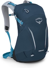
AD The Osprey Hikelite backpack combines lightweight design with practical features, including a breathable mesh back panel, soft webbing straps, and stretch mesh water bottle pockets. With zipped storage and an organiser compartment, it is ideal for day hikes and outdoor use.

