Conquer Four Alfred Wainwright Summits on Your Helvellyn Walk from Glenridding
Initiate your Helvellyn walk from Glenridding, an excellent trail steering clear of Swirral Edge and Striding Edge. This lengthier 12-mile route is quite demanding yet ideal for avoiding precarious edges in unreliable weather. The journey promises breathtaking views and encompasses four of Wainwright’s notable summits: White Side, Helvellyn, Nethermost Pike, and Dollywaggon Pike. This recommended route offers a quieter alternative to the more popular paths leading to Helvellyn.
Commence in the village of Glenridding, which provides plenty of parking. Head west from here, tracing Glenridding Beck’s path through the scenic Glenridding valley. As you progress through the valley, ensure you’re on the north side of Glenridding Beck. This is crucial for starting your climb to White Side’s summit. Venturing onto the south side could inadvertently redirect you towards Red Tarn and up the ascent via Swirral Edge.
Upon conquering White Side, navigate south along the ridge towards Lower Man. Then make your way south-east to reach the Helvellyn summit. Continue your adventure south, crossing the expansive ridge to Nethermost Pike and onwards to Dollywaggon Pike. Your descent will bring you to Grisedale Tarn, followed by a lengthy walk north-east through Grisedale Valley, shadowing Grisedale Beck all the way to Patterdale.
Conclude your Helvellyn walk from Glenridding by trekking north back to the village. This is done via a footpath running beside the A592. This route, while extensive, promises an invigorating Lake District walking experience, replete with stunning views and a rich sense of achievement.
Helvellyn Walk from Glenridding: Maps and Tools
Visit either the OS Maps website or the Outdooractive website to view this walking route in greater detail. Both platforms offer a range of features, including the ability to print the route, download it to your device, and export the route as a GPX file. You can also watch a 3D fly-over and share the route on social media.
Helvellyn Walk from Glenridding: Distance, Duration, Statistics
Distance: 11¾ miles
Distance: 19 kilometres
Duration: 6½ hours
Ascent: 3177 feet
Ascent: 968 metres
Type: Circular walk
About Glenridding
Glenridding is a village situated at the southern tip of Ullswater in the English Lake District. It serves as a base for mountain walkers aiming to tackle Helvellyn, England’s third tallest peak, along with other substantial mountains. The village falls within the Patterdale civil parish, the Eden District, and the Cumbria shire county, located in England’s North West region.
The village’s name, Glenridding, is believed to have Cumbric roots: ‘glinn’ meaning ‘valley’ and ‘redïn’ denoting ‘ferns’ or ‘bracken’, akin to the Welsh ‘glyn rhedyn’. This suggests the original meaning was ‘valley overgrown with bracken’. It was first recorded as Glenredyn around 1290, with the current form likely influenced by the Middle English ‘ridding’, indicating a ‘clearing’.
On the 6th of December 2015, Storm Desmond brought severe flooding to Glenridding, with rivers overflowing after intense rain. A subsequent deluge on the 10th of December exacerbated the damage, affecting homes and businesses. In response, the community established a Flood Action Group to enhance recovery efforts and implement strategies to mitigate future flood risks.
Overlooking the village is the historic Greenside Mine, once the Lake District’s most prolific lead mine. Lead ore was first found in the 18th century, and mining activities continued until the mine’s closure in 1962. The mine played a crucial role in the development of Glenridding and the nearby areas.
Today, Glenridding is known for the Ullswater ‘Steamers’. This leisure boating service, operating from Glenridding pier with a fleet of five vessels, was initially set up to transport goods to Pooley Bridge and further to Penrith.
Recommended Ordnance Survey Map
The best map to use on this walk is the Ordnance Survey map of the Lake District North-Eastern Area, reference OS Explorer OL5, scale 1:25,000. It clearly displays footpaths, rights of way, open access land and vegetation on the ground, making it ideal for walking, running and hiking. The map can be purchased from Amazon in either a standard, paper version or a weatherproof, laminated version, as shown below.
Standard Version
Helvellyn Walk from Glenridding: My Photos
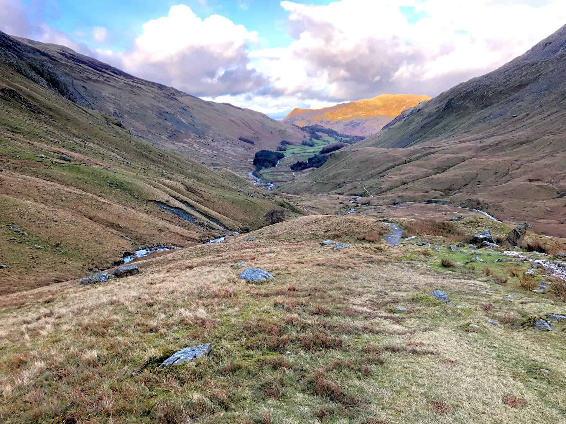
Strolling alongside Glenridding Beck on our Helvellyn walk from Glenridding.
The sweeping view towards Catstye Cam, captured during our Helvellyn walk from Glenridding.

Walking in the Yorkshire Dales with 43 Circular Routes
AD This Cicerone guidebook includes 43 circular walks exploring valleys, hills, and moors between Kirkby Stephen and Pateley Bridge. With OS maps, local highlights, and routes ranging from 3–11 miles, it is a year-round companion for walkers of all abilities.
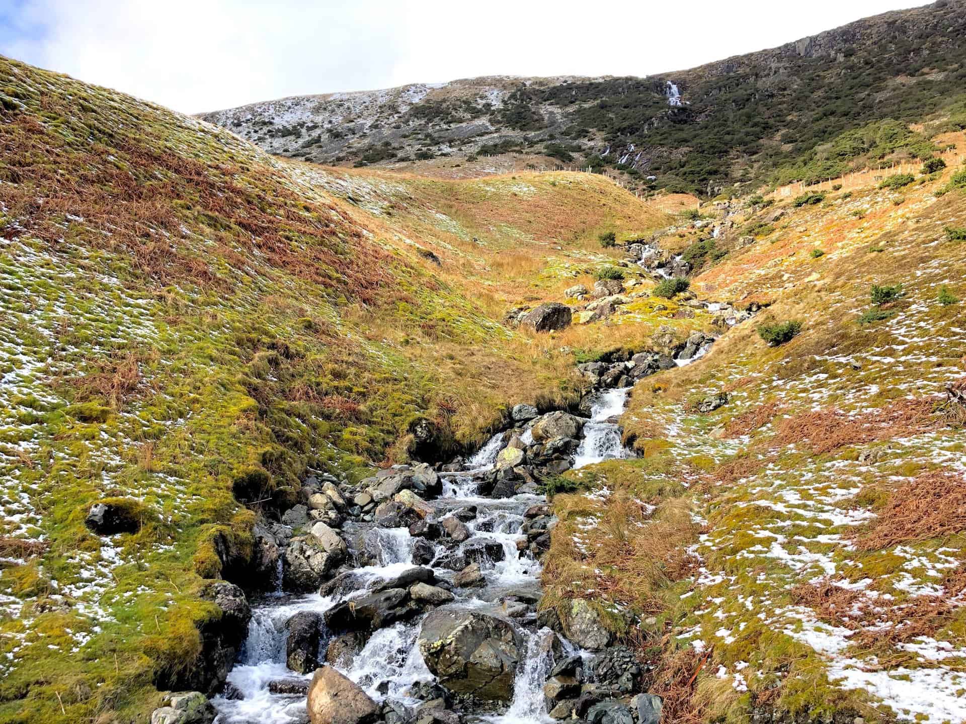
The serene Roten Beck waterfall, a highlight on the Glenridding Common stretch.

Grisport Unisex Adult Peaklander Hiking Boots
AD The Grisport Unisex Adult Peaklander Hiking Boots are crafted in Italy with a durable waxed leather upper, Spotex breathable lining, and a reliable Track-on rubber sole. Waterproof and weighing just 1120g, they offer comfort, resilience, and dependable performance on demanding trails.
The valley path towards Red Tarn, not to be taken on this particular Helvellyn walk from Glenridding.

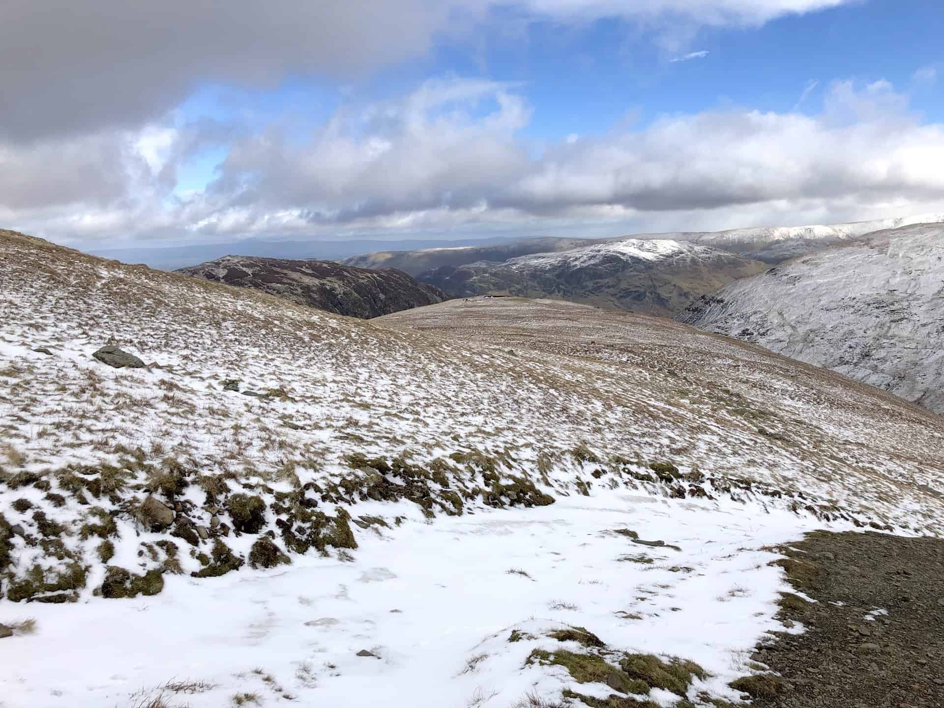
Looking east, Glenridding Common offers a tranquil scene on the Helvellyn walk from Glenridding.
Grisport Unisex Adult Peaklander Hiking Boots
AD The Grisport Unisex Adult Peaklander Hiking Boots are crafted in Italy with a durable waxed leather upper, Spotex breathable lining, and a reliable Track-on rubber sole. Waterproof and weighing just 1120g, they offer comfort, resilience, and dependable performance on demanding trails.
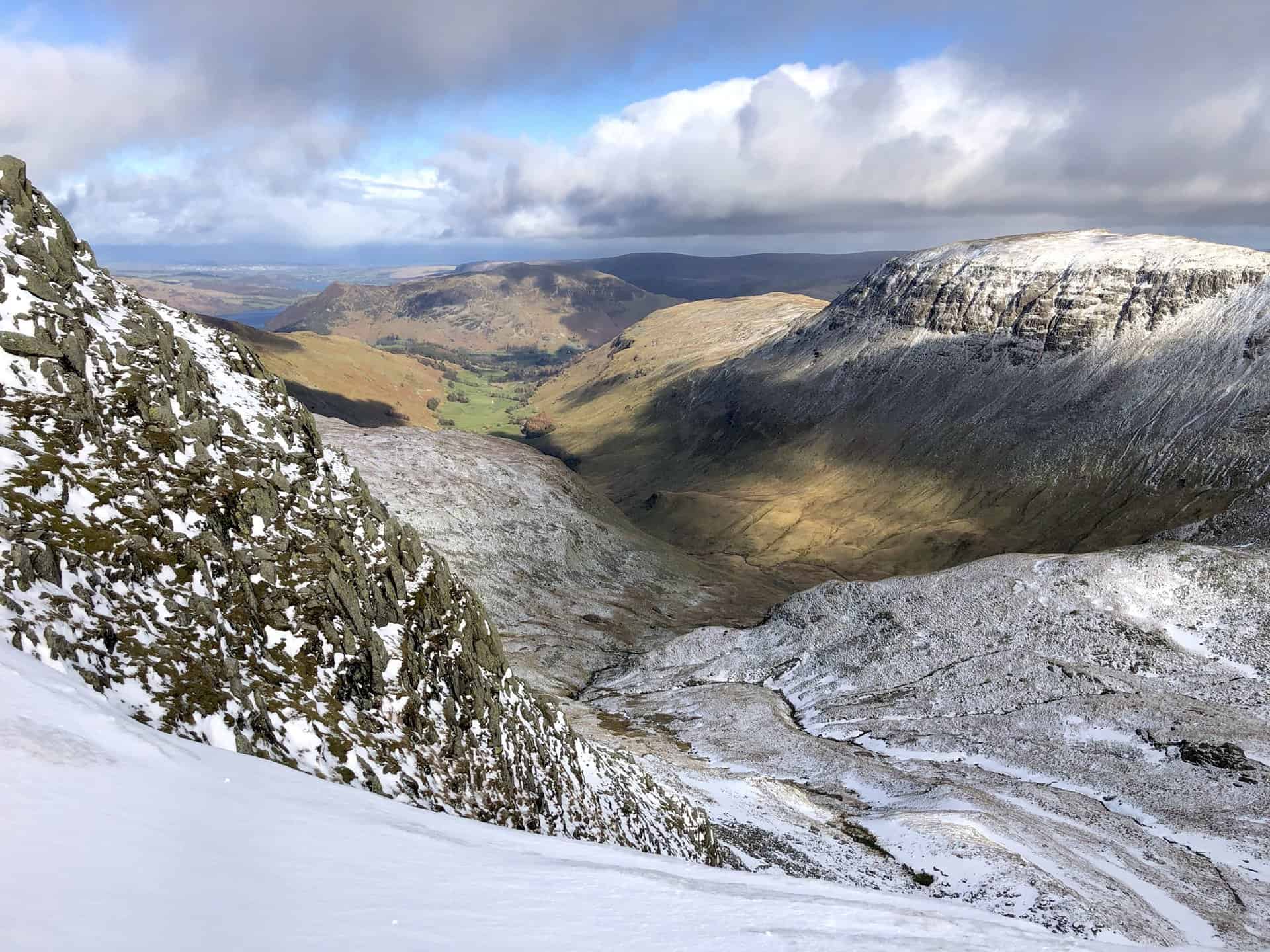
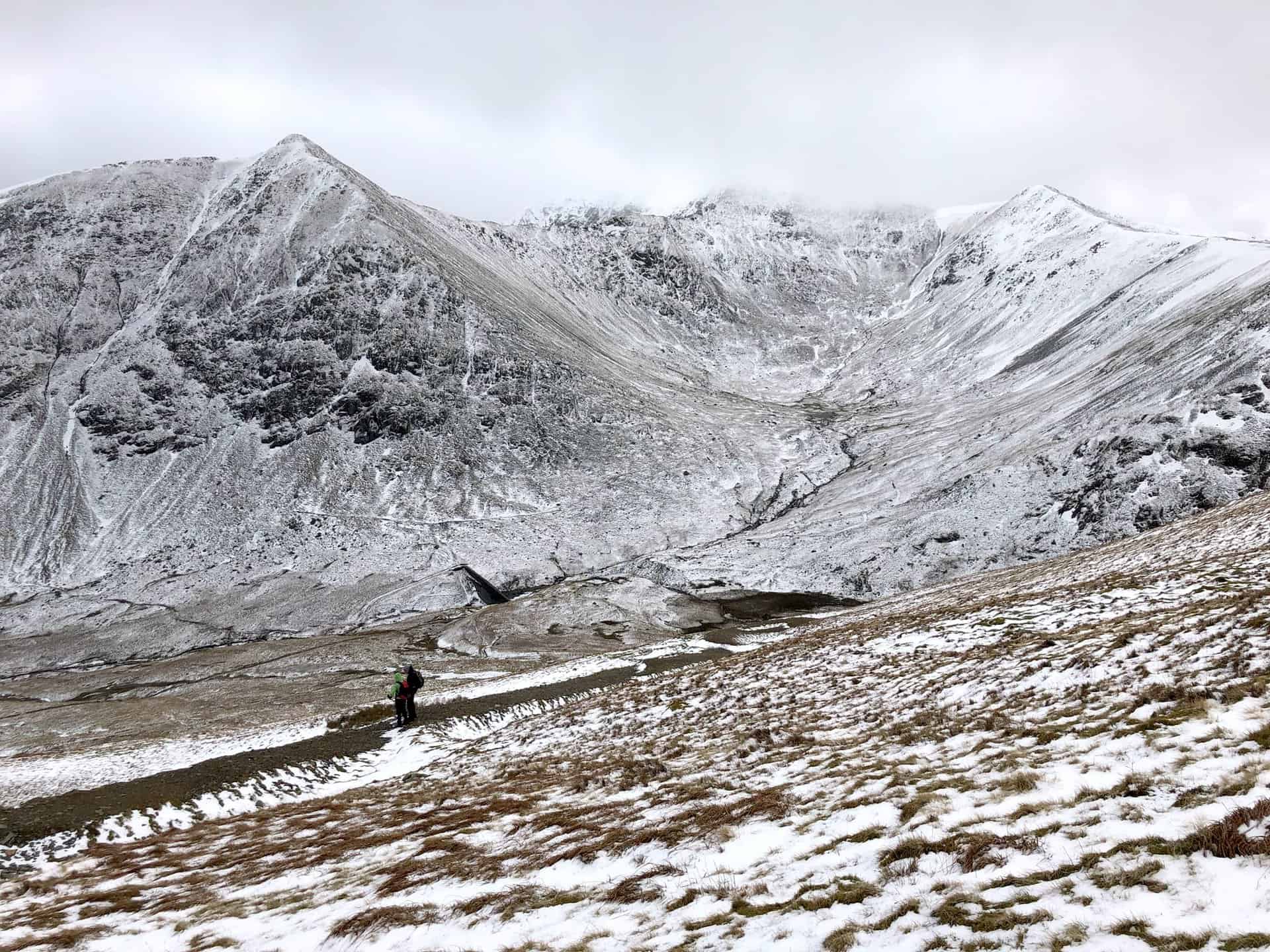
Brown Cove’s allure, with Helvellyn looming in the distance.
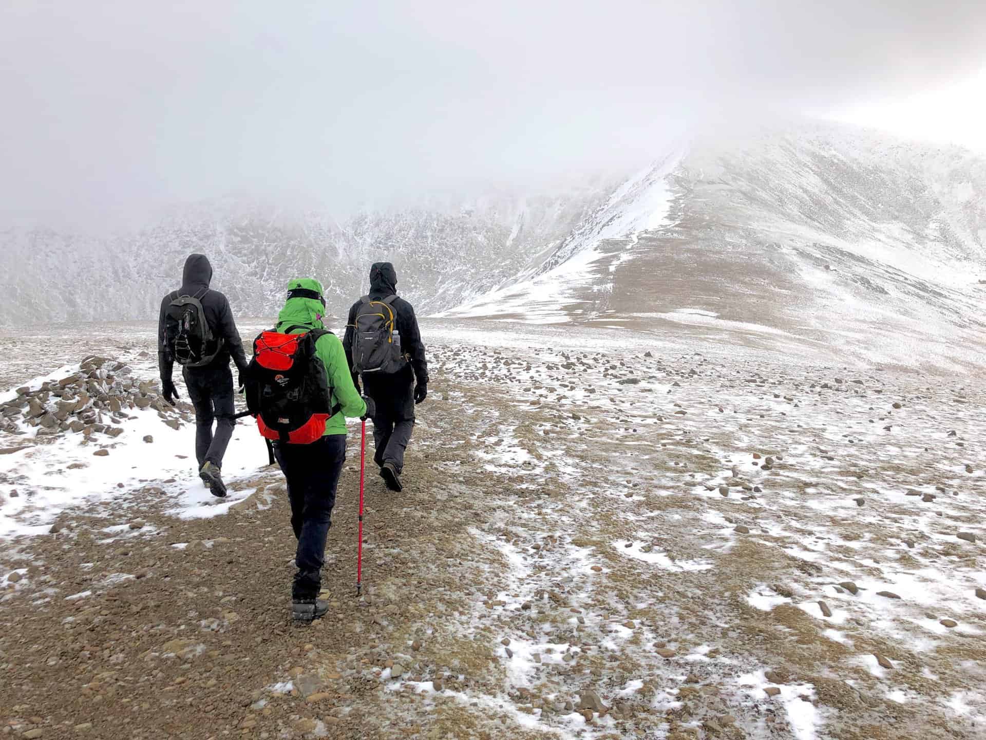
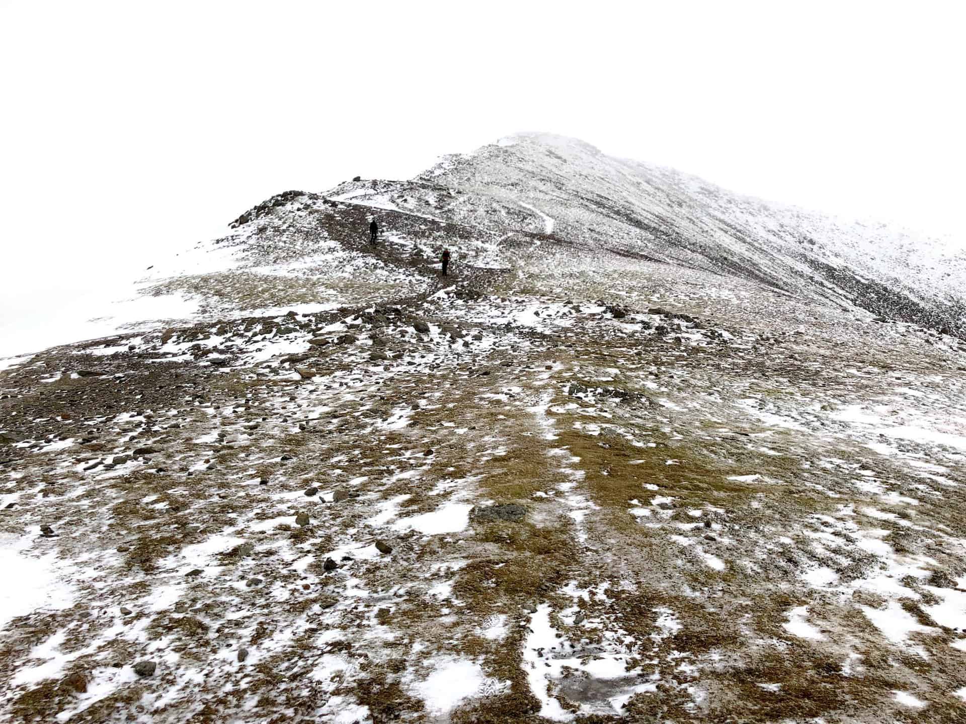
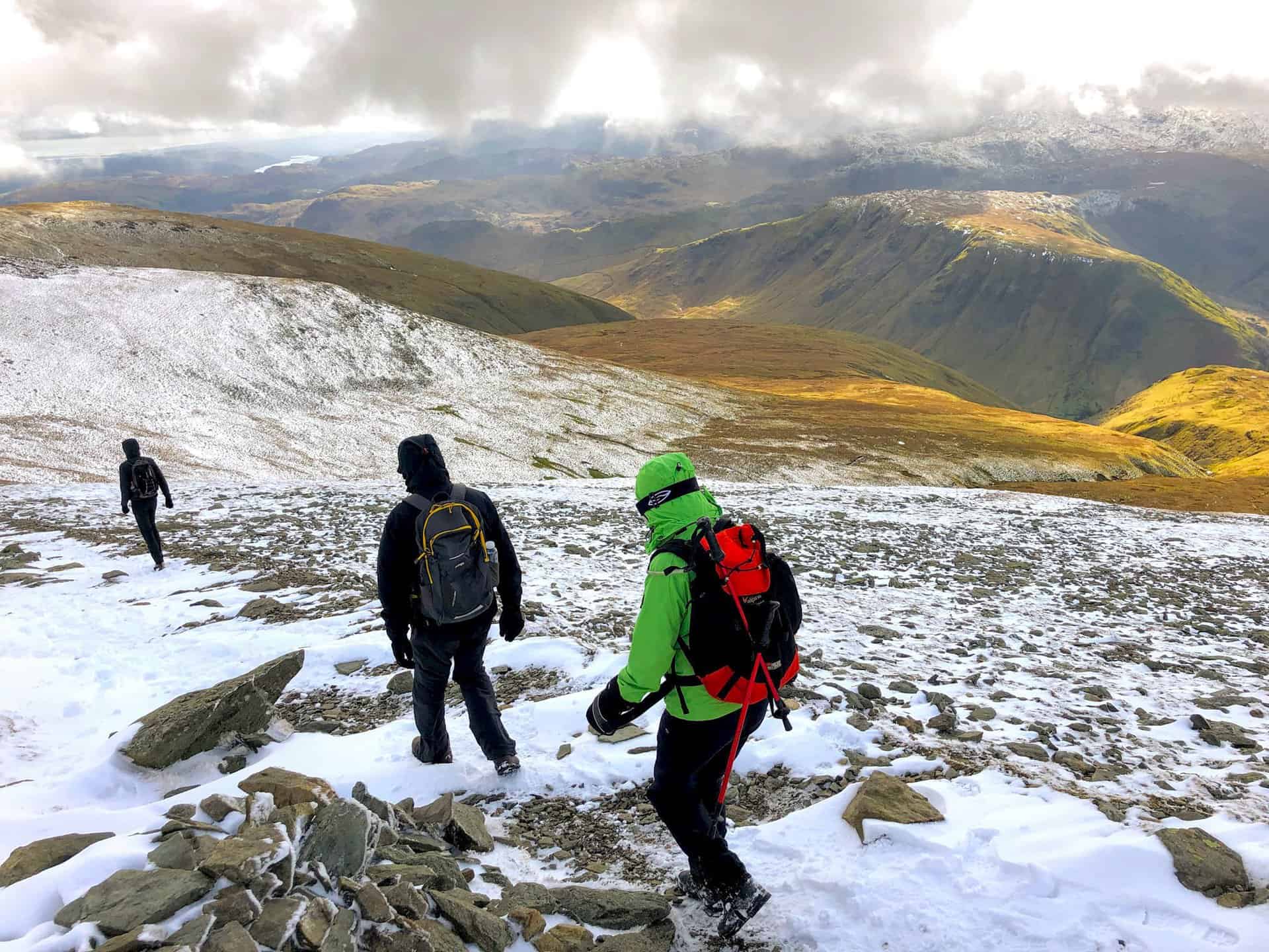
Battling the wind en route to Lower Man, a challenging segment of the Helvellyn walk from Glenridding.

Fifty Walks Across the Beautiful North York Moors National Park
AD Discover 50 routes across the North York Moors, from short easy strolls to challenging high-level hikes. With OS maps, route descriptions, and local highlights, it also includes the legendary 40-mile Lyke Wake Walk, described in four accessible stages.
Thirlmere’s beauty unfolds to the west as we continue our ascent.
Gazing up at Lower Man’s peak, anticipation builds on the Helvellyn walk from Glenridding.
Fifty Walks Across the Beautiful North York Moors National Park
AD Discover 50 routes across the North York Moors, from short easy strolls to challenging high-level hikes. With OS maps, route descriptions, and local highlights, it also includes the legendary 40-mile Lyke Wake Walk, described in four accessible stages.
Eastern vistas over Brown Cove, Glenridding and Ullswater frame our journey.
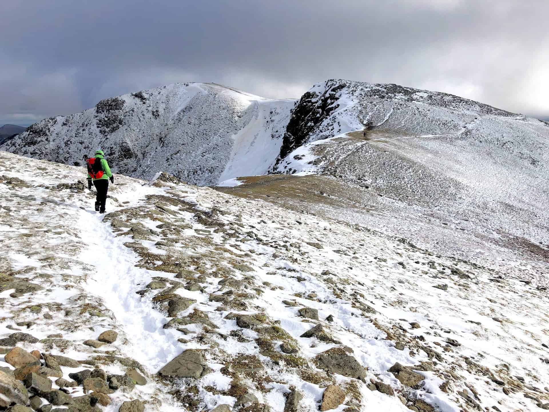
A climber’s determination near Helvellyn’s peak, a poignant moment on the Helvellyn walk from Glenridding.

Osprey Hikelite Unisex Backpack for Comfortable and Lightweight Hiking
AD The Osprey Hikelite backpack combines lightweight design with practical features, including a breathable mesh back panel, soft webbing straps, and stretch mesh water bottle pockets. With zipped storage and an organiser compartment, it is ideal for day hikes and outdoor use.
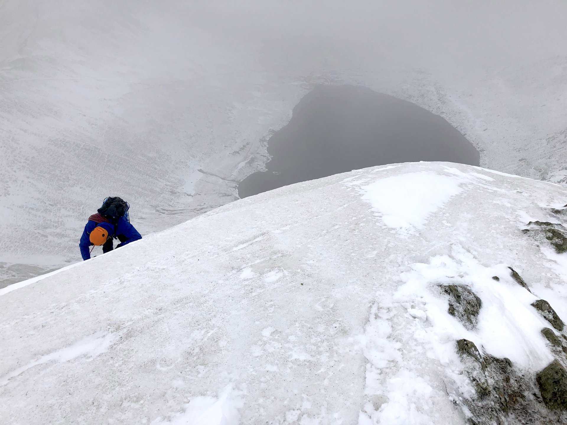
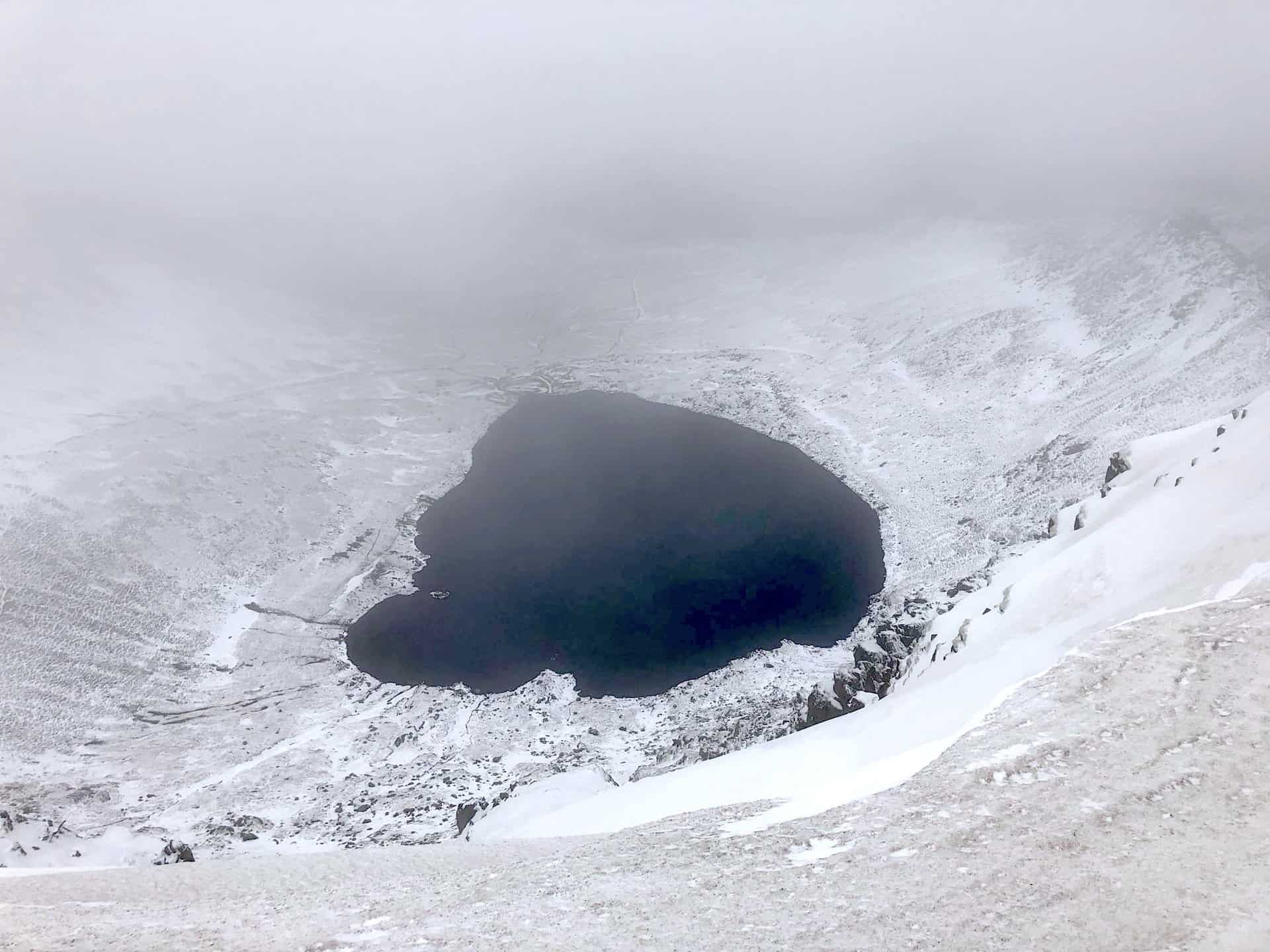
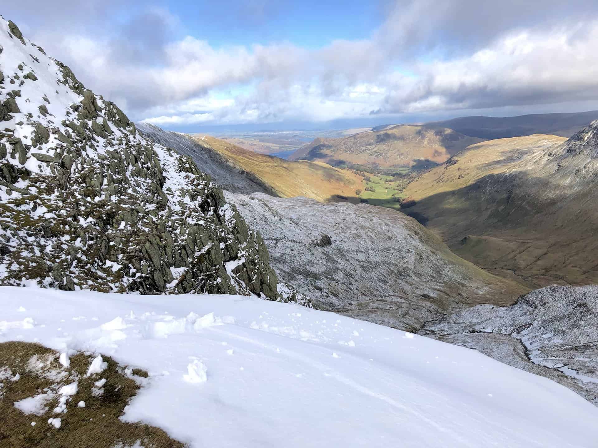
The dramatic descent view to Red Tarn from Helvellyn’s summit.
Osprey Hikelite Unisex Backpack for Comfortable and Lightweight Hiking
AD The Osprey Hikelite backpack combines lightweight design with practical features, including a breathable mesh back panel, soft webbing straps, and stretch mesh water bottle pockets. With zipped storage and an organiser compartment, it is ideal for day hikes and outdoor use.
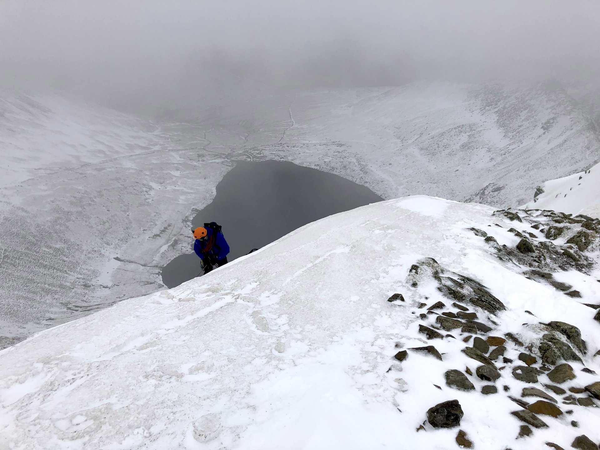
Red Tarn and Ullswater seen from above, postcard-worthy from Helvellyn.
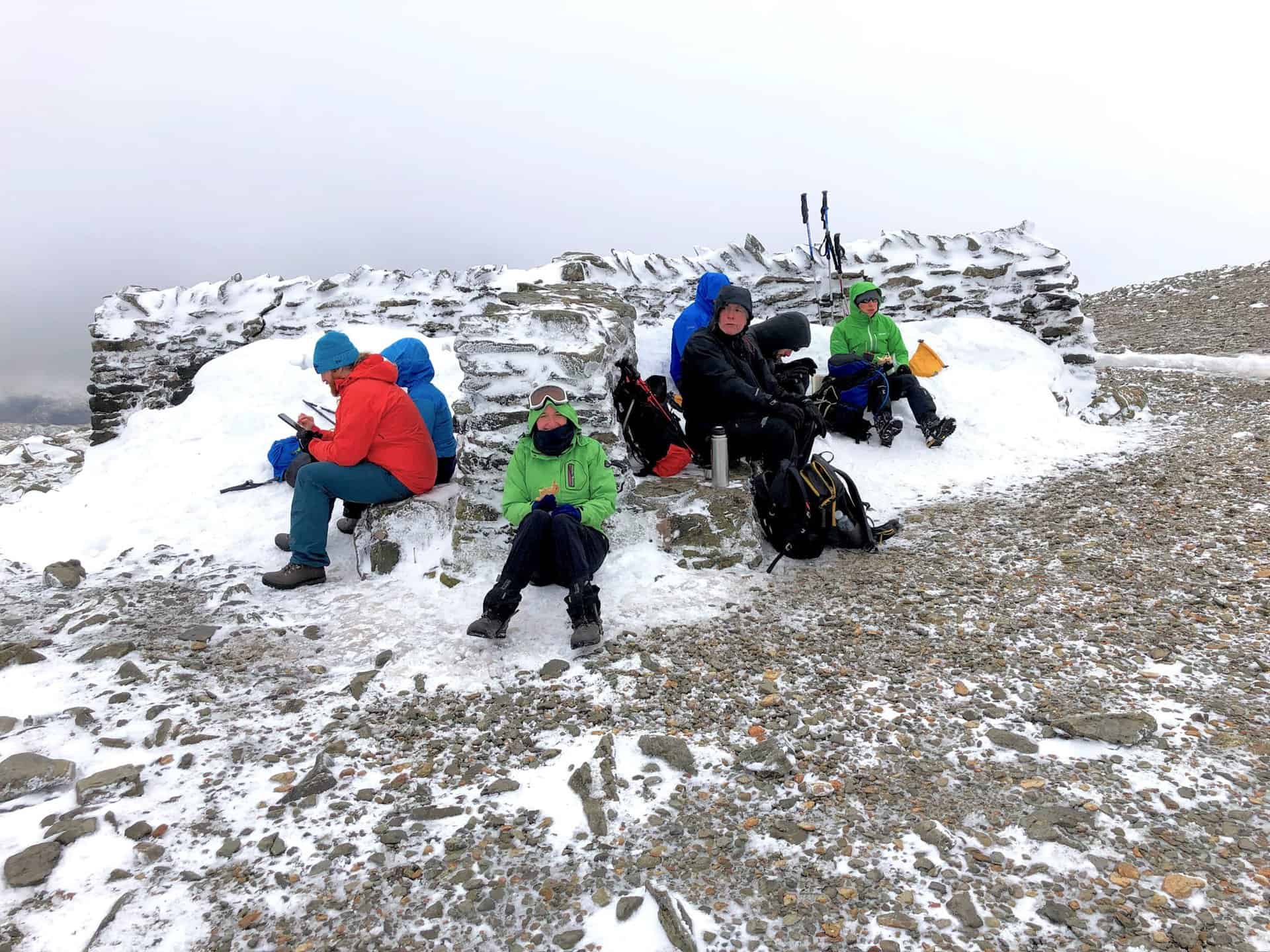
A well-deserved lunch break at Helvellyn’s summit, basking in the success of our climb.

Peak Bagging Wainwrights with Routes to Complete All Fells
AD This comprehensive guide offers 45 circular routes linking all 214 Wainwright fells. With maps, GPX downloads, elevation profiles, and practical advice, it provides efficient yet inspiring ways to complete this classic Lake District challenge at your own pace.
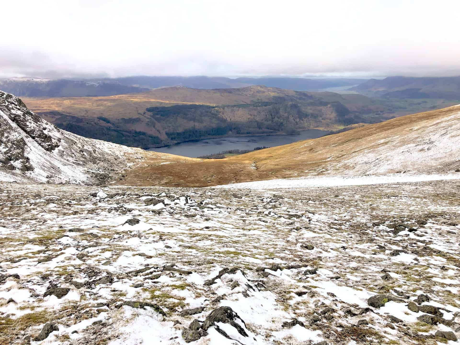
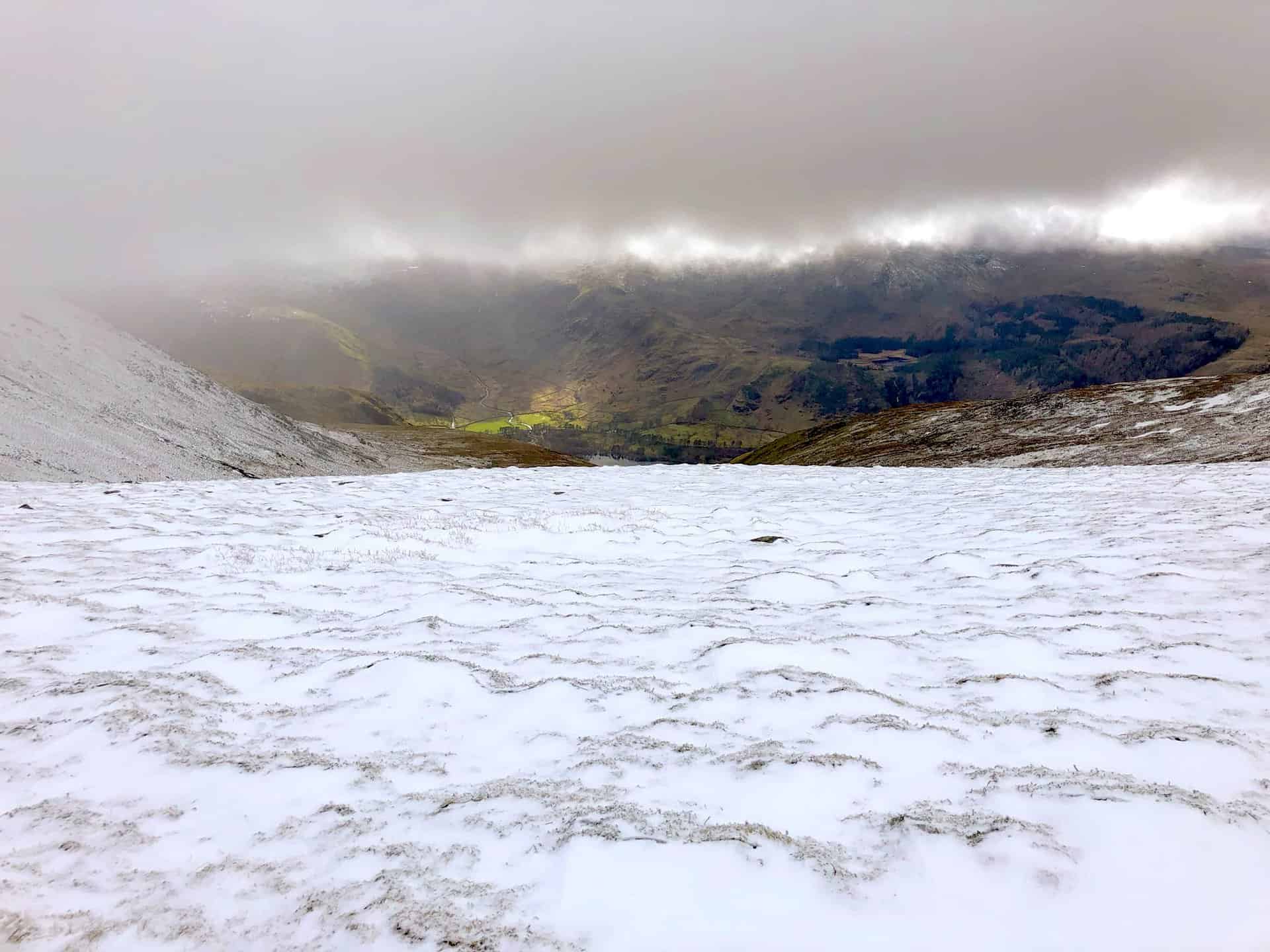
As the fog lifts, a breathtaking view towards Wythburn is revealed, located at the southern end of Thirlmere.
Navigating High Crag on the way to Dollywaggon Pike.
Peak Bagging Wainwrights with Routes to Complete All Fells
AD This comprehensive guide offers 45 circular routes linking all 214 Wainwright fells. With maps, GPX downloads, elevation profiles, and practical advice, it provides efficient yet inspiring ways to complete this classic Lake District challenge at your own pace.
The ascent to Dollywaggon Pike: steep yet invigorating.
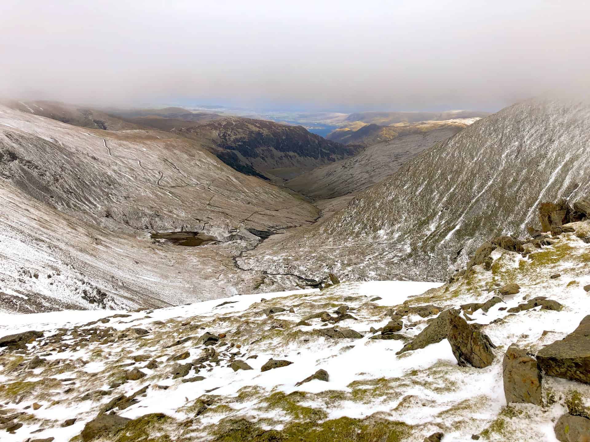
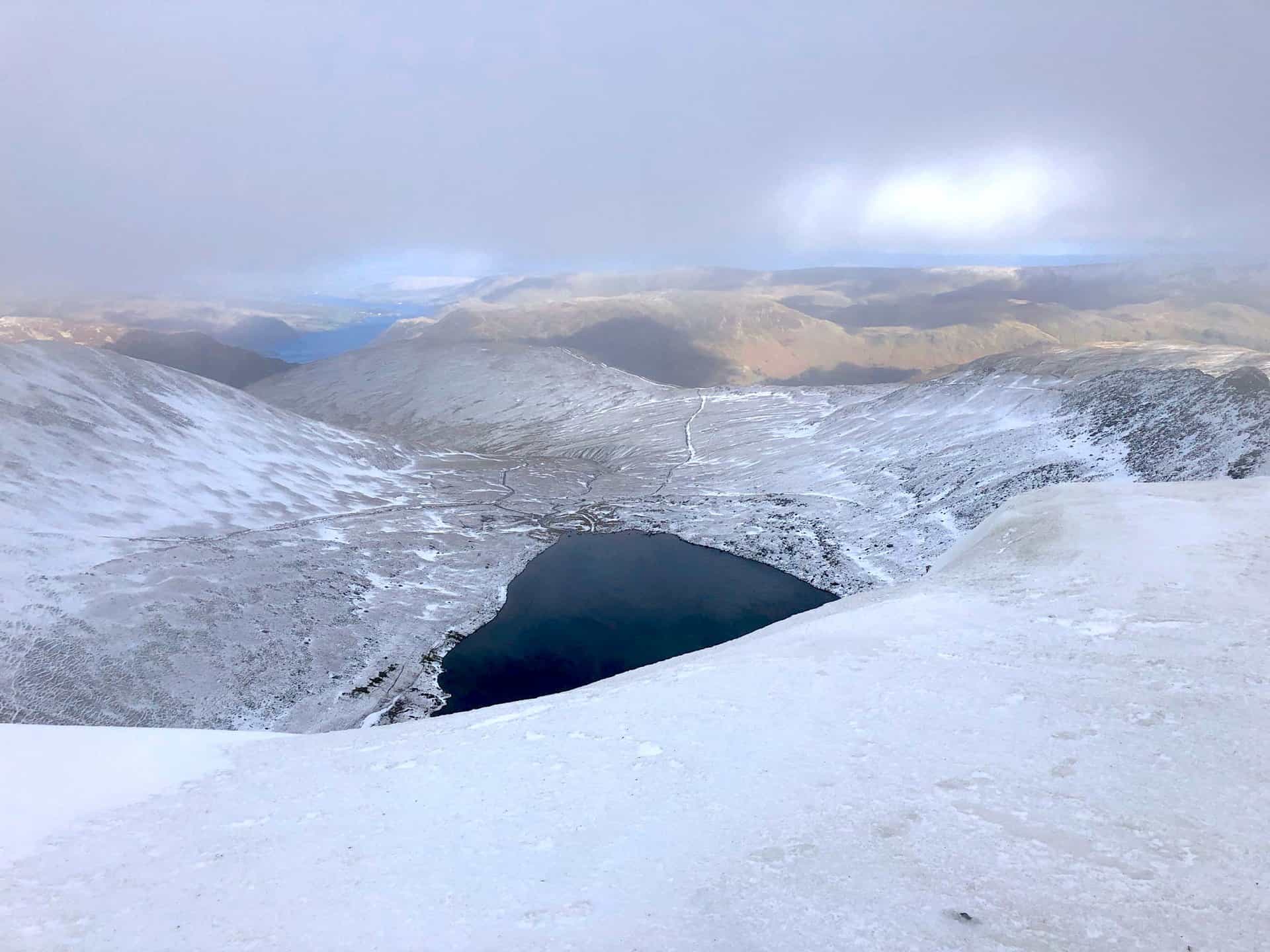
The panorama from Dollywaggon Pike, a spectacular point overlooking Grisedale towards Patterdale and Ullswater.

Berghaus Hillmaster II GTX Men's High Rise Hiking Boots
AD The Berghaus Hillmaster II GTX men’s hiking boots feature a waterproof, breathable GORE-TEX membrane, a memory foam tongue and collar for a personalised fit, and a Vibram sole delivering exceptional grip, stability, and shock protection for confident performance on any terrain.
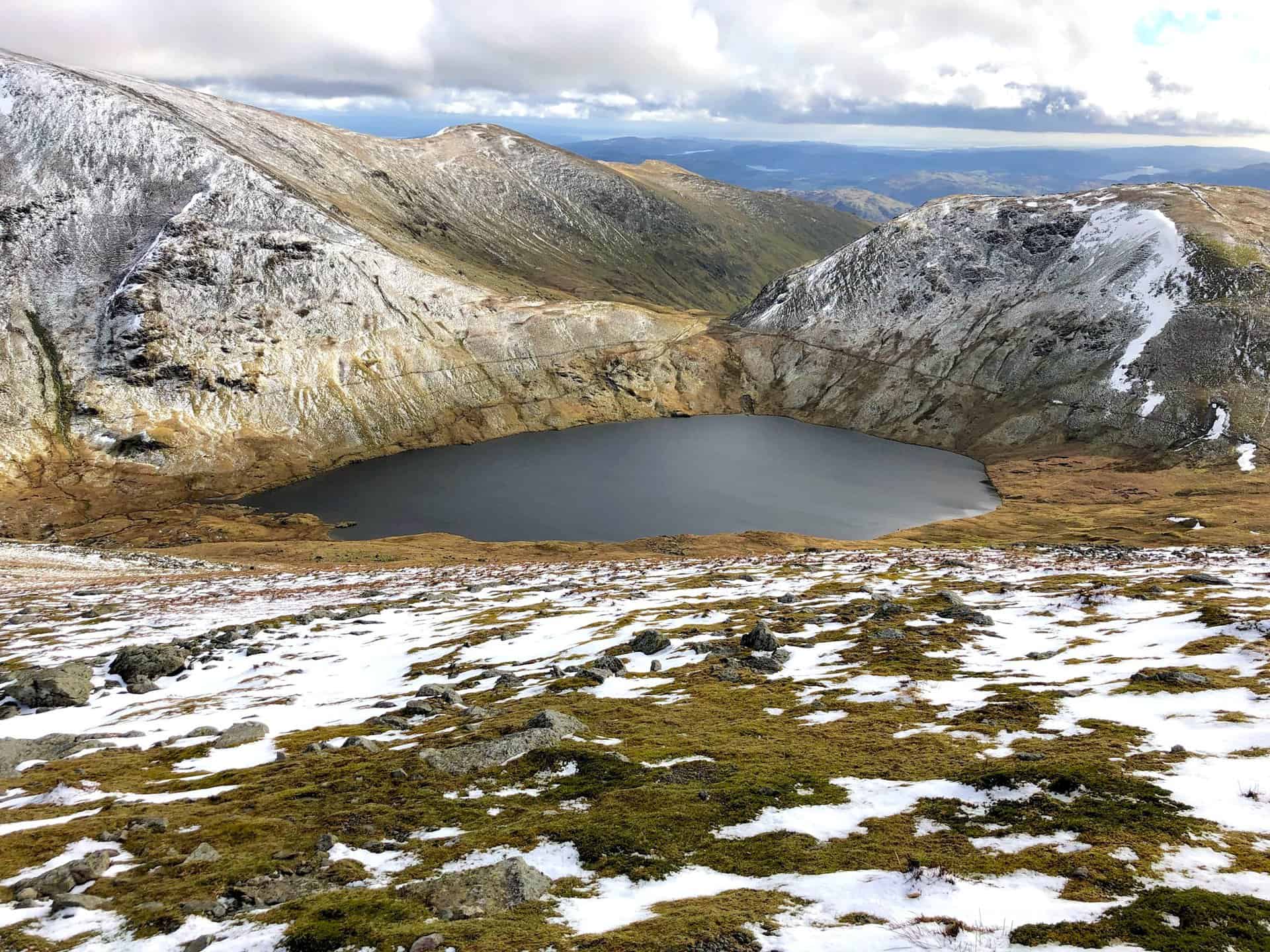
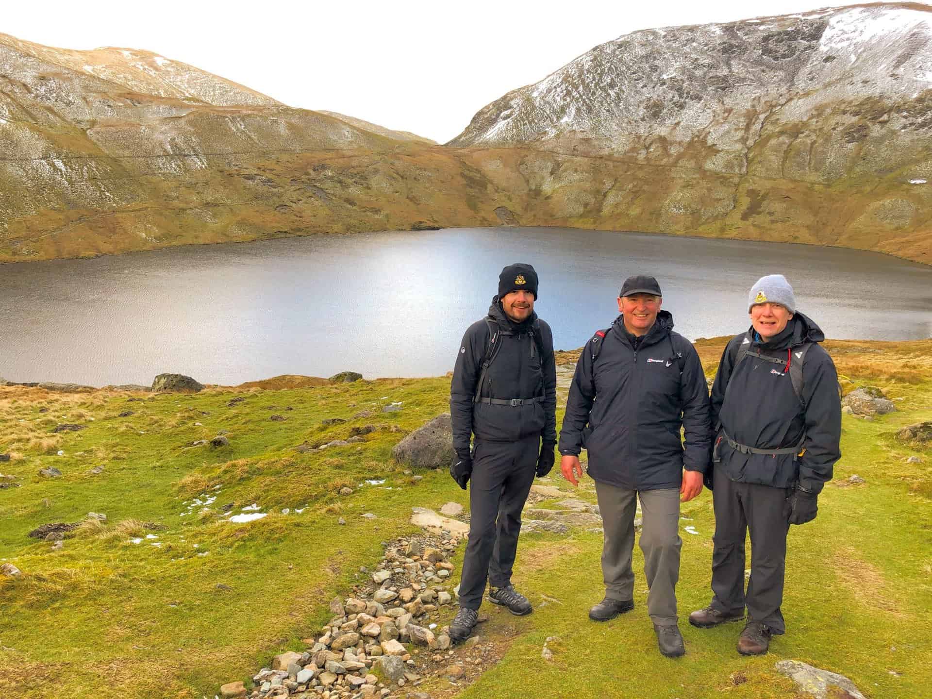
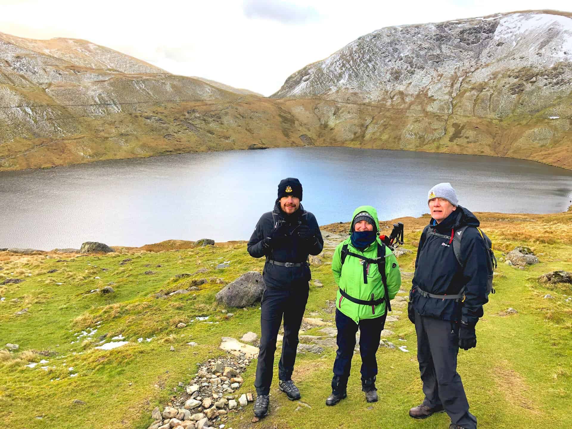
Grisedale Tarn’s serene waters mark a tranquil spot on our walk.
Berghaus Hillmaster II GTX Men's High Rise Hiking Boots
AD The Berghaus Hillmaster II GTX men’s hiking boots feature a waterproof, breathable GORE-TEX membrane, a memory foam tongue and collar for a personalised fit, and a Vibram sole delivering exceptional grip, stability, and shock protection for confident performance on any terrain.
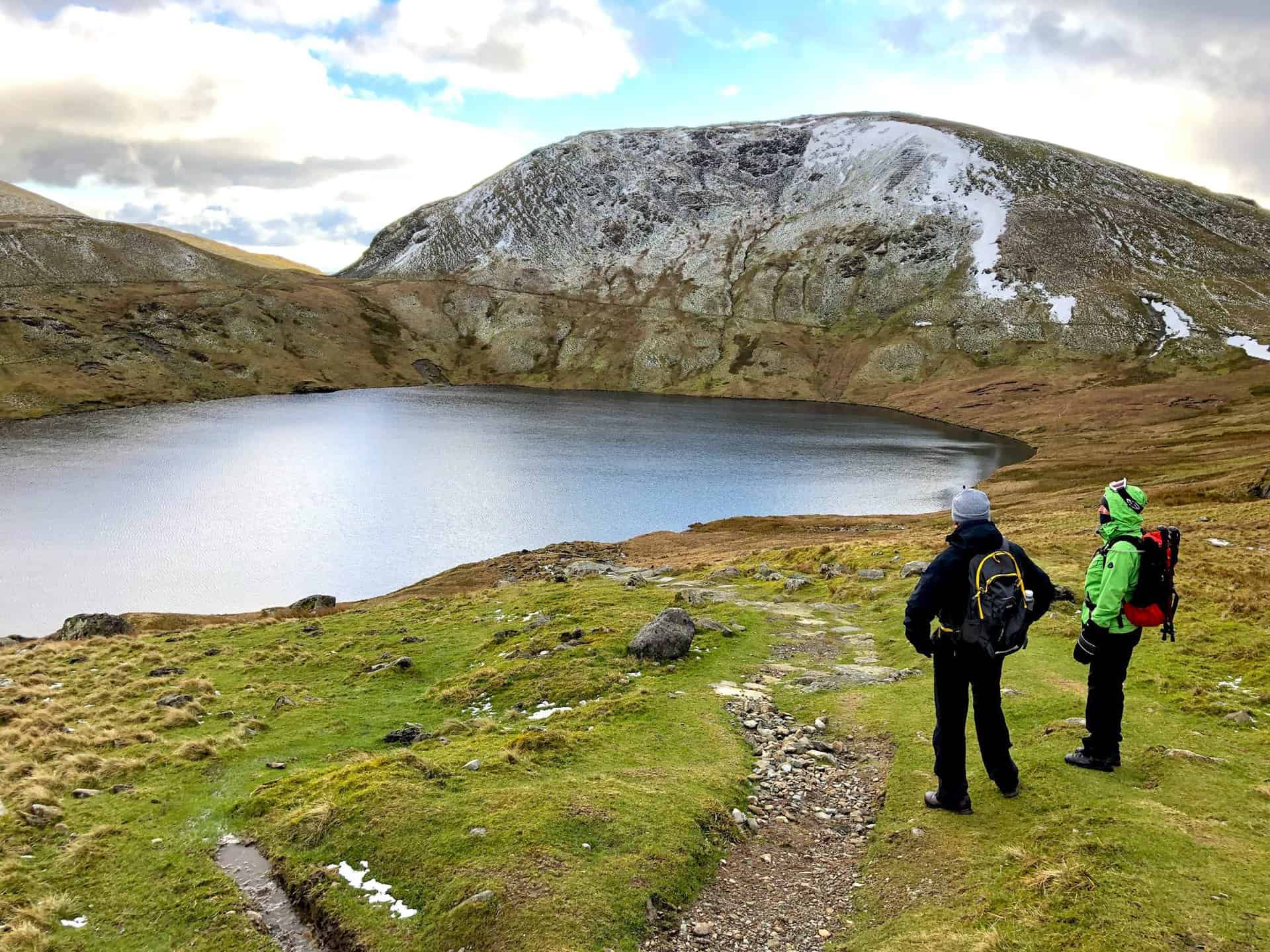
Pausing for a photo with the serene backdrop of Grisedale Tarn.

Kendal Mint Co Energy Gel with Citrus and Mint Flavour
AD Kendal Mint Co energy gels deliver 27g of fast-absorbing carbohydrates plus electrolytes and B vitamins for improved performance. Vegan, gluten free, and Informed Sport certified, these caffeine-free gels are refreshing, easy to digest, and ideal for running, cycling, and endurance.
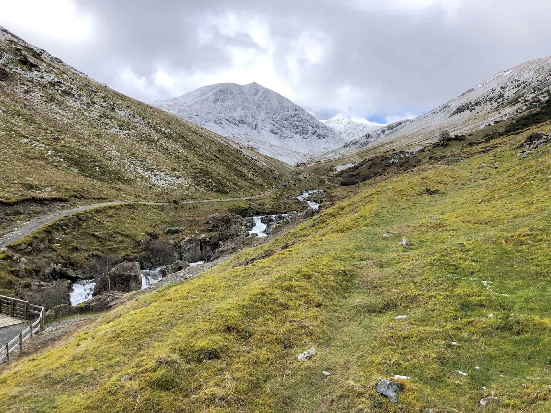
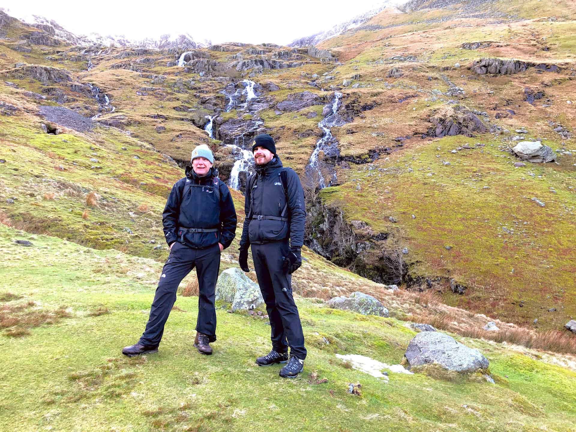
The cascading waterfalls on Patterdale Common, a refreshing sight.
Kendal Mint Co Energy Gel with Citrus and Mint Flavour
AD Kendal Mint Co energy gels deliver 27g of fast-absorbing carbohydrates plus electrolytes and B vitamins for improved performance. Vegan, gluten free, and Informed Sport certified, these caffeine-free gels are refreshing, easy to digest, and ideal for running, cycling, and endurance.
Overlooking Grisedale, with the imposing Place Fell in the backdrop.
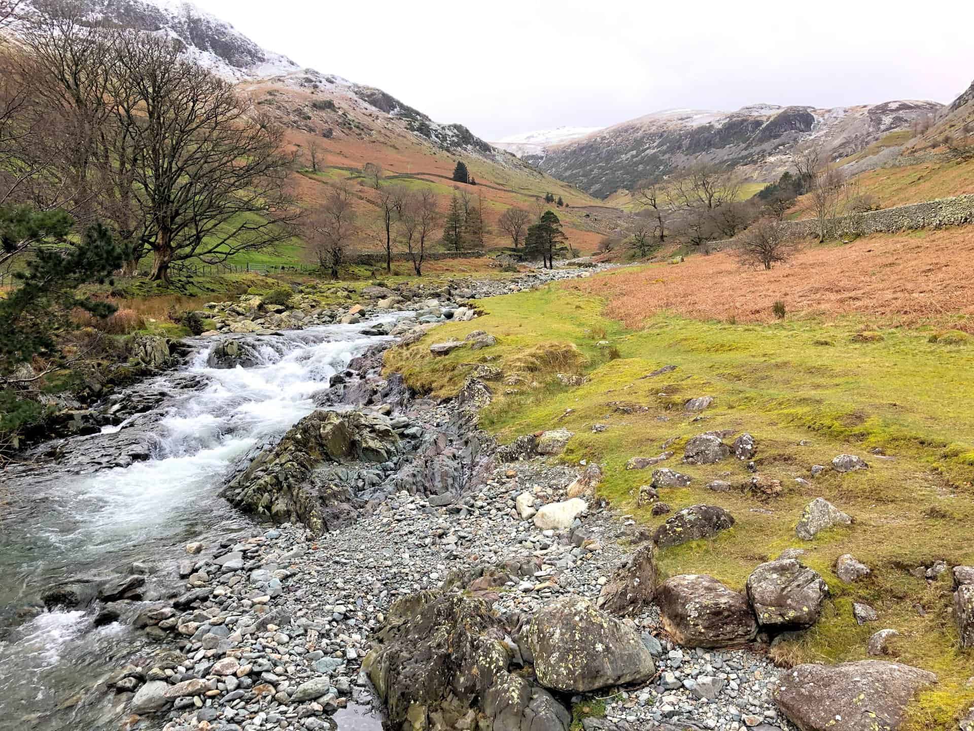
The gentle flow of Grisedale Beck, a constant companion on the Grisedale section of our route.


Thermos Stainless King Flask for Travel and Daily Adventures
AD The Thermos Stainless King 470ml flask keeps drinks hot for 18 hours or cold for 24. With durable stainless steel, vacuum insulation, a serving cup, and a leakproof design, it is perfect for commutes, journeys, and outdoor adventures.
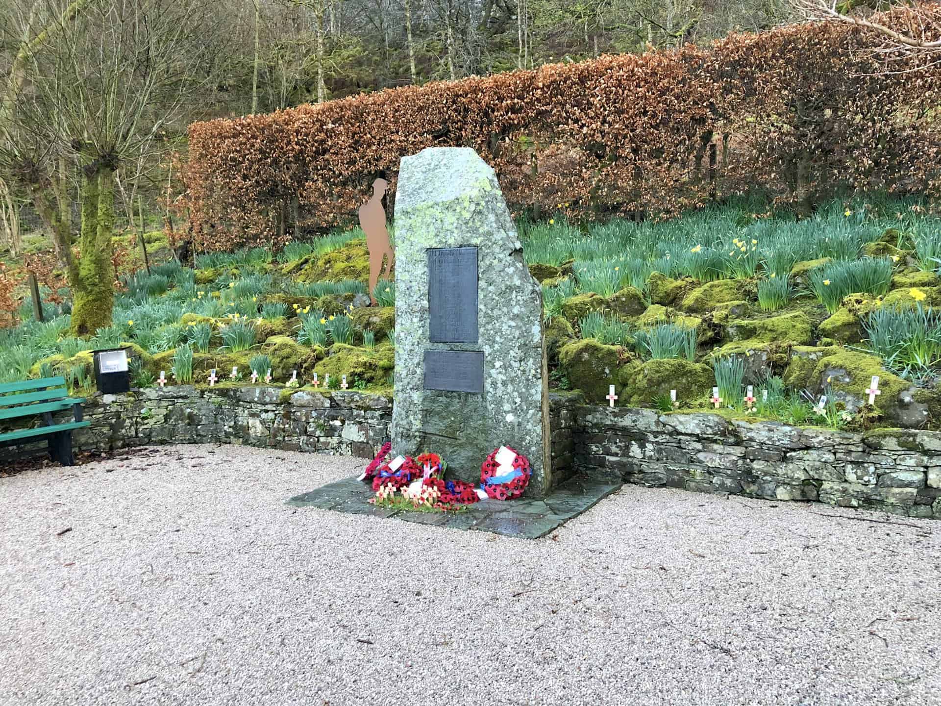
Patterdale and Glenridding War Memorial Project
Towards the end of the First World War the inhabitants of Patterdale collected money to establish a permanent monument as a memorial to the officers and men who died in the war. William Hibbert Marshall, owner of Patterdale Hall, donated a piece of land to allow for the building of the monument in February 1921, on the shores of Ullswater between Glenridding and Patterdale. The memorial slab was hewn from a twenty-ton piece of local slate and the finished product still weighs around five tons. It was unveiled in October 1921.
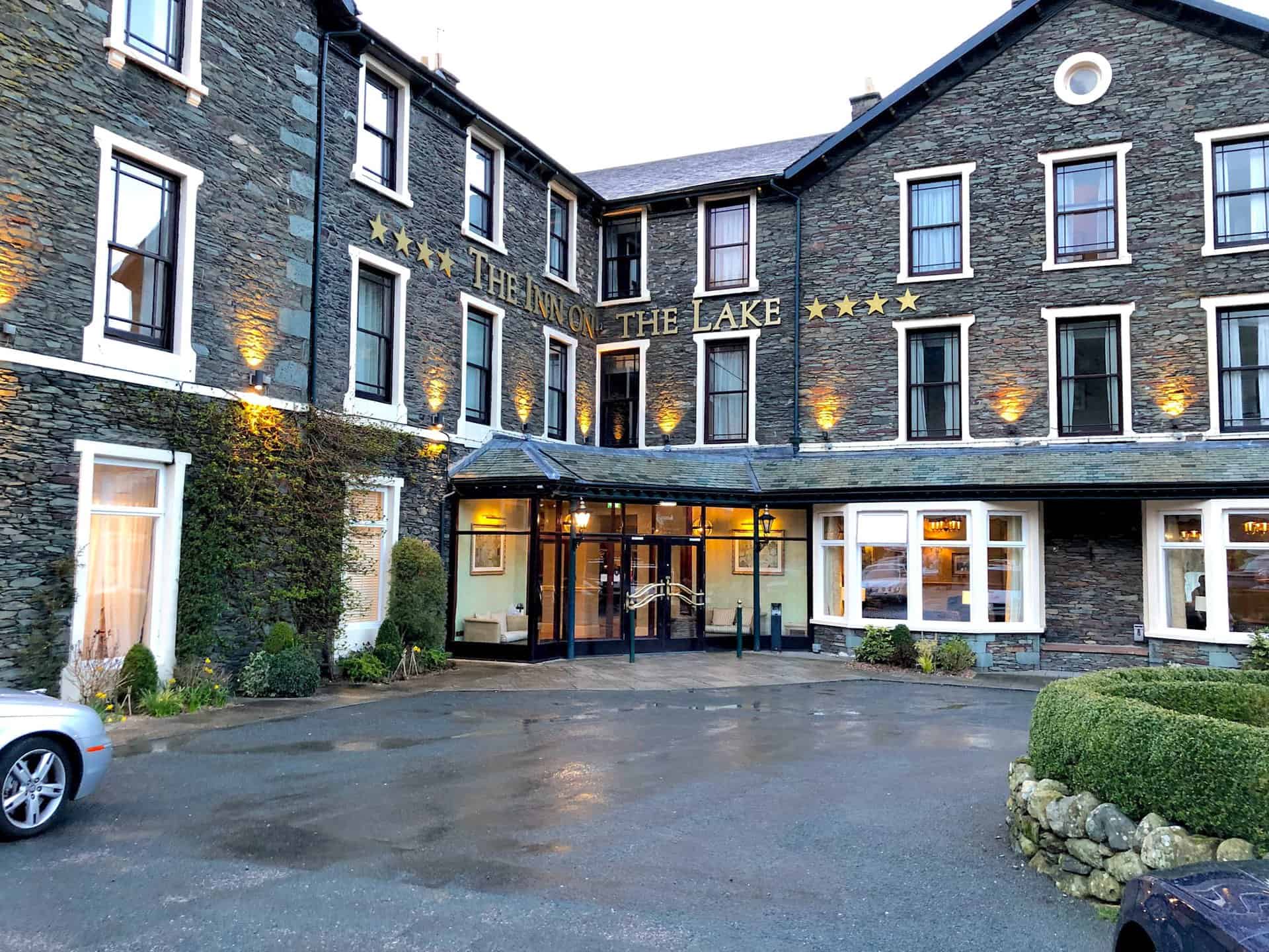
Ending the day near The Inn On The Lake, with the pub next door offering a perfect conclusion to our Helvellyn walk from Glenridding.
Thermos Stainless King Flask for Travel and Daily Adventures
AD The Thermos Stainless King 470ml flask keeps drinks hot for 18 hours or cold for 24. With durable stainless steel, vacuum insulation, a serving cup, and a leakproof design, it is perfect for commutes, journeys, and outdoor adventures.