A Fresh Look at the Classic Route of the Danby Beacon Walk
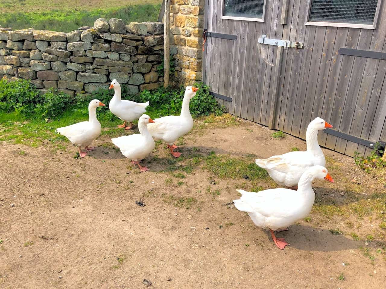
Hi all, I’ve recently updated my guide to the Danby Beacon walk, and it’s now live on my website. The journey begins in Lealholm, a charming little village with ample free parking in the village centre.
Highlights include a stop at Danby Beacon, the Danby Lodge National Park Centre, and a distant glimpse of Danby Castle. Unfortunately, Danby Castle is private property, so it can only be admired from afar. The trek, one of my most favoured circular walks in Yorkshire, spans approximately 11 ¼ miles. As always, I’ve included maps and tools you’ll need for the walk, along with information on distance, duration, elevation statistics, and a selection of photos.
Visit https://www.paulbeal.com/danby-beacon-walk
The history of Danby Beacon stretches back to the 1600s, during a time when England faced the threat of invasion from France. A soldier and his wife were stationed to watch for the anticipated French fleet. Upon sighting, they were tasked with lighting the beacon, signalling the first inland warning of invasion.
For those interested in exploring more about the story of Danby Beacon, I’ve written an in-depth article titled “Danby Beacon: A Symbol of Resilience in the North York Moors,” which you can view below.
Visit https://www.paulbeal.com/danby-beacon
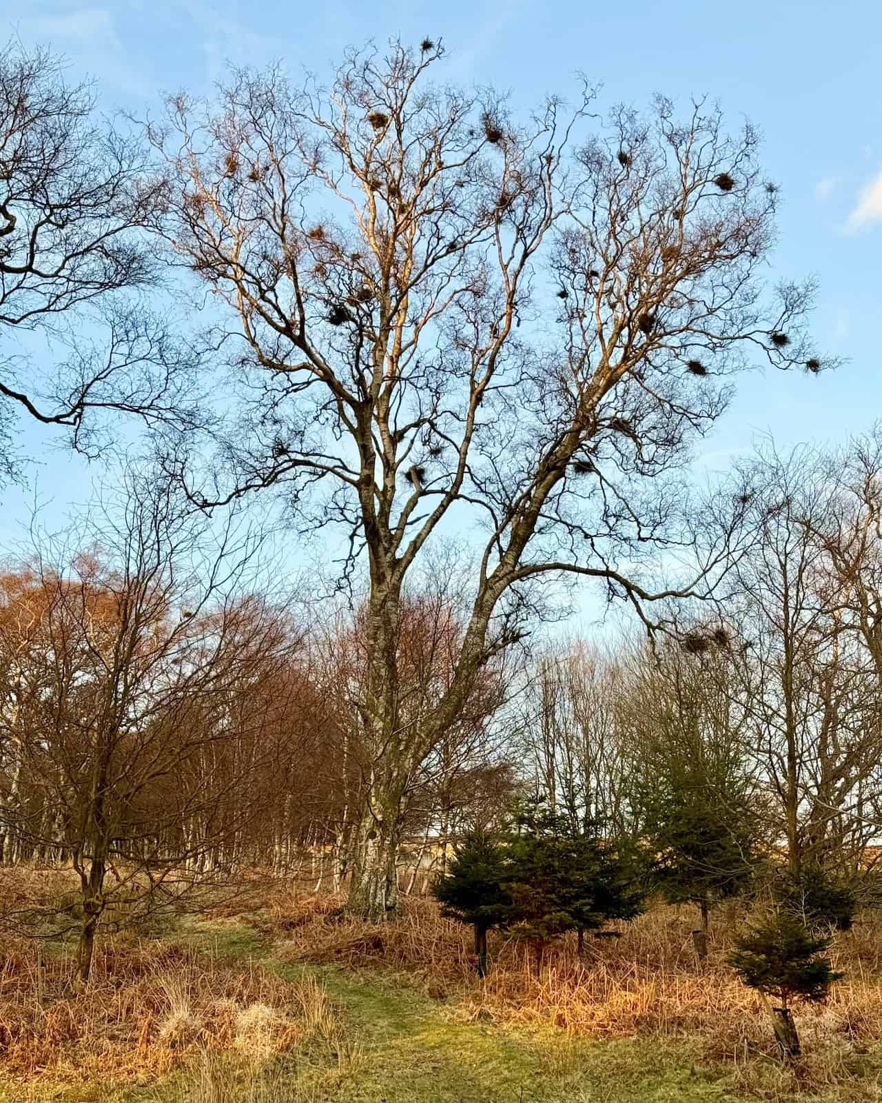
Unraveling the Mystery Behind Witch’s Broom in Trees
For years, whenever I noticed those clumpy bits nestled among the branches of trees, I assumed they were birds’ nests. But after some research using a popular search engine that begins with ‘G’, I discovered it’s actually Witch’s Broom.
Witch’s Broom is a peculiar and fascinating phenomenon where a dense cluster of twigs and branches sprout from a single point, resembling a broom. This growth anomaly can be sparked by various factors, including infections from fungi, viruses, or bacteria. In some cases, insects or mites are the culprits, or it could simply be the result of physical damage to the tree.
Though it may not always be harmful, this Witch’s Broom can stunt the tree’s overall growth and weaken its structure.
Leisurely Strolls Through the Yorkshire Dales from Grassington
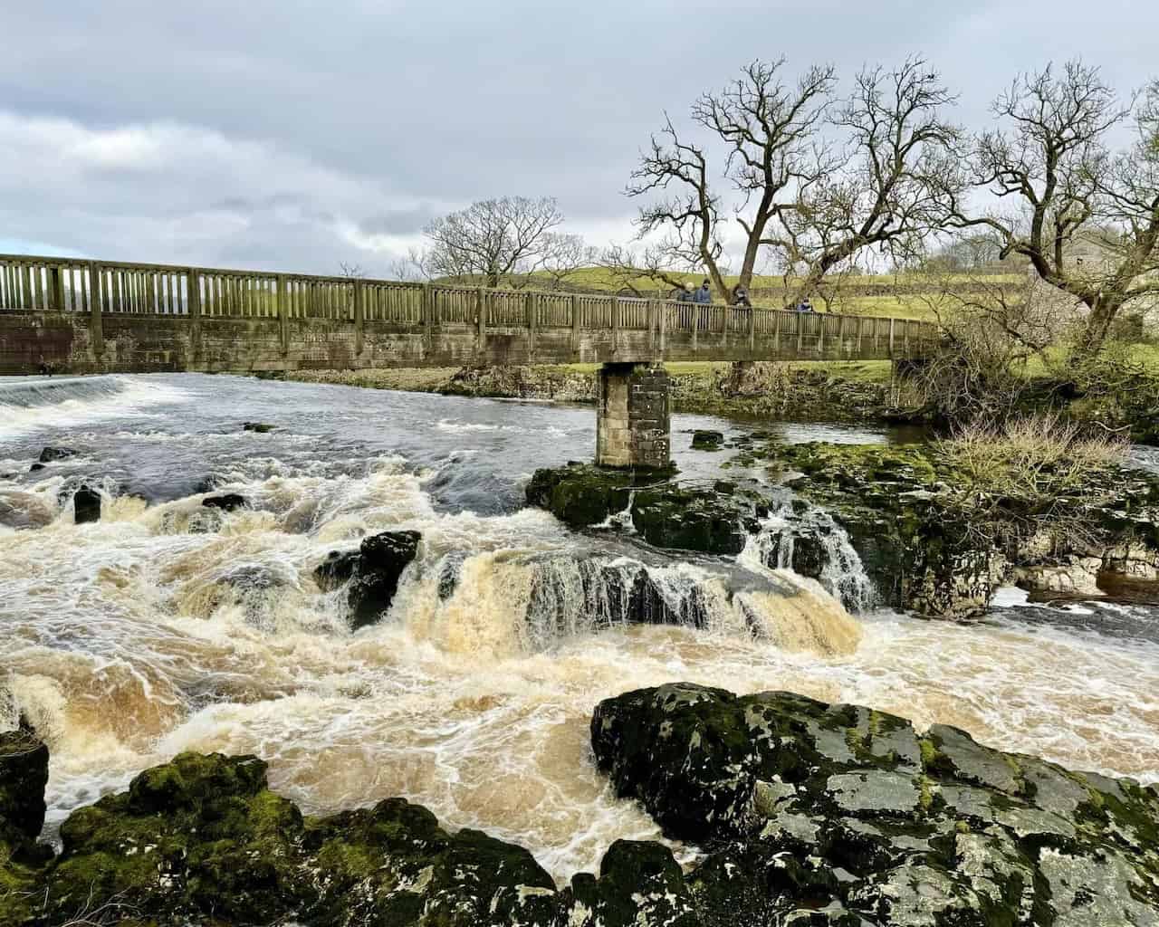
Yesterday, my friends and I met in Grassington for a walk in the Yorkshire Dales. Our first stop was Linton Falls, an impressive set of waterfalls on the River Wharfe. Highly popular and a must-visit if you’re in the Grassington area.
After that, we headed east, alongside the river, for a very pleasant stroll. The path was easy to follow, leading us all the way to Hebden Suspension Bridge, just south of Hebden village. At the bridge, we had planned to stop for a break, coffees, and snacks, but one of our group suggested a visit to the café called The Old School Tea Room in Hebden. Following his advice, we found ourselves in a very nice, relaxing spot where we could’ve stayed all day.
Forcing ourselves to leave the café, we continued north along a track, aiming to reach Grassington Moor to see the extensive areas of disused lead mines. While the most popular route is a well-trodden track following Hebden Beck, we chose a detour, climbing up to Edge Top on the eastern side of the main track above the valley. This detour proved to be an absolutely delightful choice, offering great views of the typical, lovely Yorkshire Dales countryside, especially as we passed Mossy Moor Reservoir where we stopped for lunch. It was quite a relaxed affair; none of us was in a hurry, just enjoying the day and the weather.
We made our way up to Cupola Corner and spent some time exploring the area, a fascinating place likely buzzing with activity centuries ago due to extensive lead mining, dating back to the 17th century or possibly even earlier, though I’m not entirely sure about the dates.
Doubling back, we took a route along Old Moor Lane past Yarnbury, then all the way back to Grassington via a quiet, minor road. We concluded our adventure with refreshments at The Devonshire Grassington, a traditional, family-run pub and hotel. It was a very comfortable and relaxed ending to a great day.
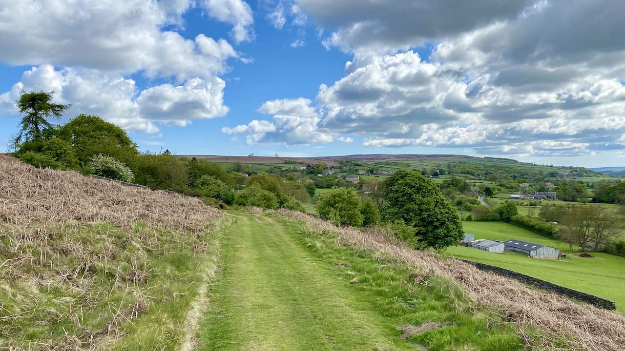
A Tranquil Walk Between Commondale and Castleton in the North York Moors
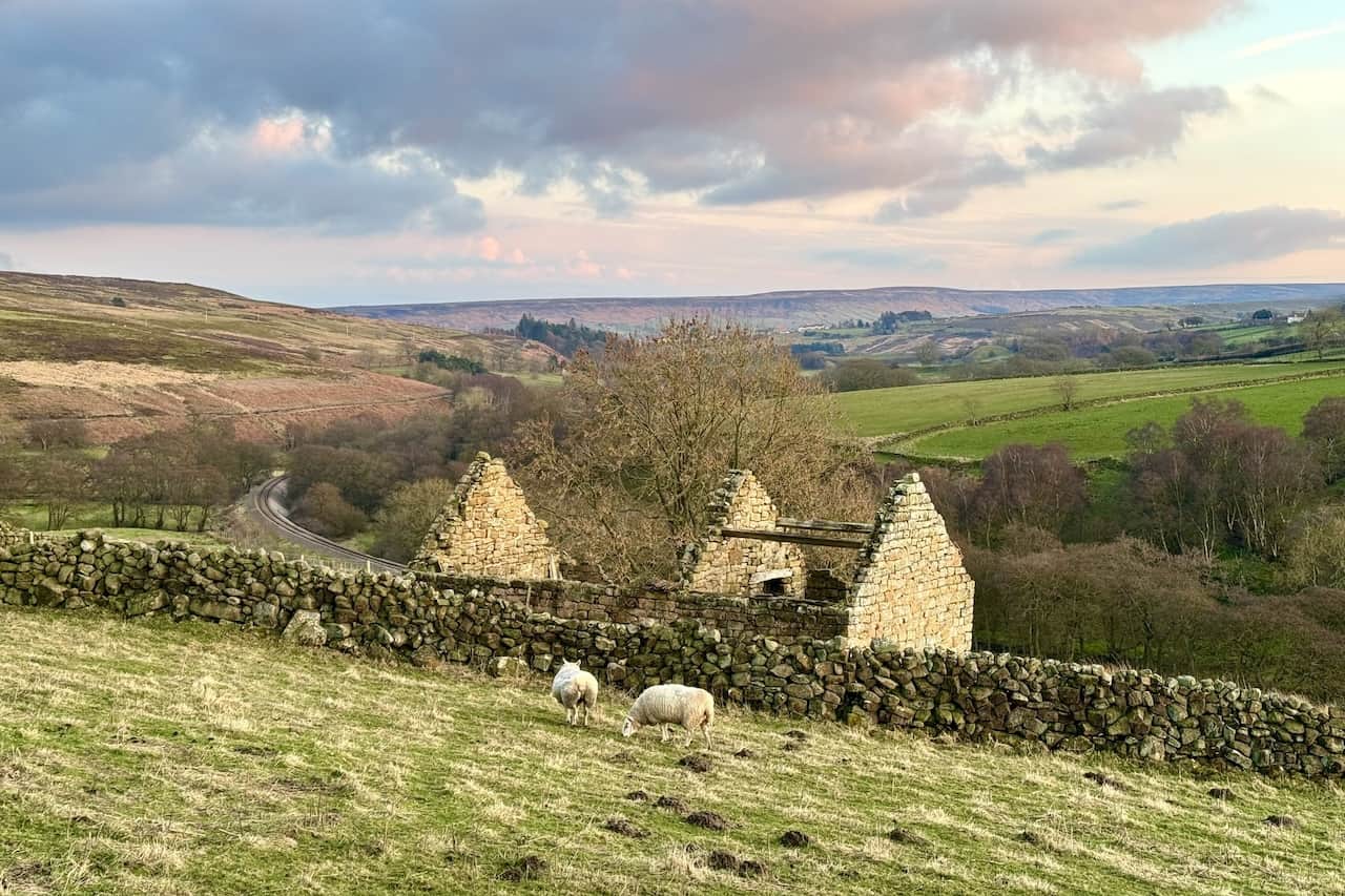
One of my most cherished circular walks in Yorkshire takes me along a track between Commondale and Castleton in the North York Moors. I often pause here to take in the view of the picturesque rural landscape.
Sheep graze on grassy fields near the old, roofless stone barn that stands forgotten. A railway, lined with trees, winds its way through the Commondale Beck valley below.
To the right of the valley, a patchwork of farmers’ fields stretches out in various shades of green; to the left, the heather-covered moorland. In the distance, the layered hills of the North York Moors National Park rise gently against the sky.
Discovering a North Yorkshire Gem with a Segment of the Esk Valley Walk
The Esk Valley Walk is a long-distance path in North Yorkshire. It starts with a circular loop in the North York Moors, just south of Castleton, then trails the River Esk to its estuary in the North Sea at Whitby. The path stretches about 37 miles.
I’ve just added a new walk to my website, a favourite of mine. It covers much of the initial loop section of the Esk Valley Walk, beginning from Castleton and spanning roughly 12½ miles. Despite its recognised long-distance path (LDP) status, be aware that some sections may become somewhat boggy during winter.
Visit https://www.paulbeal.com/esk-valley-walk
A Comprehensive Guide to the Castleton Walk in the North York Moors
Hello, everyone! I’m excited to share a new guide on my website: ‘Castleton Walk: Trekking Ancient Pathways in the North York Moors.’ This circular walk covers 12½ miles and takes about 5¾ hours to complete, offering a splendid way to enjoy the stunning landscapes of the North York Moors.
Starting in Castleton, the walk begins just south of the road bridge over the River Esk. The route crosses a variety of rugged terrains and historic paths, including the Esk Valley Walk, Quakersʼ Causeway, and Panniermanʼs Causeway. Each path has its own unique appeal.
On your route, explore the charming village of Commondale. After completing the walk, Castleton itself offers an excellent opportunity for further exploration. The path leads you through expansive moorlands, over the ancient stone slabs of Quakersʼ Causeway, and through the tranquil Danby Park’s Silver Birch woodland, which is just one of the many highlights of the walk.
Visit https://www.paulbeal.com/castleton-walk
The Ultimate Guide to Four Reservoir Circular Walks in Yorkshire
Explore the beauty of the English countryside with these circular walks in Yorkshire, featuring trails of varying lengths around picturesque reservoirs, catering to walkers of all abilities.
Discover the Swinsty Reservoir circular walk, perfect for enthusiasts of all ages. Spanning a distance of 3 miles, this scenic route offers tranquility and leisure.
Visit https://www.paulbeal.com/swinsty-reservoir-circular-walk
For those just beginning or bringing along their children, the Fewston Reservoir circular walk is an ideal choice. Covering 4 miles, it’s designed to be user-friendly while still capturing the essence of the reservoir.
Visit https://www.paulbeal.com/fewston-reservoir-circular-walk
The Swinsty Reservoir walk provides a lengthier experience at 7 miles and allows walkers to enjoy the beauty of Fewston Reservoir en route.
Visit https://www.paulbeal.com/swinsty-reservoir-walk
Lastly, for those seeking a comprehensive experience, the Fewston Reservoir walk spans 10 miles, exploring not just the Fewston but also the vastness of the Swinsty Reservoir.
Visit https://www.paulbeal.com/fewston-reservoir-walk
Launching the Danby Walk Guide Through the North York Moors
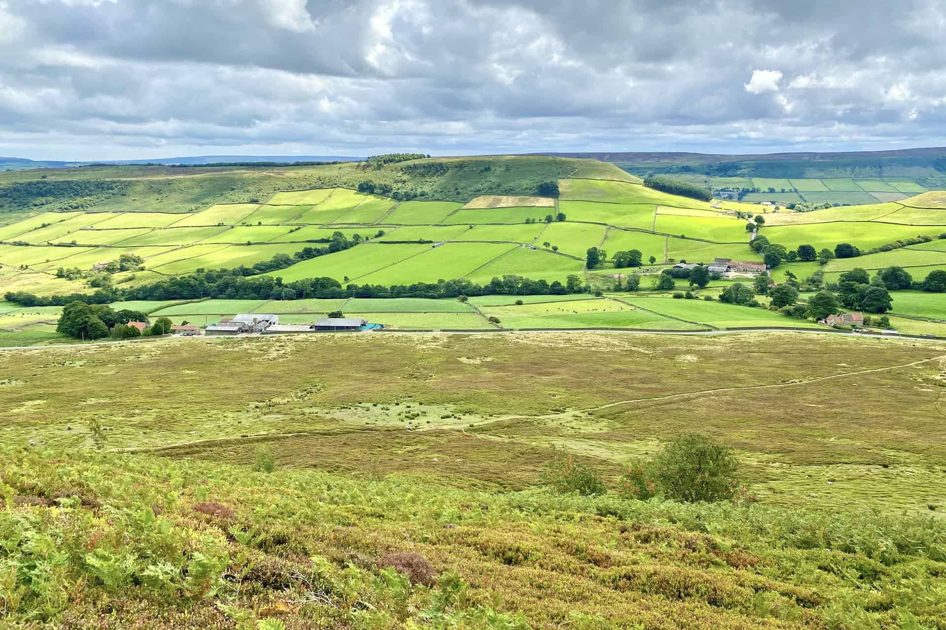
Exciting news for all you walking enthusiasts looking for great circular walks in Yorkshire! I’ve just launched a detailed guide to the North York Moors’ Danby walk on my website. A 12½-mile journey through the breathtaking landscapes of the North York Moors, featuring spectacular views of Little Fryup Dale and Great Fryup Dale.
Highlights of the Danby walk:
- Start from the heart of Danby, a lovely village.
- Explore the Ainthorpe Rigg moorland.
- Marvel at the views into Little Fryup Dale and Great Fryup Dale.
- Conclude with a peaceful trek through Danby Park’s woodlands.
I’ve made it easy for you to dive into the details. Visit my website for in-depth route descriptions, and access handy tools on OS Maps and Outdooractive platforms – including route downloads, 3D fly-overs, and more!
Visit https://www.paulbeal.com/danby-walk
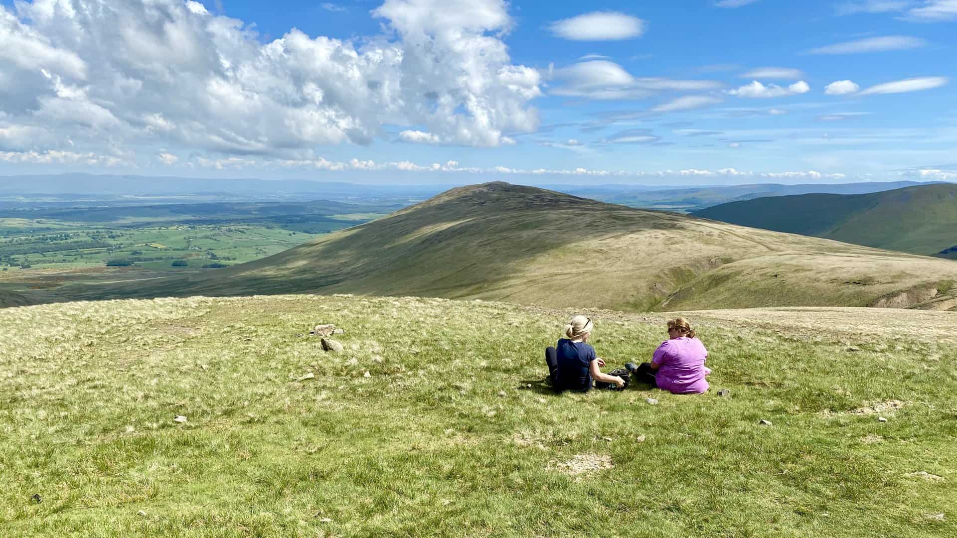
Embracing the Mountainous Landscapes of the Lake District
The topography of the Lake District, characterised by its mountain ranges and valleys, naturally lends itself to numerous horseshoe walks. These are circular, high-level routes that frequently incorporate a ridge or a series of peaks, typically winding around the top of a valley.
Examples of such walks include the Fairfield Horseshoe, the Coledale Horseshoe, the Mosedale Horseshoe, the Deepdale Horseshoe, and the Newlands Horseshoe.
Adding to this list is the Kentmere Horseshoe, details of which I’ve just published on my website. This route is fairly lengthy and challenging, spanning about 13 miles and taking 7-8 hours to complete, but, like the others, it offers amazing views and is exceptionally rewarding.
I recommend attempting the Kentmere Horseshoe on a pleasant spring or summer day. For further details, including parking, walk statistics, maps, and photos, please visit my website page below.
Visit https://www.paulbeal.com/kentmere-horseshoe
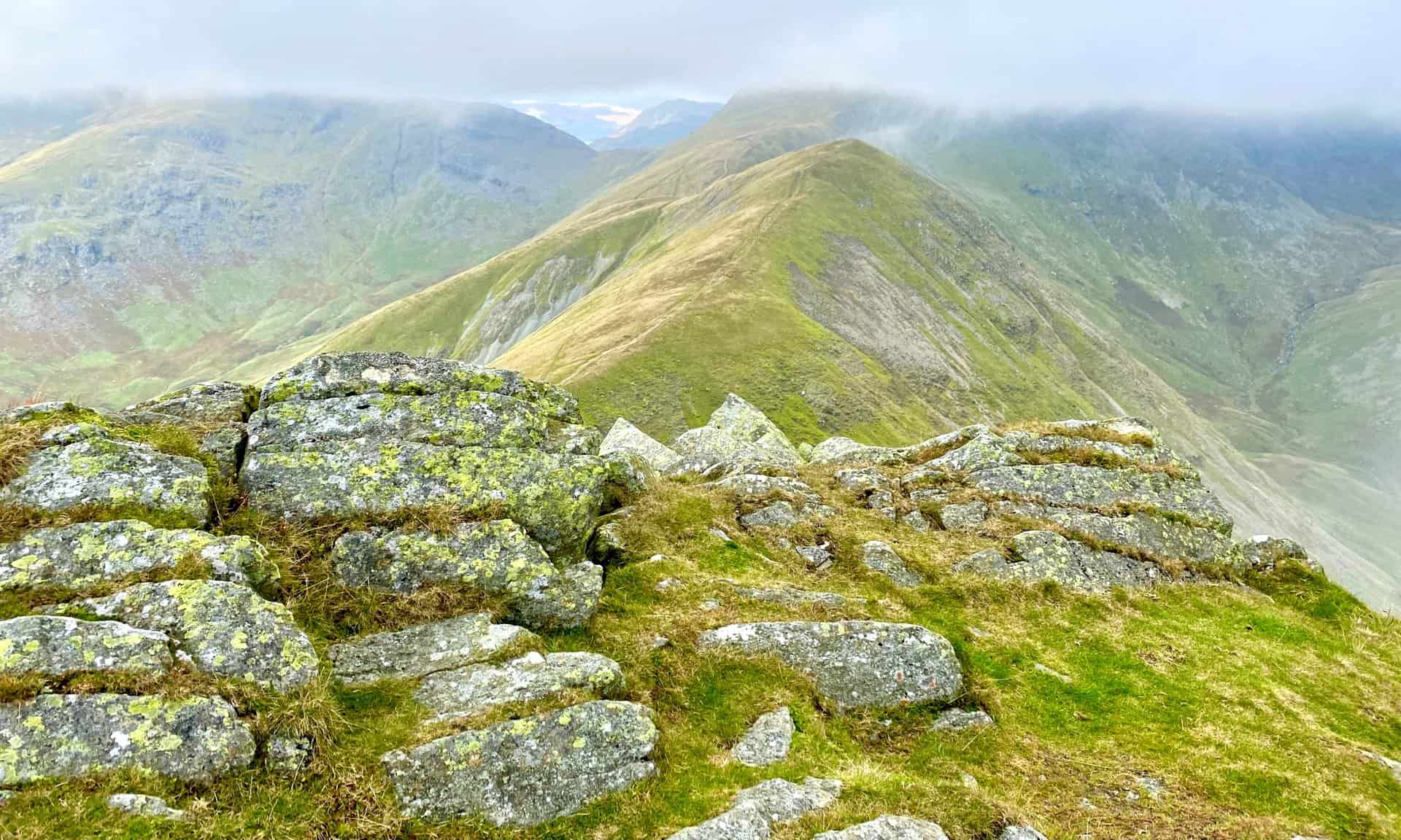
A Memorable Expedition to Great Gable from Honister Slate Mine
Last year, my friends and I decided to tackle a Great Gable walk, starting from Honister Slate Mine, on the B5289 Honister Pass road between Rosthwaite and Buttermere in the Lake District. We had four Wainwrights in our sights: Grey Knotts, Brandreth, Green Gable, and Great Gable – not that we’re hardcore Wainwright Baggers or anything!
After parking, we hopped out of our cars and were immediately greeted by the daunting sight of the steep path leading up to Grey Knotts. A quick look around confirmed I wasn’t the only one thinking, “What have we gotten ourselves into?” accompanied by a few mumbled expletives from the group. But, ever determined (or maybe just too stubborn to back down), we started the climb.
Slow and steady, we made our way up, reaching the summit of Grey Knotts and ticking off our first Wainwright. Next, we headed south-west towards Brandreth, our boots squelching through the boggy bits. Pro tip: sticking close to the fence line helps with not getting lost!
Our journey then took us south across the grassy expanses, down into Gillercomb Head and back up again to Green Gable, the third Wainwright. After a brief dip into Windy Gap, we faced the rocky ascent to Great Gable. Reaching the summit, we took our time exploring, especially around Westmorland Cairn and White Napes, taking in the incredible views down to Wast Water.
The descent from Great Gable was a bit of a nerve-wracker, carefully picking our way down the north-west slopes, through rocky terrain and slippery sliding scree. We then veered east, passing under the imposing Gable Crag, and headed north, below Greengable Crag, along Moses’ Trod and across the fells.
Wrapping up, the path eased up, leading us past Fleetwith and down a stone track by Bell Crags, back to where we started at Honister Slate Mine. Though it was challenging, our Great Gable walk was definitely a memorable experience, filled with a mix of laughter, a few grumbles, and of course, the usual sense of achievement.
Visit https://www.paulbeal.com/great-gable-walk
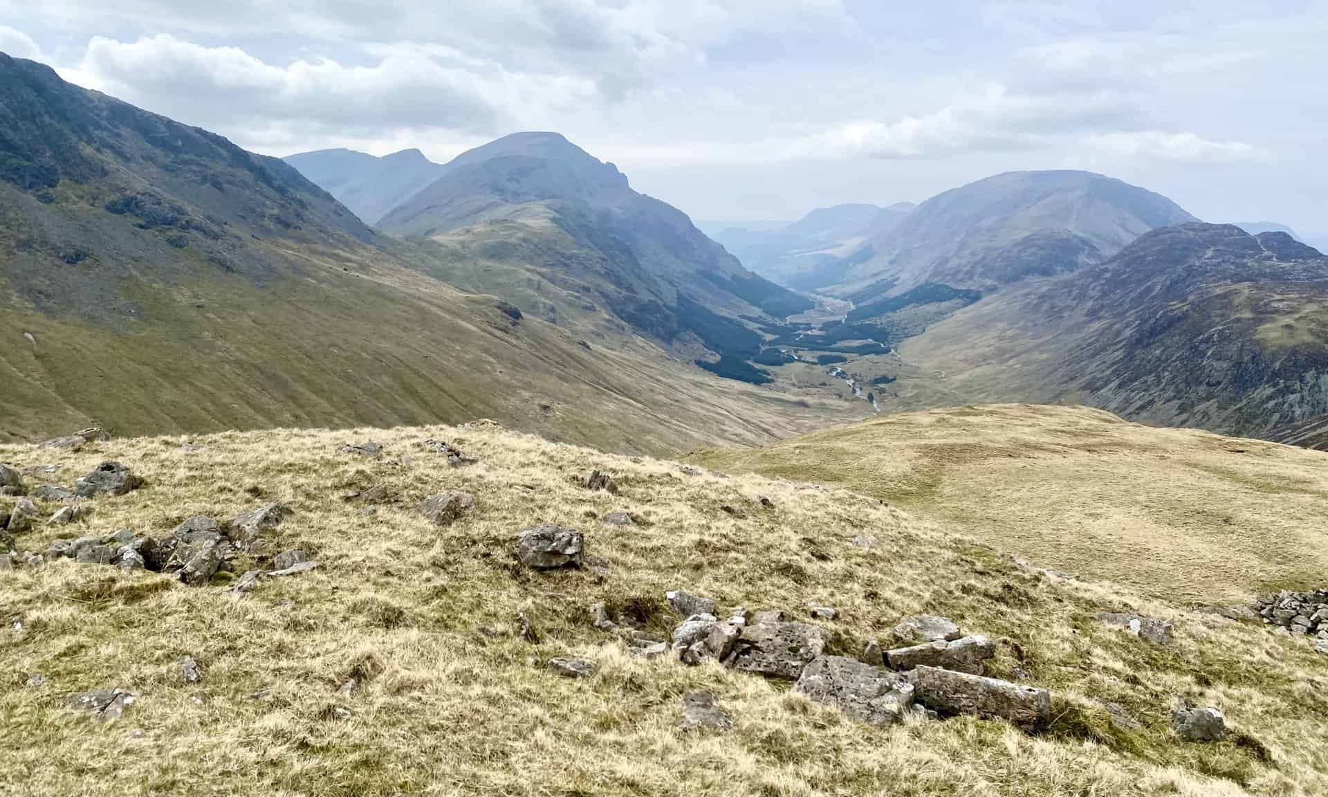
Clockwise or Anti-Clockwise Around the Lake District Newlands Horseshoe
A few weeks ago, I shared details on my website about the Newlands Horseshoe walk, a remarkable high-level walking route encircling the Newlands Beck valley in the Lake District. The route, starting from Gutherscale just north-east of Skelgill, proceeds in a clockwise direction, encompassing the five Wainwrights: Catbells, Maiden Moor, High Spy, Dale Head, and Hindscarth. The walk offers spectacular views throughout its 10½-mile length.
Visit https://www.paulbeal.com/newlands-horseshoe-walk
Of course, the Newlands Horseshoe can also be undertaken in an anti-clockwise direction, starting from various points. I’ve just published a variation of the route starting from Little Town, incorporating a shortcut that reduces the distance to 9½ miles. I invite you to explore this engaging alternative.
Visit https://www.paulbeal.com/newlands-horseshoe
The webpage provides comprehensive walk statistics and includes some of my photographs, offering a glimpse of what to anticipate on the trail.
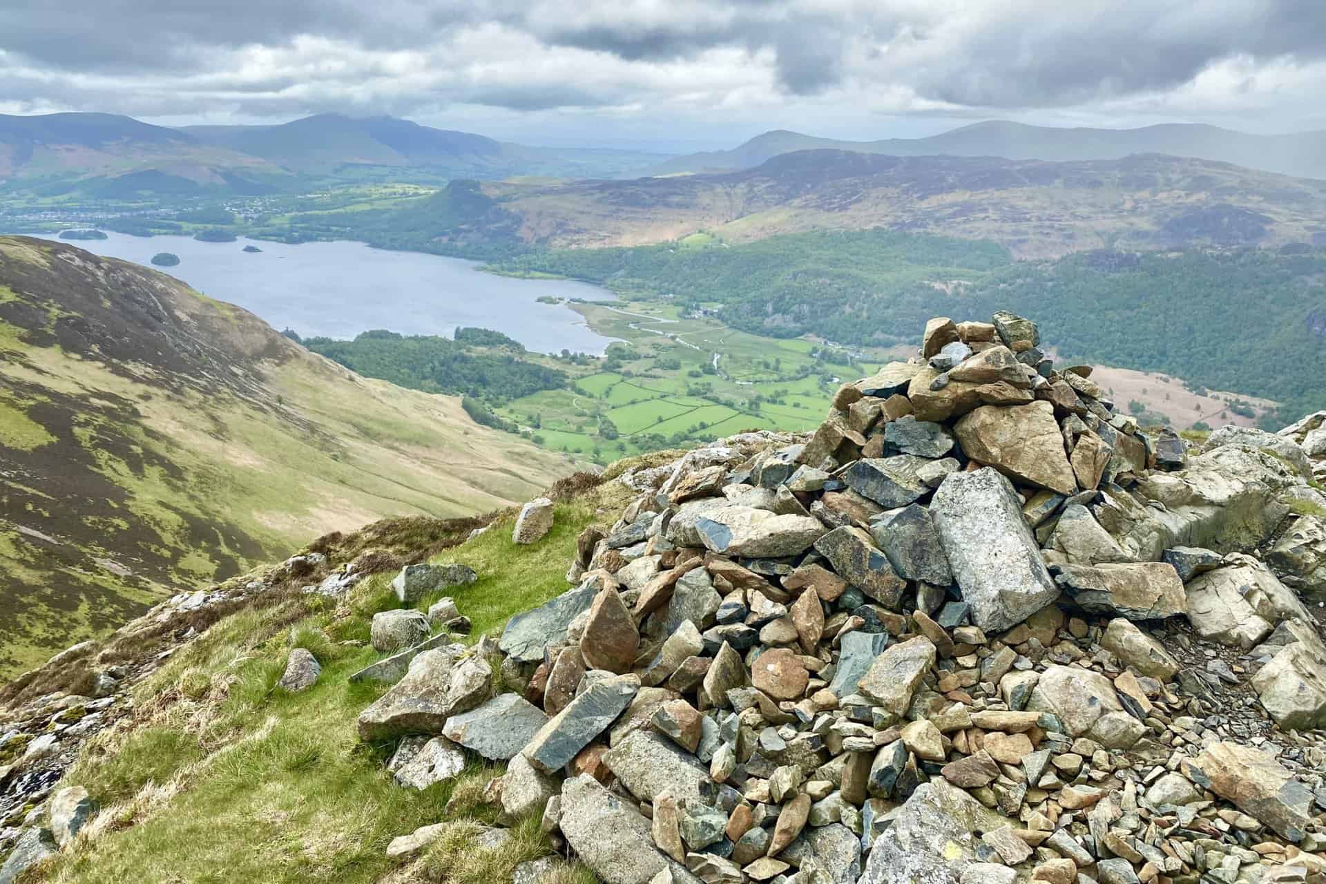
Reflecting on a Challenging Trek in the Lake District’s Varied Terrains
I’ve just republished an account of a trek we took just a couple of years ago in the Lake District, and oh, how I wish we had gone the other way round!
Starting from Bowscale, we ventured westward, climbing towards Bowscale Tarn through beautiful landscapes. The initial part of our journey was simply enchanting.
After descending to cross the River Caldew, we passed through the stunning valley between Bowscale Fell and Carrock Fell. The climb to Coomb Height, however, proved challenging due to the steep path and the scorching heat.
The journey along the Cumbria Way to High Pike and the ascent of Carrock Fell were all fairly straightforward, offering peaceful moments and delightful views along the way.
However, the descent from Carrock Fell was a challenge, and quite nerve-wracking. The steep slope covered in slippery, unstable scree made things rather precarious, and we often found ourselves slipping on our backsides.
Reaching the small tarmac road at the bottom, which led us back to our starting point at Bowscale, was a relief. Being back on solid ground never felt so good.
Looking back, understanding now that climbing up Carrock Fell on the scree would have been easier than climbing down—a common case with Lake District scree slopes—I’d recommend taking the route anti-clockwise instead of clockwise.
Despite these challenges, this walk is one I thoroughly recommend. The views from High Pike are exceptionally stunning, making all the effort well worth it.
Visit https://www.paulbeal.com/carrock-fell-walk