ADVERTISEMENT
Following the River Wharfe Through the Yorkshire Dales on This Hebden Walk
This circular Hebden walk is a wonderfully varied route through the heart of Wharfedale, taking in two of the Yorkshire Dales’ most appealing villages, a celebrated ancient woodland and one of the most striking waterfalls in the area. Setting off from the quiet village of Hebden, the route blends open countryside, riverside paths and characterful streets, with plenty of history and natural interest woven in along the way.
The walk begins on Main Street in Hebden, just off the B6265, and heads out across the meadows of the Grassington Park Estate before joining the broad stone track of High Lane down into Grassington. From there, it works its way around the western edge of the village along Wood Lane, Moody Sty Lane and Garrs End Lane, before slipping into open countryside on Cove Lane and entering Grass Wood Nature Reserve. The route passes the remains of an Iron Age settlement and the ancient Brigantian hill fort of Fort Gregory, before dropping down to the banks of the River Wharfe at Lower Grass Wood. The riverside path then leads past Ghaistrill’s Strid, the arched stone bridge at the western edge of Grassington, Linton Falls Hydro and the dramatic Linton Falls themselves. Joining the Dales Way, the route continues alongside the Wharfe to Hebden Suspension Bridge, before returning across fields and along Hebden Beck back into the village.
The walk covers eight and a half miles, or roughly thirteen and a half kilometres, with around 816 feet of ascent, equivalent to 249 metres. It is a circular route taking approximately three and three-quarter hours to complete at a steady pace. The recommended map is Ordnance Survey OS Explorer OL2, Yorkshire Dales Southern and Western Area, and parking is easy to find along Main Street in Hebden, either beside the dry stone wall opposite Green Terrace or near The Old School Tea Room.
Grass Wood Nature Reserve is one of the great natural highlights of the route. Set in the celebrated landscape of the Yorkshire Dales and managed by the Yorkshire Wildlife Trust, it is a majestic woodland of limestone scars and open grassy clearings that supports a remarkable range of plants and animals. Spring brings birdsong from nuthatch, great spotted woodpecker, treecreeper, redstart, wood warbler and blackcap, and the wildflower display ranges from the tiny dog violet to the delicate lily-of-the-valley, whose bell-like flowers shine brightly in the shade during May and June. The wood is also home to a wealth of fungi, including clouded agaric and purple deceiver, and diverse insect life that includes the day-flying speckled yellow moth and the northern brown argus butterfly.
There is plenty to enjoy along the way, beginning with the 18th-century Clarendon Hotel on Main Street in Hebden and the flower-rich Grassington Park Estate Meadows, a Site of Special Scientific Interest with more than fifty plant species. Grassington itself is a former lead-mining village with cobbled streets, independent shops, art galleries and traditional pubs, including The Devonshire, which doubles as The Drovers Arms in Channel 5’s All Creatures Great and Small. Further on, the route passes Fort Gregory, a Brigantian hill fort thought to date from around AD 70, before reaching Ghaistrill’s Strid, where the River Wharfe is squeezed through a narrow channel in the limestone bedrock. Linton Falls Hydro, a restored hydroelectric station originally built in 1909, sits beside the dramatic Linton Falls, marking one of the easternmost features of the Craven Fault. The walk also takes in Hebden Suspension Bridge, built in 1885 by local blacksmith William Bell, and ends back beside The Old School Tea Room, a charming spot set in the village’s former schoolhouse.
With its rich blend of countryside, woodland, river scenery and history, this Hebden walk really is a wonderful way to spend a day in the Yorkshire Dales. From the welcoming pubs and tea rooms of Hebden and Grassington to the quieter corners of Grass Wood and the dramatic falls along the Wharfe, every stretch of the route offers something different to enjoy. For the full route description, maps, statistics and a complete photo gallery, please head over to the website using the link below.
Visit https://www.paulbeal.com/hebden-walk
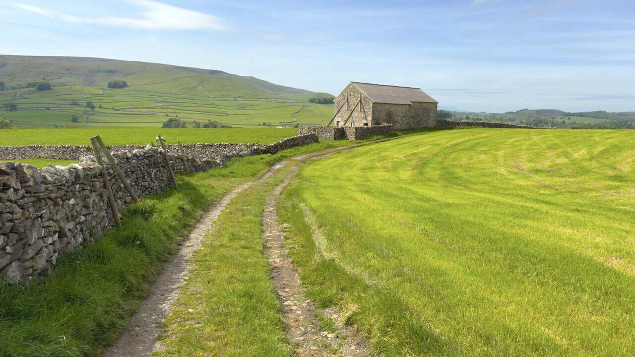
Wide Views and Open Moorland Found Along This Great Ayton Walk Route
This Great Ayton walk is a varied 9¼-mile circular route that takes in woodland, farmland, open moorland and some of the most rewarding viewpoints on the northern edge of the North York Moors. Setting out from the village itself, the walk weaves through quiet lanes, forestry tracks and ancient woodland before climbing onto Hutton Moor and reaching the dramatic sandstone outcrop at Hanging Stone.
The walk begins at the small car park and roadside parking area at the eastern end of High Street in Great Ayton, close to the village green. From here, the route heads south along Station Road, past Fletcher’s Farm Coffee Shop and over the railway line, before climbing the flanks of Round Hill on a quiet bridleway. The path leads through Ayton Banks Wood, on into Mill Bank Wood, then up past Bankside Farm and through Pale End Plantation. From Percy Cross Rigg, a fine moorland bridleway leads north-west across Hutton Moor before joining the Cleveland Way and dropping down to Hanging Stone. The return passes Little Roseberry, Aireyholme Farm, Cliff Ridge Wood and Rye Hill before completing the loop back into the village.
The full route covers 9¼ miles, or 14¾ kilometres, with around 1459 feet of ascent, or 448 metres. Most walkers will complete the circuit in about four and a half hours. It is a circular walk in Northern England, best followed using Ordnance Survey Explorer map OL26, which clearly shows footpaths, rights of way, open access land and the surrounding terrain.
Great Ayton is a picturesque village set at the foot of the Cleveland Hills, on the edge of the North York Moors National Park. The River Leven flows gently through the village, linking its two centres at High Green and Low Green, while the distinctive 320-metre profile of Roseberry Topping rises to the north. The village has a long and fascinating history, recorded in the Domesday Book of 1086 and forever linked with Captain James Cook, whose family moved here in 1736. Today, Great Ayton enjoys a thriving independent High Street and a calendar of cherished local events, all of which earned it a place on The Sunday Times’ Best Places to Live list in 2022.
Highlights along the way include the open views south towards the Cleveland Hills and the striking outline of Roseberry Topping, whose jagged profile was shaped by a partial summit collapse in 1912. Further on, the moorland stretches of Percy Cross Rigg and Hutton Moor open up wide views north towards the coast, with Highcliff Nab, the turbines of Teesside Wind Farm and even the silvery line of the North Sea all visible. The dramatic sandstone outcrop at Hanging Stone is a real highlight, perched above Guisborough with sweeping views to the north. Closer to the village, the route passes Aireyholme Farm and the “In search of Cook’s Cottage” interpretation board, before descending through Cliff Ridge Wood beneath magnificent old beech trees.
If you enjoy big views and a good day’s walking in open countryside, this Great Ayton walk has plenty to offer. Full directions, photographs, maps and route tools are all available on my website, where you can also find the GPX file and printable details to take with you on the day.
Visit https://www.paulbeal.com/great-ayton-walk
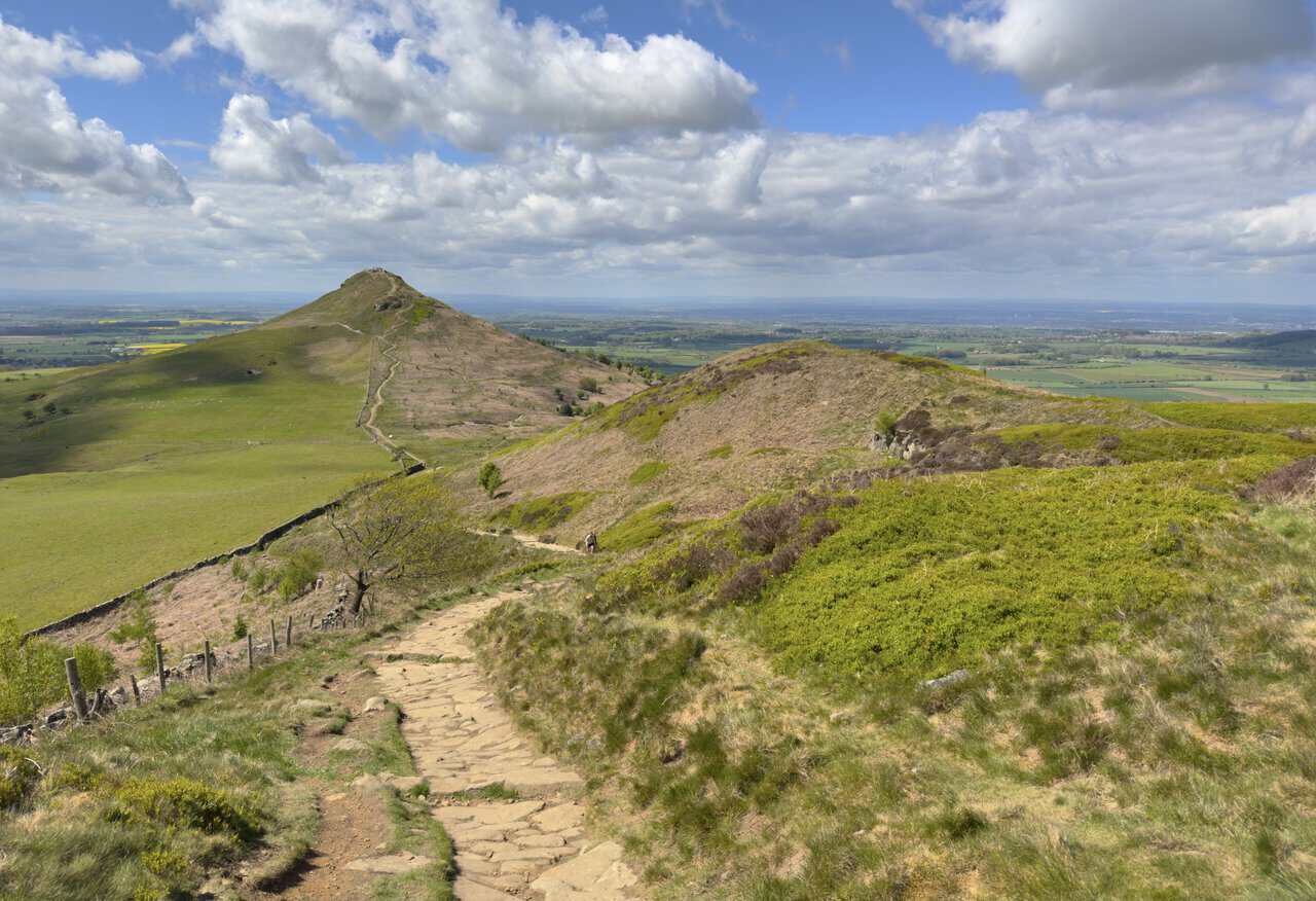
Fishing Villages, Ironstone History and Clifftops on the Runswick Bay Walk
This circular walk from Runswick Bay takes in two of North Yorkshire’s finest coastal villages, dramatic clifftop paths, a peaceful woodland nature reserve and centuries of local history. Starting and finishing at Runswick Bank Top, the route follows the Cleveland Way north to Staithes before looping inland through Dalehouse, Oakrigg Wood and Hinderwell on the return. Along the way, you will pass through places shaped by fishing, ironstone mining and maritime folklore, with plenty of time to explore the harbours, lanes and landmarks that make this stretch of coast so rewarding on foot.
The walk begins at the pay-and-display car park on Bank Top Lane, from where you descend into the lower village of Runswick Bay to explore its cottages, narrow streets and sandy beach before joining the Cleveland Way. The coastal path climbs onto the clifftops above Wrack Hills and Lingrow Cliffs, passing Port Mulgrave and Old Nab before dropping down into Staithes at roughly the halfway point. From Staithes, the route heads inland along the main road before turning off into Dalehouse, where a quiet path follows a former ironstone tramway into Oakrigg Wood Nature Reserve. The final section passes through Hinderwell, taking in St Hilda’s Church and its ancient Holy Well, before a straight, level mile along a roadside footpath brings you back to Runswick Bank Top.
The Runswick Bay walk covers a distance of eight and a quarter miles, or thirteen kilometres, and takes around four hours to complete. It is a circular route with a total ascent of 1080 feet, or 329 metres, so you should expect a good number of short climbs along the way, particularly on the clifftop sections. The walk falls within the Yorkshire Coast area and is covered by OS Explorer map OL27. Pay-and-display parking is available at two car parks on Bank Top Lane at Runswick Bank Top.
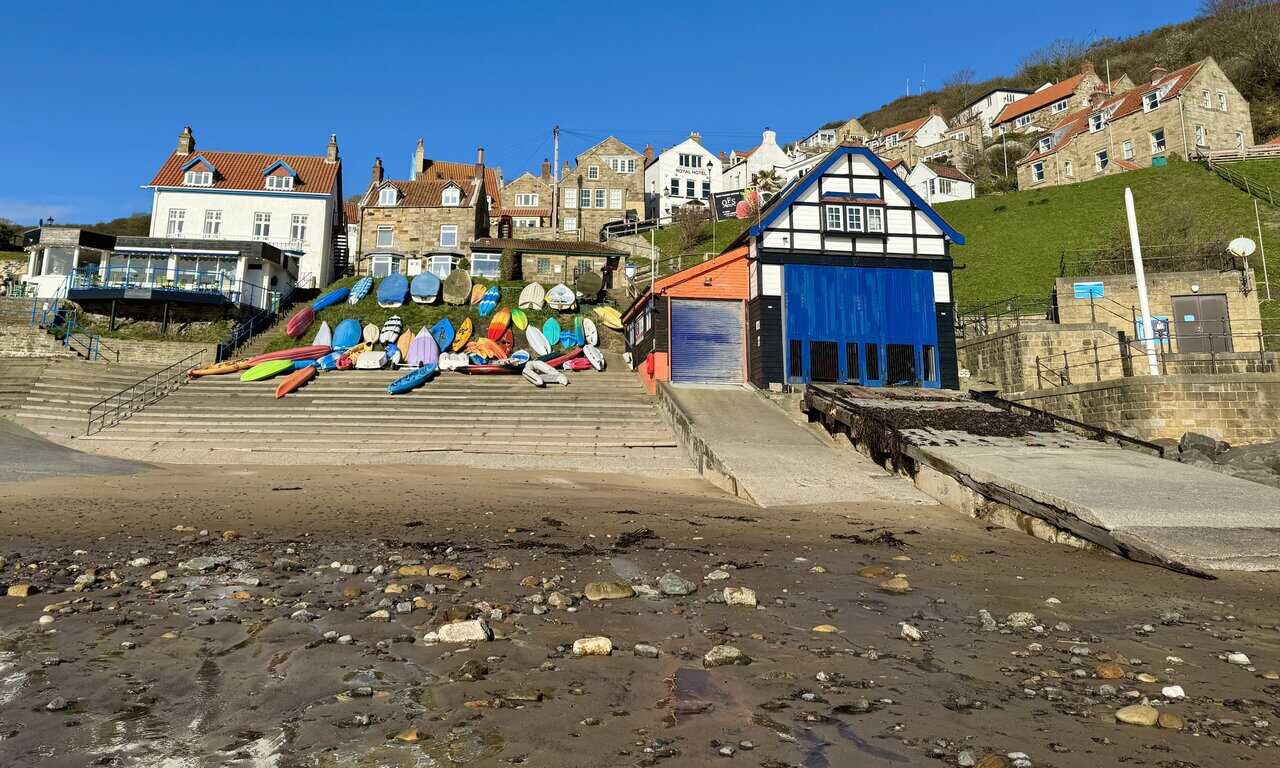
Runswick Bay is one of the most striking locations on the North Yorkshire coast, sitting roughly nine miles north-west of Whitby within the North York Moors National Park. The crescent-shaped bay was named Beach of the Year by The Sunday Times in 2020. The village is divided into two parts: the modern hamlet of Bank Top on the cliff edge and the historic lower village, where red-roofed cottages huddle against steep shale cliffs. The structure of the lower village is a direct result of the Great Landslide of 1682, when the original settlement was almost entirely destroyed as the cliff face collapsed. Every inhabitant escaped to higher ground before their homes were swallowed by the sea, and the villagers rebuilt on the more sheltered southern part of the bay. The area holds international importance for its Jurassic geology, with cliffs revealing rocks nearly 200 million years old, and is well known for fossil hunting. Local folklore tells of a benevolent spirit known as the Hob, said to live in the caves at the edge of the shore, to whom mothers once carried children suffering from whooping cough in the hope of a cure.
Highlights along the way are plentiful. In Runswick Bay itself, sandstone cottages with red pantile roofs climb the hillside above a broad, sheltered beach, and the maze of narrow paths and ginnels rewards a slow wander. The clifftop stretch above Lingrow Cliffs reveals layered Jurassic rock in tones of ochre, grey and rust, with Port Mulgrave’s quiet bay hinting at the ironstone industry that once transformed this coast. Old Nab is a bold headland with striking views along the shoreline, and the descent into Staithes reveals a village packed tightly around its harbour, the Cod and Lobster pub sitting at the water’s edge beneath Cowbar Nab. In Oakrigg Wood, carved wooden sculptures line the path through native oaks, and the former tramway tells the story of the Grinkle Ironstone Mine, from where three million tons of ironstone were carried to Port Mulgrave for shipping. At Hinderwell, St Hilda’s Church and its ancient Holy Well offer a peaceful stop rich in history, from the life of the great Anglo-Saxon saint to the folk custom of Shaking Bottle Sunday once held at the well each Ascension Day.
Whether you are drawn by the fishing heritage of Staithes, the quiet beauty of Oakrigg Wood or the layered history of Hinderwell and its Holy Well, this is a walk that offers something at every turn. Visit the full route page for detailed walking directions, maps, photos and background information to help you plan your day.
Visit https://www.paulbeal.com/runswick-bay-walk
Following the Cloughton Wyke Walk Along the North Yorkshire Coast
This circular walk along the North Yorkshire coast takes you from the village of Burniston to the secluded cove at Hayburn Wyke and back again, combining dramatic clifftop scenery with peaceful woodland and easy trail walking. The route follows two of the finest paths in the area, the Cleveland Way and the Cinder Track, and the contrast between them gives the walk a real sense of variety. With rocky inlets, a double waterfall, a nature reserve and a historic coaching inn along the way, there is plenty to see and enjoy across the full route.
The walk begins on Field Lane in Burniston, near the stone bridge that carries the Cinder Track overhead. From there, you head north-east along the lane towards the coast and pick up the Cleveland Way clifftop path, which also forms part of the King Charles III England Coast Path. The outward leg passes the Long Nab Coastguard Station and Mine Shelter before following the cliff edge north through Cloughton Wyke and on to the viewpoint at Rodger Trod. From there, the path descends through National Trust woodland to reach the beach at Hayburn Wyke. The return follows Hayburn Beck upstream through the wooded valley, then joins the Cinder Track at Whitehouse Farm for a flat and easy walk south past the Hayburn Wyke Inn and the former Cloughton Station, finishing back at Field Lane.
The full route covers eight and three-quarter miles, or fourteen kilometres, and takes around four and a quarter hours to complete. Total ascent is 1052 feet, or 321 metres, with several climbs and descents along the clifftop section and a steady descent into Hayburn Wyke. The walk is a circular route in the Yorkshire Coast area, and the recommended map is OS Explorer OL27. Parking is available on Field Lane near the Cinder Track bridge, with an additional car park at the far end of the lane.
Cloughton is a small village on the edge of the North York Moors National Park, about five miles north of Scarborough. Its name appears in the Domesday Book of 1086 as “Cloctune”, meaning the town in the valley, and the village has been part of the Duchy of Lancaster estate since 1267. The rocky inlet at Cloughton Wyke takes its name from the Old Norse word for a sea inlet, and the exposed cliffs here date from the Middle Jurassic period, around 170 million years ago. The site forms part of what is known as the Cloughton Formation and is popular with fossil hunters and geology enthusiasts. Hayburn Wyke, at the walk’s northern turning point, is a designated Site of Special Scientific Interest, and the surrounding woodland is managed by the National Trust and the Yorkshire Wildlife Trust as a nature reserve, home to roe deer, badgers and over thirty species of breeding birds.
The clifftop views along this stretch of coast are outstanding, with layered rock faces, bright yellow gorse and green farmland stretching away in both directions. Cloughton Wyke itself is a striking rocky inlet where a stream tumbles through a gully to meet the sea, and the banded sandstone and shale cliffs are a draw for geologists. At Hayburn Wyke, the double waterfall where Hayburn Beck drops over a rocky ledge onto the beach is the clear highlight, with fossil-rich rock layers exposed in the cliff face. The woodland walk along the beck is one of the most peaceful sections, with wild garlic, ferns and birdsong throughout. On the return, the Cinder Track passes the Hayburn Wyke Inn, an eighteenth-century coaching inn serving real cask ales and homemade food, and the beautifully converted former Cloughton Station, where a 1962 Derby-built railway carriage named Oscar has been refurbished into self-catering accommodation.
If you’re looking for a walk that offers dramatic coastal scenery, a hidden waterfall, tranquil woodland and easy trail walking all in a single outing, the Cloughton Wyke walk delivers on every count. You can find the full route description, photographs and detailed directions on my website.
Visit https://www.paulbeal.com/cloughton-wyke-walk
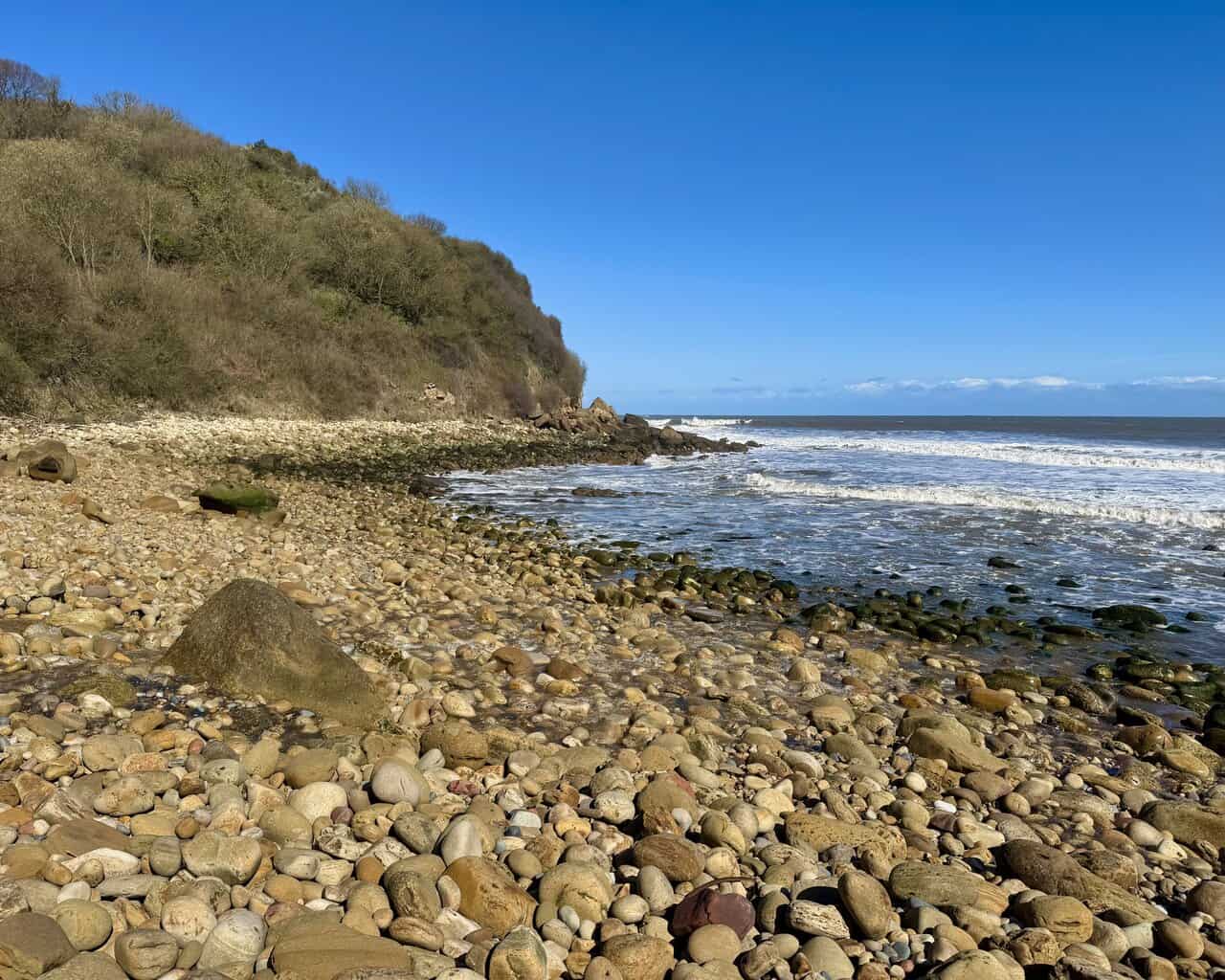
Cliffs and Coastline Along the Robin Hood’s Bay Walk to High Hawsker
The Robin Hood’s Bay walk is a circular route combining clifftop drama, village history and the peaceful inland corridors of the old Cinder Track. It links two of the area’s best-known long-distance routes, the Cleveland Way National Trail and the Cinder Track, which follows the former trackbed of the Scarborough to Whitby Railway, to create a varied and rewarding day out. Along the way, there are sweeping views across the bay, striking geological formations and plenty of interest above and below the cliffs.
The walk starts at the Station Car Park in Robin Hood’s Bay, a long-stay pay-and-display car park with toilet facilities, and heads south along the Cinder Track before cutting across to the Cleveland Way coastal path via Mark Lane and the clifftop approach into the village. The route descends into Robin Hood’s Bay itself, passing through the narrow streets and climbing back out to the clifftop at Mount Pleasant North, where the Cleveland Way and Coast to Coast Path head north together. From here, the path follows the dramatic clifftops for several miles, passing through Rain Dale and Limekiln Slack before branching inland near Northcliffe Holiday Park. A broad stone track crosses the Cinder Track and passes through farmland to reach the village of High Hawsker, where the route turns south along the road before rejoining the Cinder Track for the return leg back into Robin Hood’s Bay.
The Robin Hood’s Bay walk covers nine and a quarter miles, or just under fifteen kilometres, and takes around four and a quarter hours to complete. The total ascent is 945 feet, or 288 metres. It is a circular walk in the Yorkshire Coast area, and the recommended map is OS Explorer OL27 at the 1:25,000 scale, which clearly shows footpaths, rights of way and open access land. Station Car Park, the start and finish point, has plenty of spaces and an overflow car park nearby. The route is well waymarked throughout, following National Trail signage for the Cleveland Way and clear markers for the Cinder Track and Coast to Coast Path.
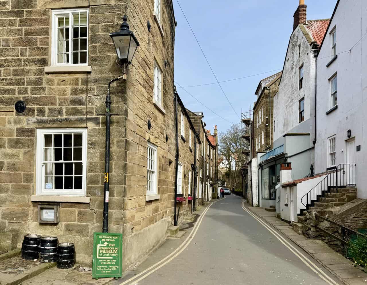
Robin Hood’s Bay is one of the most distinctive villages on the North Yorkshire coast, a maze of narrow streets and red-roofed cottages tumbling steeply down to the sea. Locally known as Bay or Bay Town, it sits within the North York Moors National Park, in the ancient parish of Fylingdales, a name thought to derive from the Old English word for marshy ground. The village has a long and colourful history, from its origins as a small coastal community described by Henry VIII’s topographer in 1536 as a fishing town of twenty boats, to its later reputation as one of the busiest smuggling hubs on the Yorkshire coast. During the 18th and early 19th centuries, the whole community was said to be involved in the so-called free trade, with a warren of interconnected cellars and passageways allowing contraband to pass from the bottom of the village to the top without seeing the light of day. Fishing later became the dominant industry, and by the 1820s the village’s fleet was larger than that of Whitby. The foreshore is also of significant geological interest, sitting on one of the finest Jurassic coastlines in northern England, with ammonites and other fossils regularly found along the beach.
The highlights of the walk are many and varied. The initial descent to Robin Hood’s Bay on the Cleveland Way offers a dramatic first view of the red-roofed village against the cliffs and sea. Within the village, points of interest include the original Victorian water fountain, reinstalled beside a flight of steps in 2016, the former police station built in 1886 and now a holiday cottage, and a memorial stone recounting the remarkable story of the Whitby lifeboat being hauled overland through seven-foot snowdrifts to rescue the crew of the brig Visiter in 1881. Out on the clifftop, an OS-marked exceptional viewpoint looks back across the full sweep of the bay towards Ravenscar, while the eroded cliff faces above Bulmer Steel, Craze Naze and Normanby Stye Batts reveal striking bands of grey, brown and ochre rock above broad, boulder-strewn shores. On the return leg, a small stone bridge on the Cinder Track offers one of the finest views on the whole route, looking south across Robin Hood’s Bay towards Ravenscar in the distance.
Full route directions, an interactive map, OS map details and walk statistics are available on the website, along with a photo gallery from the route. Visit the link below to read the full walk guide and start planning your visit to this outstanding stretch of the North Yorkshire coast.
Visit https://www.paulbeal.com/robin-hoods-bay-walk
Robin Hood’s Bay Views and Coastal Scenery on the Hayburn Wyke Walk
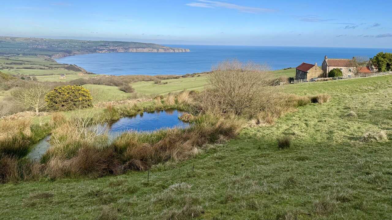
The Hayburn Wyke walk is a circular coastal route on the North Yorkshire coast that combines the clifftop drama of the Cleveland Way, the wartime history of the Ravenscar Radar Station, sweeping views across Robin Hood’s Bay, and the sheltered beauty of Hayburn Wyke, a hidden coastal valley where ancient woodland meets a rocky shore and a double waterfall tumbles onto the beach. The contrast between the open clifftop path outward and the quiet return along the Cinder Track gives the route a very satisfying shape.
The walk starts at the small pay-and-display car park near the Hayburn Wyke Inn, before dropping through National Trust woodland to the beach at Hayburn Wyke, where Hayburn Beck falls onto the shore as a waterfall. From there, the route climbs to the clifftop and follows the Cleveland Way north, passing Petard Point and the Ravenscar World War II Radar Station before arriving at Ravenscar. A short detour descends past the Raven Hall Hotel to one of the finest views of Robin Hood’s Bay on the walk, before the route turns south and joins the Cinder Track for the return to Hayburn Wyke via Staintondale.
The walk covers nine and a quarter miles and takes around four and a half hours to complete, with a total ascent of 1256 feet. It is a circular route best navigated using the Ordnance Survey Explorer map OL27. Parking is available at the pay-and-display car park near the Hayburn Wyke Inn, where the charge at the time of writing was £5 for the day, payable by cash only.
Hayburn Wyke is a Site of Special Scientific Interest, recognised for both its geology and its wildlife. The cliffs date from the Middle Jurassic period, and the beck has exposed the Hayburn Wyke plant bed, which contains around sixty fossil species and is regarded as one of Yorkshire’s most important Jurassic plant fossil sites. The woodland supports oak, ash, birch, elm and large-leaved lime alongside ferns, mosses and liverworts, while breeding birds including chiffchaff, pied flycatcher, redstart and blackcap make it a lively place in spring and summer.
The beach at Hayburn Wyke is an unspoilt cove where Hayburn Beck cascades directly onto the shore, a rare natural feature. The Cleveland Way delivers sweeping coastal views and a close look at the surviving buildings of the Ravenscar Radar Station, including the Communications Hut, Transmitter and Receiver Block, Fuel Store and Engine House. The descent past the Raven Hall Hotel offers the finest view of Robin Hood’s Bay on the walk, while the return along the Cinder Track passes through two stone tunnels, a tree-lined cutting and the former station at Staintondale.
Whether you are drawn by the coastal scenery, the history or the wildlife, the Hayburn Wyke walk has a great deal to offer. The full route description, interactive maps, photographs, and links to view the route on OS Maps and Outdooractive are all available on the website.
Visit https://www.paulbeal.com/hayburn-wyke-walk
Alum Works and Boggle Hole on the Ravenscar Walk to Robin Hood’s Bay
This circular walk from Ravenscar to Robin Hood’s Bay brings together clifftop views, coastal history and a gentle return along the old railway line. Starting high above the North Sea in Ravenscar, the route follows the Cleveland Way to Peak Alum Works, continues along the coast to Boggle Hole and Robin Hood’s Bay, then heads back inland on the Cinder Track. It is a varied walk that mixes open scenery, local history and a real change of pace between the outward and return legs.
From the start, the route feels varied. There are open clifftop paths with wide views across Robin Hood’s Bay, sections of woodland as the path drops towards the shore, and places that reveal the area’s industrial and military past. The return journey is quieter, following the old railway through greener countryside back to Ravenscar.
The walk starts in Ravenscar, where there is roadside parking on Raven Hall Road opposite the public toilets. From there, the route heads north towards the Ravenscar Visitor Centre before turning left onto the Cleveland Way public footpath to Robin Hood’s Bay. The first section descends on concrete tracks and woodland paths towards the coast, leading to Peak Alum Works, where the remains of the old industrial site form one of the most striking landmarks on the route.
After passing through or around the alum works, the walk continues north along the clifftop on the Cleveland Way. It passes the old Second World War pillbox near Peter White Cliff, drops down to Boggle Hole, and then carries on towards Robin Hood’s Bay, where the route descends into the village. From the lower village, the walk climbs the main road to the top, passes the Victoria Hotel, follows Station Road and Thorpe Lane, and reaches St Stephen’s Church before joining the Cinder Track. The return follows the old railway line past Fyling Hall, Browside Farm and the Ravenscar Brickworks before rejoining the Cleveland Way and climbing back into Ravenscar.
This is a circular walk of 8¾ miles, or 14 kilometres, with a total ascent of 1147 feet, or 350 metres. It takes around 4¼ hours and lies on the Yorkshire Coast. The recommended map is Ordnance Survey Explorer OL27, covering the North York Moors Eastern Area at a scale of 1:25,000. It clearly shows footpaths, rights of way, open access land, vegetation and ground features.
Parking is on Raven Hall Road in Ravenscar, and the route starts very close to the Ravenscar Visitor Centre. The mix of coastal paths, village streets, stepped descents and the steady return along the Cinder Track makes this a varied but straightforward route to follow, especially with the Cleveland Way guiding much of the outward leg.
Ravenscar is a small, scattered village set high on the cliffs of the North Yorkshire coast, roughly midway between Scarborough and Whitby. It sits within the North York Moors National Park and looks out across Robin Hood’s Bay, with open moorland stretching inland. Once known simply as Peak, it remains a quiet and unspoilt place, very different from the larger resorts along the coast, and it makes an excellent starting point for a walk that combines shoreline and countryside.
Ravenscar has a long history. In the late fourth century, the Romans built a signal station here as part of a chain of coastal defences, and a Latin dedication slab connected with the site was later discovered during the construction of Raven Hall. The village’s later story includes the building of Raven Hall in 1774, the fortunes of the Childs and Willis families, and the work of William Hammond, who helped shape the settlement by building St Hilda’s Church and the windmill. Today, visitors can still enjoy the clifftop setting, the remains of the Roman station, the Raven Hall Hotel and the Ravenscar Visitor Centre. The village also marks the eastern end of the Lyke Wake Walk and sits on both the Cleveland Way National Trail and National Cycle Route 1.
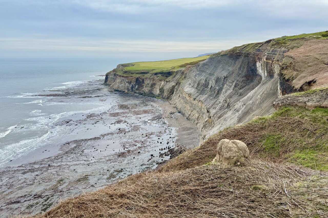
Soon after leaving Ravenscar, the path opens onto broad coastal views, with green fields falling away towards the sea and Robin Hood’s Bay visible in the distance. The descent through woodland, the bright yellow gorse along the cliff edge, and the sweep of the bay make the outward leg especially enjoyable. Peak Alum Works is one of the main highlights, both for the scale of its ruins and for what they reveal about an industry that shaped this part of the coast for more than two centuries.
The clifftop section beyond the alum works is especially memorable. The narrow path between field and sea offers wide views towards the pale cliffs around Robin Hood’s Bay, while places such as Miller’s Nab, High Scar and the crumbling wartime pillbox at Peter White Cliff add interest along the way. The descent to Boggle Hole changes the feel of the walk again, with its folklore, youth hostel, rocky inlet and beach framed by high cliffs. From there, the approach to Robin Hood’s Bay feels gradual and rewarding, with the red-roofed village drawing closer before the route drops into its steep streets and coastal setting.
The return along the Cinder Track has a quieter charm. After the climb out of Robin Hood’s Bay past the Victoria Hotel, the Methodist Church and St Stephen’s Church, the former railway line leads back through greener and more peaceful surroundings. Old bridges, the Stationmaster’s House at Fyling Hall, glimpses back towards the coast, and the remains of the Ravenscar Brickworks all add interest to the final stretch. By the time the route reaches the last bridge and the houses on Raven Hall Road come back into view, the walk feels neatly complete.
If you want a walk that shows the range of the Yorkshire coast, this route from Ravenscar to Robin Hood’s Bay is hard to beat. It combines clifftop scenery, industrial heritage, old village streets and a gentle return along the old railway line, making it a route well worth exploring in full before you set out.
Visit https://www.paulbeal.com/ravenscar-walk
A Classic Lake District Walk to Scafell Pike via the Corridor Route
This is one of my favourite circular mountain routes in the Lake District, and one I have walked several times over the years. It has a bit of everything: an easy valley start, a steady climb beside a stream, a superb high-level traverse, the summit of Scafell Pike, and a long, leg-wearying return that really makes you feel you have earned the day. It is not a walk to rush, but if you give it the time it deserves, it is hugely rewarding.
The walk starts from Seathwaite, a tiny hamlet at the head of Borrowdale, just over nine miles south of Keswick. Getting there is straightforward, following the B5289 down the eastern side of Derwent Water, through Rosthwaite and on to Seatoller, before taking the narrower road up the valley to Seathwaite itself. That final stretch always feels as though you are heading properly into the mountains.
Scafell Pike is extremely popular, and Seathwaite can be busy in good weather. I try to arrive early if I can. There is roadside parking, as well as a large field made available by the landowner for parking, for which there is a charge. In my view, it is well worth paying. Despite the popularity of the route, every time I have done this walk I have managed to park without too much trouble.
From Seathwaite, the walk begins gently, following an easy and very pleasant valley path south to Stockley Bridge. It is a great way to start the day, allowing you to warm up without effort as the fells gradually close in around you. Stockley Bridge itself is iconic and appears in countless photographs, and it always feels like the real gateway to the higher ground.
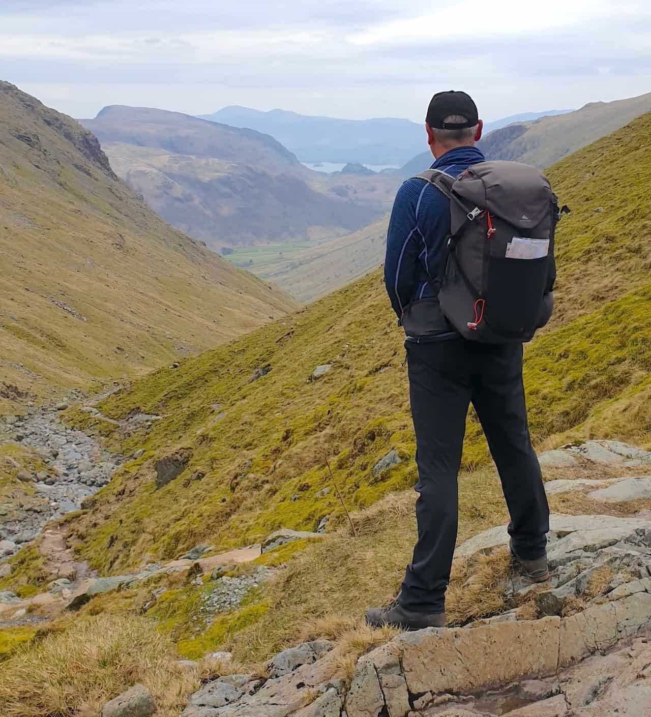
After crossing the bridge, the character of the walk changes. The route turns west, then south-west, and begins a steady climb alongside Styhead Gill. Underfoot, the ground becomes noticeably rockier as the path climbs beside the stream. Higher up, the gradient eases and Styhead Tarn comes into view, sitting beautifully in a natural bowl beneath the surrounding fells.
From the tarn, the route climbs to Sty Head, the historic mountain pass linking Borrowdale, Wasdale and Langdale. At the col, I turn east, then south, to follow the Corridor Route. This is always one of my favourite sections of the day. The path traverses the flanks of Great End, following the natural contours of the hillside. It is narrow and rocky in places, with a couple of short scrambly sections, but nothing that ever feels unreasonable. The views along here are superb and change constantly as you move along the slope.
After passing above the head of the impressive Piers Gill, the final ascent of Scafell Pike begins with a climb south-east. From this point, you will almost certainly notice more people around, as the route joins walkers coming up from Wasdale. I actually quite enjoy this change in atmosphere. There is often a real sense of shared effort as everyone works their way upwards. As height is gained, the ground becomes increasingly rough and boulder-strewn, eventually leading onto the summit plateau of Scafell Pike.
In good weather, the summit will be busy, and I have never seen that as a problem. People are resting, chatting, eating lunch and enjoying the views, all with the shared satisfaction of standing on England’s highest mountain at 978 metres above sea level. Most walkers will have come up from Wasdale, which is the shortest and most popular ascent. The Seathwaite route is busy too, but it tends to feel slightly less intense.
Leaving the summit, the route heads north-east across very rocky ground towards Broad Crag. This is a section where I always slow down and pay attention, especially if visibility is poor. The line across the boulder field is not immediately obvious and the path is initially quite indistinct. Once through this area, the route passes between Broad Crag and Ill Crag, before continuing beneath the southern flanks of Great End.
The descent then turns south into the broad, open valley alongside Ruddy Gill. Lower down, the route follows Grains Gill on a clearer, well-defined path. By this point in the day, this section often feels longer than expected. On tired legs, the valley seems to stretch on and on back towards Stockley Bridge. Once there, the final gentle walk north to Seathwaite feels very welcome.
This is a full day out, and I think it is best treated as such. Although OS Maps suggests a time of around five hours and forty minutes, I have always found that optimistic. I allow three to four hours to reach the summit, and at least another three hours for the return. Personally, I set aside seven to eight hours so I can take my time and enjoy the route properly.
I would always aim to do this walk when the forecast is settled and there is plenty of daylight, ideally in spring or summer when the days are long. The last thing you want is to be descending rough ground as the light fades, particularly on the return section. Plenty of daylight also makes the drive through Borrowdale far more relaxed, as the narrow road can feel awkward after dark.
Once the walk is over, there are several options for a well-earned drink along the main road as you head back towards Keswick, as well as plenty of choice in Keswick itself for food. It is a great way to round off a long, memorable and very satisfying day on the hill.
Visit https://explore.osmaps.com/route/30332745/scafell-pike-walk-the-corridor-route-from-seathwaite
Follow a Wensleydale Walking Route Featuring the Tupgill Park Estate
This richly varied Wensleydale walk begins at historic Wensley Bridge and follows the River Ure eastwards before climbing steadily towards Middleham. Once in the town, the route explores the market square, the churchyard of St Mary and St Alkelda and the impressive ruins of Middleham Castle. From here, you will cross Middleham Low Moor on a public bridleway, with the racehorse gallops visible to the north-east, before reaching the landscaped grounds of the Tupgill Park Estate. The path then winds through ornamental ponds, woodland and parkland before turning west towards Spigot Lodge, descending fields to West Witton and eventually rejoining the River Ure for a peaceful final stretch back to Wensley Bridge.
The full walk covers 11¼ miles and takes around 5 hours, with a total ascent of 249 metres. On the walk page, you will find a full set of directions, detailed route statistics and links to both Ordnance Survey and Outdooractive maps. You can print the route, download it for offline use or export it as a GPX file. A printable PDF and a supporting video are also available if you prefer to plan your walk visually.
The route is full of character from the outset. The riverside section beside the Ure offers gentle walking and fine views towards Penhill, followed by a steady climb towards Middleham. Highlights here include the 13th-century Church of St Mary and St Alkelda, Swine Market with its Jubilee Fountain and the striking remains of Middleham Castle, which once housed Richard III. Crossing Middleham Low Moor adds a completely different feel, with wide skies, open ground and the unmistakable presence of the local racing industry. Beyond the moor, the walk enters the tranquil estate of Tupgill Park, known for its woodland paths, ornamental ponds, the Fishing Temple and the playful entrance to The Forbidden Corner.
The scenery evolves again as you leave the estate and head west towards West Witton, with views across Wensleydale taking in Bolton Hall, Preston-under-Scar and the rolling fields below Capple Bank. The village itself is charming, home to St Bartholomew’s Church and the Fox & Hounds. The final leg leads down to Lords Bridge, a handsome stone crossing offering views along the river. From here, a peaceful woodland path follows the Ure all the way back to Wensley Bridge, rounding off a route that blends riverside walking, historic towns, open moorland, landscaped parkland and traditional Dales scenery.
If you enjoy routes with plenty of variety, rich local history and changing landscapes, this Wensleydale walk linking Wensley, Middleham, West Witton and Tupgill Park is an excellent choice. You will find the full route description, maps and planning resources on my website using the link below.
Visit https://www.paulbeal.com/tupgill-park
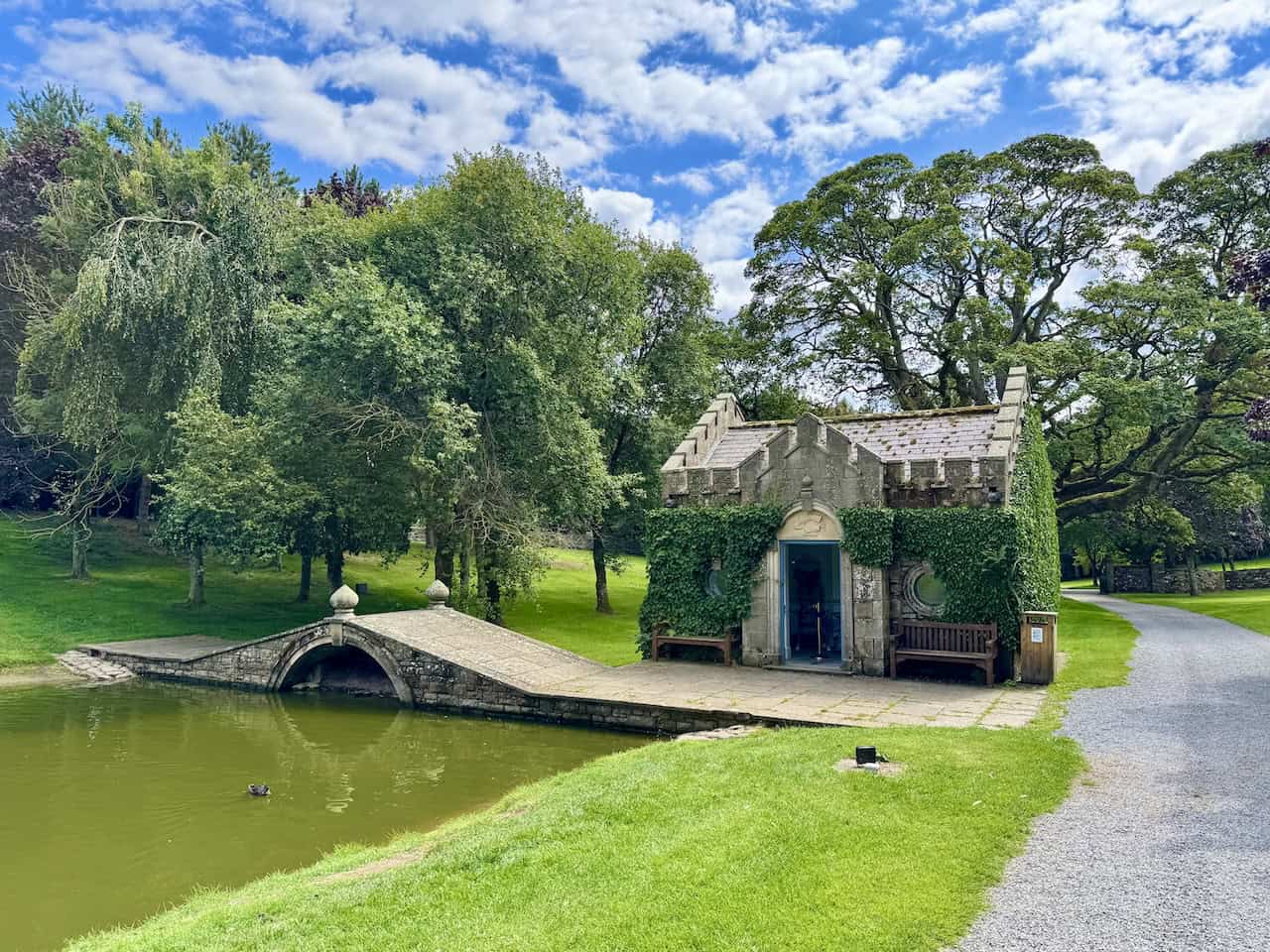
Enjoy a North Yorkshire Walk Featuring the River Ure and the Cover Bridge Inn
This lovely North Yorkshire walk from Middleham is available in full on my website. Beginning in the heart of the town, the route leads past the historic castle before following the Six Dales Trail south through farmland and wooded valleys to the River Cover. It then continues to the Cover Bridge Inn and picks up a beautiful riverside stretch beside the River Ure. From here, the walk enters Jervaulx Park, skirts the abbey, climbs gently towards Ellingstring and crosses open countryside to reach East Witton. The return leg heads across fields and meadows towards Hullo Bridge before finishing back in Middleham, weaving together riverside scenery, village history and classic Wensleydale landscapes.
The full walk is 12 miles and takes around 5½ hours, with a total ascent of 337 metres. On the walk page, you will find complete directions, route statistics and parking advice. There are also links to Ordnance Survey and Outdooractive maps, giving you the option to print the route, download it to your device or export it as a GPX file.
Middleham itself is steeped in history, with roots stretching back to Roman times and strong links to Richard III. The impressive castle dominates the town, and the winding streets reveal Georgian buildings, ancient market areas and landmarks such as Swine Cross, Jubilee Fountain and the old Methodist Church. The wider area is rich in heritage too. Jervaulx Park, once home to a prosperous Cistercian abbey, lies along the route, and the walk passes through the villages of Ellingstring and East Witton, both shaped by centuries of rural life, farming and the influence of historic estates.
There is a great deal to enjoy along the way. Early highlights include the cobbled Market Place, the red telephone box and the castle’s imposing walls. The racehorse gallops south of Middleham offer a glimpse of the town’s equestrian heritage before the path drops to the River Cover and its stepping stones. The Cover Bridge Inn is a favourite stopping point, steeped in character, and the riverside section beside the Ure is wonderfully peaceful. Views of Jervaulx Abbey, the quiet lanes into Ellingstring, the farmland around East Witton and the sculpted bedrock near Hullo Bridge all add variety. The final approach back to Middleham, with the castle rising ahead, makes a fitting end to a scenic and historic day out.
If you enjoy riverside walking, historic villages and a route that offers plenty of visual interest, this North Yorkshire walk is a superb choice. You can view the full route description, maps and planning resources on my website using the link below.
Visit https://www.paulbeal.com/north-yorkshire-walk

Follow Woodland Trails and Quiet Lanes on the Appleton-le-Moors Walk
This peaceful circular walk from Sinnington to Appleton-le-Moors is now available to explore on my website. Beginning in the centre of Sinnington beside the village hall and maypole, the route heads north past stone cottages and the parish church before joining woodland bridleways on Wiley Flat Lane. It continues through quiet countryside to Cropton, crosses the River Seven via a footbridge and climbs to Appleton-le-Moors before returning through Bishop Hagg Wood and along the riverbank to Sinnington. Walkers can look forward to woodland trails, characterful villages, gentle riverside paths and classic North Yorkshire scenery throughout.
The full circuit is 7 miles and takes around 3¼ hours to complete, with a total ascent of 242 metres. Full directions, detailed statistics and parking advice are included on the walk page. You will also find links to Ordnance Survey and Outdooractive maps, which allow you to print the route, download it to your device and export it as a GPX file.
Appleton-le-Moors sits within the North York Moors National Park and has a long and fascinating history. Once part of the North Riding of Yorkshire, the village appears in the Domesday Book and still reflects its mediaeval planned layout, where each cottage originally had a long garth stretching towards the rear lane. Archaeological finds include flint tools, Roman coins and a mediaeval oven, showing centuries of human settlement. One of the village’s most striking buildings is Christ Church, a Grade I listed 19th-century church designed by J. L. Pearson in the French Gothic style, known for its rose window, tower and spire and beautifully detailed interior. The church, along with the former village school, was funded by Mary Shepherd, whose husband Joseph Shepherd was born in the village and later became a wealthy shipowner.
The walk offers many memorable highlights. In Sinnington, the route passes the village hall, historic maypole and the 12th-century Church of All Saints before heading into open countryside. Wiley Flat Lane provides a lovely woodland section beneath tall oaks and ash trees, eventually opening to views towards Spaunton Moor. Near Kirby Balk, a traditional stone farmhouse offers a classic North Yorkshire scene. In Cropton, walkers pass the New Inn, home to Cropton Brewery, and continue to St Gregory’s Church, a striking Norman Revival building. The route crosses the River Seven via a wooden footbridge, climbs towards Appleton-le-Moors and then heads south through open farmland with wide views over Sinnington and the Vale of Pickering. The return through Bishop Hagg Wood and alongside the River Seven offers a peaceful finish before reaching the 18th-century stone bridge and the village green where the walk began.
If you enjoy woodland trails, pretty villages, historic churches and gentle North Yorkshire landscapes, this Appleton-le-Moors walk is a delightful choice. You can explore the full route description, maps and planning tools on my website via the link below.
Visit https://www.paulbeal.com/appleton-le-moors

Discover Open Moorland and Hidden Valleys on a Yorkshire Moors Walk
This superb Yorkshire moors walk from Gollinglith Foot is available in full on my website. Starting beside the red telephone box and the River Burn, the route climbs out of the valley on the Six Dales Trail, crosses quiet farmland and pine woodland, then heads out over the open expanse of Pott Moor. From here, it joins the high bridleway along Dale Edge, where wide views open over Upper Nidderdale, before turning north towards South Haw and dropping into the hidden valley of Steel House Gill. The return follows the developing River Burn and then Coal Road above Colsterdale, linking together open moorland, tucked-away valleys and classic Dales scenery in one rewarding circuit.
The full route is 11½ miles and takes about 5¾ hours to walk, with a total ascent of 351 metres. On the walk page you will find complete turn-by-turn directions, route statistics and parking advice. There are also links to Ordnance Survey and Outdooractive maps, giving you options to print the route, download it to your device or export it as a GPX file for your GPS or phone.
Colsterdale is a quiet, steep-sided valley shaped by the River Burn, a tributary of the River Ure. Although it sits within the Nidderdale Area of Outstanding Natural Beauty and the Swinton Estate, it feels far more secluded than the busier parts of the Dales. The valley is dotted with sighting towers, built to survey the ground during the construction of Leighton and Roundhill Reservoirs and their pipelines. The name ‘Colsterdale’ was first recorded in 1281 and is thought to mean ‘coalman valley’, a nod to medieval mining here. The dale has seen parish boundary changes, reservoir schemes and even a First World War training camp for the Leeds Pals, later reused as a Prisoner of War camp, leaving layers of history in what now feels like a peaceful, little-visited corner of the hills.
Along the way there are plenty of highlights. Early on, the bridleway from Gollinglith Foot climbs through woodland before emerging by the abandoned Pickersgill House and the farmsteads at Towler Hill and High Sourmire. A descent through conifers leads into a small valley where, in summer, tall bracken gives the path a rough and adventurous feel. Beyond Pott Moor High Road, the broad track over Pott Moor blows the cobwebs away before suddenly revealing your first big views into Upper Nidderdale, with Little Whernside and Great Whernside on the skyline.
The high traverse of Dale Edge gives superb panoramas towards Scar House Reservoir, the River Nidd and the distant village of Middlesmoor. Further on, the route passes a disused shaft, a stone sheepfold and the boundary stone on South Haw, then drops into the quiet cleft of Steel House Gill where the River Burn begins. The final section beside the Burn and along Coal Road offers a lovely mix of shooting house, heather-clad slopes, patchwork fields and far-reaching views across Colsterdale before you return to the footbridge and car park at Gollinglith Foot.
If you enjoy big skies, airy moorland tracks and exploring quieter valleys away from the crowds, this Yorkshire moors walk is a fantastic choice. You can view the full route description, maps and planning tools on my website using the link below.
Visit https://www.paulbeal.com/yorkshire-moors-walk
