Experience Amazing Lake District Views on the Red Pike Walk from Buttermere
Start your adventure in the charming village of Buttermere. Head south-west, bound for Scale Bridge. This Red Pike walk will then take you north-west along the southern banks of Crummock Water. Keep going until you reach Scale Beck just ahead.
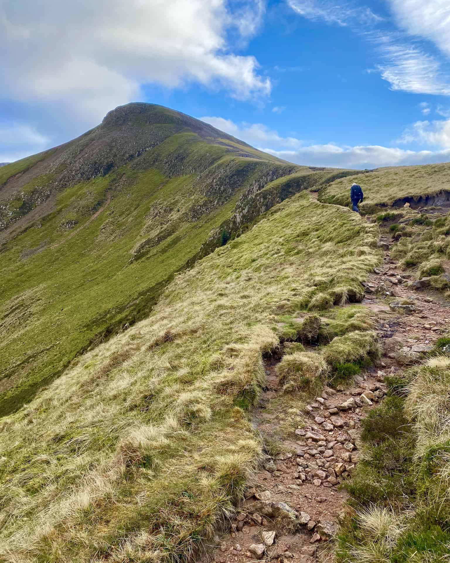
Proceed south, cutting up through the valley adorned with the majestic Scale Force waterfall. Next, set your bearings south-east, aiming for Lingcomb Edge, an absolute gem of the Lake District. Continue this south-eastern trajectory to reach the Red Pike summit, a highlight of this exhilarating Lake District hike.
Maintain your south-east course, navigating above Chapel Crags, to ascend High Stile’s peak. The next stop on our Red Pike walk is High Crag. Proceed south-east again, above Eagle Crag and Comb Crags. At High Crag’s apex, marvel at the breath-taking vistas.
Ready for descent? Navigate High Crag’s downward path via Gamlin End. The journey continues to Scarth Gap Pass, a path that leads down between High Wax Knott and Low Wax Knott. The descent is not over yet; the trail leads further down Buttermere Fell.
Reach Buttermere’s south-eastern corner and head north-west. Your path hugs Buttermere’s southern side and ventures through the tranquil Burtness Wood. Continue to the fords of Sourmilk Gill, then head north back to your starting point in Buttermere, concluding this 9-mile Red Pike walk.
Red Pike Walk: Maps and Tools
Visit either the OS Maps website or the Outdooractive website to view this walking route in greater detail. Both platforms offer a range of features, including the ability to print the route, download it to your device, and export the route as a GPX file. You can also watch a 3D fly-over and share the route on social media.
Red Pike Walk: Distance, Duration, Statistics
Distance: 8½ miles
Distance: 13¾ kilometres
Duration: 5 hours
Ascent: 2949 feet
Ascent: 899 metres
Type: Circular walk
About Red Pike
Red Pike, situated in the High Stile mountain range of the western Lake District, acts as a natural divider between Ennerdale and the picturesque valley encompassing Buttermere and Crummock Water. The direct ascent of Red Pike from Buttermere, via Bleaberry Tarn, is highly popular and attracts many hikers each year.
One of the area’s most revered walks is the ridge walk from Red Pike to High Stile, continuing to High Crag and concluding at Haystacks. The route is hailed as one of the finest in the region, offering breathtaking views of the Scafells, Great Gable, and Pillar.
The distinctive red coloring of Red Pike can be attributed to the presence of syenite in the rock and subsoil of the fell. This striking feature becomes especially evident in areas where surface erosion has occurred, such as the stony track adjacent to Scale Force and the path leading from Bleaberry Tarn to the summit. The red pathways are easily discernible from a considerable distance.
Red Pike holds the 62nd position in the list of Wainwrights, which are fells featured in Alfred Wainwright’s Pictorial Guide to the Lakeland Fells. With an elevation of 755 meters (2478 feet), Red Pike is designated as a significant landmark in Alfred Wainwright’s Western Fells. Its location can be identified by the grid reference NY 160 154, and it is covered by the Ordnance Survey Explorer map OL4 and Landranger map 89.
Recommended Ordnance Survey Map
The best map to use on this walk is the Ordnance Survey map of the Lake District North-Western Area, reference OS Explorer OL4, scale 1:25,000. It clearly displays footpaths, rights of way, open access land and vegetation on the ground, making it ideal for walking, running and hiking. The map can be purchased from Amazon in either a standard, paper version or a weatherproof, laminated version, as shown below.
Standard Version
Red Pike Walk: My Photos
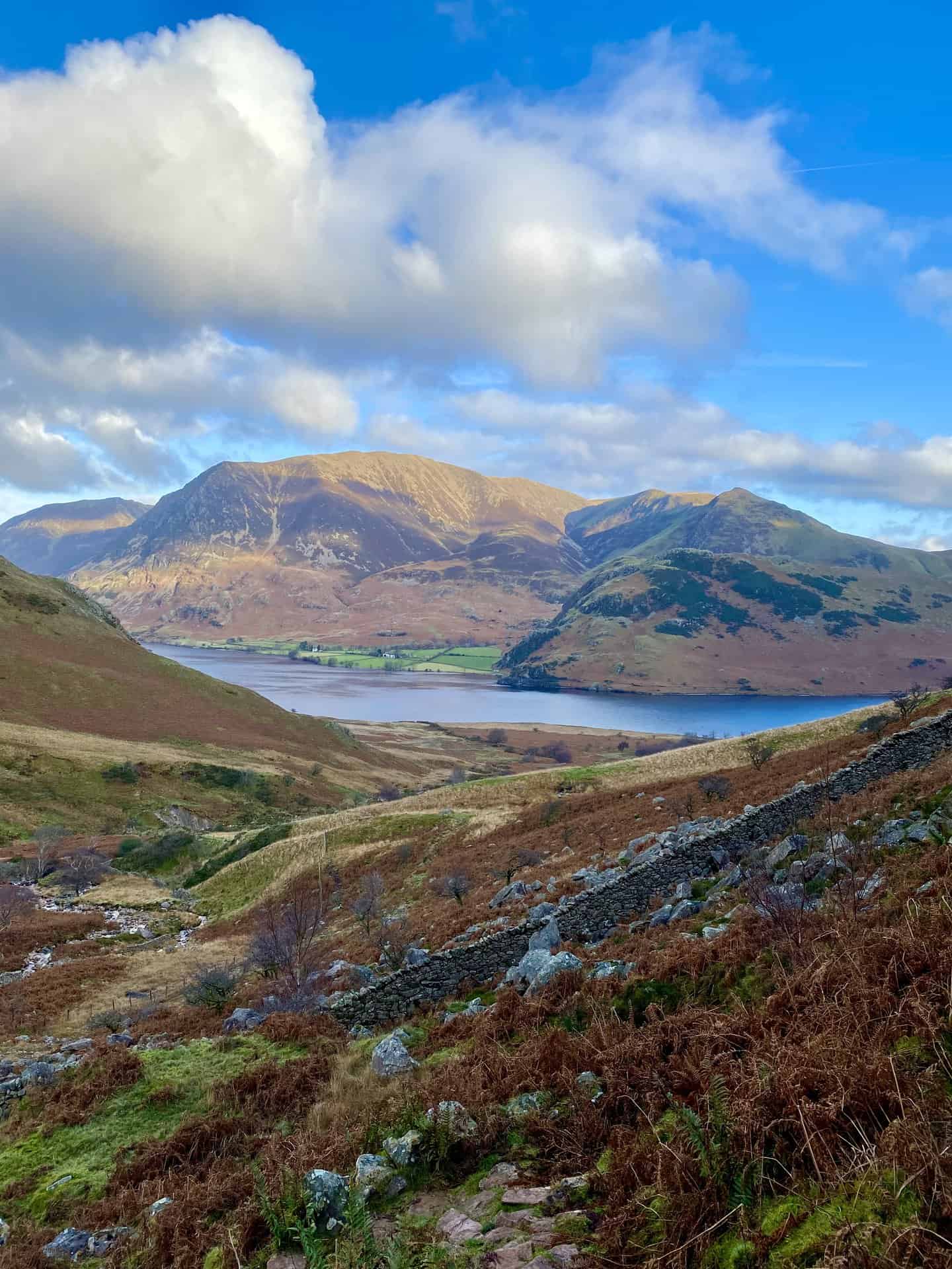
The view across Crummock Water to Grasmoor from Scale Force.
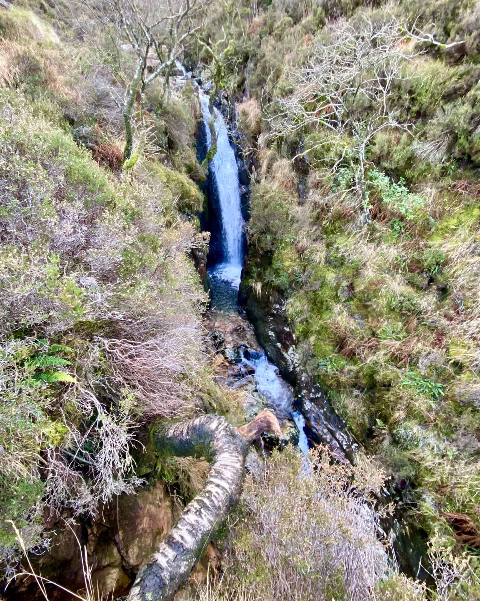
Scale Force, about one-quarter of the way round this Red Pike walk.

Walking in the Yorkshire Dales with 43 Circular Routes
AD This Cicerone guidebook includes 43 circular walks exploring valleys, hills, and moors between Kirkby Stephen and Pateley Bridge. With OS maps, local highlights, and routes ranging from 3–11 miles, it is a year-round companion for walkers of all abilities.
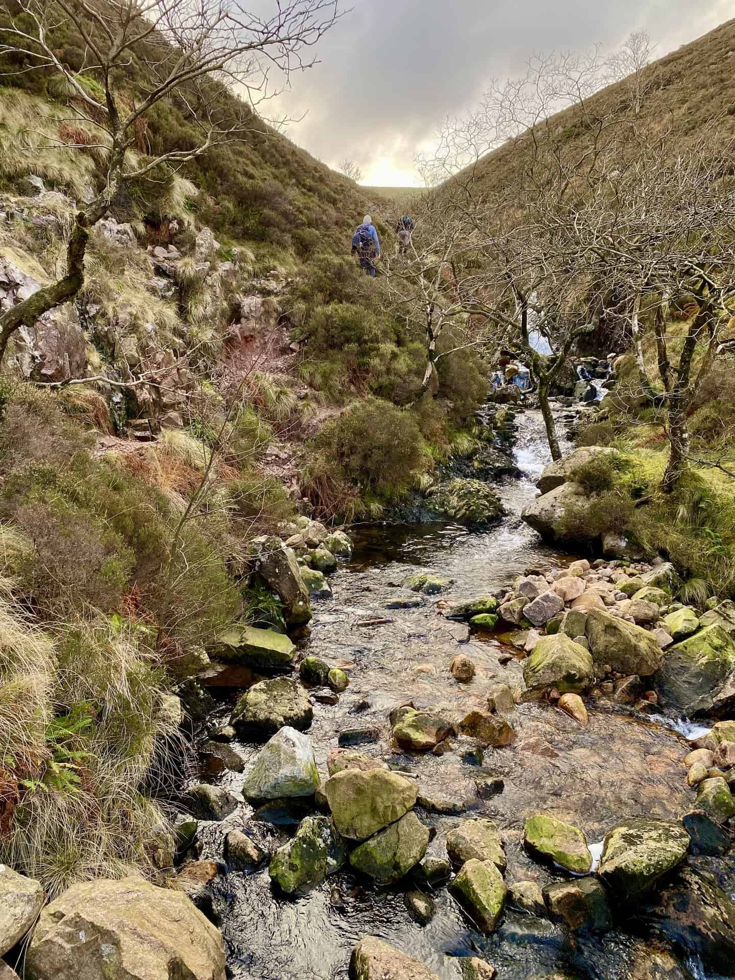
The steep-sided valley created by Scale Beck between Gale Fell and Blea Crag.

Grisport Unisex Adult Peaklander Hiking Boots
AD The Grisport Unisex Adult Peaklander Hiking Boots are crafted in Italy with a durable waxed leather upper, Spotex breathable lining, and a reliable Track-on rubber sole. Waterproof and weighing just 1120g, they offer comfort, resilience, and dependable performance on demanding trails.
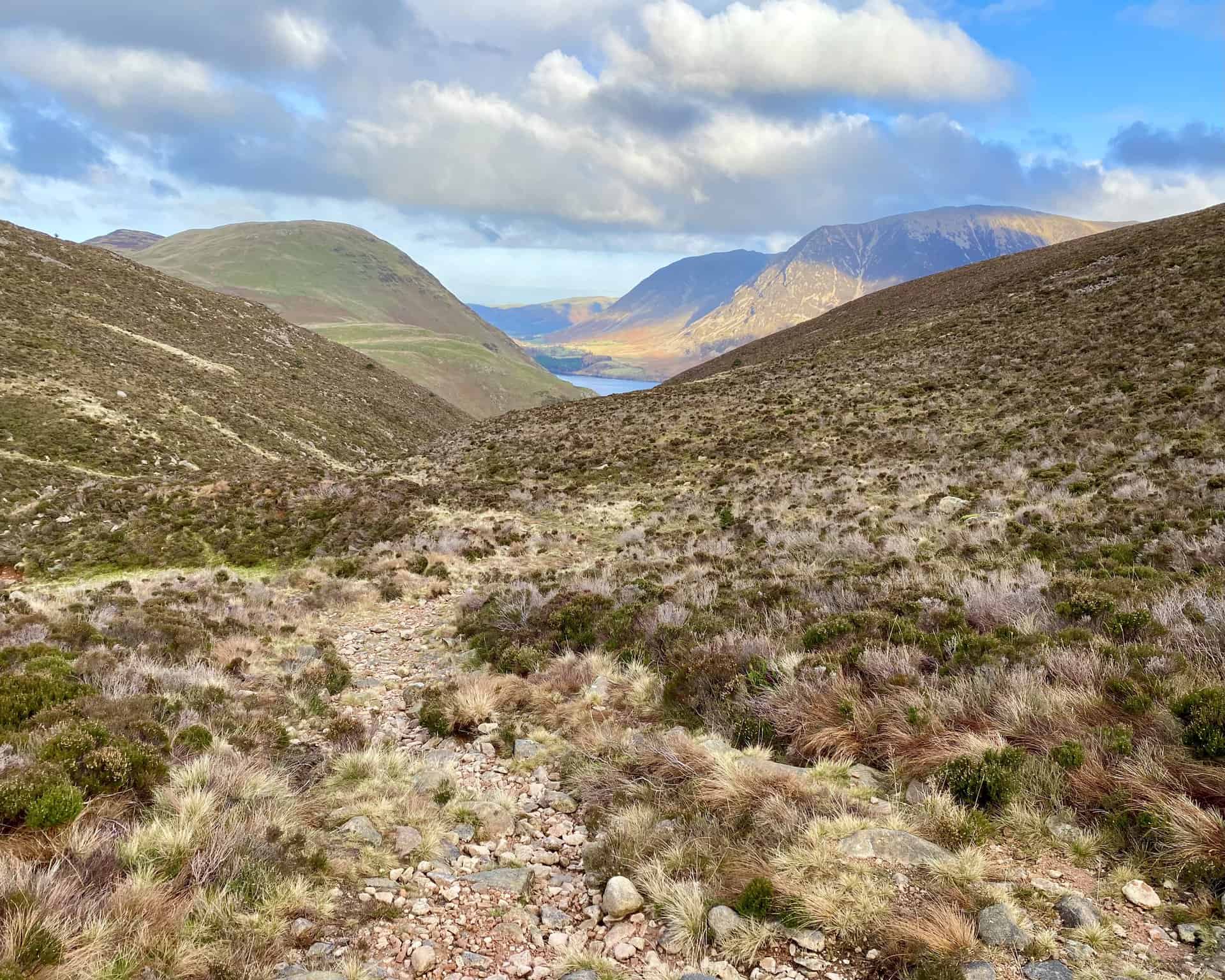
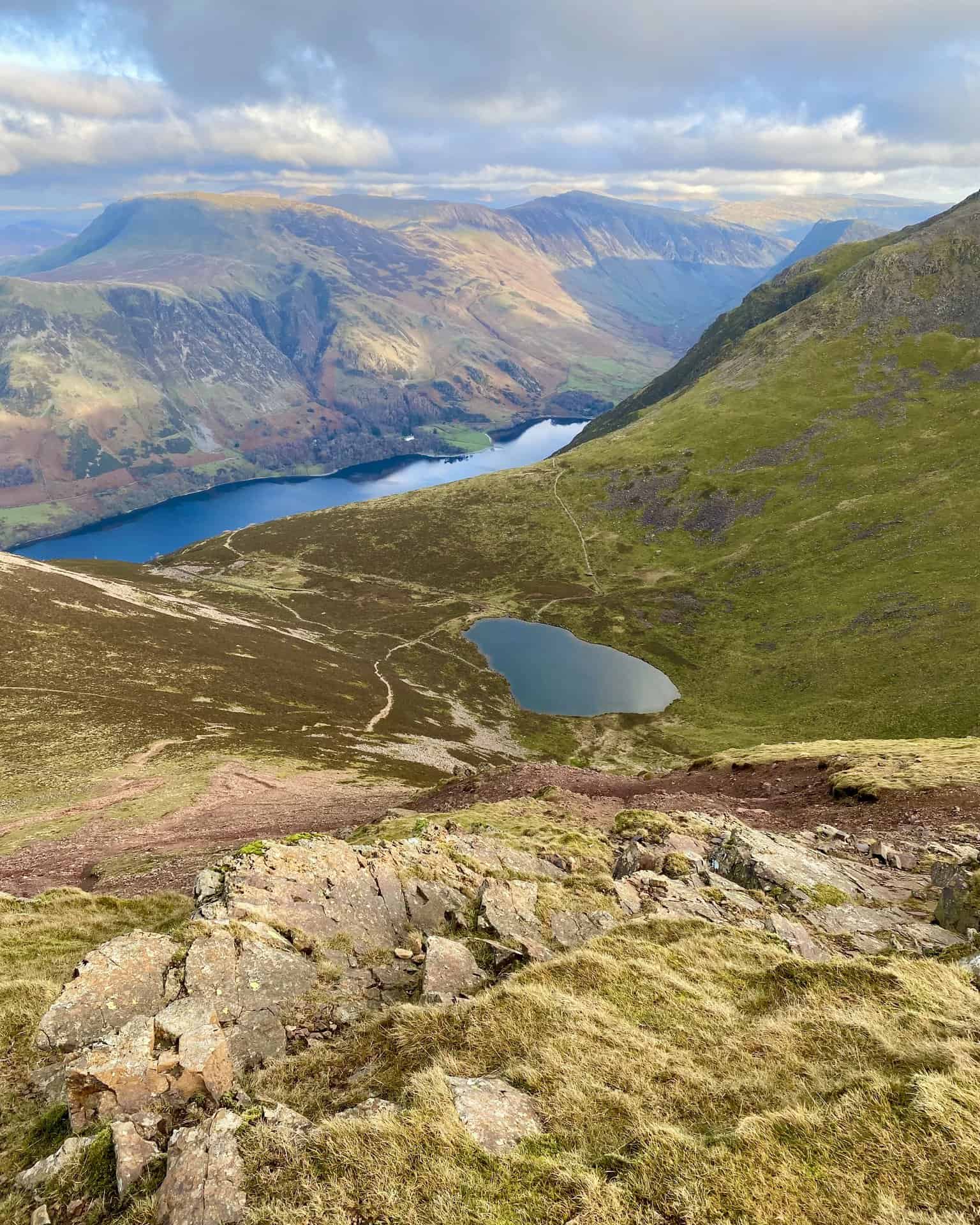
Looking back towards Crummock Water as we start the climb up to Lingcomb Edge.
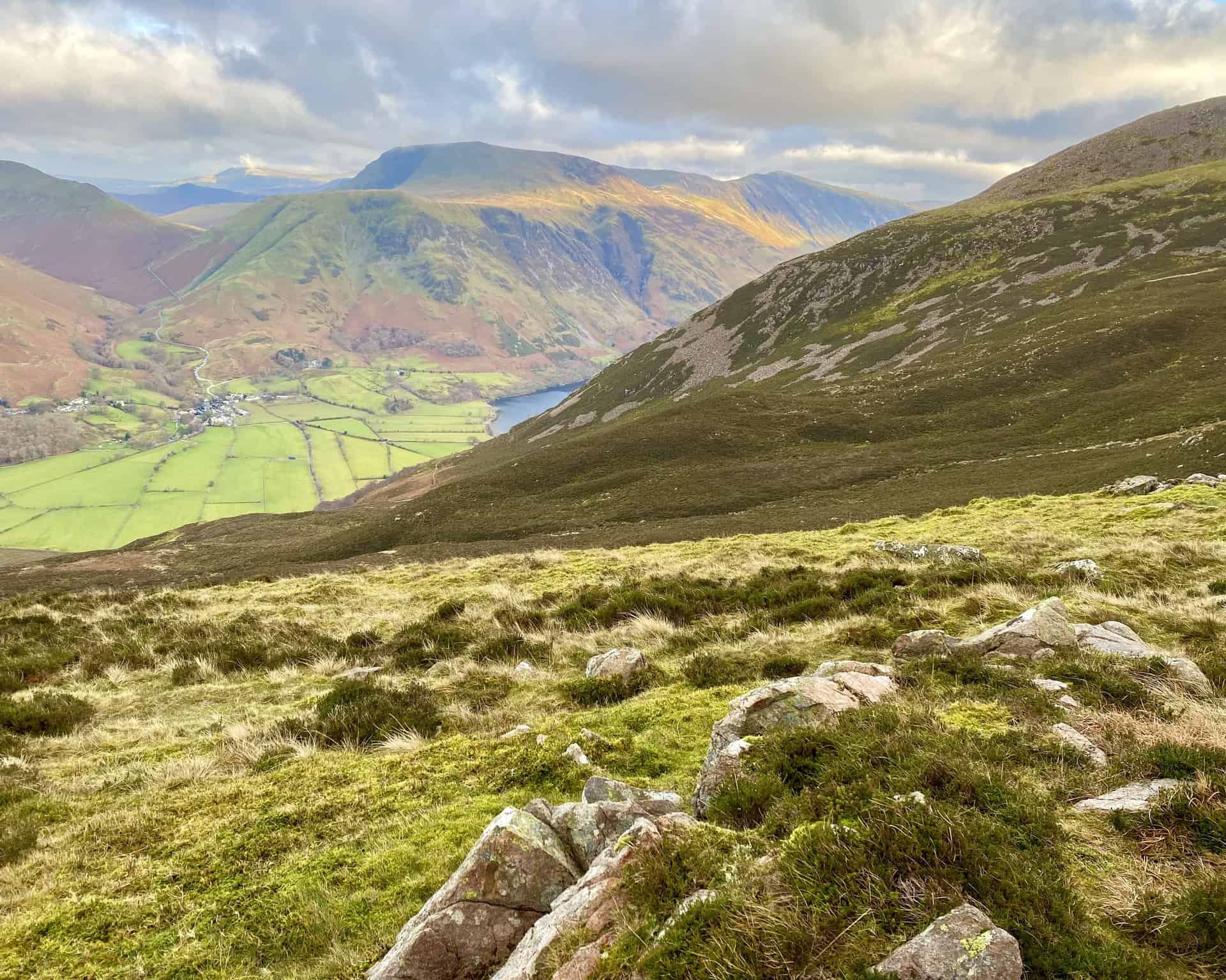
The view down to Buttermere (the village) from Lingcomb Edge.
Grisport Unisex Adult Peaklander Hiking Boots
AD The Grisport Unisex Adult Peaklander Hiking Boots are crafted in Italy with a durable waxed leather upper, Spotex breathable lining, and a reliable Track-on rubber sole. Waterproof and weighing just 1120g, they offer comfort, resilience, and dependable performance on demanding trails.
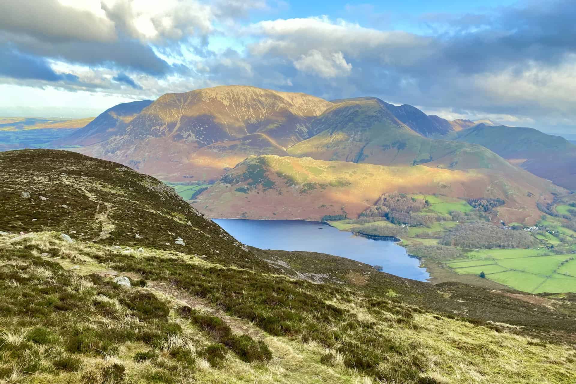
Amazing views from Lingcomb Edge: Crummock Water backed by Rannerdale Knotts, Grasmoor and Whiteless Pike to name but a few.
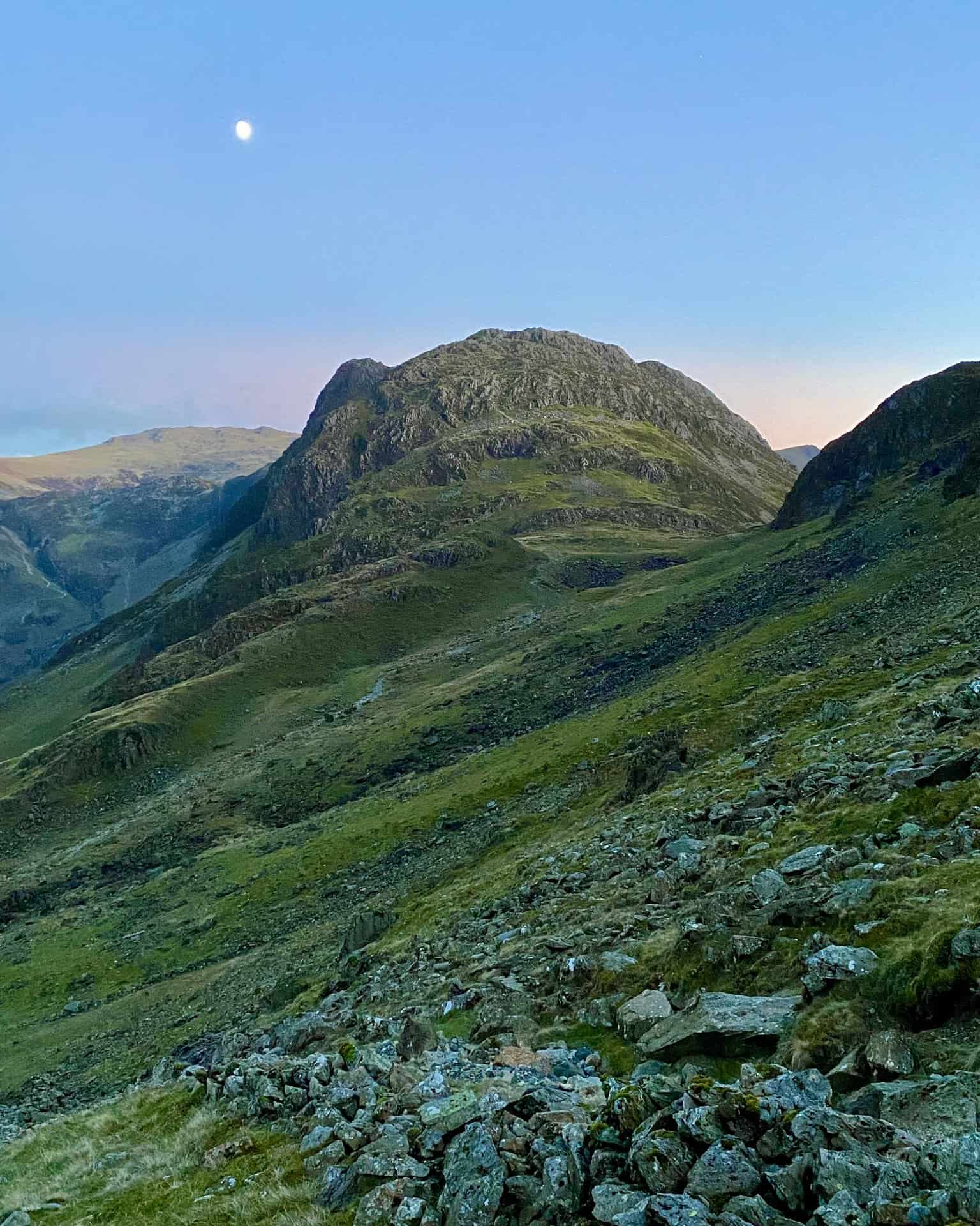
The start of the climb to the top of Red Pike from Lingcomb Edge.

Fifty Walks Across the Beautiful North York Moors National Park
AD Discover 50 routes across the North York Moors, from short easy strolls to challenging high-level hikes. With OS maps, route descriptions, and local highlights, it also includes the legendary 40-mile Lyke Wake Walk, described in four accessible stages.
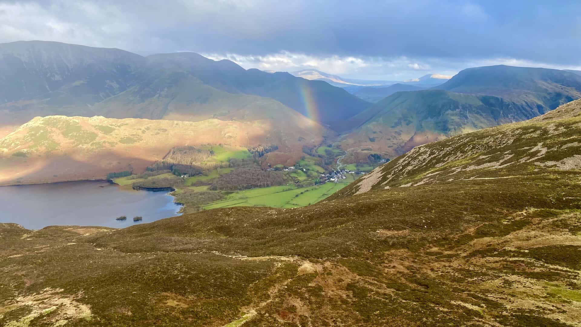
The sun lights up Rannerdale Knotts and a rainbow appears above Buttermere (the village).
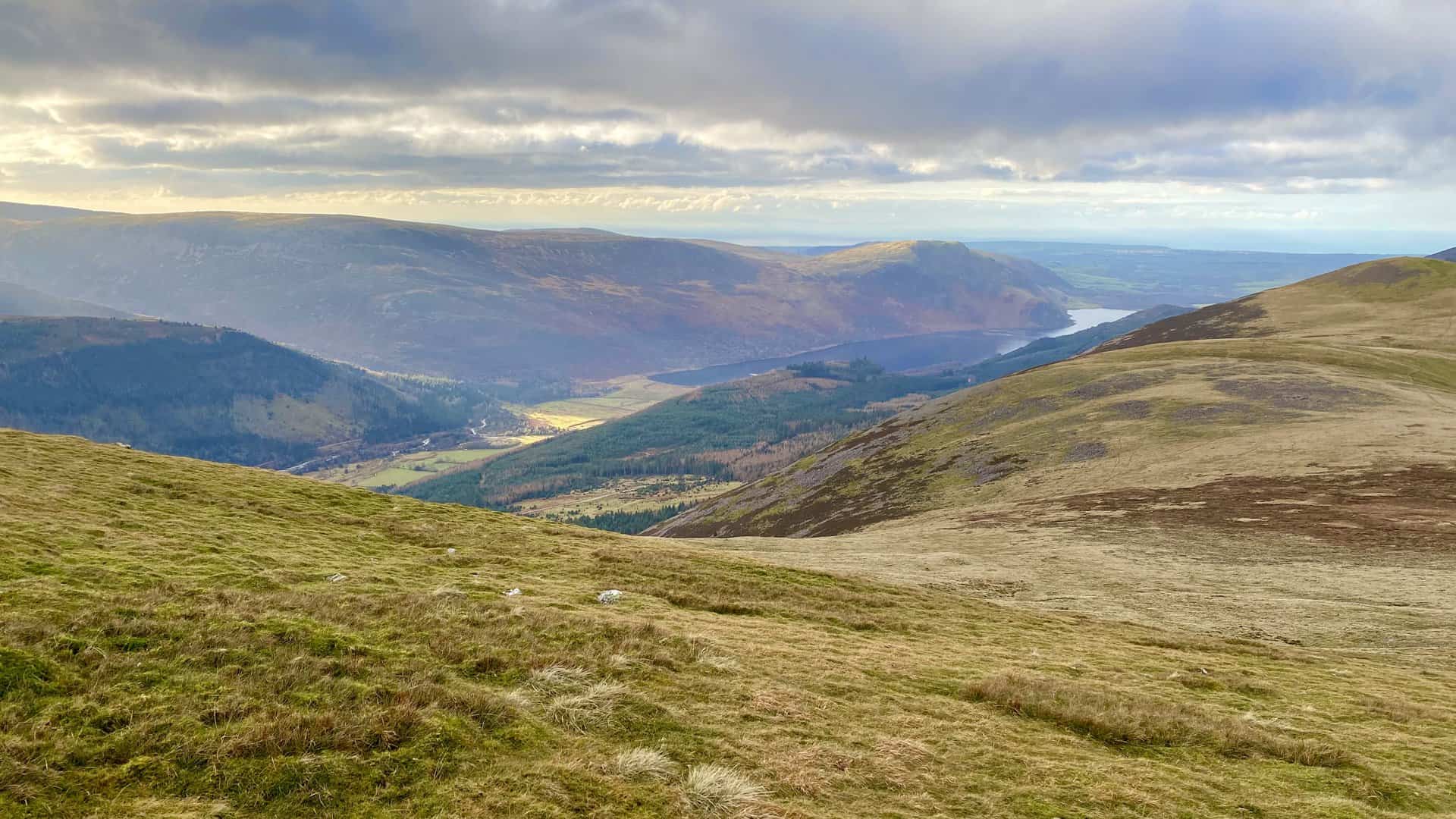
Ennerdale Water as seen from Red Pike.
Fifty Walks Across the Beautiful North York Moors National Park
AD Discover 50 routes across the North York Moors, from short easy strolls to challenging high-level hikes. With OS maps, route descriptions, and local highlights, it also includes the legendary 40-mile Lyke Wake Walk, described in four accessible stages.
Magical scenes on the Red Pike walk.
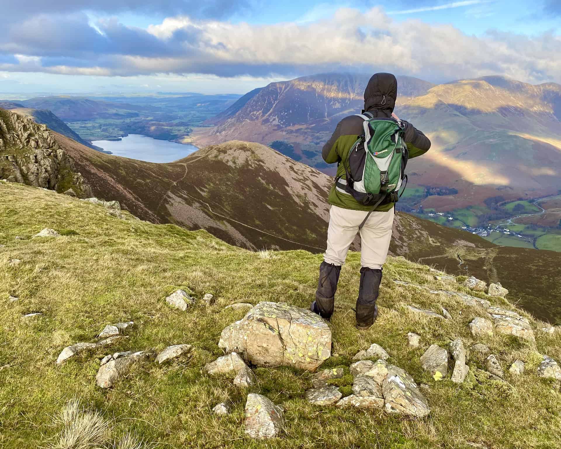
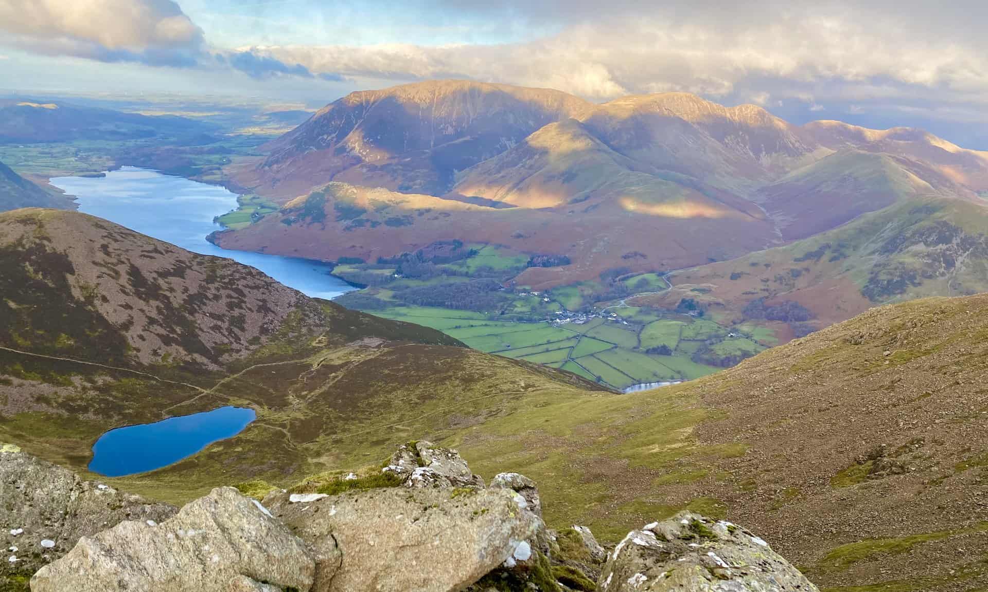
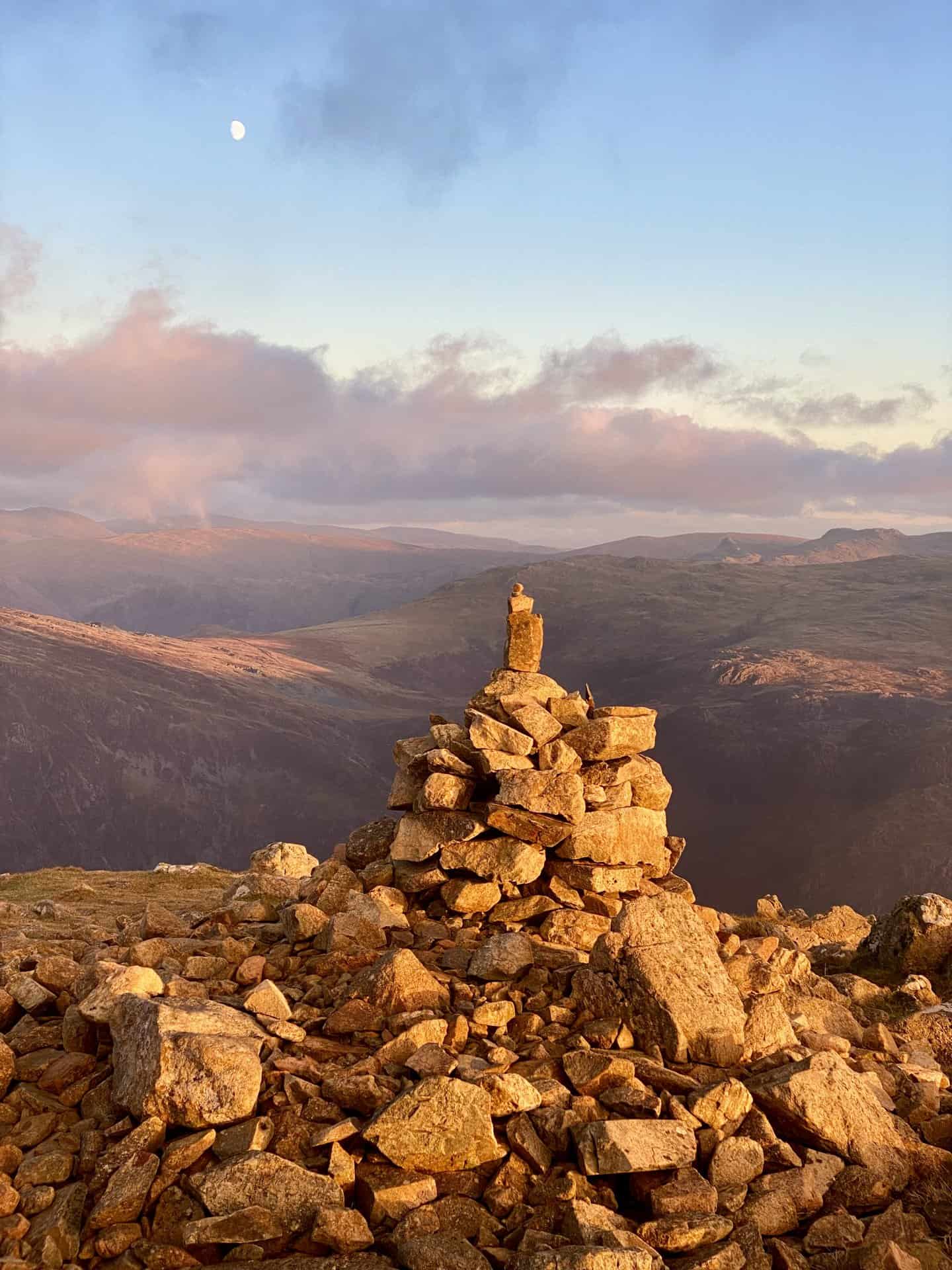
Looking down upon Bleaberry Tarn and Buttermere from the Red Pike summit, height 755 metres (2477 feet).

Osprey Hikelite Unisex Backpack for Comfortable and Lightweight Hiking
AD The Osprey Hikelite backpack combines lightweight design with practical features, including a breathable mesh back panel, soft webbing straps, and stretch mesh water bottle pockets. With zipped storage and an organiser compartment, it is ideal for day hikes and outdoor use.
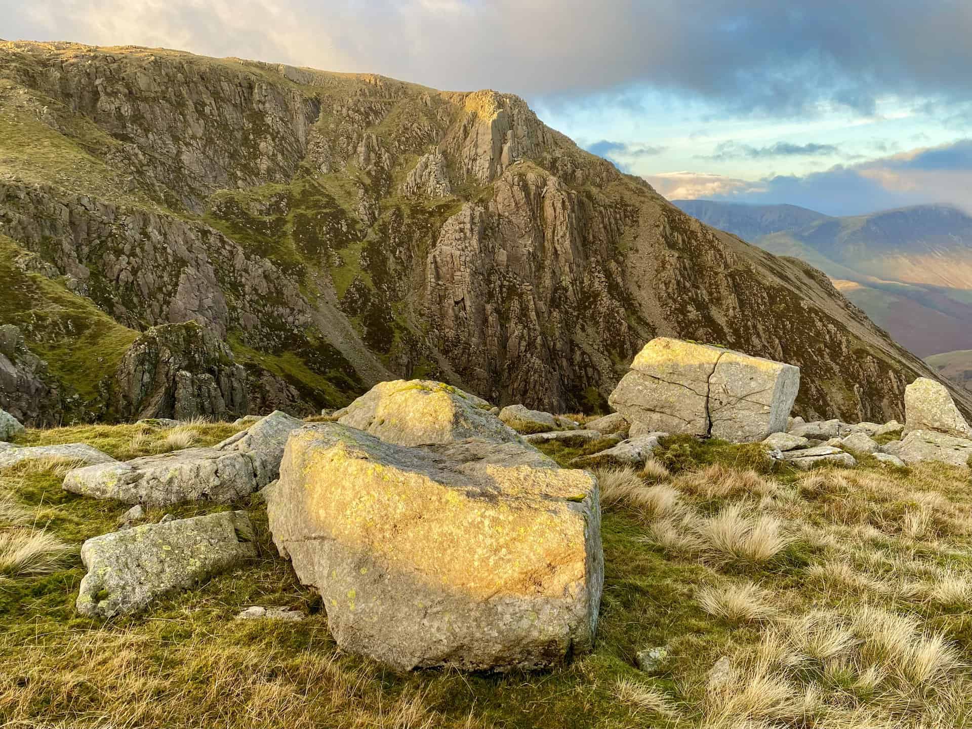
Chapel Crags between Red Pike and High Stile, with Bleaberry Tarn visible below.
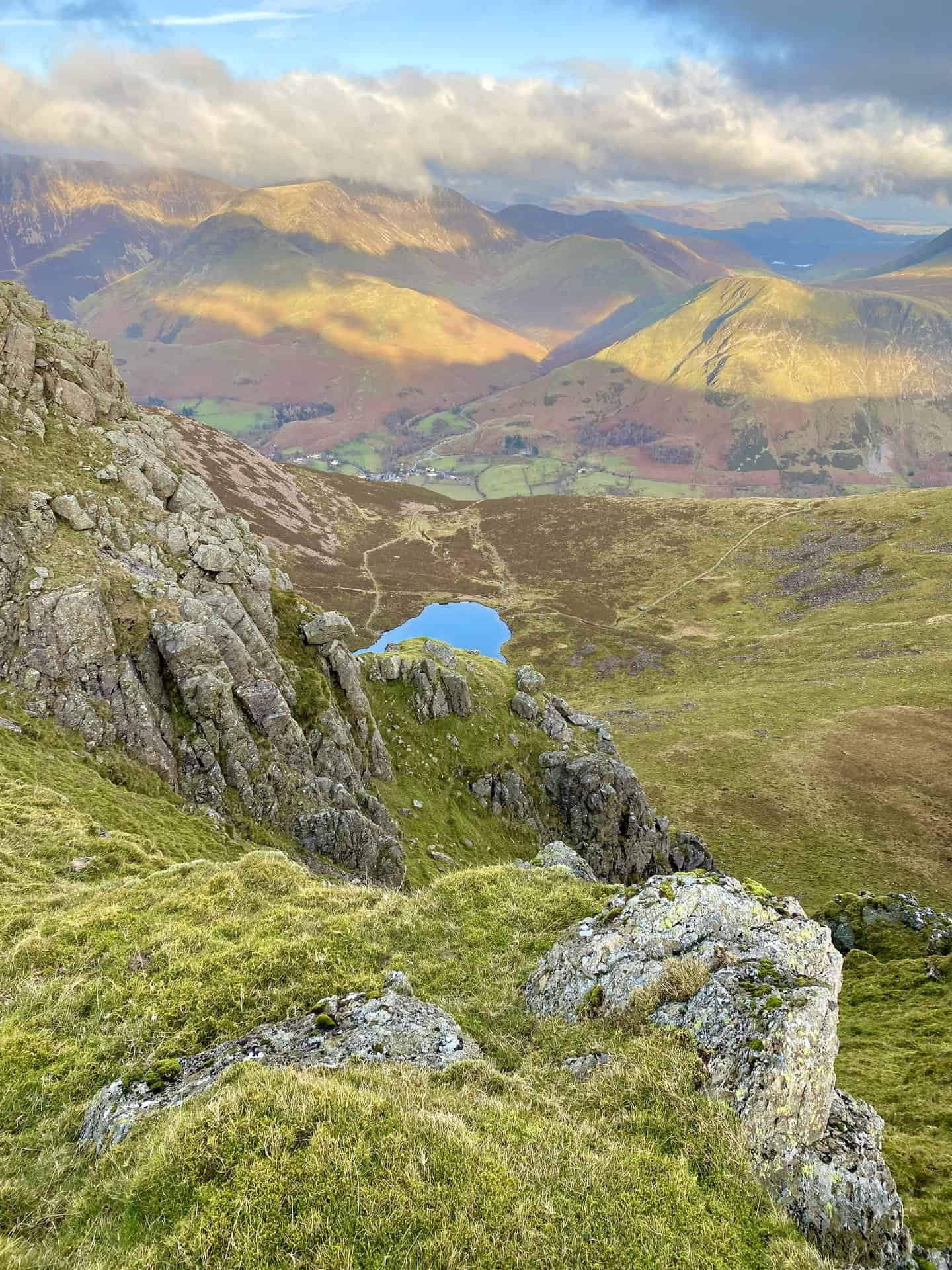
Spectacular vistas from above Chapel Crags.
Osprey Hikelite Unisex Backpack for Comfortable and Lightweight Hiking
AD The Osprey Hikelite backpack combines lightweight design with practical features, including a breathable mesh back panel, soft webbing straps, and stretch mesh water bottle pockets. With zipped storage and an organiser compartment, it is ideal for day hikes and outdoor use.
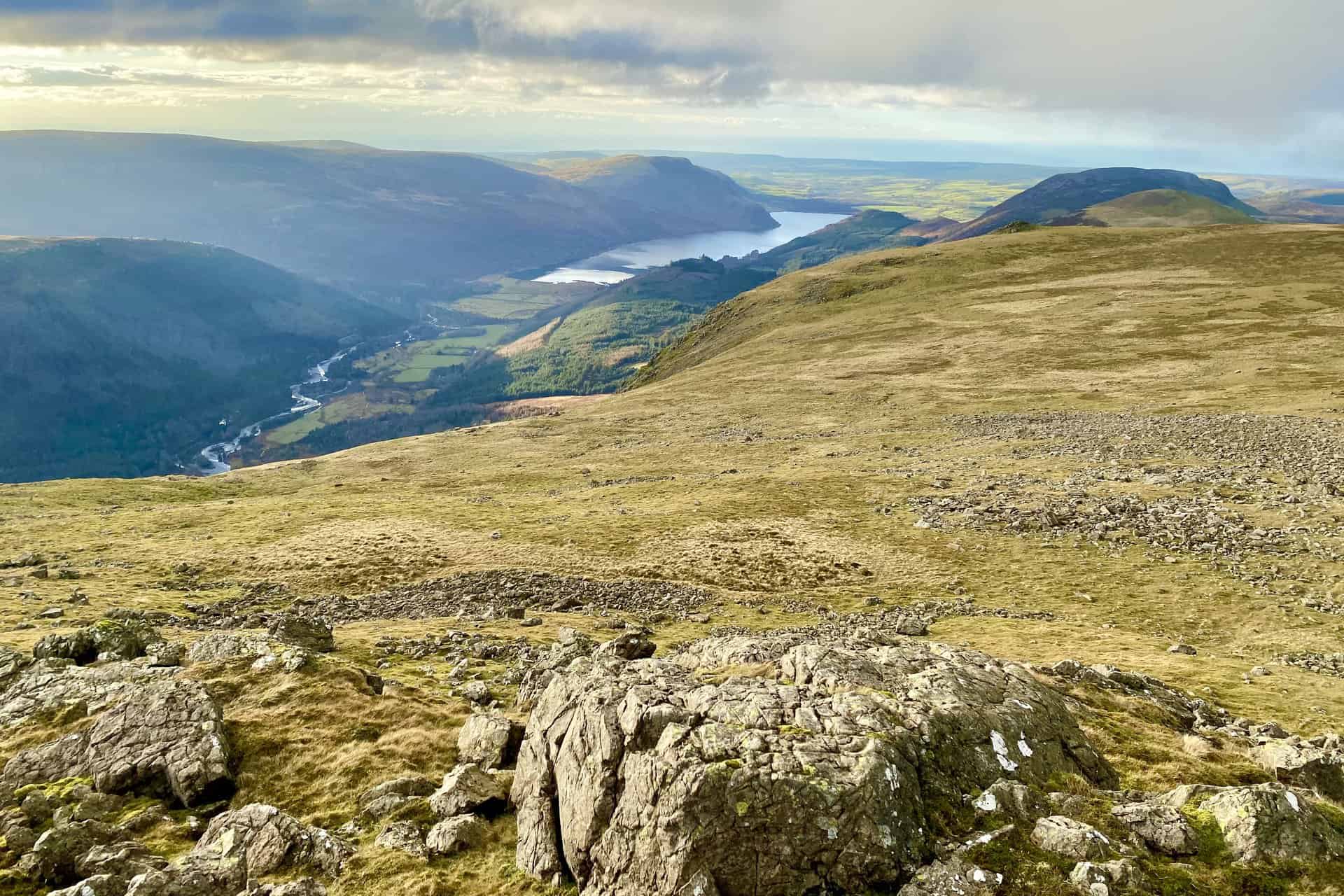
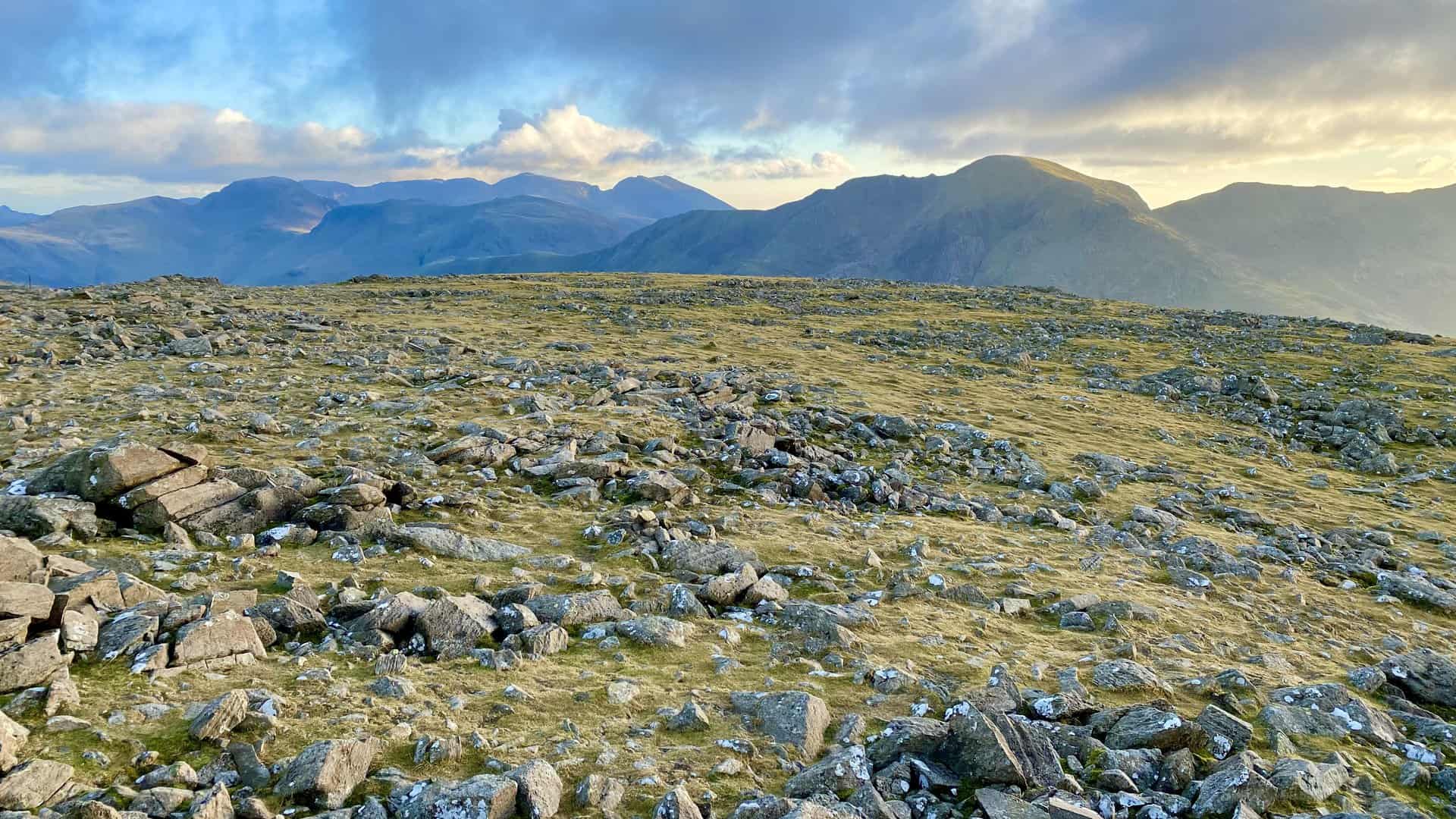
The view west through the Ennerdale valley as we approach High Stile.
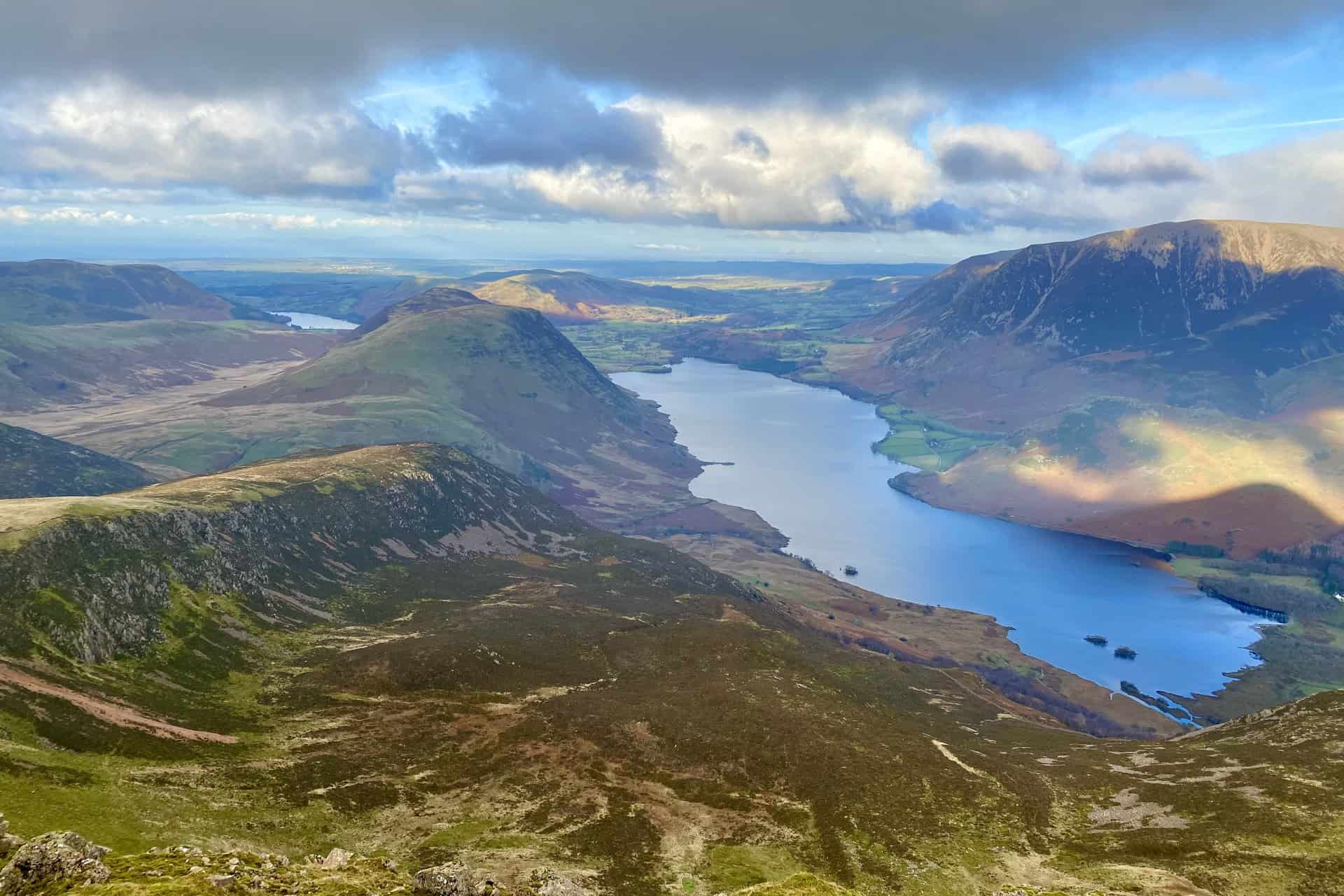
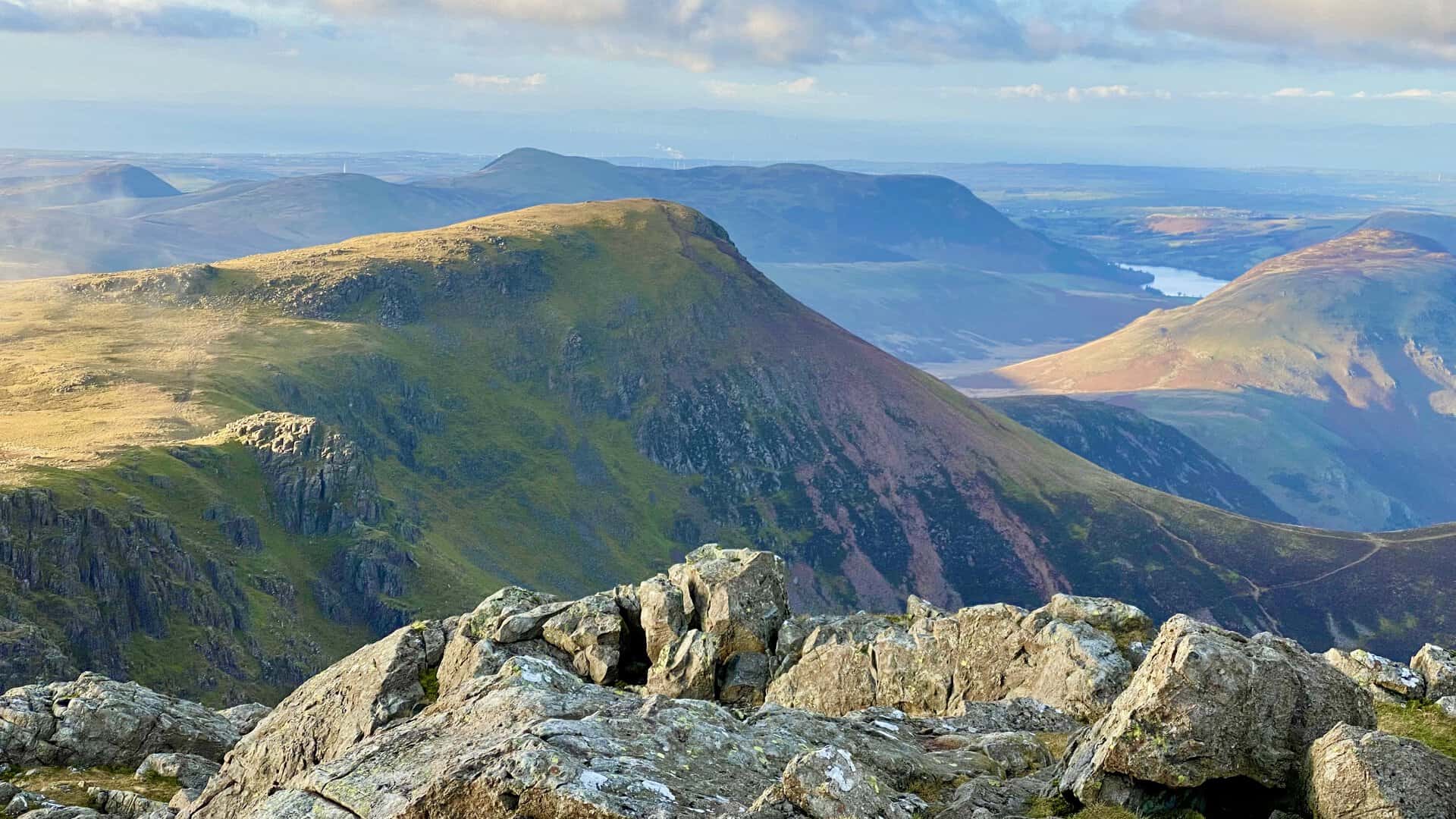
Bleaberry Tarn, Crummock Water and, in the sunshine, many of the Lake District’s north-western fells including Rannerdale Knotts, Grasmoor, Whiteless Pike, Eel Crag, Sail, Causey Pike and Ard Crags.

Peak Bagging Wainwrights with Routes to Complete All Fells
AD This comprehensive guide offers 45 circular routes linking all 214 Wainwright fells. With maps, GPX downloads, elevation profiles, and practical advice, it provides efficient yet inspiring ways to complete this classic Lake District challenge at your own pace.
The summit of High Stile, height 807 metres (2648 feet), with the Scafell Pike range of mountains on the horizon. High Stile is the halfway point of this Red Pike walk.
More magnificent panoramas from the top of High Stile including the distant Loweswater, a smaller lake to the north-west of Crummock Water.
Peak Bagging Wainwrights with Routes to Complete All Fells
AD This comprehensive guide offers 45 circular routes linking all 214 Wainwright fells. With maps, GPX downloads, elevation profiles, and practical advice, it provides efficient yet inspiring ways to complete this classic Lake District challenge at your own pace.
Grey Crag on the eastern face of High Stile.
The summit of High Crag, height 744 metres (2441 feet).

Berghaus Hillmaster II GTX Men's High Rise Hiking Boots
AD The Berghaus Hillmaster II GTX men’s hiking boots feature a waterproof, breathable GORE-TEX membrane, a memory foam tongue and collar for a personalised fit, and a Vibram sole delivering exceptional grip, stability, and shock protection for confident performance on any terrain.
Looking south-east towards Hay Stacks during the descent of High Crag, about two-thirds of the way round this Red Pike walk.