Take a Breathtaking Hike on this Grasmoor Walk from Crummock Water
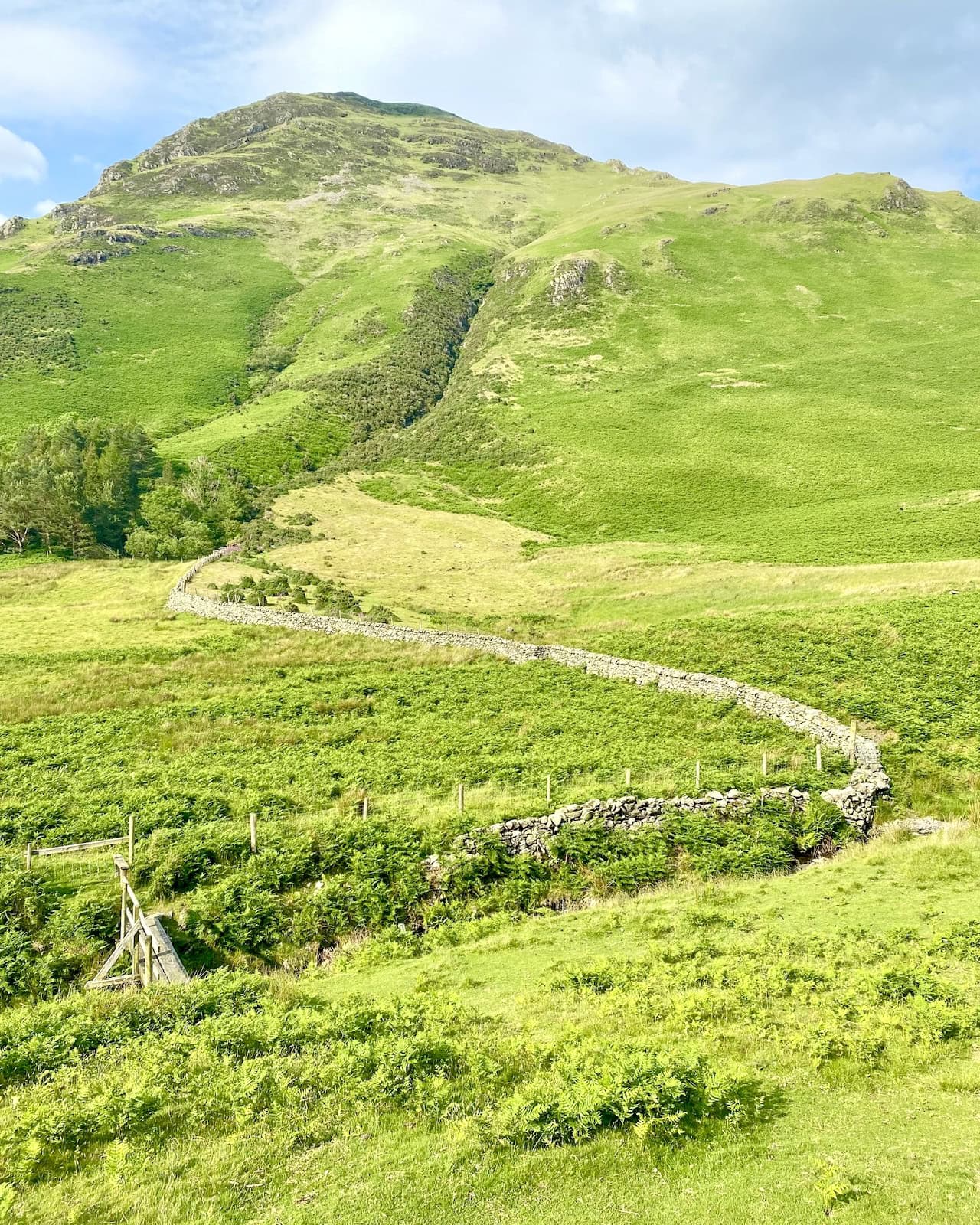
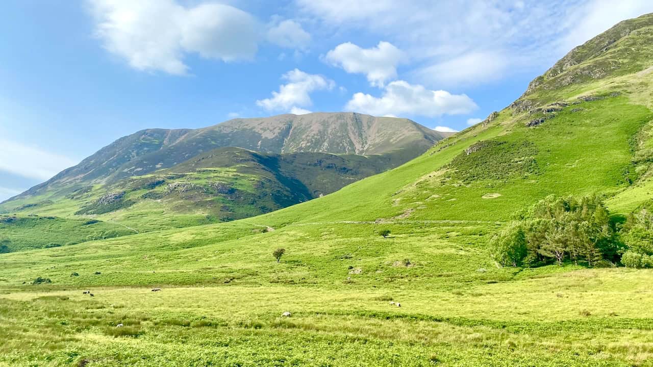
Begin your Grasmoor walk at one of the two car parks situated on the B5289 along the eastern shore of Crummock Water. Conveniently positioned about midway along the lake, these car parks serve as excellent starting points for your hike. From here, stride briefly uphill to connect with a trail leading north. As you advance, the imposing slopes of Grasmoor loom to your right, enhancing the scenic allure of your trek.
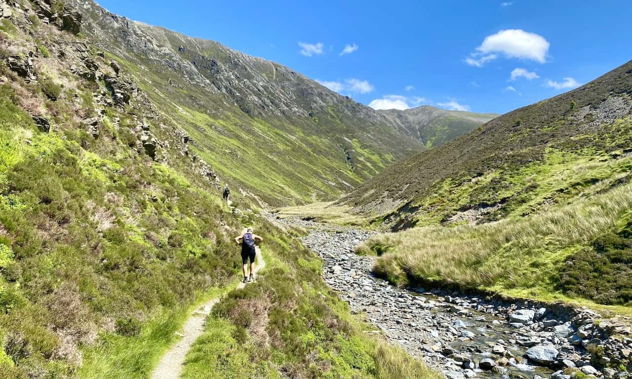
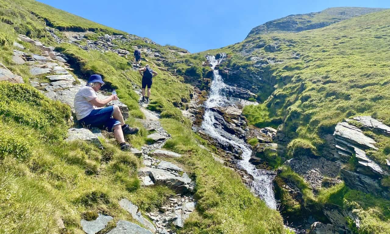
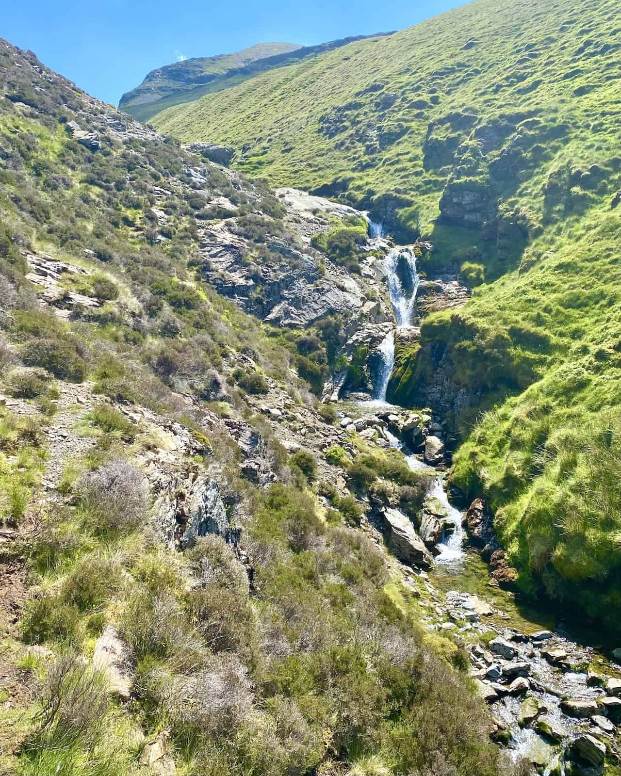
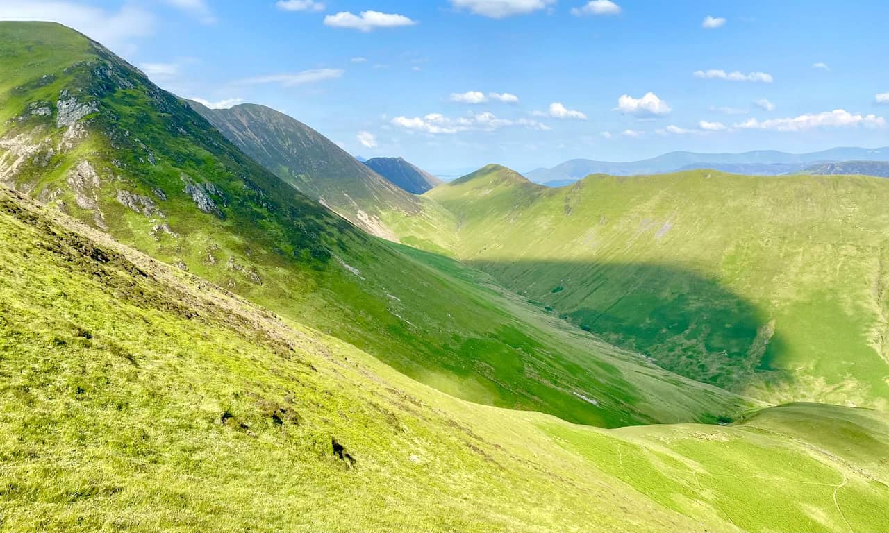
Continue northwards, passing notable landmarks such as Low Kid Crag and High Kid Crag. Soon, you will arrive at a footbridge crossing Liza Beck. After crossing, turn east and follow Liza Beck as it winds through the picturesque Gasgale Gill. This portion of your Grasmoor walk ascends through a beautiful valley dotted with waterfalls, requiring some mild scrambling over tricky sections.
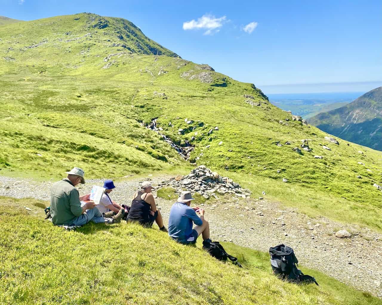
Upon covering nearly two miles through the valley, you’ll reach Coledale Hause, nestled between Sand Hill to the north and Crag Hill to the south. This spot offers a splendid vantage point for views eastward across Coledale Beck valley. Pause here to enjoy a well-deserved break and perhaps a coffee, before continuing your journey.
Next, proceed south-west, skirting the western side of Crag Hill briefly. Then, veer west up the grassy slopes on a path that gradually levels off. This route leads directly to Grasmoor’s summit, where you’ll be rewarded with some of the finest vistas in the Lake District. Consider this idyllic spot for a lunch break, absorbing the panoramic views.
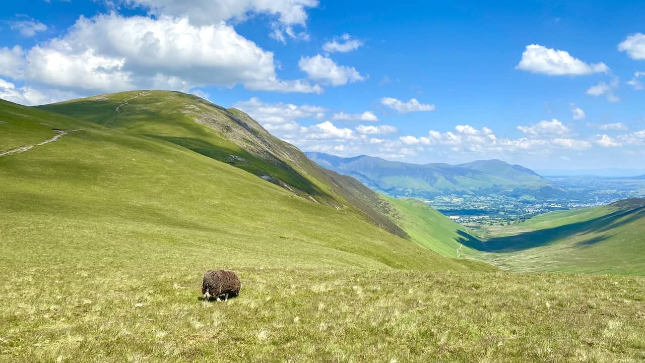
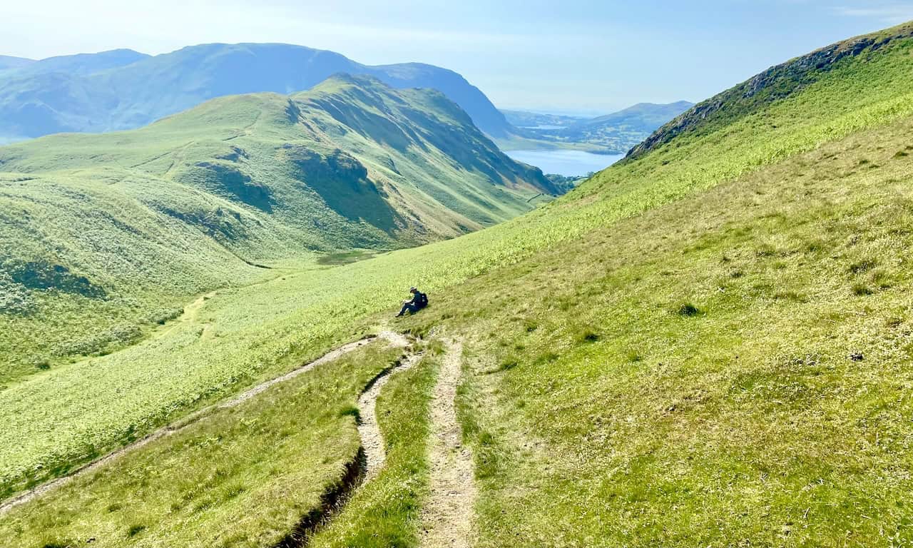
Following your summit experience, take an easterly path down to the relatively flat expanse of Wandope Moss. Optionally, you can stroll to the Wainwright summit of Wandope to enjoy further impressive views of Crag Hill’s rocky façade. Continue your descent in a south-west direction across Whiteless Edge until you crest Whiteless Pike. From here, descend south before shifting north-west, following Squat Beck through the valley beneath Rannerdale Knotts.
Complete your Grasmoor walk by crossing the footbridge below Dale How, then continue north-west towards Rannerdale Bridge, ultimately returning to the car park. This 8½-mile route offers a captivating and challenging journey through the Lake District, promising unforgettable vistas on a clear day. Remember this walk as a highlight among your outdoor adventures.
Grasmoor Walk: Maps and Tools
Visit either the OS Maps website or the Outdooractive website to view this walking route in greater detail. Both platforms offer a range of features, including the ability to print the route, download it to your device, and export the route as a GPX file. You can also watch a 3D fly-over and share the route on social media.
Grasmoor Walk: Distance, Duration, Statistics
Distance: 8½ miles
Distance: 13½ kilometres
Duration: 4¾ hours
Ascent: 2692 feet
Ascent: 821 metres
Type: Circular walk
Recommended Ordnance Survey Map
The best map to use on this walk is the Ordnance Survey map of the Lake District North-Western Area, reference OS Explorer OL4, scale 1:25,000. It clearly displays footpaths, rights of way, open access land and vegetation on the ground, making it ideal for walking, running and hiking. The map can be purchased from Amazon in either a standard, paper version or a weatherproof, laminated version, as shown below.
Standard Version
About Grasmoor
Grasmoor is a mountain in the north-western part of the Lake District. It is the highest peak in a group of hills located between the villages of Lorton, Braithwaite, and Buttermere, and it overlooks Crummock Water. The mountain’s steep western flank drops dramatically to Crummock Water. This face is not suitable for rock climbers due to the lack of clean rock, although Alfred Wainwright describes a challenging route up this face in his ‘Pictorial Guides to the Lakeland Fells’. To the east, the fell is connected to others by Crag Hill and Coledale Hause. Grasmoor is also noted for having the most extensive scree slopes in the north-western fells.
Name and Geography
The name ‘Grasmoor’ originates from the Old Norse word ‘grise’, meaning ‘wild boar’, which is also present in other Lake District place names like Grisedale Pike. The north-western fells, encompassing Grasmoor, lie between the rivers Derwent and Cocker. This area is an oval swathe of hilly country, elongated on a north-south axis. Two roads cross from east to west, dividing the fells into three groups. Grasmoor resides in the central sector, which rises between Whinlatter Pass and Newlands Pass. The highest ground in this sector forms an east-west ridge starting at Grasmoor and descending eastwards over Crag Hill, Sail, Scar Crags, and Causey Pike, with Grasmoor being the highest.
Grasmoor Walks
From the valley floor near Little Town at the eastern end, the ridge requires a four-mile gradual ascent to reach the summit of Grasmoor. From Crummock Water in the west, the summit is accessible by a steep scree slope in a much shorter distance. The summit itself is at the west end of a broad, gently domed promenade of moss and short grass, with a narrowing in the middle where the deep bowl of Dove Crags bites into the northern face. East of this plateau are broad, smooth slopes descending to a wide unnamed col at 722 metres, connecting onward to Crag Hill. At the western end, the summit area narrows, ending at the subsidiary top of Grasmoor End at 745 metres, above the western face. Large scree slopes descend from here to the lakeside road below. Grasmoor also features a minor ridge descending south-westward over Lad Hows before dropping steeply to the valley floor.
Surrounding Areas and Geology
To the south of Grasmoor lies the valley of Rannerdale, which flows to Crummock Water between Lad Hows and the neighbouring Wandope. The drainage of this area is augmented by Cinderdale Beck, which separates Lad Hows from the main body of the fell. The northern flank of the ridge stands above Liza Beck, in the valley of Gasgale Gill. This stream flows west towards Crummock Water but is diverted northward by the low top of Lanthwaite Hill, eventually joining the Cocker after leaving the lake. Thus, an area of lowland to the north-west is annexed to Grasmoor from the natural territory of Whiteside.
The surface rocks of Grasmoor are mainly from the Ordovician Kirkstile Formation, which includes laminated mudstone and siltstone typical of the Skiddaw range. There is no history of mining beneath Grasmoor. The bowl of Dove Crags is one of the largest glacial combs or cirques in the Lake District, notable for its lack of a tarn but several dry hollows. This feature has been shaped by a significant landslip over at least the last 20,000 years, which has displaced Liza Beck northwards, narrowing Gasgale Gill valley and causing the unusually extensive scree slopes of Whiteside.
Grasmoor Summit and Views
The summit of Grasmoor features a large sprawling cairn and several smaller cairns, characterised by sheep-mown grass. The view from the top is extensive, although some foreground is obscured due to the extent of the summit. All major Lake District ranges are visible, except for the Far Eastern Fells, with High Stile above Crummock Water being a prominent sight, especially from the western end of the plateau.
Grasmoor in the Wainwrights
In the list of Wainwrights by height, Grasmoor is ranked 20th. It stands at a height of 852 metres (2794 feet), with the grid reference NY 174 203. The relevant maps for this area are OS Explorer OL4 and OS Landranger 89 and 90. According to Alfred Wainwright’s book, ‘The North Western Fells’, Grasmoor offers a significant challenge and spectacular views, making it a notable feature of this region.
Grasmoor Walk: My Photos
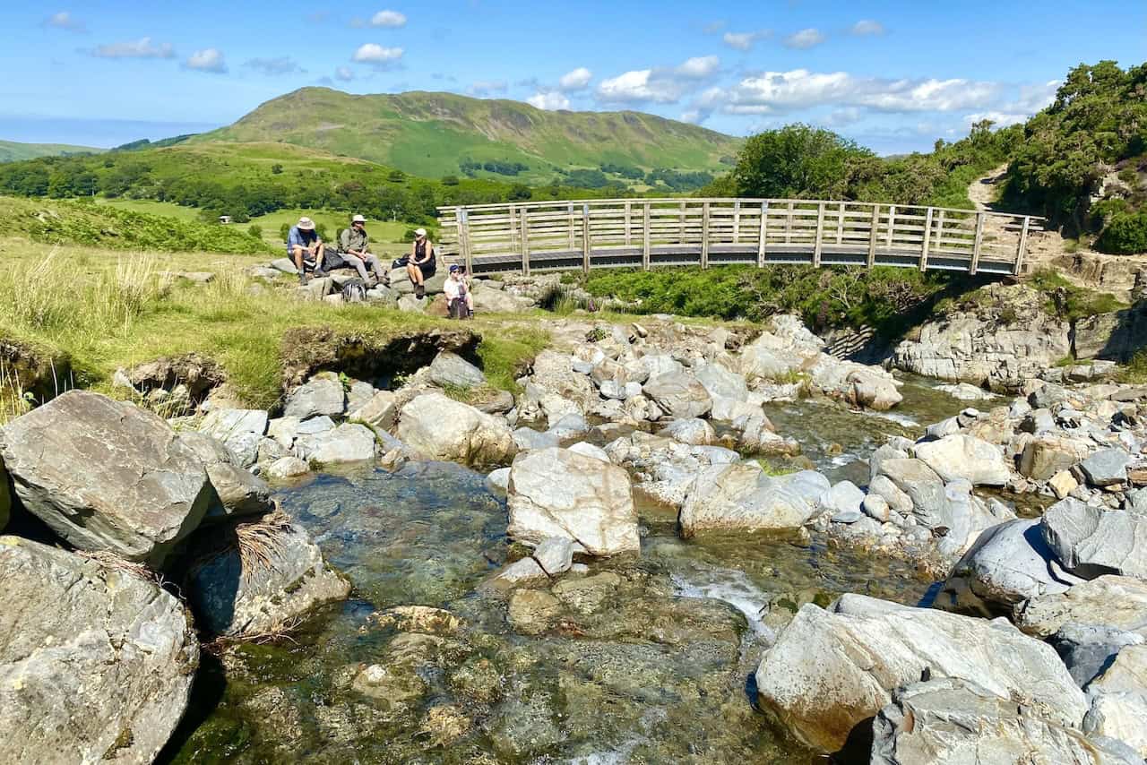
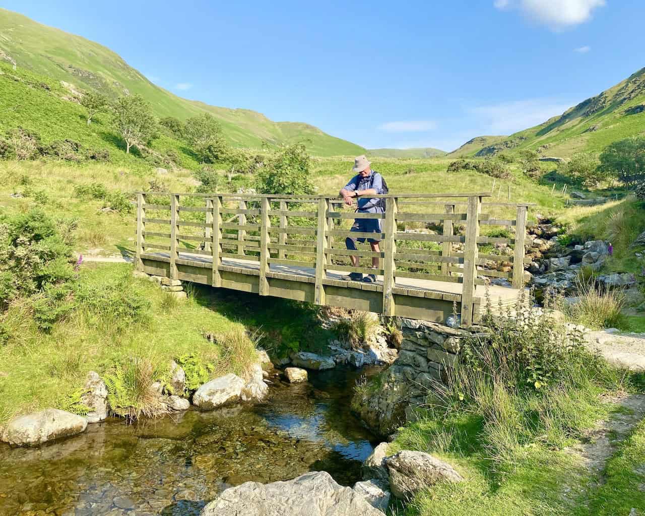
The footbridge over Liza Beck at the bottom of the Gasgale Gill valley.
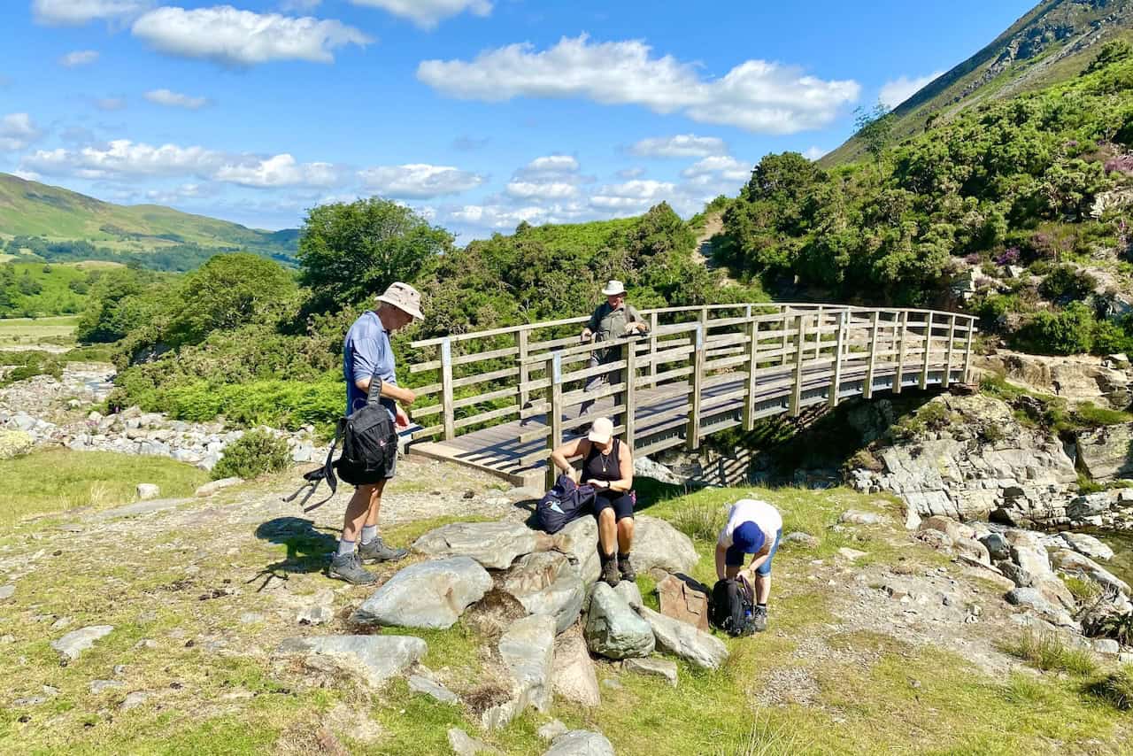
From the footbridge, Liza Beck flows in a north-westerly direction until it reaches the River Cocker at Low Liza Bridge. The river then runs south and empties its waters into Crummock Water.
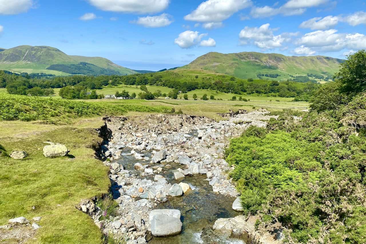
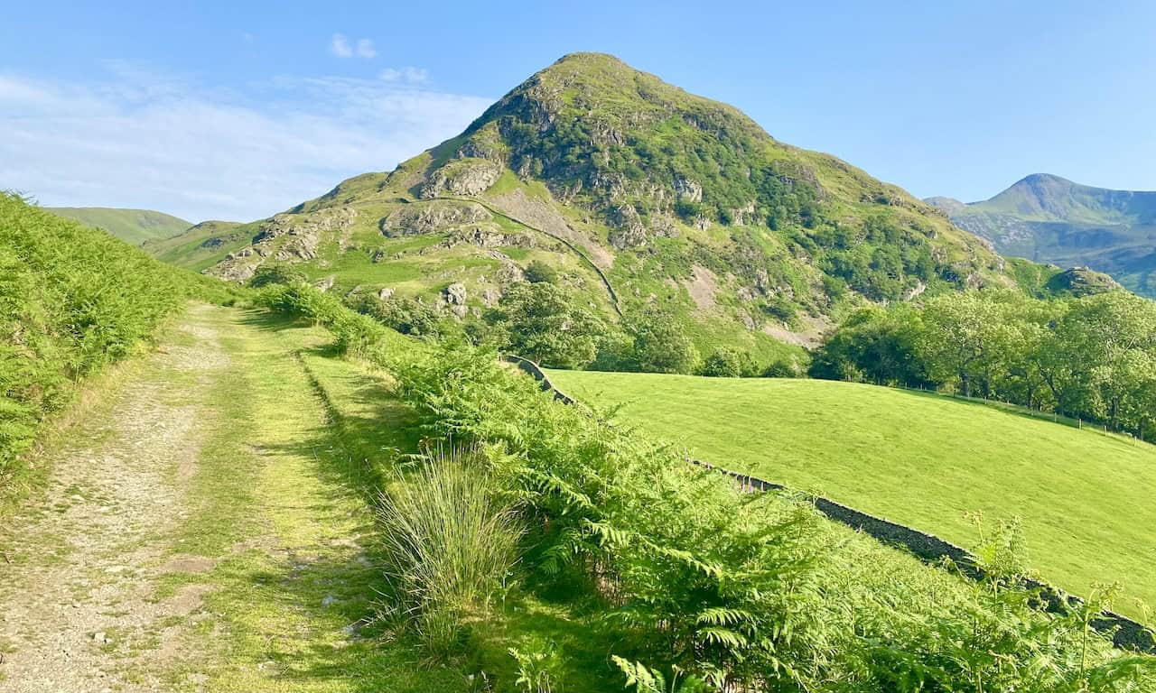
The start of the two-mile-long climb up through the Gasgale Gill valley to Coledale Hause.
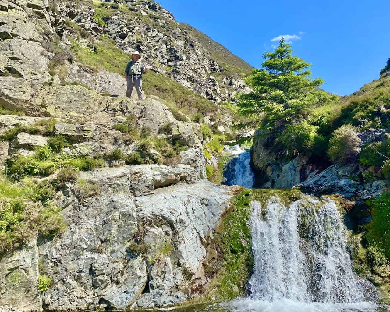
The route through the valley follows the course of Liza Beck and there are several beautiful waterfalls along the way.
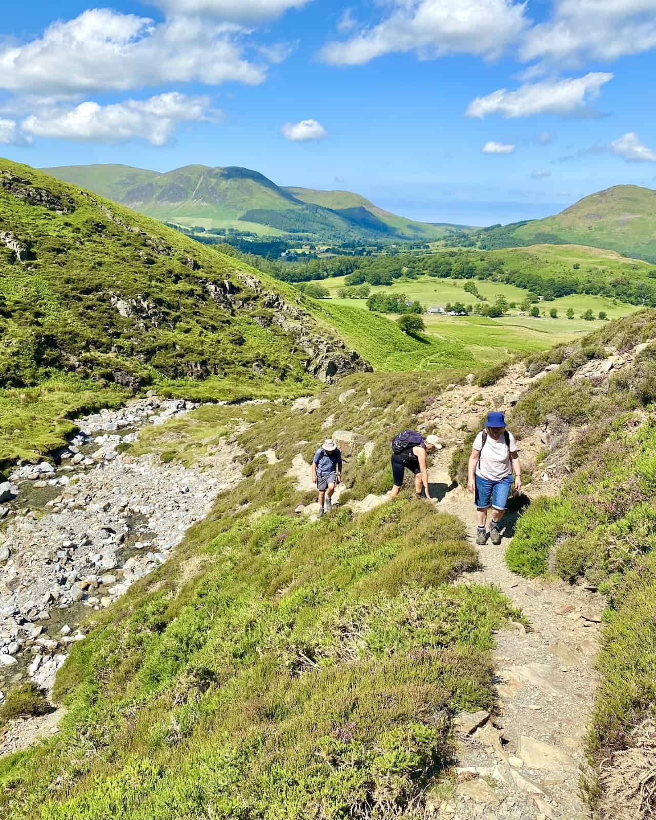
About one-third of the way up the valley and Hopegill Head becomes visible in the distance.
Almost at the top of the valley and Eel Crag (Crag Hill) can just be seen. In a few places the route through Gasgale Gill is tricky to negotiate and a bit of scrambling is required.
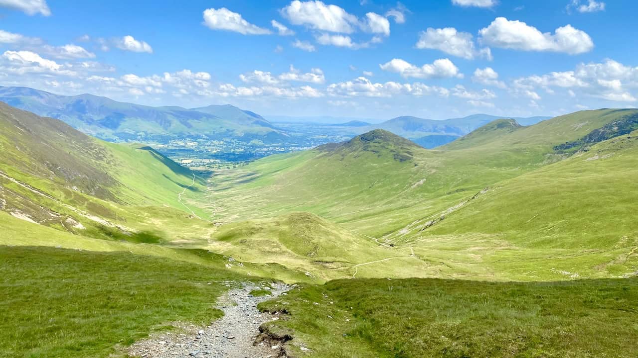
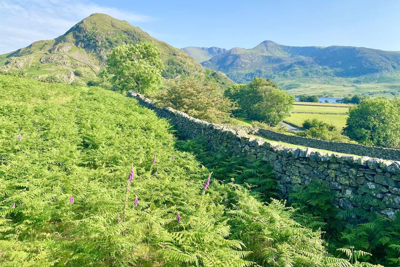
Looking north-east from Coledale Hause towards Keswick, with the mountain ranges of Skiddaw and Blencathra in the background.
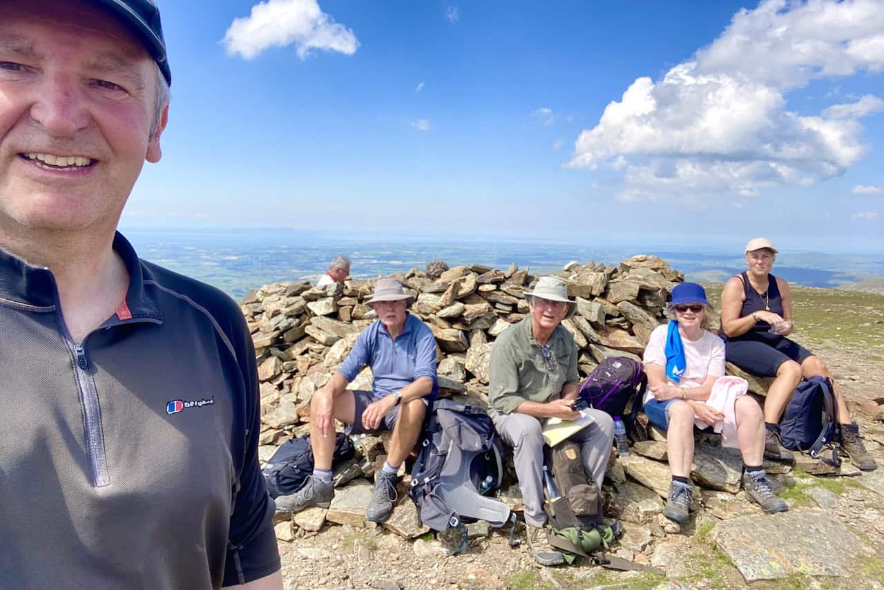
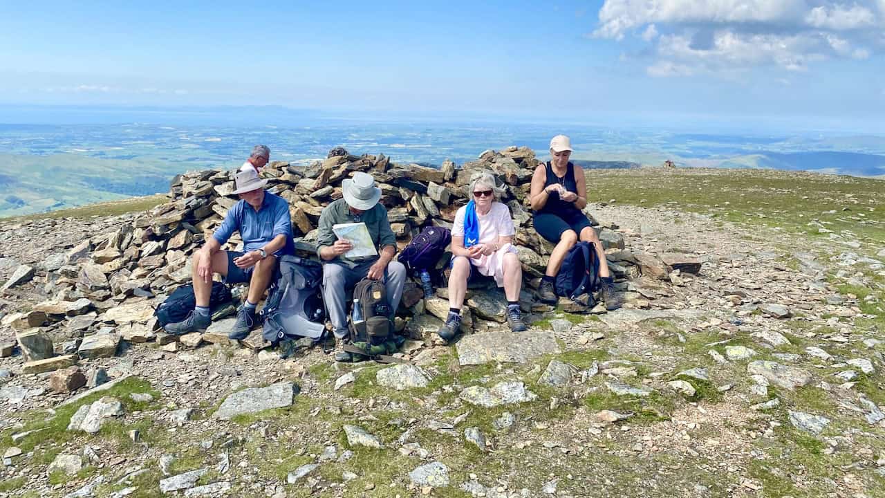
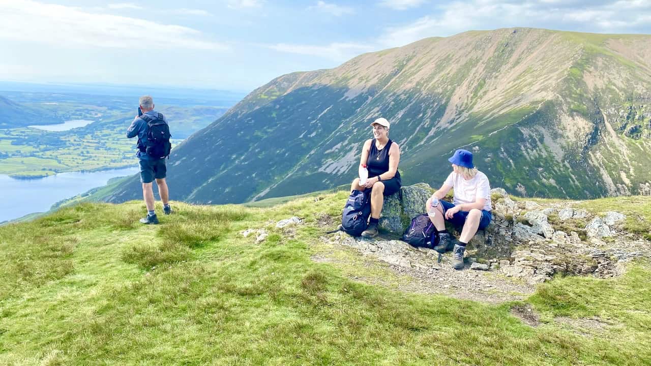
Time for a break at Coledale Hause. Coledale Hause is just over one-third of the way round our Grasmoor walk.
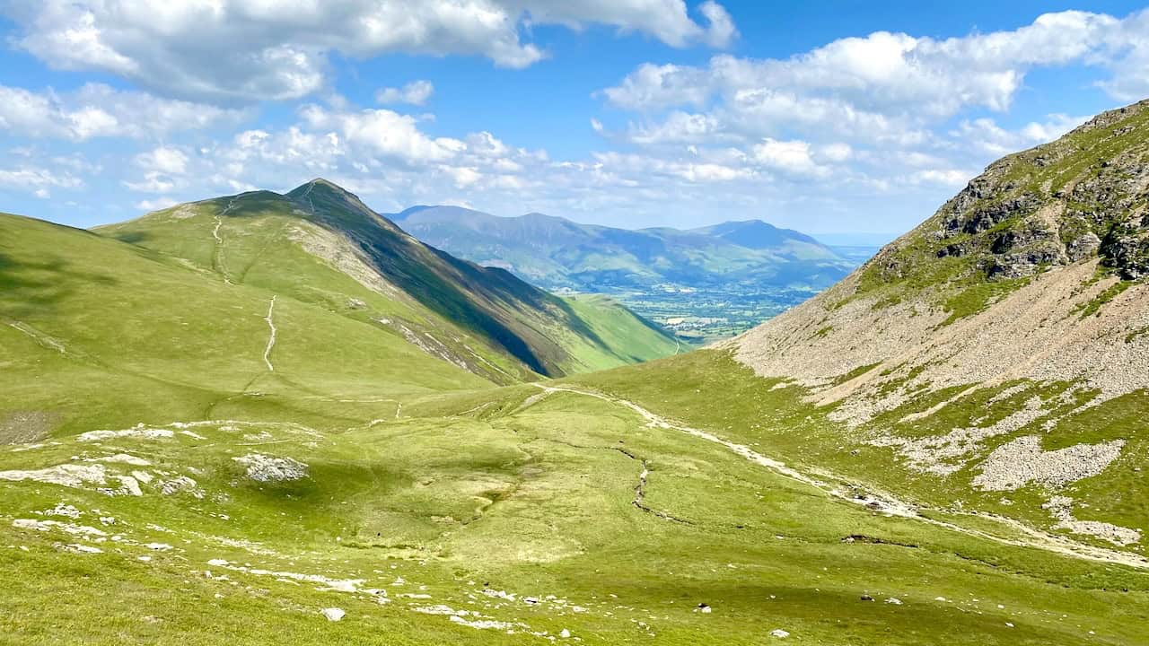
Looking back towards Keswick, Skiddaw and Blencathra soon after the beginning of the ascent of Grasmoor. On the left, the footpath from Coledale Hause to the pointed summit of Grisedale Pike can clearly be seen.
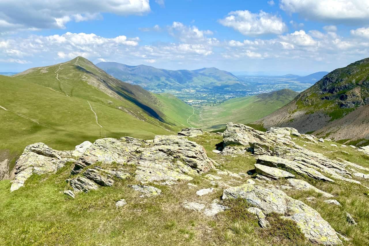
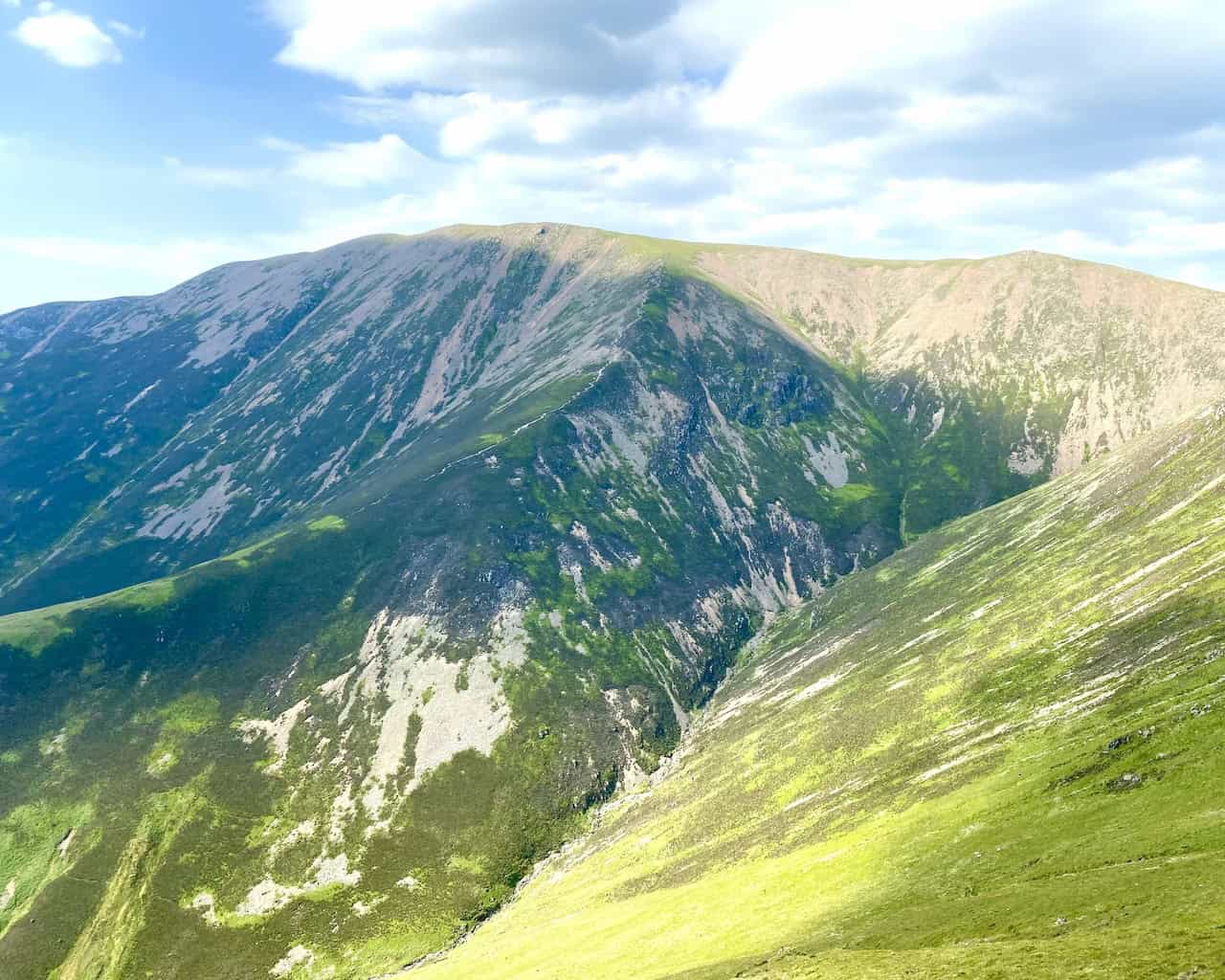
As we climb Grasmoor there are some fantastic views of Gasgale Crags and Whiteside.
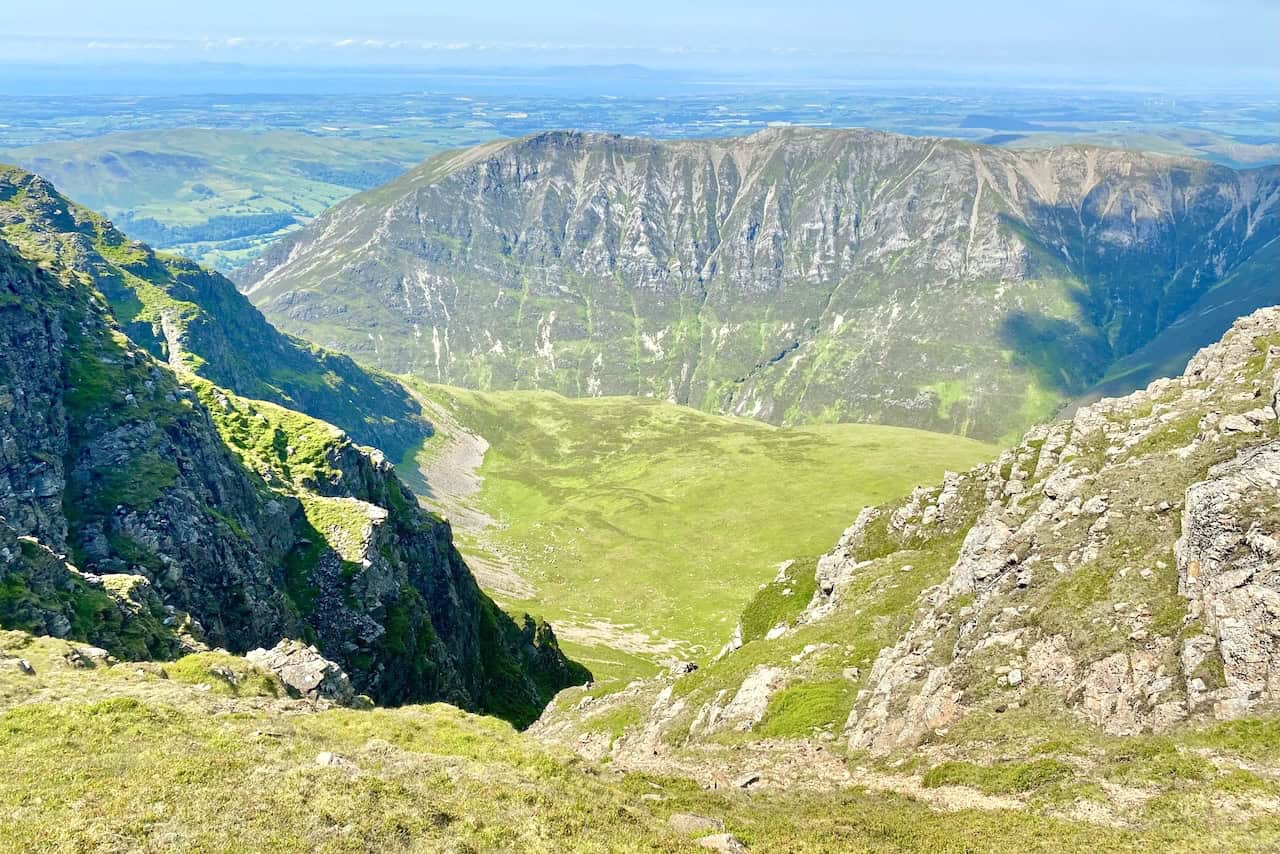
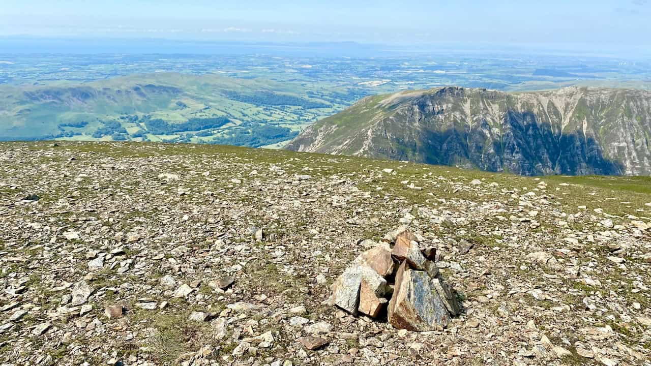
Views from the path above Dove Crags close to the summit of Grasmoor. Beyond Whiteside to the north, the Solway Firth and the mountains of south-west Scotland are visible.
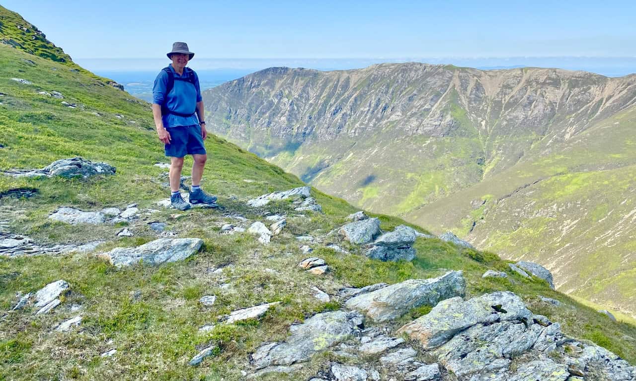
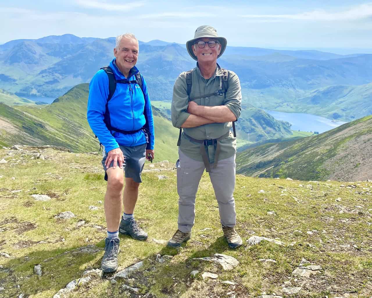
The summit of Grasmoor, height 852 metres (2794 feet). The summit is the halfway point of our Grasmoor walk.
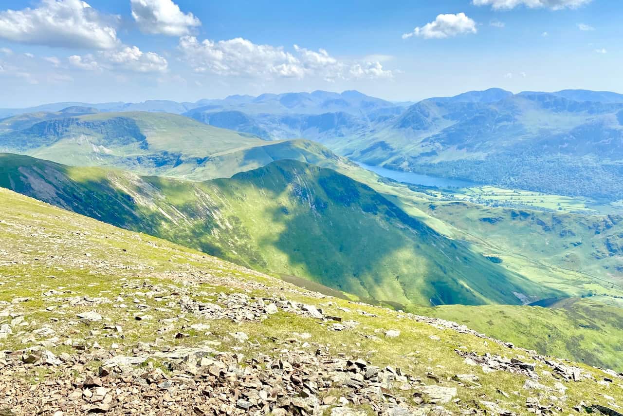
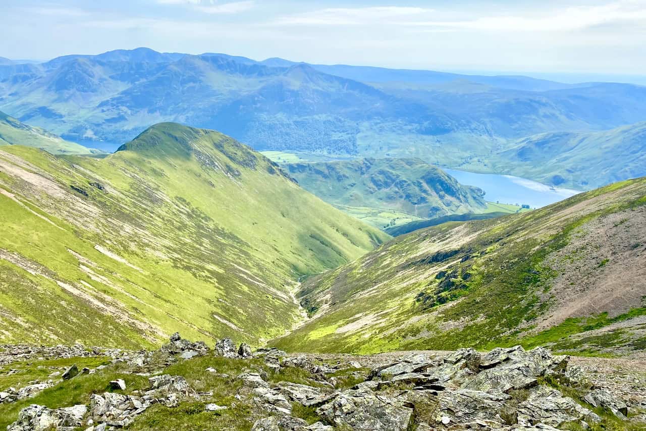
Looking south from Grasmoor towards Whiteless Pike, High Snockrigg and, in the far distance on the horizon, the mountain range which includes Sca Fell and Scafell Pike.
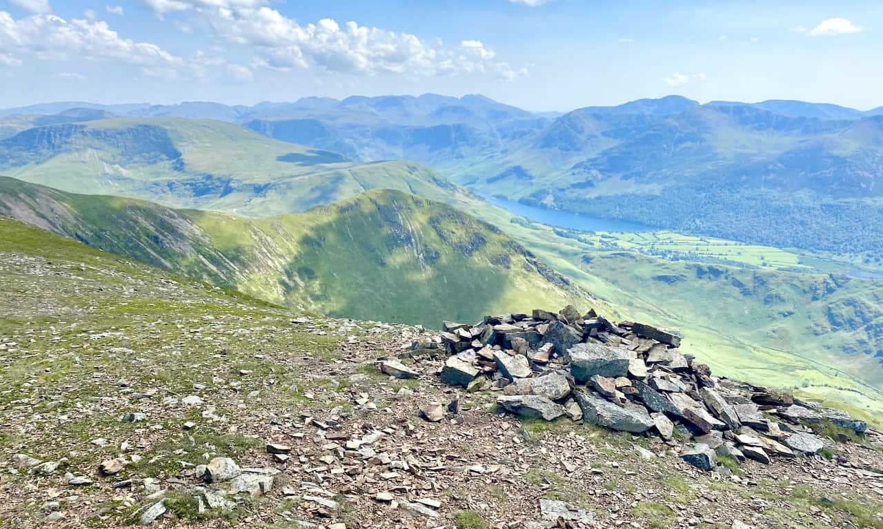
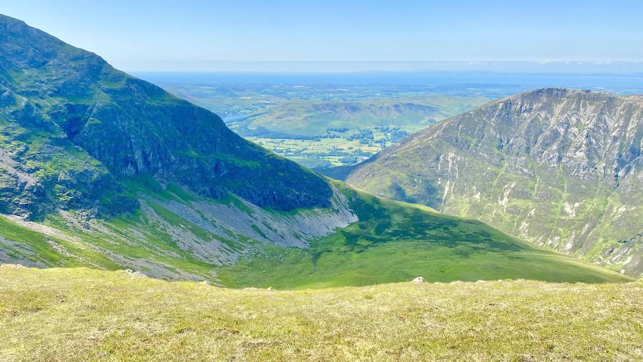
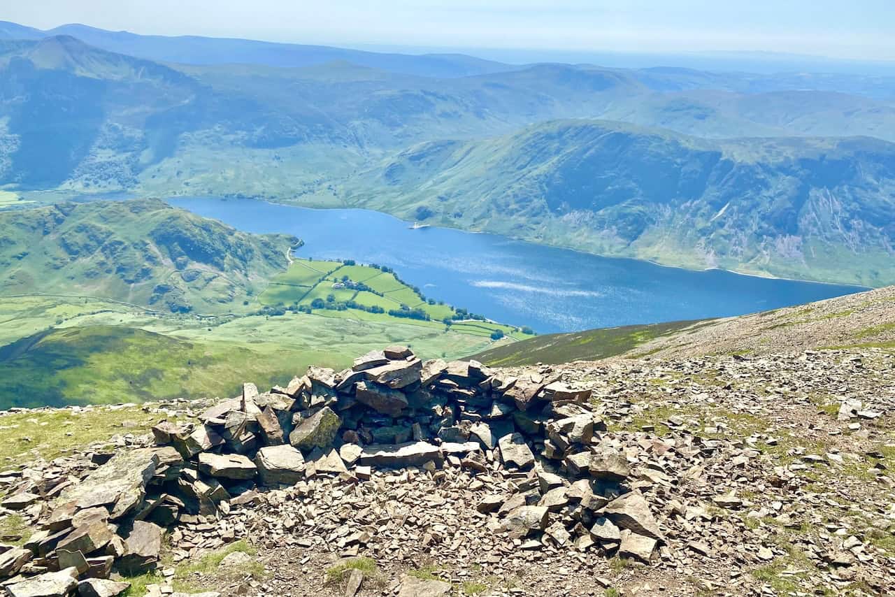
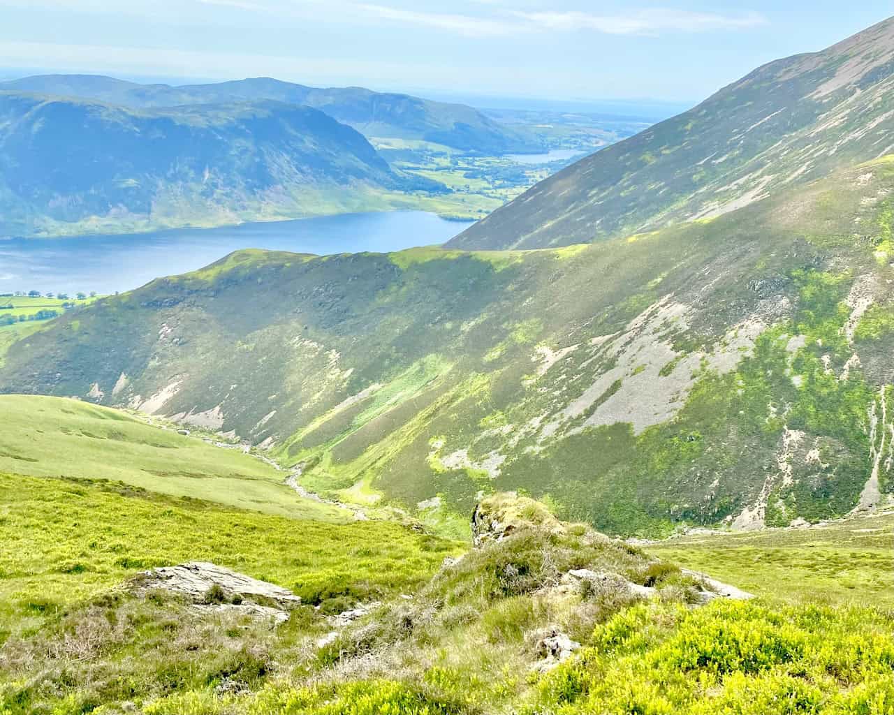
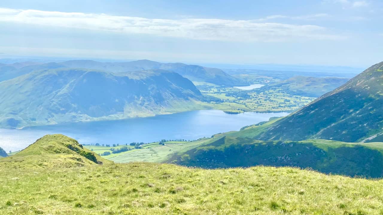
The view from Grasmoor down to Crummock Water.
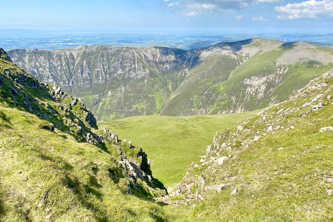
Looking north from Grasmoor towards the Solway Firth and Dumfries and Galloway in Scotland.
Fantastic views of Whiteless Pike, Rannerdale Knotts and Crummock Water during the descent of Grasmoor.
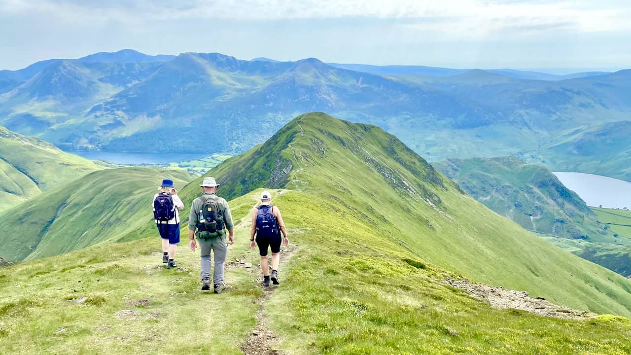
The route across Whiteless Edge to Whiteless Pike. At this point we’re about two-thirds of the way round our Grasmoor walk.
Crummock Water and, in the distance, Loweswater as seen from Whiteless Edge.
The summit of Whiteless Pike, height 660 metres (2165 feet).
The view of Crummock Water, backed by Mellbreak, from Whiteless Pike.
From Whiteless Pike an alternative path from our car park to the top of Grasmoor is clear to see. The steeper but more direct route crosses Lad Hows.
The view north-east through the Sall Beck valley with Causey Pike visible in the distance in the centre of the picture. On the right-hand side of the valley is the Knott Rigg to Ard Crags ridge, and to the left is the Wandhope, Crag Hill and Sail mountain range.
Fantastic views of Rannerdale Knotts during the descent of Whiteless Pike.
Looking up towards Whiteless Pike from the path alongside Squat Beck.
The mighty Grasmoor where we had been a couple of hours earlier.
Footbridge across Squat Beck beneath Dale How and Rannerdale Knotts.
The word ‘how’ comes from the Old Norse word ‘haugr’ for a hill or mound. ‘Knott’, again from the Old Norse, is the old word ‘knottr’ which meant a lump or a hard knot. Hows are smooth and round and knots are craggy and knot-like.
Information from https://www.friendsofthelakedistrict.org.uk/hows-knotts
Looking back towards Rannerdale Knotts from the path back to our car park. Our Grasmoor walk has been one we will never forget.
Highly Rated Osprey Hiking Backpacks for Outdoor Enthusiasts
Osprey’s reputation for crafting high-quality hiking backpacks is well-established, offering a range of options that cater to both men and women. The following four backpacks stand out for their excellent sales and customer ratings on Amazon, making them a top choice for outdoor enthusiasts seeking reliability and comfort. As an Amazon affiliate, I may earn a small commission from any purchases made through the links provided. This helps support the upkeep of this website. Rest assured, you won’t pay a penny extra, but your purchase will contribute to keeping my site running smoothly. Happy walking!

Osprey Tempest 20 Women’s Hiking Backpack
The Tempest 20 stands out as the ideal solution for day-hiking, biking, or peak-bagging, tailored specifically for women. It features a panel-loading design for ease of access, complemented by an internal zippered mesh pocket with a key clip for secure storage. Unique to this model are the Stow-on-the-Go trekking pole and LidLock bike helmet attachments, enhancing its versatility. Side stretch mesh pockets, along with an easy-access, expandable stretch mesh harness pocket, offer ample storage. Additionally, it includes a blinker light attachment (light not included) and a large stretch mesh front panel pocket for extra carrying capacity.

Osprey Talon 22 Men’s Hiking Backpack
Designed for the active adventurer, the Talon 22 provides an optimal panel-loading design suitable for day-hiking, biking, or peak-bagging. Key features include dual-zippered panel access to the main compartment and a tuck-away ice ax attachment with a bungee tie-off. It boasts a top panel zippered slash pocket for quick access items and lower side compression straps for load management. An external hydration reservoir sleeve and dual-zippered fabric hipbelt pockets enhance hydration and storage, while a large stretch mesh front panel pocket increases its utility for various activities.

Osprey Tempest 30 Women’s Hiking Backpack
The Tempest 30, designed with a women’s-specific fit, is a streamlined top-loader ideal for both extensive day trips and light-and-fast overnight adventures. It includes a fixed top lid with an external zippered slash pocket and an under-lid zippered mesh pocket with a key clip for organised storage. The pack features a tuck-away ice ax attachment with a bungee tie-off, dual upper and lower side compression straps for load adjustment, and an external hydration reservoir sleeve. For added convenience, it offers an easy-access, expandable stretch mesh harness pocket and dual-zippered fabric hip-belt pockets.

Osprey Talon 33 Men’s Hiking Backpack
The Talon 33 is engineered for dynamic movement, making it the perfect streamlined top-loader for committed day trips or light-and-fast overnight excursions. It features top load access to the main compartment for easy packing and retrieval. The backpack is equipped with a large stretch mesh front panel pocket, Stow-on-the-Go trekking pole attachment, and stretch mesh side pockets for versatile storage options. Additionally, an easy-access, expandable stretch mesh harness pocket and dual-zippered fabric hip-belt pockets offer convenient storage solutions for essential gear.