Stunning Scenery Awaits on these Nidderdale Walks
Embark on an unforgettable journey through the captivating landscapes of the Nidderdale Area of Outstanding Natural Beauty (AONB) in North Yorkshire with my comprehensive guide to an array of Nidderdale walks. Encompassing 233 square miles, the Nidderdale AONB borders the Yorkshire Dales National Park to the east and south. It includes not only most of Nidderdale itself but also portions of Wharfedale, the Washburn Valley, and Wensleydale.
The region is anchored by the picturesque town of Pateley Bridge and is crowned by its highest point, Great Whernside, standing at 2310 feet above sea level. Nidderdale boasts a diverse and dramatic landscape, featuring wild, open moorlands and secluded, pastoral dales. The exceptional quality of this landscape was formally recognised on 14 February 1994 when it was designated as an AONB by the Government.
Below, I highlight three exemplary Nidderdale walks, each showcasing a unique facet of Nidderdale’s beauty. Remember, these are just a glimpse into the myriad of trails available, with the full list detailed further down the page.
Nidderdale Walks: My Three Favourites
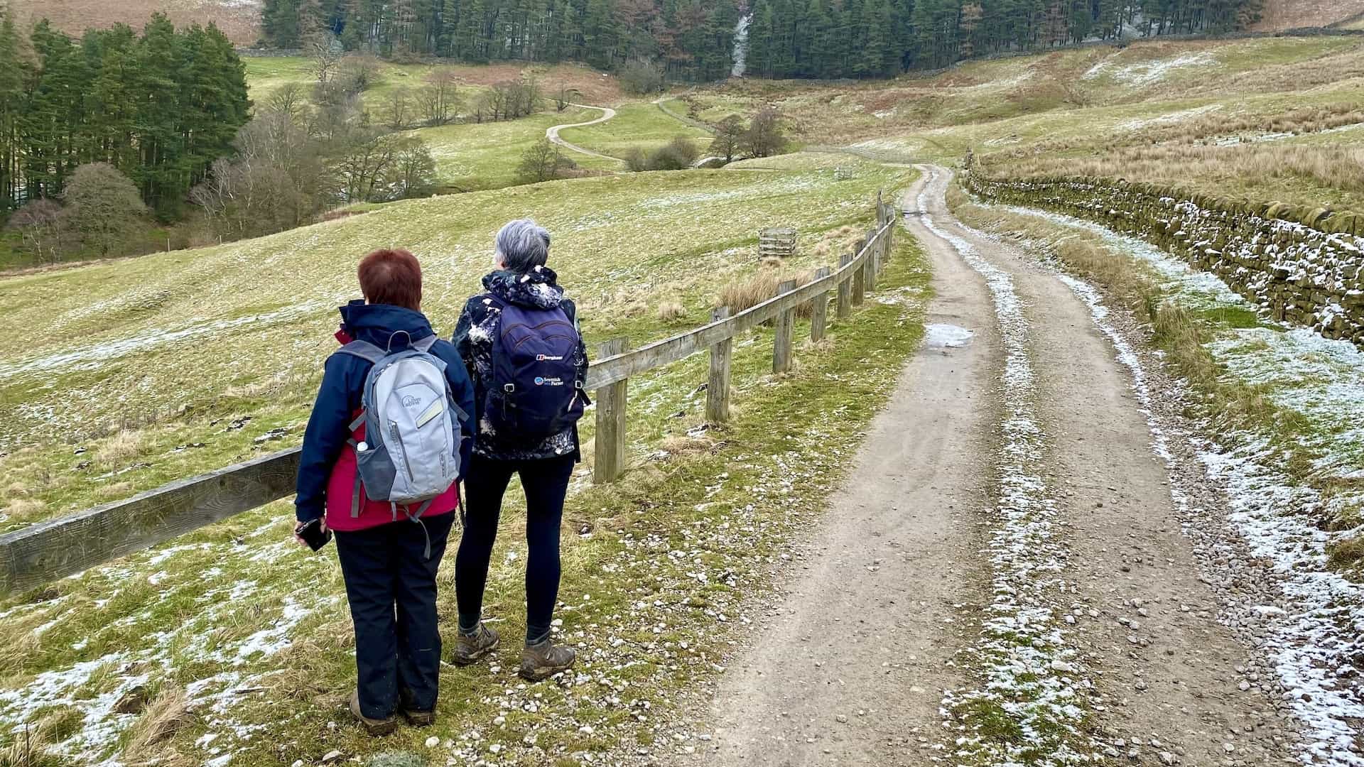
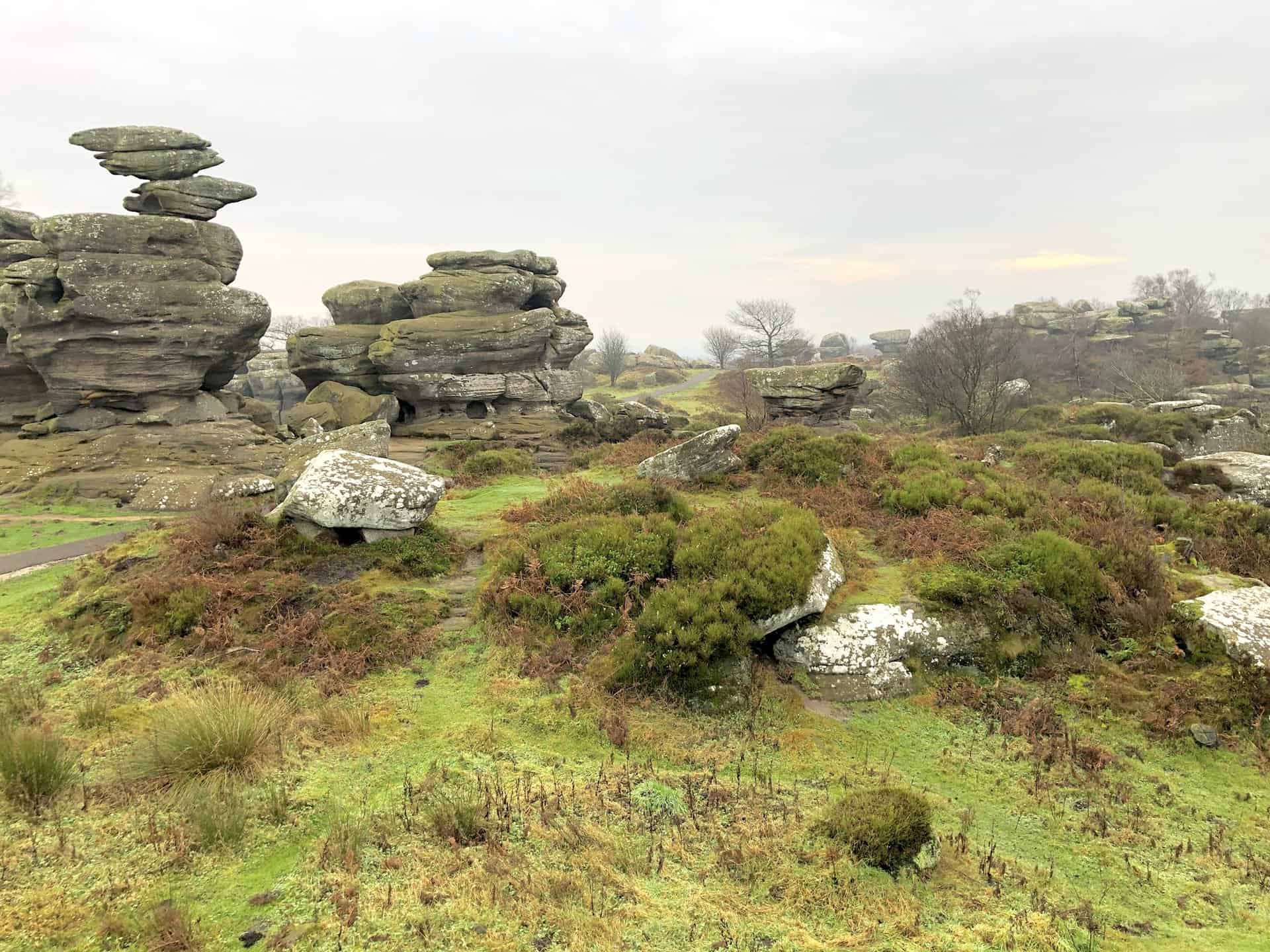
My first highlight, the Brimham Rocks walk, is a stunning 11-mile route starting from the charming Pateley Bridge. Winding along the Nidderdale Way, this trail offers breathtaking views of moorlands and dales, culminating in the awe-inspiring Brimham Rocks. This walk is not just a feast for the eyes but also a journey through history, passing through picturesque villages and ancient woodlands.
Next, my Druid’s Temple walk, a 14-mile trek from Masham to Leighton Reservoir, promises an enchanting experience. This route traverses diverse landscapes, from the serene Fearby Low Moor to the mystical Druid’s Temple. The journey encompasses panoramic views, historic sites, and the tranquil waters of Leighton Reservoir, offering a perfect blend of nature and heritage.
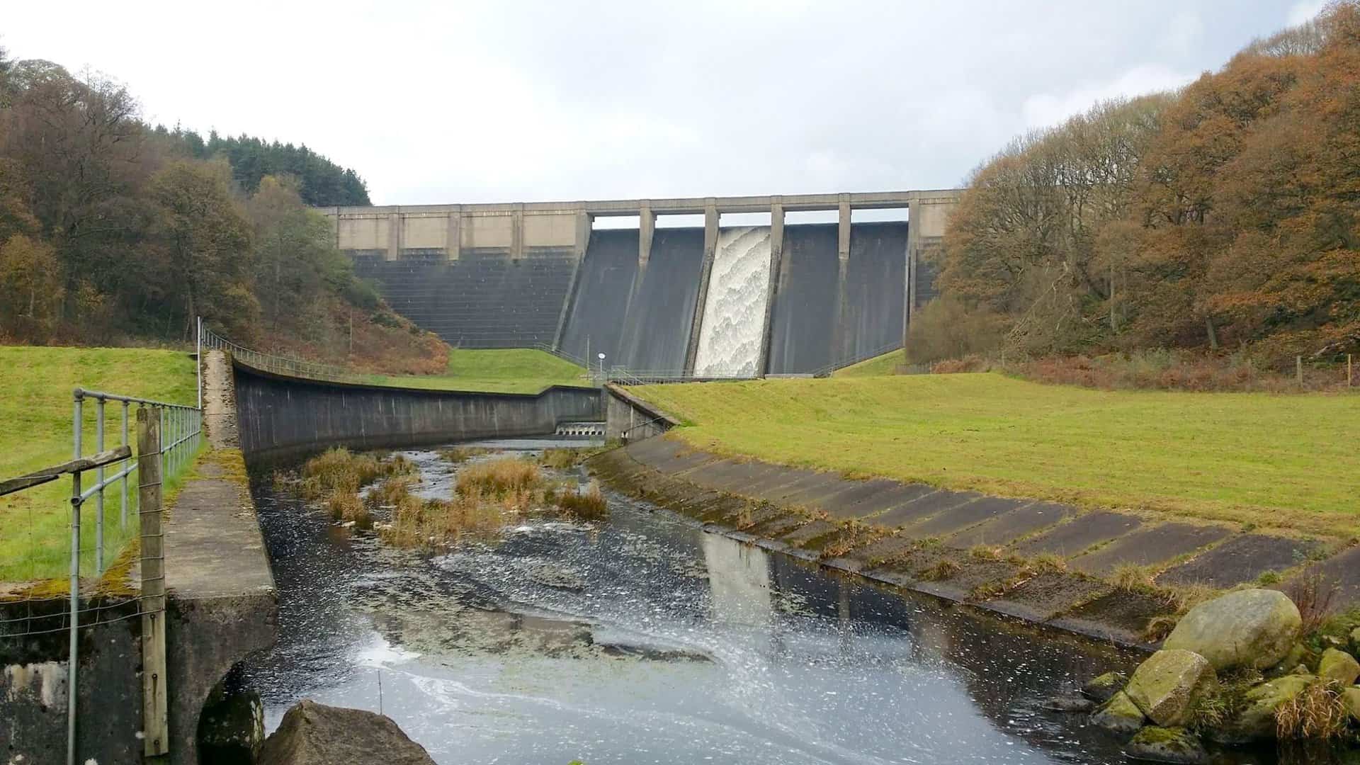
Lastly, my Scar House Reservoir walk, an 11-mile scenic route from Lofthouse, captivates with its majestic views and tranquil paths. Following the Nidderdale Way, this walk reveals the stunning beauty of Scar House Reservoir, set against the dramatic backdrop of Little Whernside. The route meanders through picturesque moorlands and valleys, offering an immersive experience in Nidderdale’s natural grandeur.
Each of these Nidderdale walks is a testament to the region’s diverse landscapes and cultural richness. As you explore the full list of trails below, prepare to be captivated by the beauty and tranquility that the Nidderdale AONB offers.
Enchanting Walks in Nidderdale
Brimham Rocks Walk: From Pateley Bridge via the Nidderdale Way
11 miles
Coldstones Cut Walk: From Pateley Bridge Plus Prosperous Mill
9 miles
Druid’s Temple Walk: A Route From Masham to Leighton Reservoir
14 miles
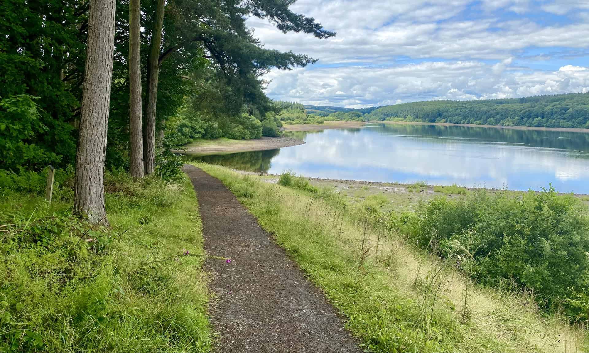
Fewston Reservoir Circular Walk: Great for Beginners and Children
4 miles
Fewston Reservoir Walk: Discovering Swinsty Reservoir and More
9 miles
Jervaulx Abbey Walk: A Rewarding Round Trip Through Nidderdale
11 miles
Leighton Reservoir Walk: Cross Dams, Bridges, and Scenic Paths
16 miles
Masham Walk: Historical Adventure to Druid’s Temple in Nidderdale
14 miles
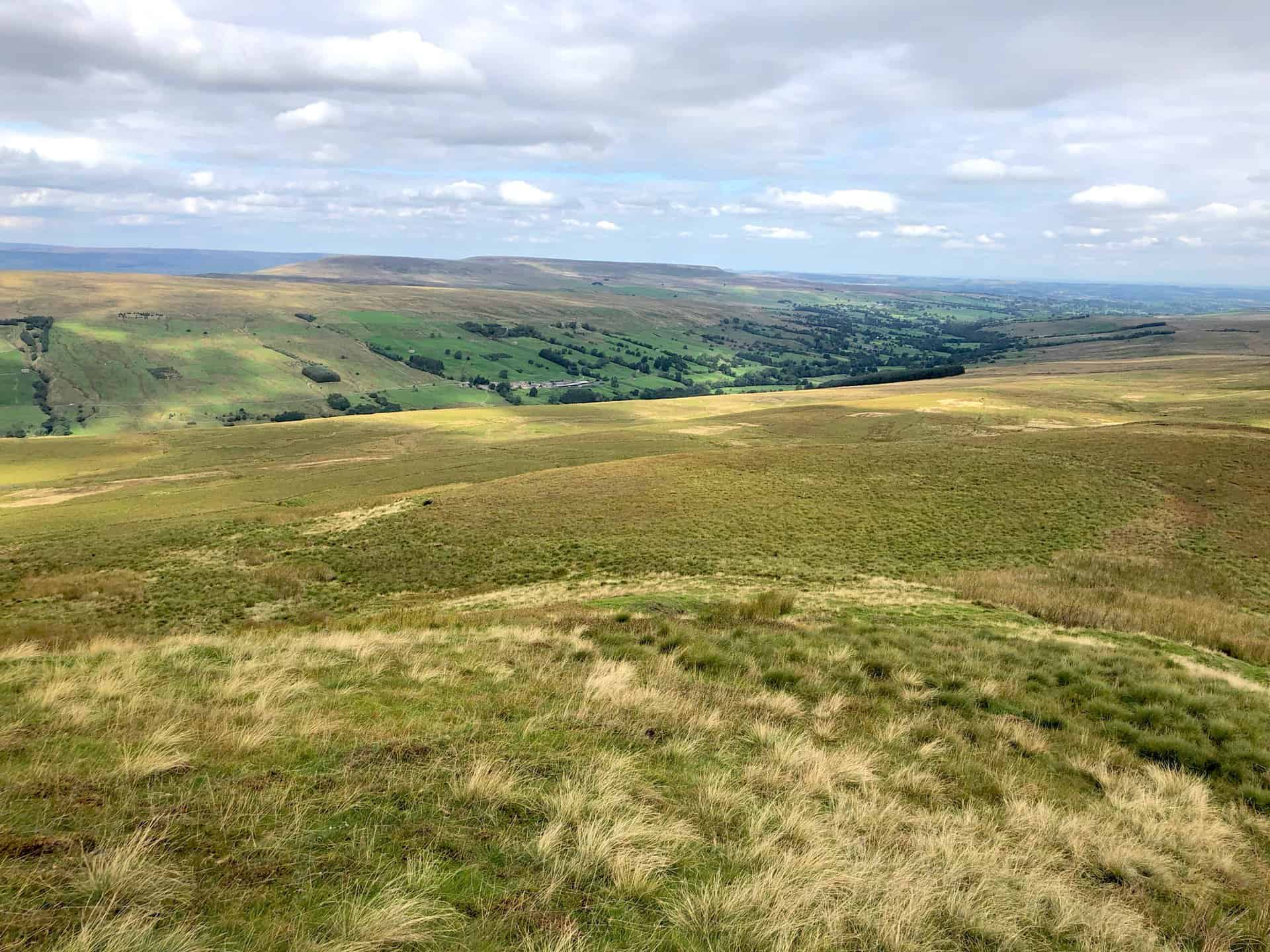
Nidderdale Walk: Discover Lumley Moor Reservoir and Dallowgill
13 miles
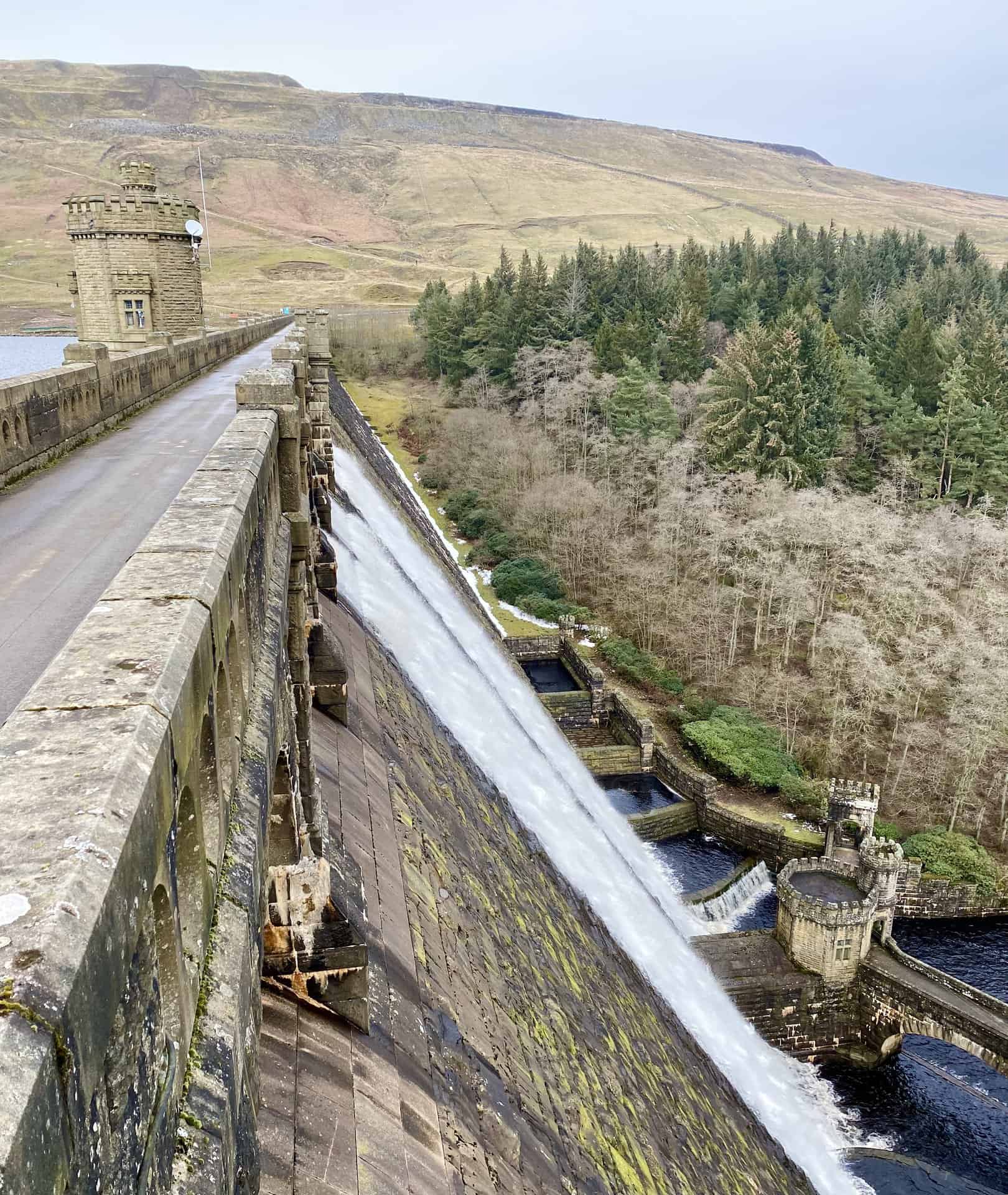
Nidderdale Way Walk: Touring Scar House and Angram Reservoirs
12 miles
Scar House Reservoir Walk: A Scenic 11-Mile Route in Nidderdale
11 miles
Swinsty Reservoir Circular Walk: A Top Leisurely Stroll for All Ages
3 miles
Swinsty Reservoir Walk: Experiencing Fewston Reservoir En Route
7 miles
Thruscross Reservoir Walk: Six Dales Trail and Tranquil Pathways
8 miles
About the Nidderdale Area of Outstanding Natural Beauty (AONB)
Nidderdale AONB, renowned for its remarkable natural beauty and ecological significance, is a treasured landscape within England’s countryside. It encompasses an array of distinctive features including diverse wildlife habitats, rich geological formations, and historic parks and gardens. Its protection and management are ensured by dedicated organisations, and the area offers unique experiences such as stargazing under pristine dark skies, exploring varied landscapes from tranquil moorlands to pastoral settings, and discovering a rich heritage in its historical landmarks.
Background to Areas of Outstanding Natural Beauty (AONBs)
Definition and Legal Framework
The concept of Areas of Outstanding Natural Beauty (AONBs) is defined under the Countryside and Rights of Way Act 2000, commonly referred to as the CROW Act. This Act provides a legal framework for the protection and conservation of landscapes in England that are considered to have significant aesthetic and ecological value. The primary goal of the CROW Act in relation to AONBs is to ensure the preservation and enhancement of their natural beauty.
Role and Responsibilities of Managing Organisations
Managing organisations play a crucial role in the stewardship of AONBs. These bodies are tasked with overseeing the conservation efforts and implementing strategies that align with the objectives set out by the CROW Act. Their responsibilities include maintaining the ecological integrity of these areas, promoting sustainable use of natural resources, and facilitating public enjoyment and understanding of the natural environment within the AONBs.
Designation Process by Natural England
Natural England, a government advisor for the natural environment in England, is responsible for the designation of new AONBs and adjusting the boundaries of existing ones. The process of designation involves a thorough assessment to determine whether a particular area meets the required standards of natural beauty. Proposals for designation are prioritised based on factors such as the presence of significant natural features, the agreement of local authorities, and the availability of resources for evaluation.
Responsibilities Towards Existing AONBs
For existing AONBs, there is an ongoing responsibility to protect their unique characteristics. This includes advising local planning authorities on development proposals within AONBs to ensure they do not adversely affect the natural beauty of the area. Natural England also considers the conservation and enhancement of these areas in its broader land management activities, ensuring a holistic approach to maintaining the ecological and aesthetic value of AONBs.
Criteria for ‘Natural Beauty’
The designation of an area as an AONB is contingent upon meeting the ‘natural beauty criterion’. This encompasses a range of factors, including the quality of the landscape, whether natural or man-made, the scenic quality such as striking coastal landforms, the sense of wildness and tranquillity, and the presence of unique natural heritage features like distinctive geology or habitats. Additionally, cultural heritage elements, including historic parklands and archaeological remains, contribute to the overall assessment of an area’s natural beauty.

Special Qualities of Nidderdale AONB
Geology
The geology of Nidderdale AONB, characterised by its gritstone and limestone layers, plays a fundamental role in shaping the distinctive landscape of the Yorkshire Dales. My Nidderdale walks are a splendid way to observe this.
Dark Skies
Nidderdale AONB boasts some of the darkest and most pristine skies in the country, offering exceptional opportunities for stargazing and astronomical observation.
Heritage
The rich heritage of Nidderdale AONB is encapsulated in its historical landmarks and centuries of human interaction with the landscape.
Landscape Character
Nidderdale AONB’s landscape character is diverse and unique, featuring tranquil water expanses, heather moorlands, and pastoral settings framed by traditional stone walls.
Historic Parks and Gardens
The historic parks and gardens of Nidderdale AONB, developed by notable local families, add a layer of cultural richness to the area’s natural beauty.
Wildlife and Habitats
Nidderdale AONB is a haven for wildlife, offering a variety of habitats from high moorlands to rare hay meadows, supporting a wide range of species.
Geology of Nidderdale AONB
Importance in the Yorkshire Dales
The geology of Nidderdale AONB is integral to the Yorkshire Dales, providing a foundation that defines much of the region’s natural and visual appeal.
Influence on Landscape Development
The underlying geology, with its layers of gritstone and limestone, has been a crucial factor in the development of Nidderdale’s distinct landscape, influencing its topography and natural features. Try one of my Nidderdale walks to witness these unique formations up close.
Interaction with Human Activities
Human activities in Nidderdale AONB, from farming to mining and quarrying, have been significantly shaped by the area’s geological characteristics, reflecting a deep interconnection between the land and its inhabitants.
Key Geological Features
Notable geological features such as How Stean Gorge, Limley, and the River Nidd, showcase the dynamic and varied geological history of the area, each offering unique insights into the region’s natural history.
Brimham Rocks
Renowned for their peculiar formations and glacial influence, Brimham Rocks epitomise the geological wonders of Nidderdale AONB, with their distinct shapes like the Sphinx and Dancing Bear being shaped over millions of years.
Dark Skies in Nidderdale AONB
Importance of Dark Skies
The dark skies of Nidderdale AONB are among its most treasured attributes, offering a rare opportunity to experience the night sky free from the pervasive effects of light pollution.
Optimal Stargazing Locations
For stargazing enthusiasts, Nidderdale AONB provides a variety of optimal locations where the clarity and darkness of the sky make for an unrivalled astronomical experience.
Visibility of Celestial Objects
The unspoiled dark skies of Nidderdale allow for a spectacular view of numerous celestial objects, including constellations, planets, the Milky Way, and occasionally, phenomena like shooting stars and the northern lights.
Best Times for Stargazing
The ideal time for stargazing in Nidderdale varies throughout the year, with mid-August through to early May typically offering the best conditions for observing the night sky.
Official Dark Sky Discovery Sites
Nidderdale AONB is home to four official dark sky discovery sites: Toft Gate Lime Kiln, Scar House Reservoir, Fewston Reservoir, and Thruscross Reservoir, each providing unique and accessible locations for stargazing and appreciating the natural nocturnal environment.
Heritage in Nidderdale AONB
Rich Heritage of the AONB
Nidderdale AONB is steeped in a rich heritage that reflects centuries of human activities and their profound connection with the landscape.
Elements of Heritage
The area’s heritage is diverse, encompassing traditional barns that dot the landscape, a history of mining and quarrying that speaks to the area’s geological richness, the development of railways that transformed transport and trade, the construction of reservoirs crucial for water management, and the evolution of textile industries that shaped the local economy and culture.
Landscape Character of Nidderdale AONB
Unique Characteristics of the AONB Landscape
The landscape of Nidderdale AONB is distinguished by its unique features, blending natural beauty with cultural elements, thereby creating a landscape that is both varied and harmonious.
Harrogate Borough Council’s Landscape Character Assessment
The Harrogate Borough Council conducted a Landscape Character Assessment to comprehensively evaluate and document the distinct characteristics of Nidderdale AONB’s landscape, providing a framework for its management and conservation.
Availability of Detailed Information
Detailed information regarding the Landscape Character Assessment is accessible on the Harrogate Borough Council website, offering an in-depth look at the varied landscape characteristics of Nidderdale AONB.
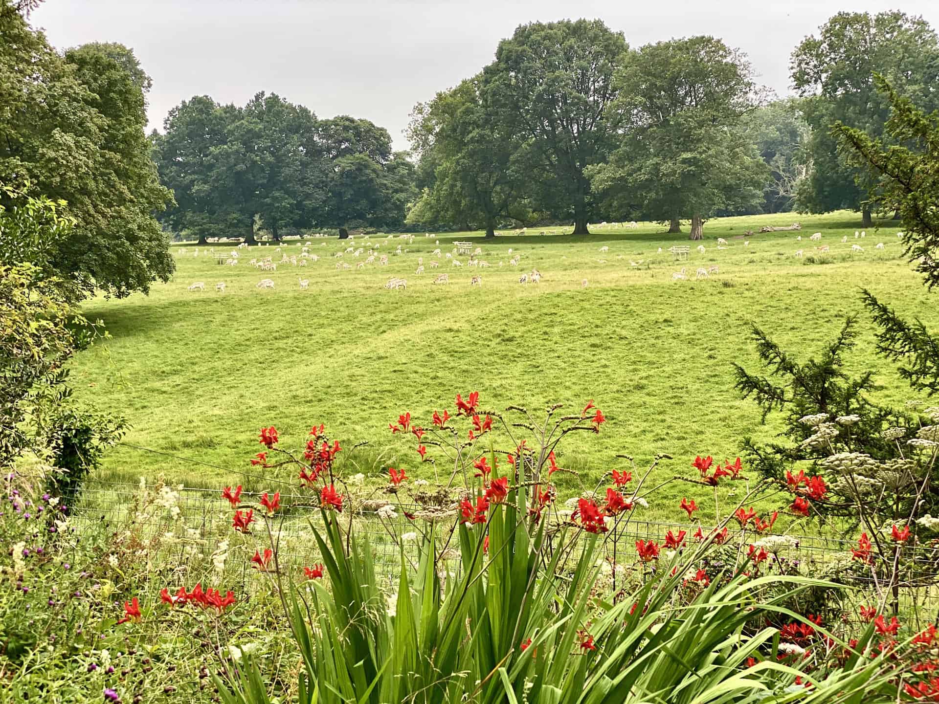
Historic Parks and Gardens in Nidderdale AONB
Role of Local Families
Local families, notably the Ingilbys, Yorkes, Mowbrays, Danbys, and Markenfields, have played a significant role in shaping the historic parks and gardens within Nidderdale AONB, adding to the area’s cultural and aesthetic richness.
Distinction From Other Parts of the Pennines
These historic parks and gardens set Nidderdale AONB apart from the wilder regions of the Pennines, showcasing a unique blend of natural beauty and landscaped elegance.
Notable Examples
Noteworthy among these are Swinton Park, Markenfield Hall, Hackfall, Fishpond Wood, and Studley Royal, each offering a unique glimpse into the area’s heritage and landscape design.

Accessibility to Visitors
Today, many of these historic parks and gardens, which I often visit during my Nidderdale walks, are open to the public, providing an opportunity to explore and appreciate the rich history and beauty of Nidderdale AONB.
Wildlife and Habitats in Nidderdale AONB
Variety of Habitats
Nidderdale AONB is characterised by a diverse range of habitats, including the expansive heather moorlands and the rare hay meadows, each supporting a unique array of flora and fauna.
Protected Wildlife Sites
The area encompasses several legally recognised sites dedicated to the protection of wildlife, highlighting its importance for both regional and national conservation efforts.
Role in Wildlife Conservation Projects
Nidderdale AONB plays a pivotal role in various wildlife conservation projects, focusing on preserving and enhancing the natural habitats and the species that depend on them.
Highly Rated Osprey Hiking Backpacks for Outdoor Enthusiasts
Osprey’s reputation for crafting high-quality hiking backpacks is well-established, offering a range of options that cater to both men and women. The following four backpacks stand out for their excellent sales and customer ratings on Amazon, making them a top choice for outdoor enthusiasts seeking reliability and comfort. As an Amazon affiliate, I may earn a small commission from any purchases made through the links provided. This helps support the upkeep of this website. Rest assured, you won’t pay a penny extra, but your purchase will contribute to keeping my site running smoothly. Happy walking!

Osprey Tempest 20 Women’s Hiking Backpack
The Tempest 20 stands out as the ideal solution for day-hiking, biking, or peak-bagging, tailored specifically for women. It features a panel-loading design for ease of access, complemented by an internal zippered mesh pocket with a key clip for secure storage. Unique to this model are the Stow-on-the-Go trekking pole and LidLock bike helmet attachments, enhancing its versatility. Side stretch mesh pockets, along with an easy-access, expandable stretch mesh harness pocket, offer ample storage. Additionally, it includes a blinker light attachment (light not included) and a large stretch mesh front panel pocket for extra carrying capacity.

Osprey Talon 22 Men’s Hiking Backpack
Designed for the active adventurer, the Talon 22 provides an optimal panel-loading design suitable for day-hiking, biking, or peak-bagging. Key features include dual-zippered panel access to the main compartment and a tuck-away ice ax attachment with a bungee tie-off. It boasts a top panel zippered slash pocket for quick access items and lower side compression straps for load management. An external hydration reservoir sleeve and dual-zippered fabric hipbelt pockets enhance hydration and storage, while a large stretch mesh front panel pocket increases its utility for various activities.

Osprey Tempest 30 Women’s Hiking Backpack
The Tempest 30, designed with a women’s-specific fit, is a streamlined top-loader ideal for both extensive day trips and light-and-fast overnight adventures. It includes a fixed top lid with an external zippered slash pocket and an under-lid zippered mesh pocket with a key clip for organised storage. The pack features a tuck-away ice ax attachment with a bungee tie-off, dual upper and lower side compression straps for load adjustment, and an external hydration reservoir sleeve. For added convenience, it offers an easy-access, expandable stretch mesh harness pocket and dual-zippered fabric hip-belt pockets.

Osprey Talon 33 Men’s Hiking Backpack
The Talon 33 is engineered for dynamic movement, making it the perfect streamlined top-loader for committed day trips or light-and-fast overnight excursions. It features top load access to the main compartment for easy packing and retrieval. The backpack is equipped with a large stretch mesh front panel pocket, Stow-on-the-Go trekking pole attachment, and stretch mesh side pockets for versatile storage options. Additionally, an easy-access, expandable stretch mesh harness pocket and dual-zippered fabric hip-belt pockets offer convenient storage solutions for essential gear.