A Scenic 9-Mile Walk from Hartsop to Stony Cove Pike and Hayeswater
Park in the Cow Bridge car park, situated by the side of the A592 just north of Brothers Water, near Hartsop. Begin your journey by heading briefly south-east along the road towards Hartsop. Then, veer south across Horseman Bridge, passing the scenic Brothers Water. Continue along the A592 towards Sykeside. This initial part of the route sets the tone for a memorable walk to Stony Cove Pike.
After Sykeside, prepare for a steep climb. Ascend south-east up to John Bell’s Banner, located on Cauldale Moor. The effort is rewarded as you traverse towards the east, reaching the summit of Stony Cove Pike. This peak is a highlight of the walk, offering spectacular views of the surrounding Lake District.
From Stony Cove Pike, descend slightly before undertaking another climb. This ascent leads you to the Beacon, marking the top of Thornthwaite Crag. Next, embark on a north-east then north walk along the High Street ridge. You’ll pass the cairn on Racecourse Hill. Continue north along the ridge, traversing the Straits of Riggindale, until you reach the top of The Knott.
Finally, begin your descent. Head west towards the northern end of Hayeswater. The path then takes you through the serene Hayeswater Gill valley, leading back to Hartsop and the car park. This 9-mile walk encapsulates the essence of the Lake District, with Stony Cove Pike and Thornthwaite Crag as prominent and memorable landmarks.
Stony Cove Pike Walk: Maps and Tools
Visit either the OS Maps website or the Outdooractive website to view this walking route in greater detail. Both platforms offer a range of features, including the ability to print the route, download it to your device, and export the route as a GPX file. You can also watch a 3D fly-over and share the route on social media.
Stony Cove Pike Walk: Distance, Duration, Statistics
Distance: 8¾ miles
Distance: 14¼ kilometres
Duration: 5 hours
Ascent: 3057 feet
Ascent: 932 metres
Type: Circular walk
About Stony Cove Pike
Stony Cove Pike, also known as Caudale Moor, is a fell situated in the far eastern part of the English Lake District. The main summit is designated as ‘Stony Cove Pike’ on Ordnance Survey maps, while the second top to the west is named ‘Caudale Moor’. The south-western ridge descending to St Raven’s Edge is known as ‘John Bell’s Banner’. Alfred Wainwright, in his Pictorial Guide to the Lakeland Fells, refers to the entire fell as Caudale Moor and uses John Bell’s Banner as an alternative name, with Stony Cove Pike specifically denoting the main summit.
Topographically, the fell is expansive, featuring six ridges emanating from the summit. The primary summit has four ridges extending in cardinal directions. The eastern ridge descends to Threshwaite Mouth, leading to Thornthwaite Crag. Northwards lies the grassy ridge towards Hartsop Dodd, and to the west, the land narrows slightly towards the secondary top of Caudale Moor / John Bell’s Banner. South of the main summit, a short spur extends into the Trout Beck valley, then steeply descends over Doup Crag.
The lower top of the fell includes the descending ridge of Rough Edge, leading north-west towards Caudale Bridge. Here, the notable Caudale Quarry can be found, known for its historically steep access track. Signs of more extensive mining are also evident in this area.
Additionally, a broad ridge descends south from the Caudale Moor top, passing over Pike How and splitting around Woundale’s head. The south-west branch goes down St Raven’s Edge to the Kirkstone Pass road at Woundale Raise, then rises again towards Wansfell. The south-eastern spur, shorter in length, drops over Hart Crag and Great Knott into the Troutbeck valley.
The summit area of Stony Cove Pike is grassy, featuring small tarns between the two tops. Stone walls along the ridges towards Hartsop Dodd, St Raven’s Edge, and Threshthwaite Mouth aid in navigation. Cairns mark both tops, and a wooden cross-topped cairn, known as Mark Atkinson’s monument, is located to the south-west of Caudale Moor.
In Alfred Wainwright’s list of 214 Lake District Fells, Stony Cove Pike ranks 55th in height, standing at 764 metres (2506 feet).
Recommended Ordnance Survey Map
The best map to use on this walk is the Ordnance Survey map of the Lake District North-Eastern Area, reference OS Explorer OL5, scale 1:25,000. It clearly displays footpaths, rights of way, open access land and vegetation on the ground, making it ideal for walking, running and hiking. The map can be purchased from Amazon in either a standard, paper version or a weatherproof, laminated version, as shown below.
Standard Version
Stony Cove Pike Walk: My Photos
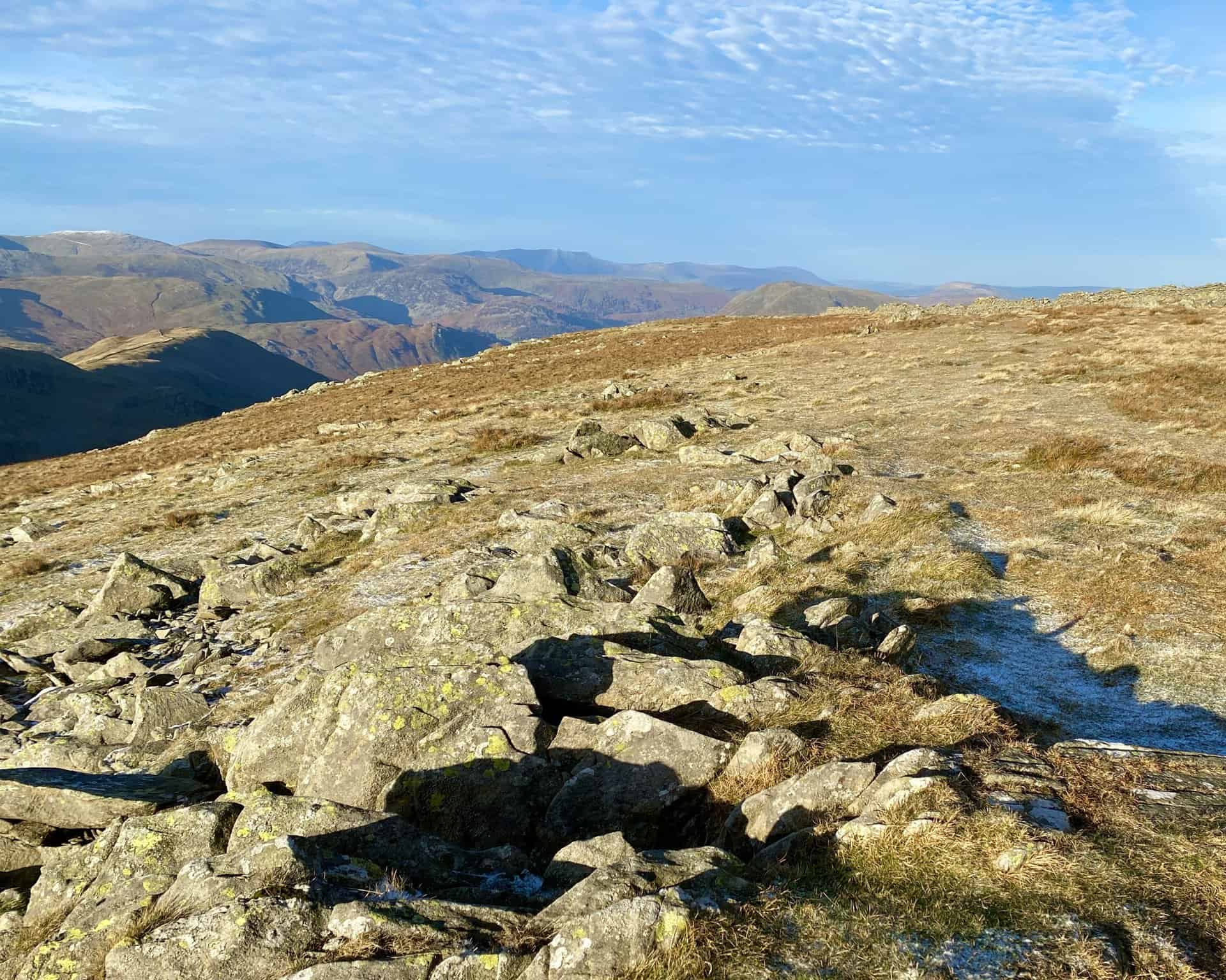
The view west from Thornthwaite Crag to the snow-covered tops of Helvellyn and Nethermost Pike on the horizon.
The summit of Thornthwaite Crag, height 784 metres (2572 feet). One of the many highlights of this Stony Cove Pike walk.

Walking in the Yorkshire Dales with 43 Circular Routes
AD This Cicerone guidebook includes 43 circular walks exploring valleys, hills, and moors between Kirkby Stephen and Pateley Bridge. With OS maps, local highlights, and routes ranging from 3–11 miles, it is a year-round companion for walkers of all abilities.

Grisport Unisex Adult Peaklander Hiking Boots
AD The Grisport Unisex Adult Peaklander Hiking Boots are crafted in Italy with a durable waxed leather upper, Spotex breathable lining, and a reliable Track-on rubber sole. Waterproof and weighing just 1120g, they offer comfort, resilience, and dependable performance on demanding trails.
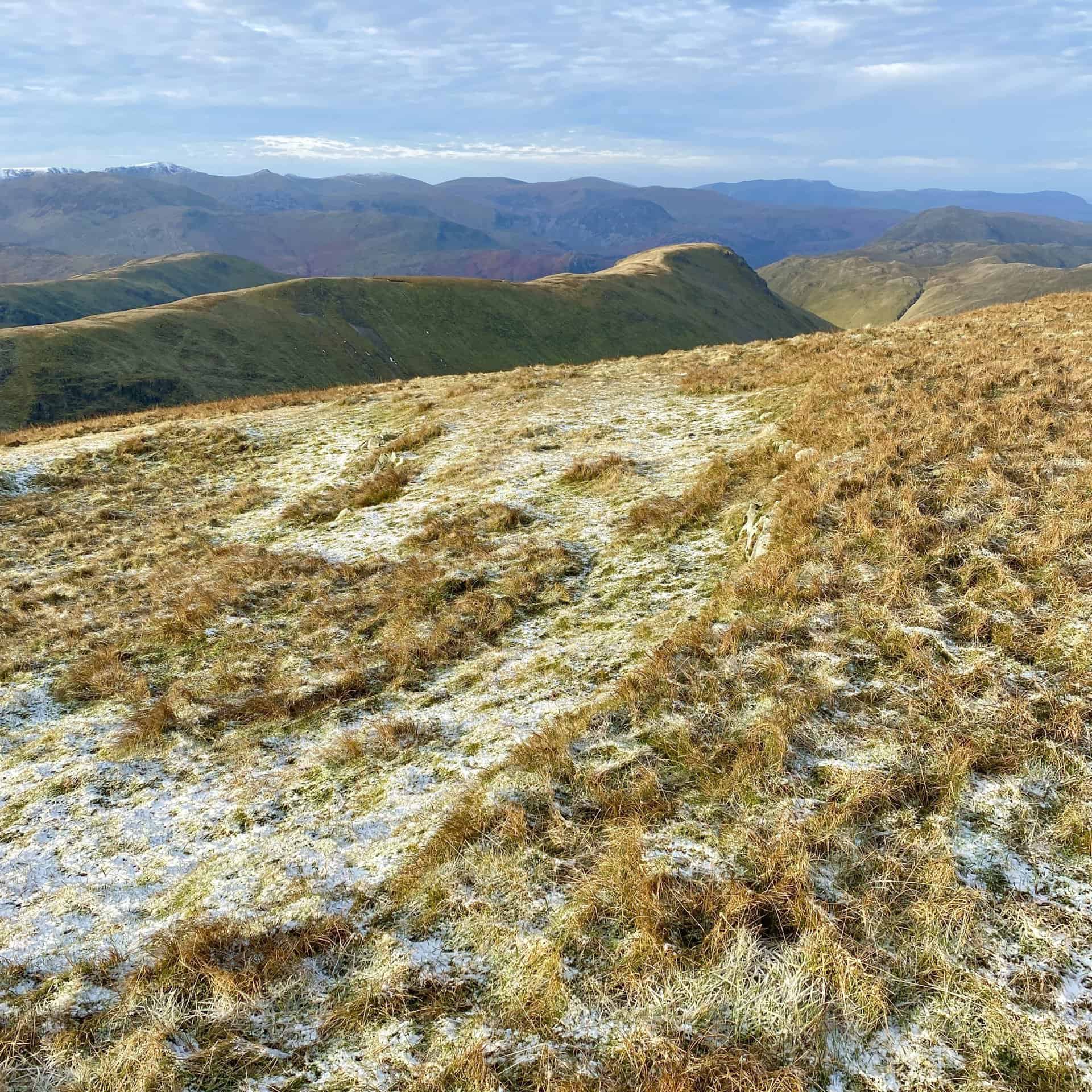
Clear views north-west from Thornthwaite Crag, with Blencathra (Saddleback) visible about 13 miles away.
Gray Crag at the end of the long, narrow ridge which leads from Thornthwaite Crag. On the left, behind the ridge, is Hartsop Dodd.
Grisport Unisex Adult Peaklander Hiking Boots
AD The Grisport Unisex Adult Peaklander Hiking Boots are crafted in Italy with a durable waxed leather upper, Spotex breathable lining, and a reliable Track-on rubber sole. Waterproof and weighing just 1120g, they offer comfort, resilience, and dependable performance on demanding trails.
The track across High Street, the course of an old Roman road. Approximately half way round our Stony Cove Pike walk.
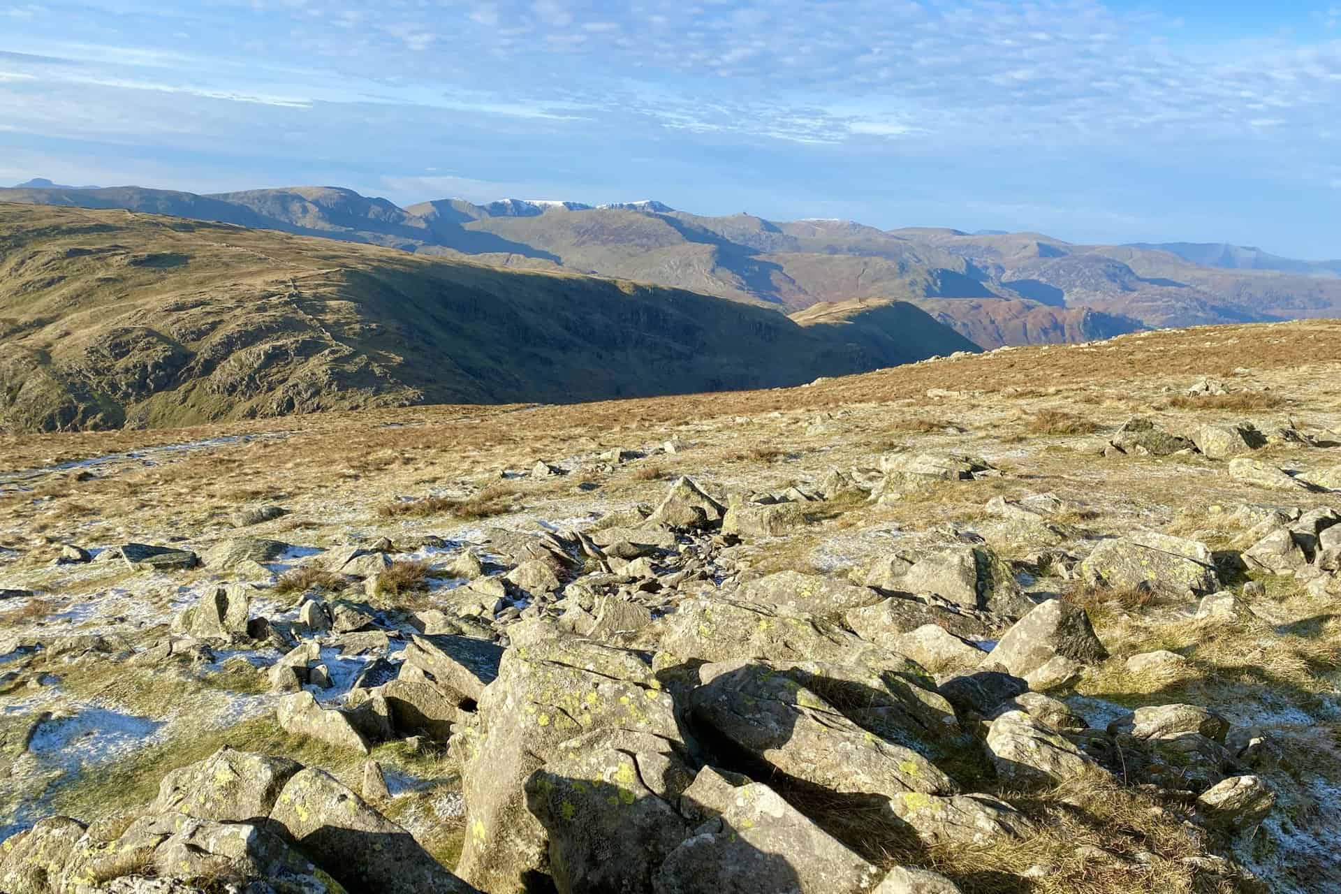
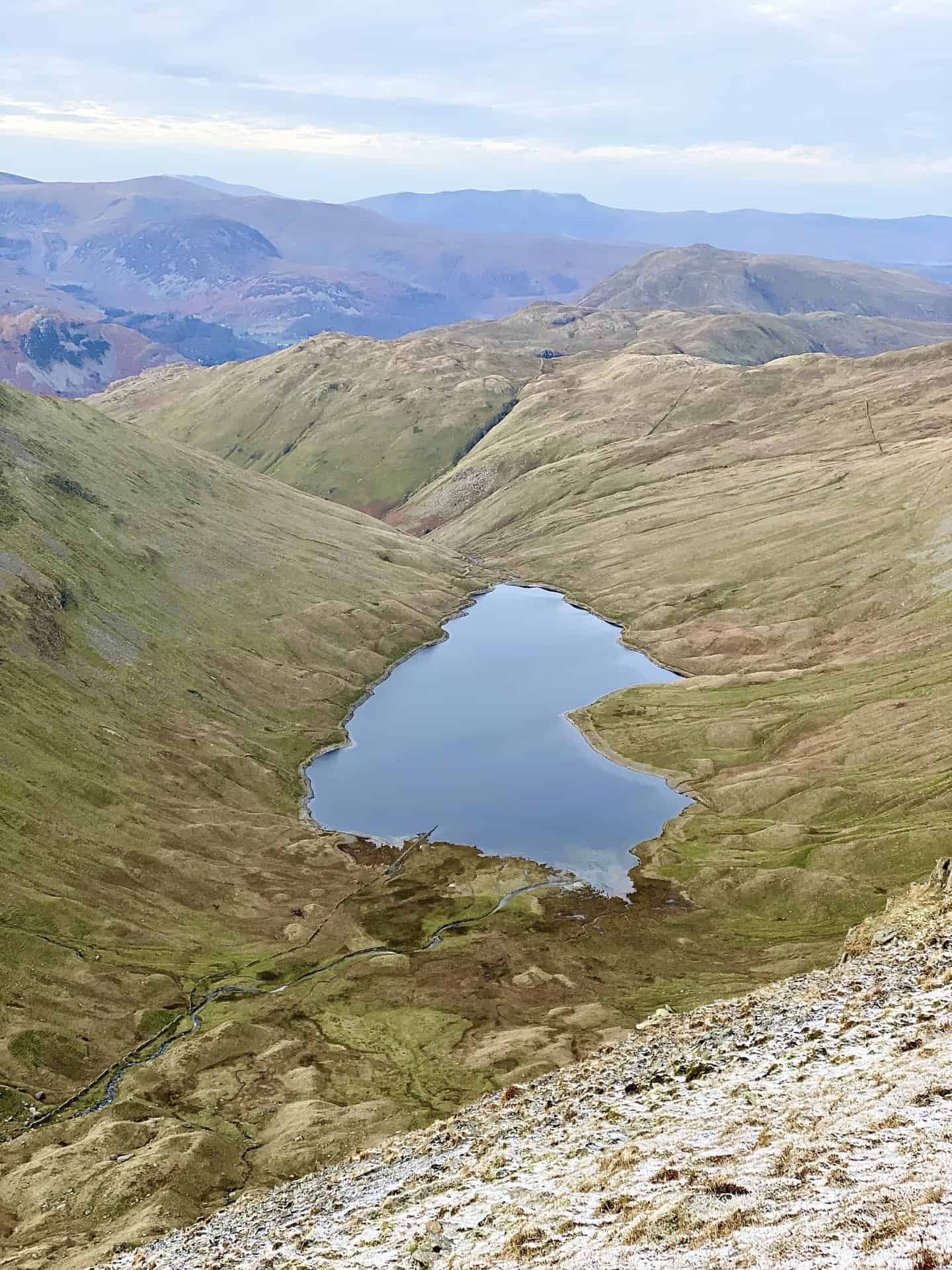
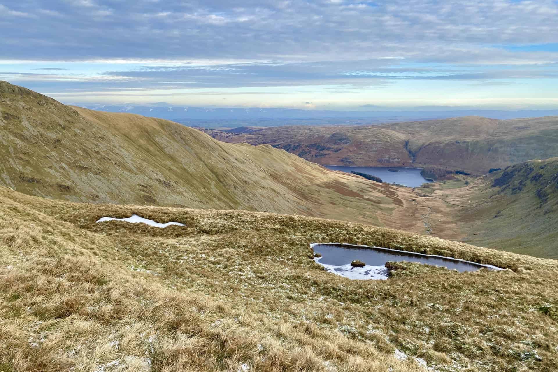
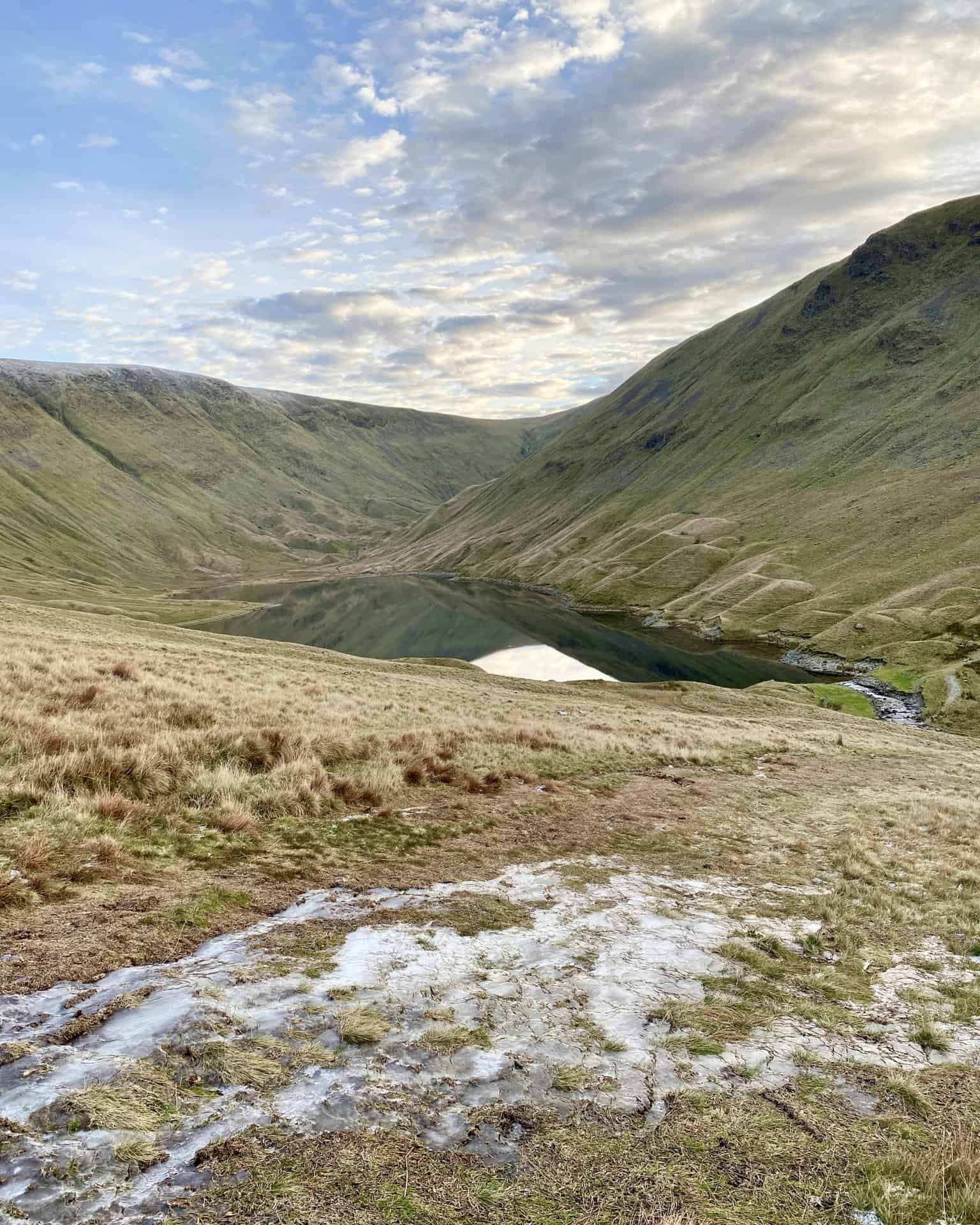
Hayeswater as seen from Racecourse Hill, just below the summit of High Street, height 828 metres (2717 feet).

Fifty Walks Across the Beautiful North York Moors National Park
AD Discover 50 routes across the North York Moors, from short easy strolls to challenging high-level hikes. With OS maps, route descriptions, and local highlights, it also includes the legendary 40-mile Lyke Wake Walk, described in four accessible stages.
The view from above Short Stile through the Riggindale Beck valley towards the southern extent of Haweswater Reservoir.
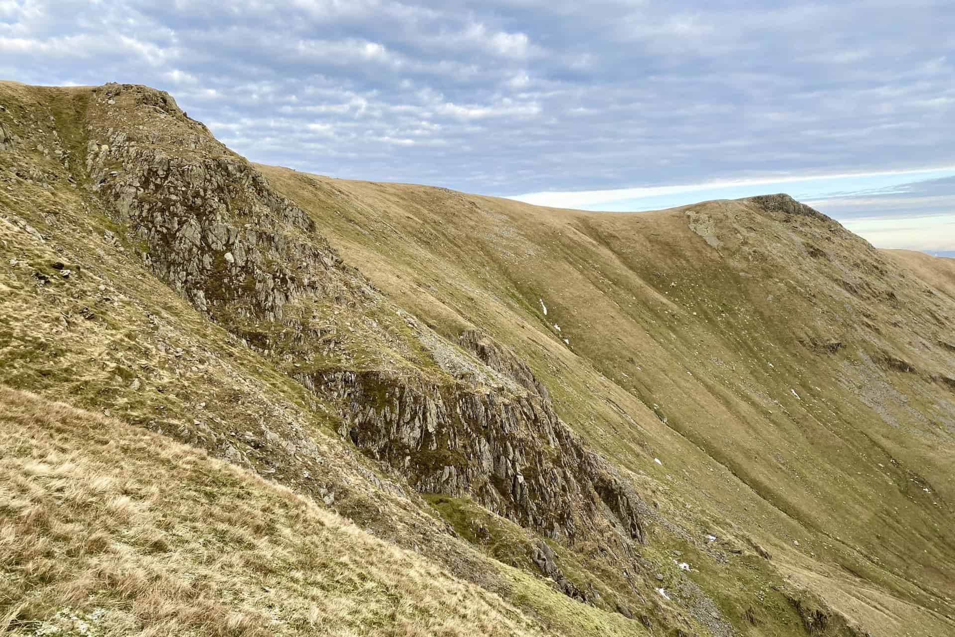
Twopenny Crag (left) and Kidsty Pike (the peak on the right).
Fifty Walks Across the Beautiful North York Moors National Park
AD Discover 50 routes across the North York Moors, from short easy strolls to challenging high-level hikes. With OS maps, route descriptions, and local highlights, it also includes the legendary 40-mile Lyke Wake Walk, described in four accessible stages.
The U-shaped glacial valley which separates Kidsty Pike and Rough Crag. Short Stile protrudes into the valley and Riggindale Beck flows through it on its way to Haweswater Reservoir.
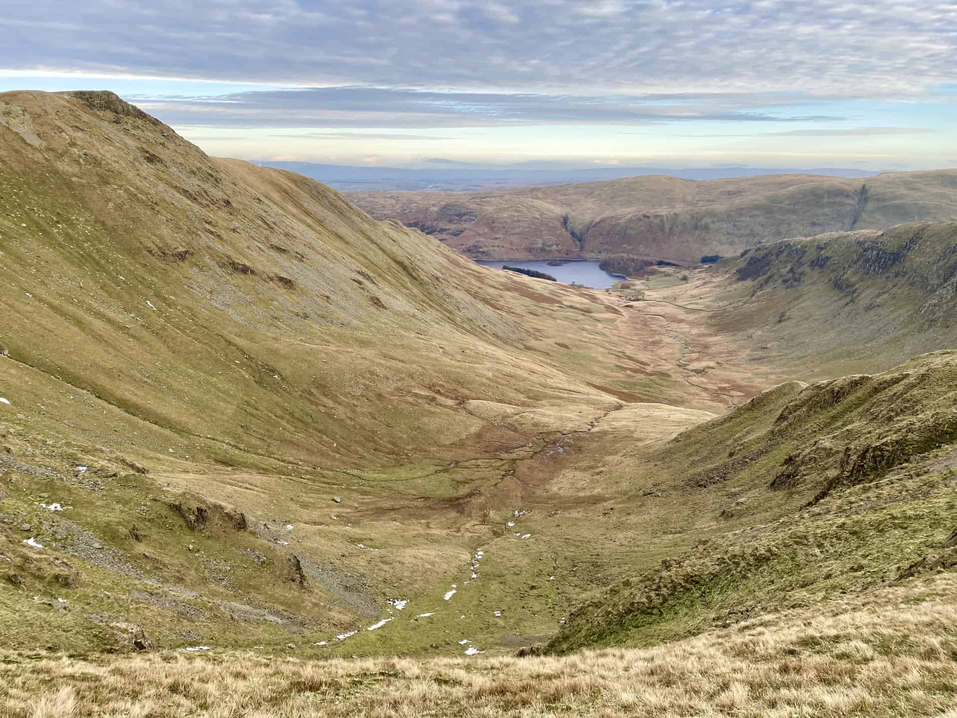
Looking back towards Thornthwaite Crag (horizon, centre) at the head of the Hayeswater Gill valley between High Street and Gray Crag.

Osprey Hikelite Unisex Backpack for Comfortable and Lightweight Hiking
AD The Osprey Hikelite backpack combines lightweight design with practical features, including a breathable mesh back panel, soft webbing straps, and stretch mesh water bottle pockets. With zipped storage and an organiser compartment, it is ideal for day hikes and outdoor use.
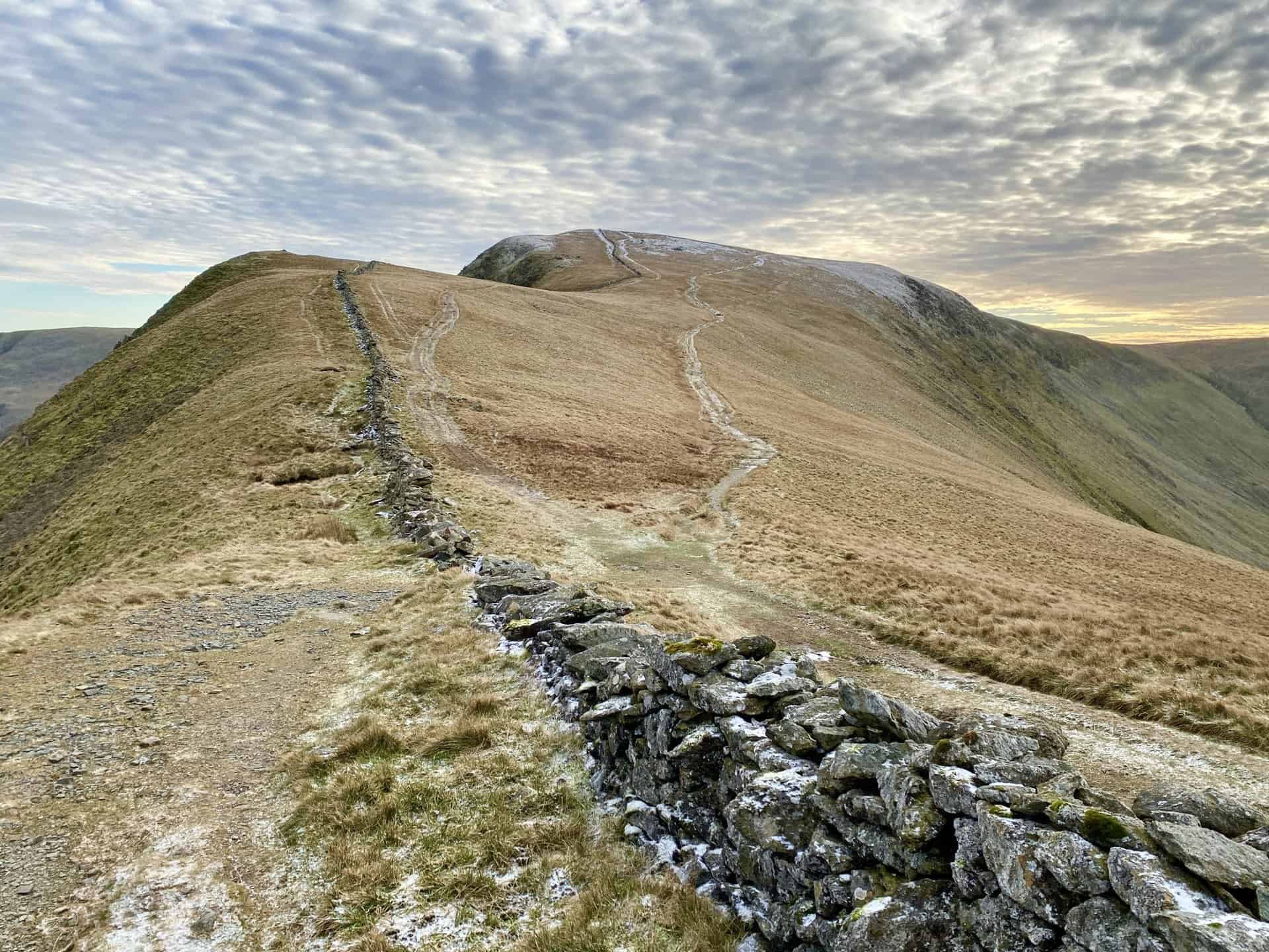
The dry stone wall leads directly to the summit of High Street, with paths on either side.
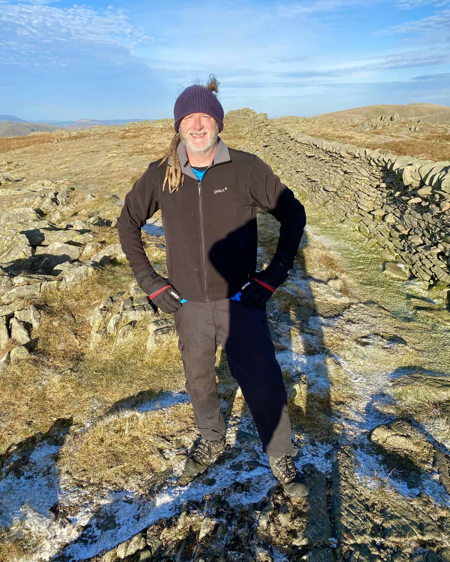
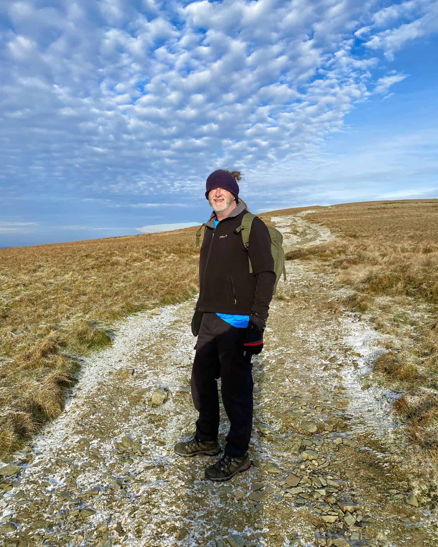
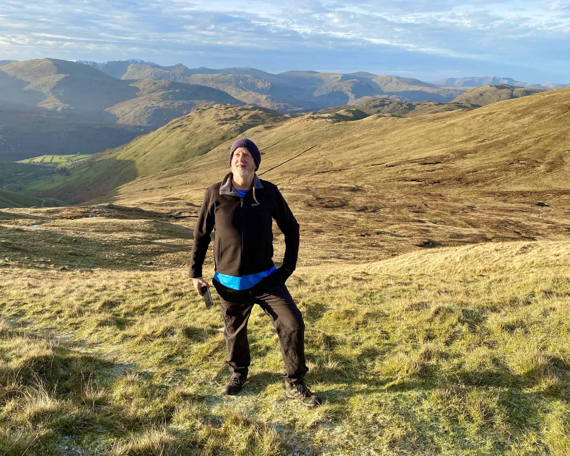
Kev strikes a pose on The Knott, height 739 metres (2425 feet). We are now three-quarters of the way round our Stony Cove Pike walk.
Osprey Hikelite Unisex Backpack for Comfortable and Lightweight Hiking
AD The Osprey Hikelite backpack combines lightweight design with practical features, including a breathable mesh back panel, soft webbing straps, and stretch mesh water bottle pockets. With zipped storage and an organiser compartment, it is ideal for day hikes and outdoor use.
Hayeswater nestled in the valley at the foot of Gray Crag (right).
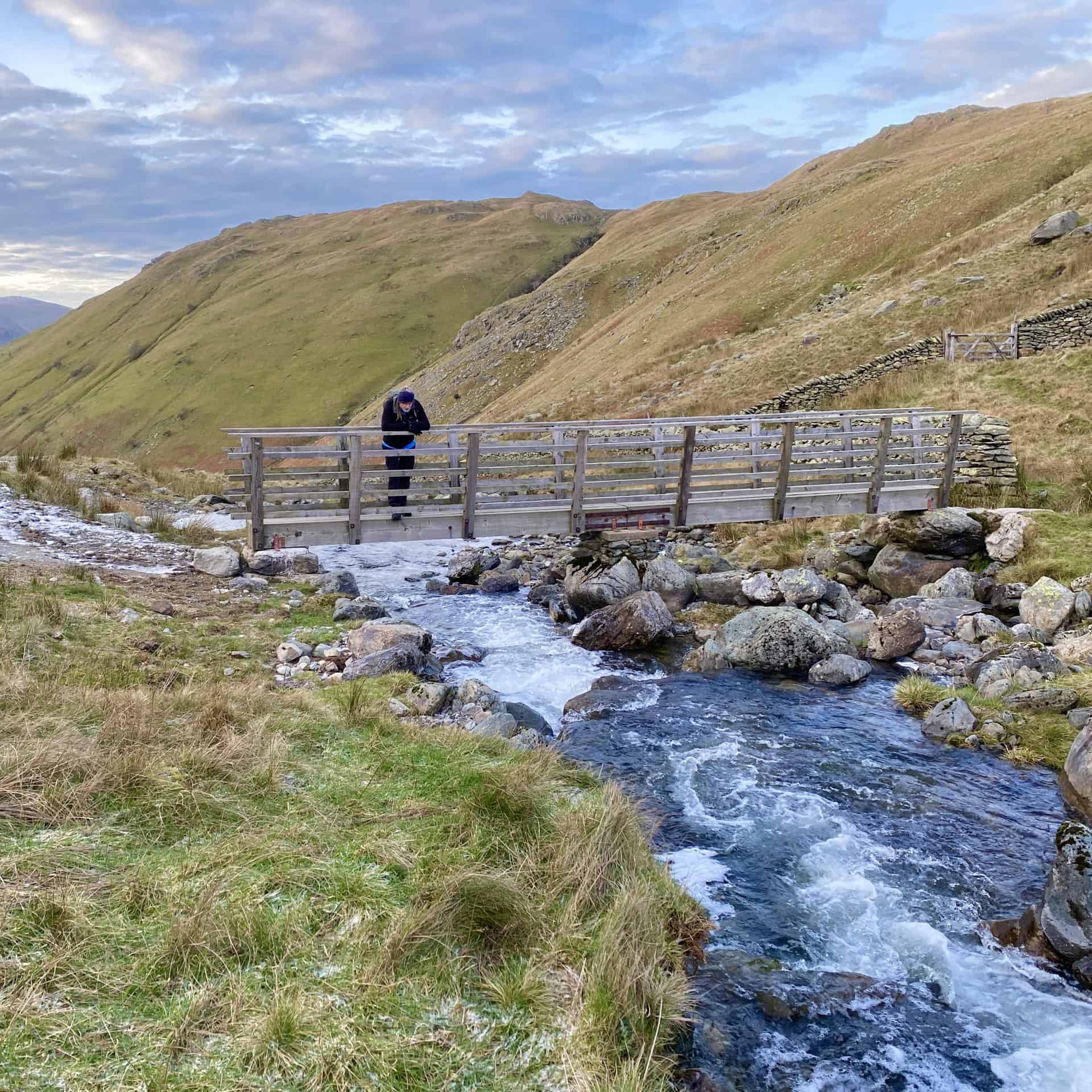
Footbridge across Hayeswater Gill, which flows west towards Hartsop. Along the way it merges with Pasture Beck and Kirkstone Beck and the resulting waters of Goldrill Beck head north and discharge into Ullswater.

Peak Bagging Wainwrights with Routes to Complete All Fells
AD This comprehensive guide offers 45 circular routes linking all 214 Wainwright fells. With maps, GPX downloads, elevation profiles, and practical advice, it provides efficient yet inspiring ways to complete this classic Lake District challenge at your own pace.
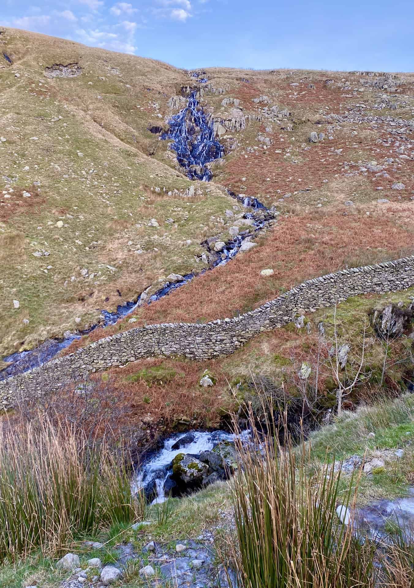
Waterfall created by Sulphury Gill on the western flanks of Rest Dodd / The Knott.
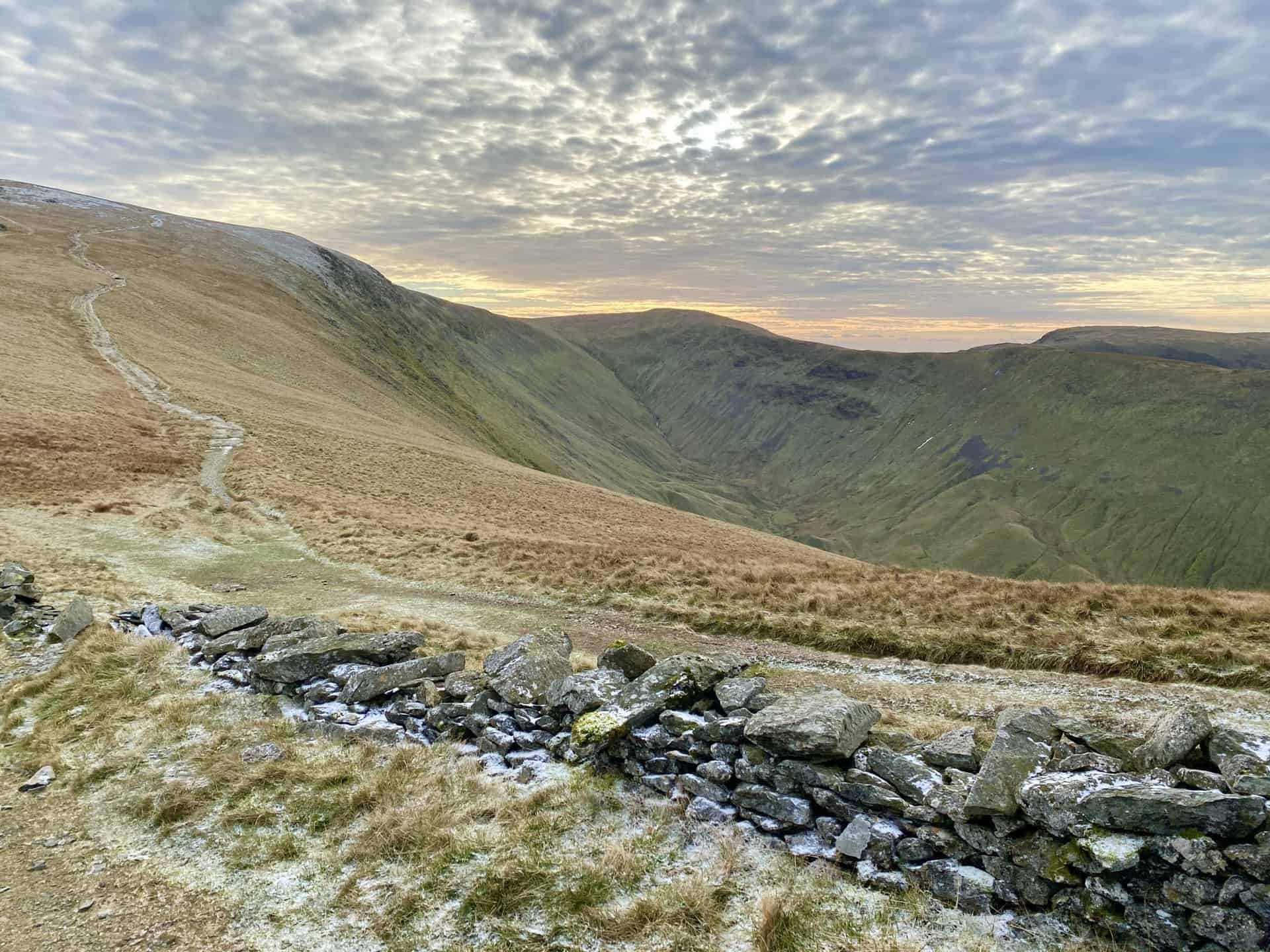
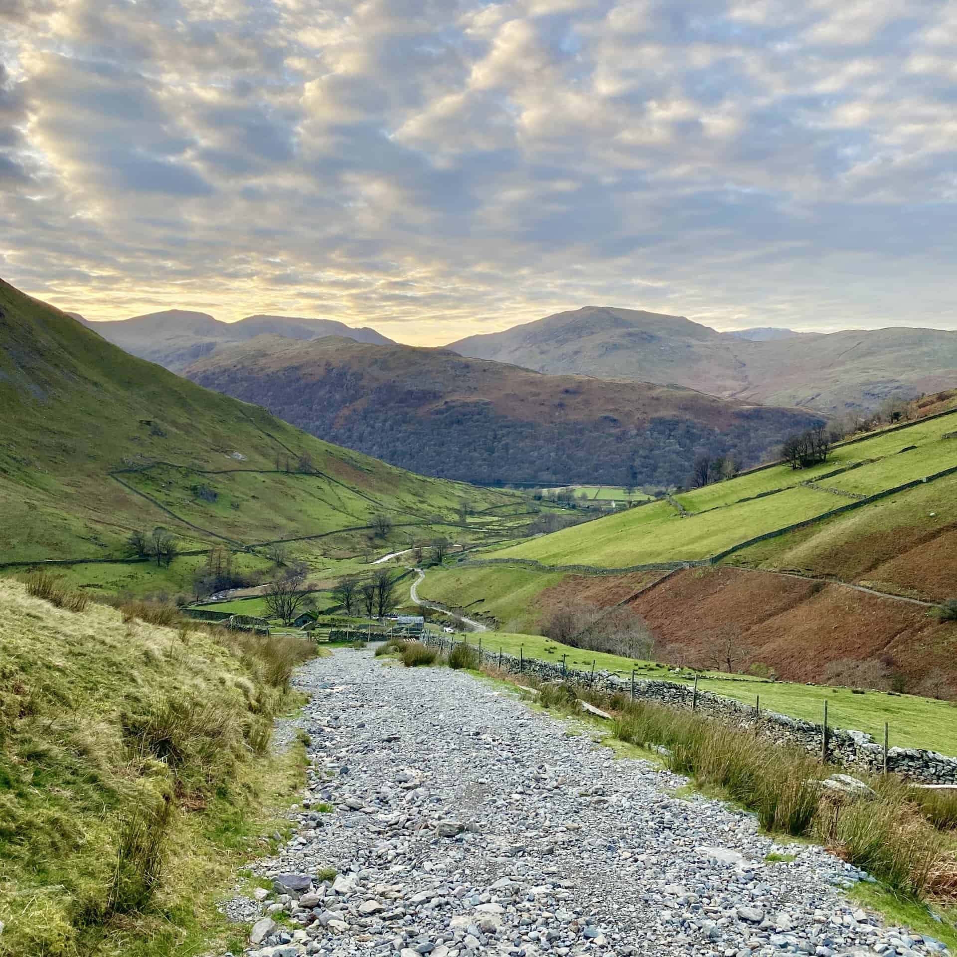
The stone track back to the hamlet of Hartsop and Cow Bridge just north of Brothers Water. A superb end to our Stony Cove Pike walk.
Peak Bagging Wainwrights with Routes to Complete All Fells
AD This comprehensive guide offers 45 circular routes linking all 214 Wainwright fells. With maps, GPX downloads, elevation profiles, and practical advice, it provides efficient yet inspiring ways to complete this classic Lake District challenge at your own pace.