Embrace the Beauty of the North York Moors on a Captivating Wainstones Walk
Begin your Wainstones walk from Chop Gate, nestled in the North York Moors. You’ll find ample parking at the village hall located at the southern tip of Chop Gate, adjacent to the B1257 Stokesley to Helmsley road.
Leaving the car park, head left up the road towards Chop Gate. Opposite the war memorial, take a left turn onto a road leading towards Carlton. Then, immediately swing right, walking behind the chapel. Here, a bridleway sign directs you north up the lane towards Chop Hill, setting the stage for your ascent.
Progress along Cold Moor Lane, then pass through the gate. Follow the path, roughly paralleling the dry stone wall with woodland to your right. Soon, veer away from the woodland, ascending northward. Approximately two miles on, the summit of Cold Moor unveils breathtaking views across the Tees Valley and beyond, marking a highlight of your Wainstones walk.
Turning right, the journey continues east along the Cleveland Way’s paved path. This route leads you down from Cold Moor, through fields, and up towards the rocky Wainstones. This iconic formation is a defining feature of the landscape.
Follow the Cleveland Way east over Hasty Bank, descending its eastern flank. After crossing the B1257, climb the steps back onto the Cleveland Way. Shortly past the gate at the hill’s crest, diverge right onto a marked bridleway, now heading south. Navigate a stream gully, veering right to traverse the steep western slopes of Urra Moor. Here, the Bilsdale valley unfolds to the west, offering a rewarding view of Cold Moor, which you explored earlier.
Continue south to a track junction at Medd Crag, turning right to descend from Urra Moor. This path leads to a minor road near Bilsdale Hall. Turn left, and follow this road to rejoin the B1257, where a left turn guides you back to the car park. This completes a splendid 8-mile journey through the North York Moors, enriched by the captivating Wainstones and diverse, stunning vistas.
Wainstones Walk: Maps and Tools
Visit either the OS Maps website or the Outdooractive website to view this walking route in greater detail. Both platforms offer a range of features, including the ability to print the route, download it to your device, and export the route as a GPX file. You can also watch a 3D fly-over and share the route on social media.
Wainstones Walk: Distance, Duration, Statistics
Distance: 8 miles
Distance: 13 kilometres
Duration: 4 hours
Ascent: 1699 feet
Ascent: 518 metres
Type: Circular walk
About the Wainstones
Natural Sculptures of the Moors
The Wainstones, nestled within the North York Moors National Park, are remarkable sandstone crags that form the largest such group in the moors. Their resistance to weathering has resulted in a stunning landscape of pillars, buttresses, joints, and fissures, sculpted by natural forces over millennia. The area’s unique acoustic feature, where the wind creates a wailing sound as it passes through the rocks, along with the intricate shapes, capture the imagination of visitors. The origin of the name ‘Wainstones’ is speculated to either come from their resemblance to a ‘Wain’ or ‘Wagon’ or from a legend involving the slaying of a Danish chieftain, suggesting a profound historical depth that adds to the allure of the location.
The Wainstones Walk and Cleveland Way
Positioned at the western end of Hasty Bank, overlooking the village of Great Broughton, the Wainstones offer a memorable experience for those embarking on the Wainstones walk. This trek is part of the Cleveland Way, a national trail that provides a panoramic view of the North York Moors, extending 109 miles from the quaint town of Helmsley to the coastal town of Filey. The trail, celebrated for its stunning vistas of dramatic coastlines and heather-covered moorland, draws both seasoned hikers and casual visitors. Annually, up to 2000 adventurers complete the entire Cleveland Way, with many others enjoying shorter segments, including the picturesque Wainstones walk.
Climbers’ Haven and Natural Beauty
The popularity of the Wainstones among rock climbers is well-deserved, with challenges like the twin pillars of the steeple and the needle offering unique climbing experiences. These natural formations, coupled with the vibrant heather bloom in late summer, underscore the appeal of the Wainstones walk within the larger Cleveland Way trail. It serves as a gateway for those eager to immerse themselves in the beauty and heritage of England’s countryside, making it a prime destination for anyone seeking to connect with the natural world and explore the rich tapestry of England’s natural and cultural heritage.
No Connection to Alfred Wainwright
As far as I know, the Wainstones are not related to Alfred Wainwright or his works. Alfred Wainwright was renowned for his detailed guidebooks and illustrations of the Lakeland Fells in the English Lake District, rather than the North York Moors where the Wainstones are located. His famous ‘Pictorial Guide to the Lakeland Fells,’ focuses mainly on the Lake District, and there’s no direct connection between his publications and the Wainstones.
Recommended Ordnance Survey Map
The best map to use on this walk is the Ordnance Survey map of the North York Moors Western Area, reference OS Explorer OL26, scale 1:25,000. It clearly displays footpaths, rights of way, open access land and vegetation on the ground, making it ideal for walking, running and hiking. The map can be purchased from Amazon in either a standard, paper version or a weatherproof, laminated version, as shown below.
Wainstones Walk: My Photos
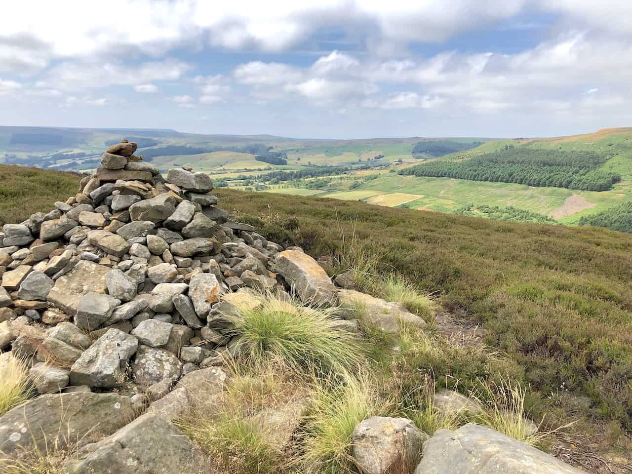
Cairn at the top of Cold Moor, standing at an elevation of 390 metres (1280 feet), marks a serene waypoint for hikers.
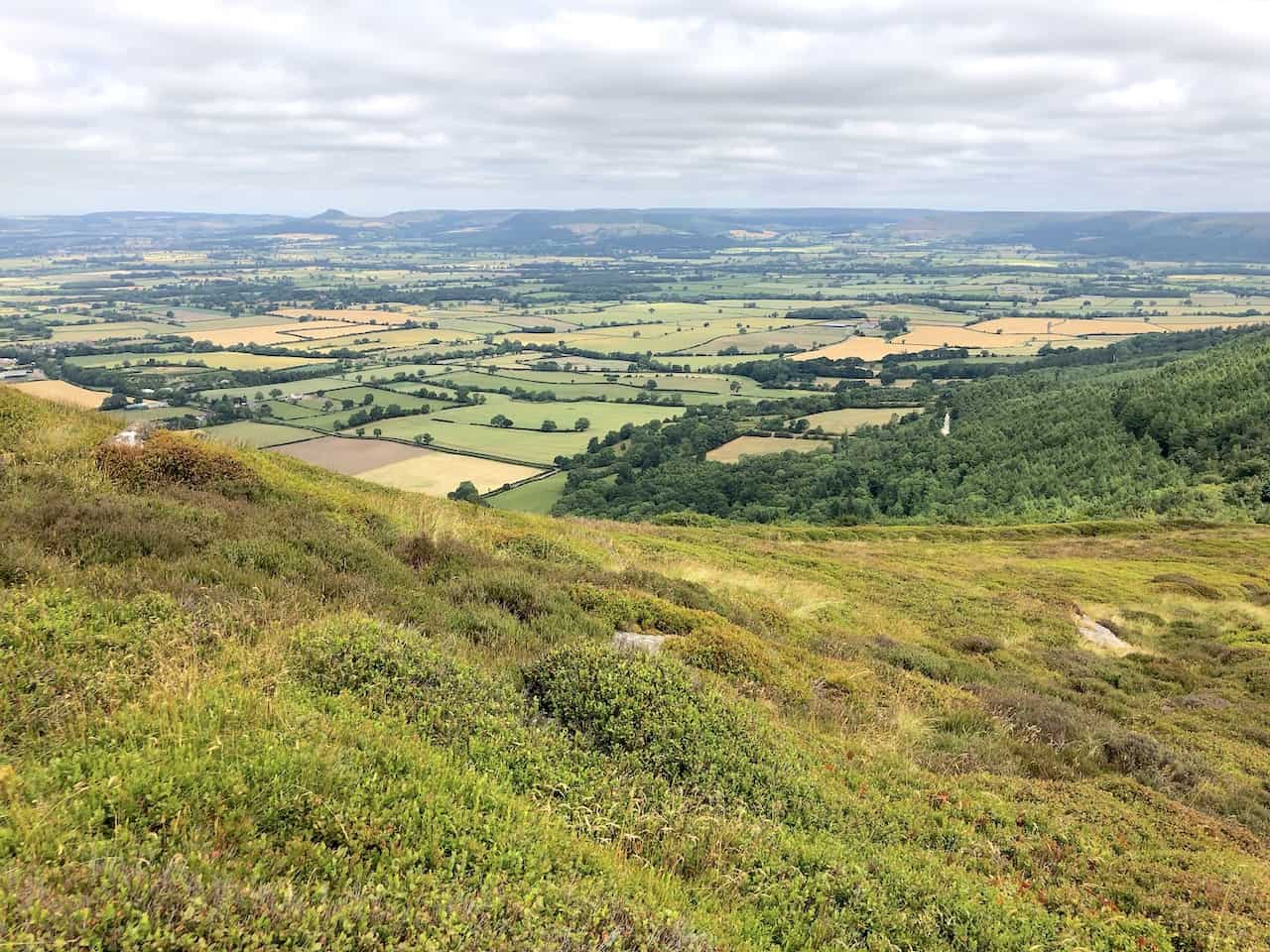
Gazing across to the Wainstones from the vantage point of Cold Moor offers a breathtaking view.

Walking in the Yorkshire Dales with 43 Circular Routes
AD This Cicerone guidebook includes 43 circular walks exploring valleys, hills, and moors between Kirkby Stephen and Pateley Bridge. With OS maps, local highlights, and routes ranging from 3–11 miles, it is a year-round companion for walkers of all abilities.
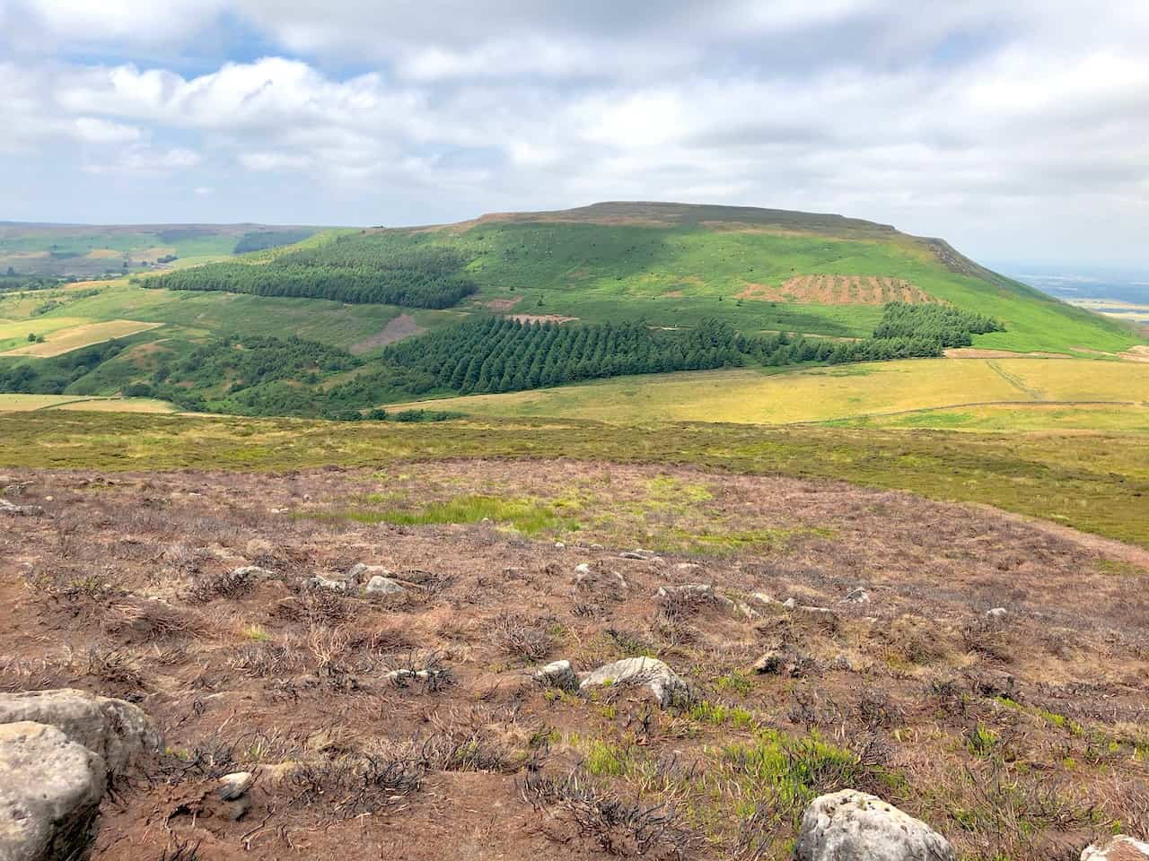
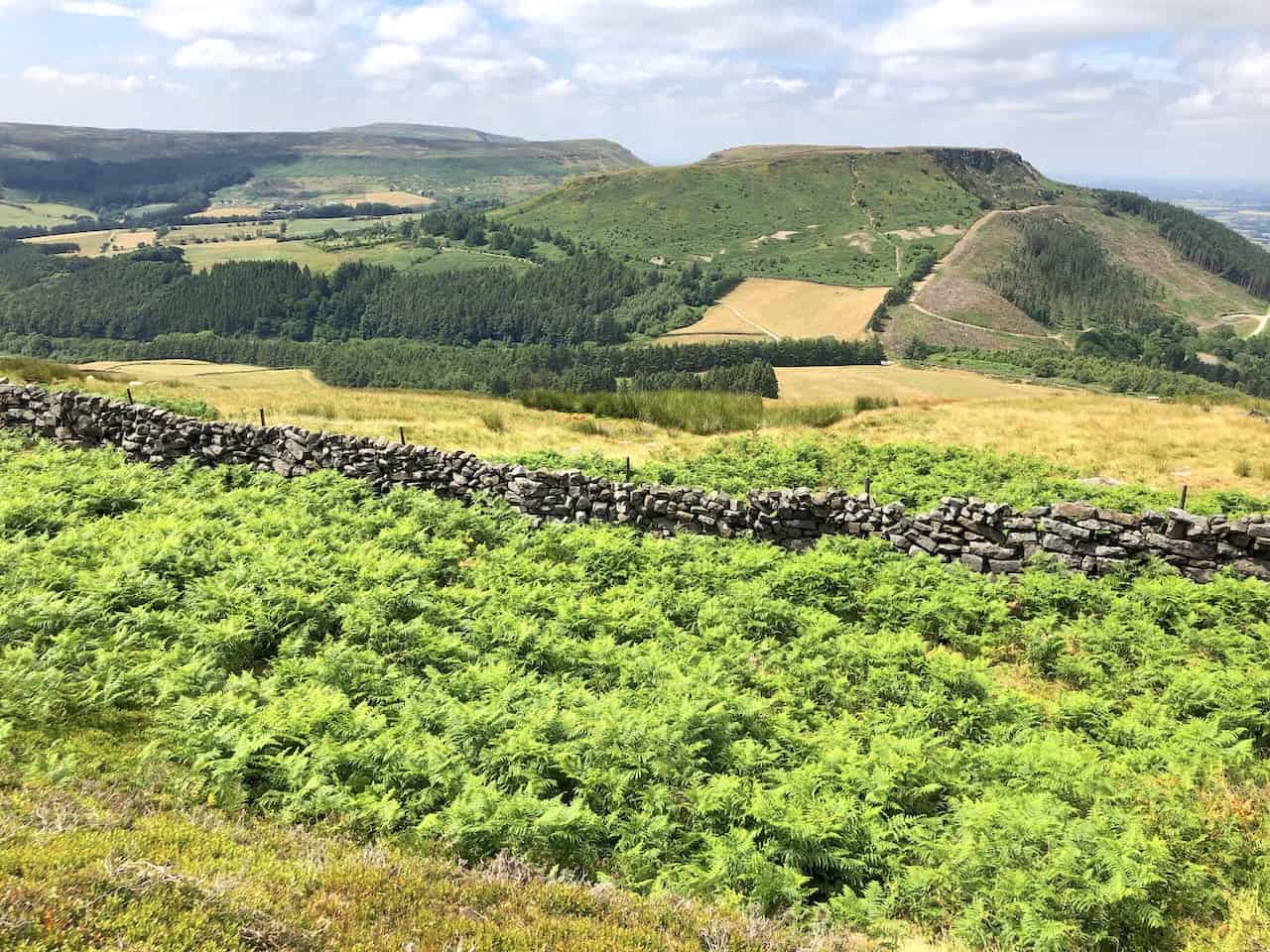
The shape of Cringle Moor, as viewed from Cold Moor, paints a captivating landscape.

Grisport Unisex Adult Peaklander Hiking Boots
AD The Grisport Unisex Adult Peaklander Hiking Boots are crafted in Italy with a durable waxed leather upper, Spotex breathable lining, and a reliable Track-on rubber sole. Waterproof and weighing just 1120g, they offer comfort, resilience, and dependable performance on demanding trails.
From the northward view along the Cleveland Way on Cold Moor, the distinctive shape of Roseberry Topping emerges on the horizon, to the right of centre. The charming village of Great Broughton nestles in the landscape’s top third, on the left.
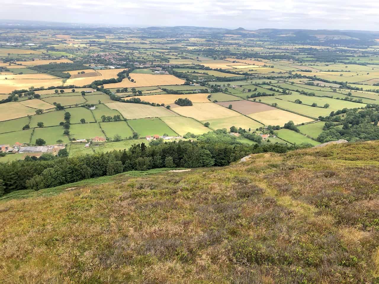
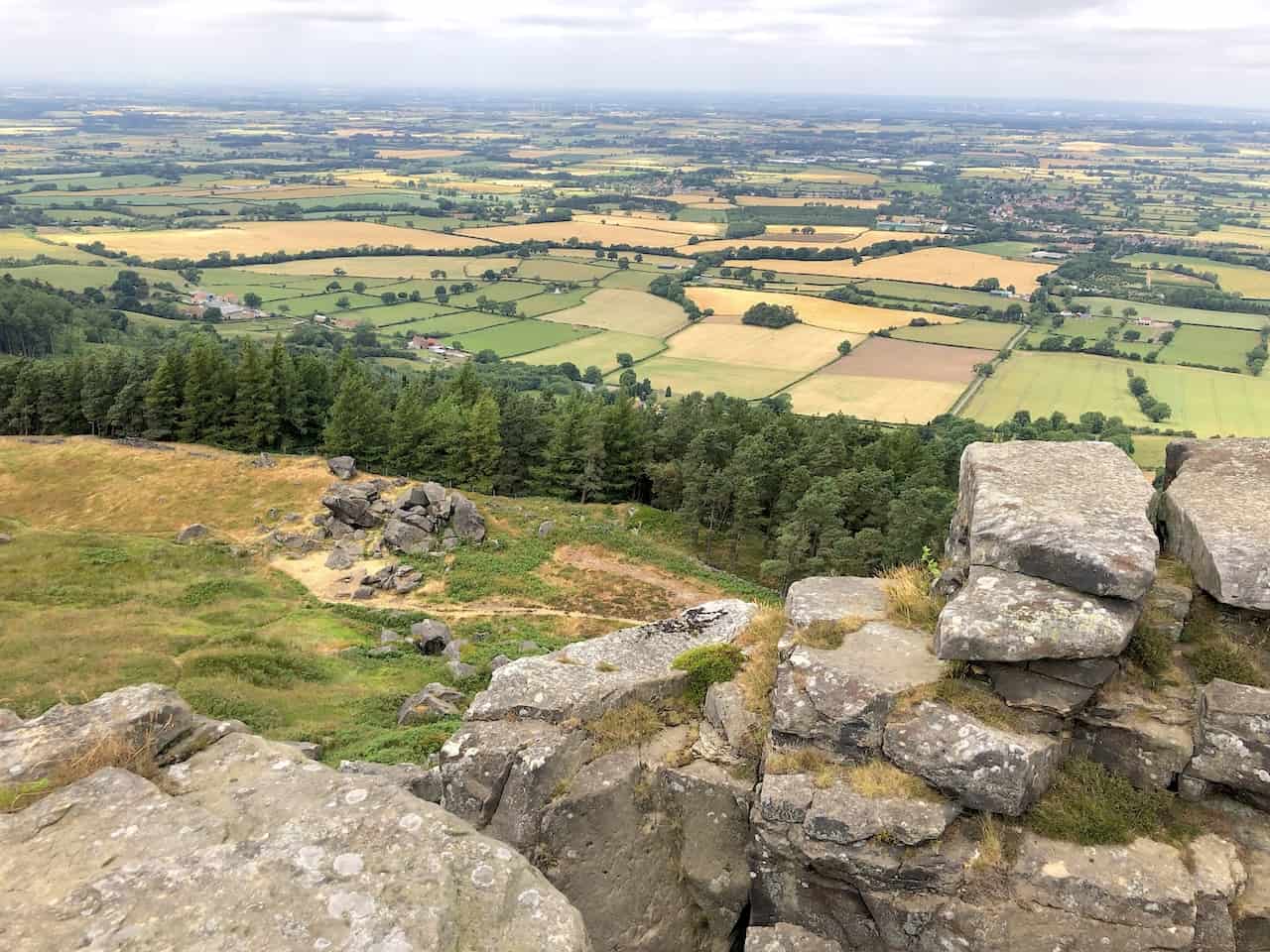
The north-western vista from Cold Moor unfolds over the Tees Valley lowlands, offering expansive views of this amazing area.
Grisport Unisex Adult Peaklander Hiking Boots
AD The Grisport Unisex Adult Peaklander Hiking Boots are crafted in Italy with a durable waxed leather upper, Spotex breathable lining, and a reliable Track-on rubber sole. Waterproof and weighing just 1120g, they offer comfort, resilience, and dependable performance on demanding trails.
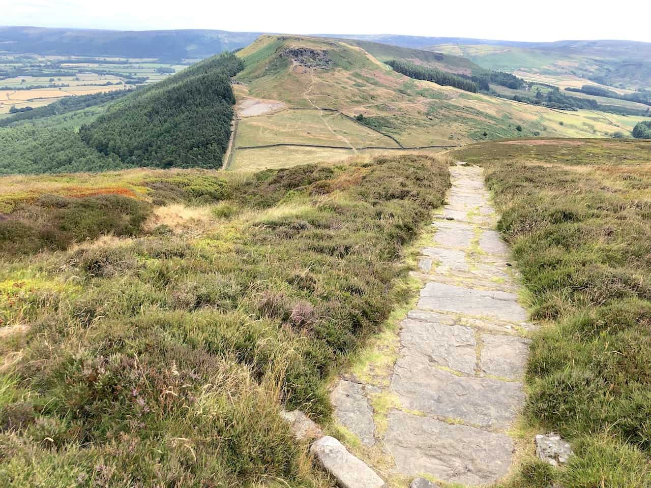
Embarking on this Wainstones walk, heading east and leaving Cold Moor via the Cleveland Way, leads to a stimulating ascent up Hasty Bank to reach the Wainstones.

Fifty Walks Across the Beautiful North York Moors National Park
AD Discover 50 routes across the North York Moors, from short easy strolls to challenging high-level hikes. With OS maps, route descriptions, and local highlights, it also includes the legendary 40-mile Lyke Wake Walk, described in four accessible stages.
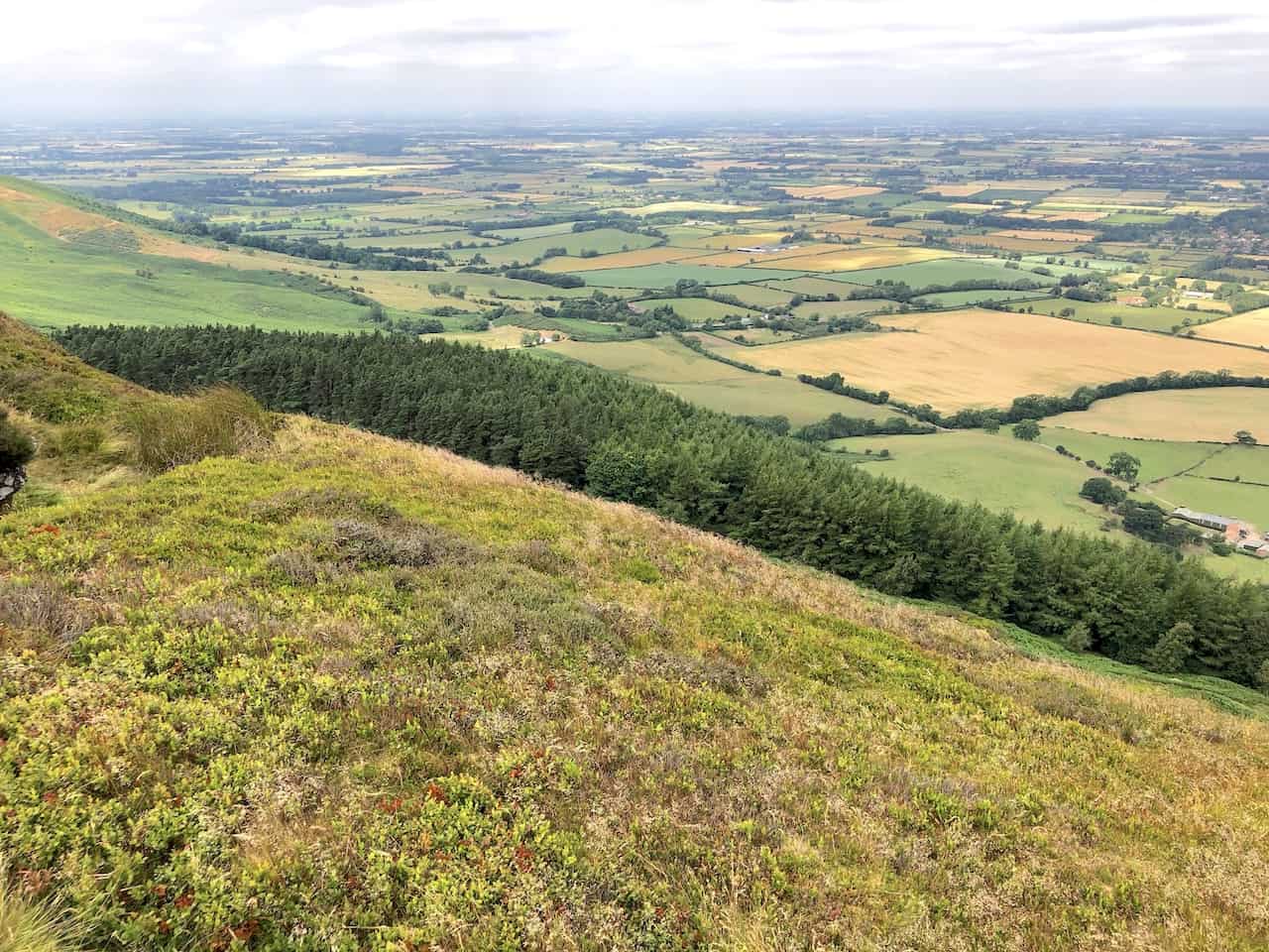
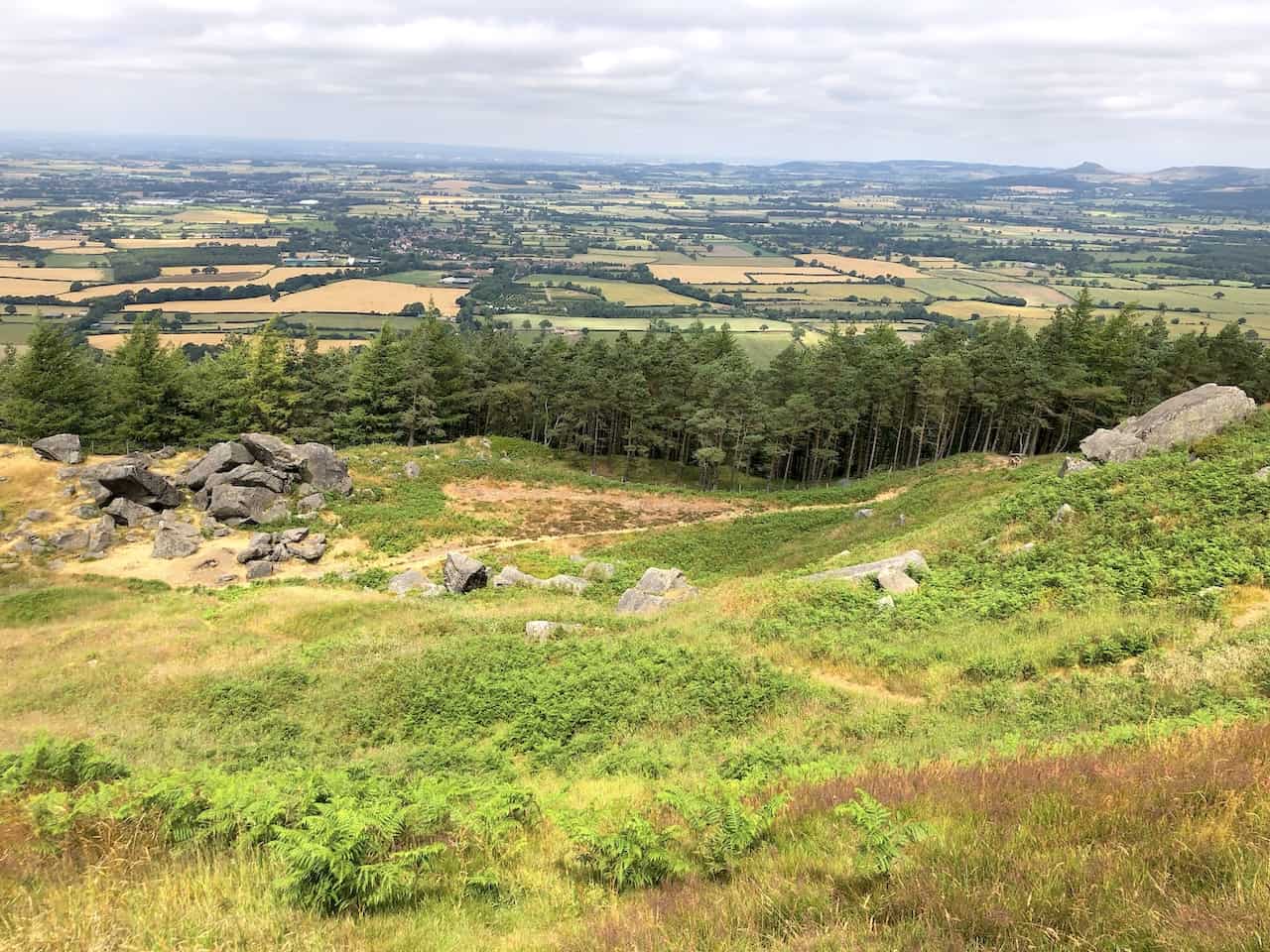
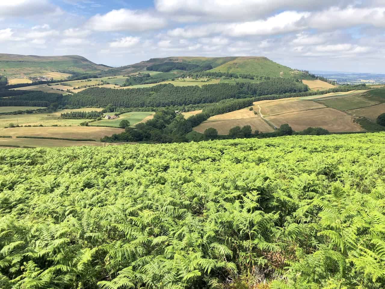
The patchwork of farmland in the Ingleby Greenhow area lies nestled below the Cleveland Hills, a testament to the region’s rich agricultural heritage.
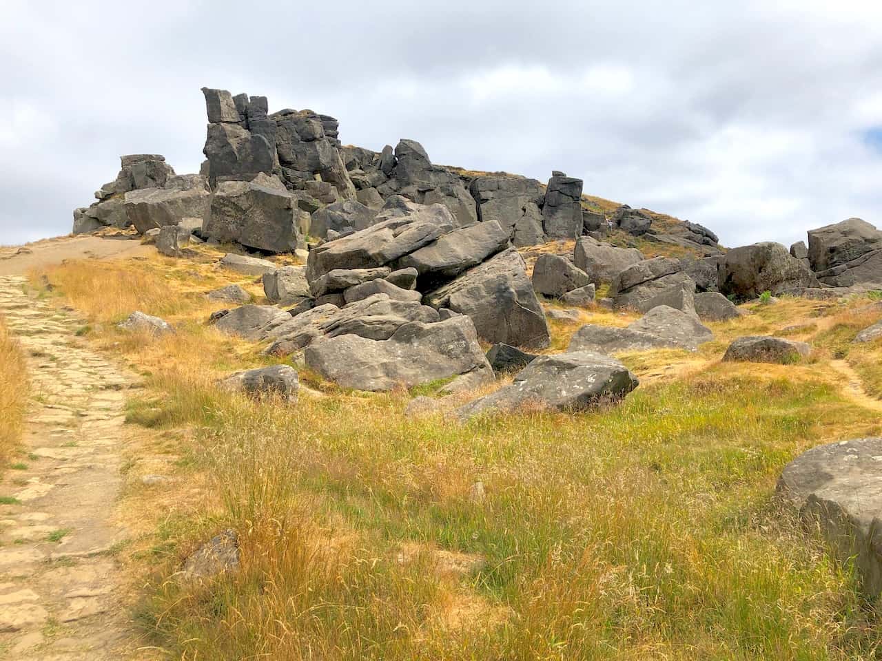
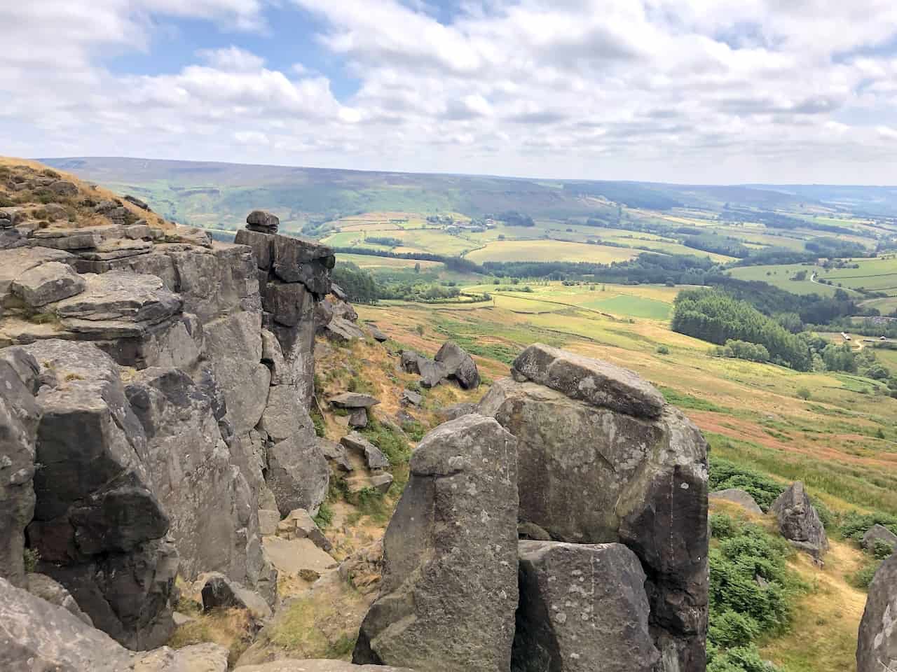
The Wainstones, a striking rocky outcrop at the western extremity of Hasty Bank, presents a rugged face to the observer.
Fifty Walks Across the Beautiful North York Moors National Park
AD Discover 50 routes across the North York Moors, from short easy strolls to challenging high-level hikes. With OS maps, route descriptions, and local highlights, it also includes the legendary 40-mile Lyke Wake Walk, described in four accessible stages.
A full 360° panorama awaits at the Wainstones, offering spectacular views that stretch out in every direction.

Osprey Hikelite Unisex Backpack for Comfortable and Lightweight Hiking
AD The Osprey Hikelite backpack combines lightweight design with practical features, including a breathable mesh back panel, soft webbing straps, and stretch mesh water bottle pockets. With zipped storage and an organiser compartment, it is ideal for day hikes and outdoor use.
The Cleveland Way traces a scenic route across Hasty Bank, forming part of the larger journey through this picturesque region.
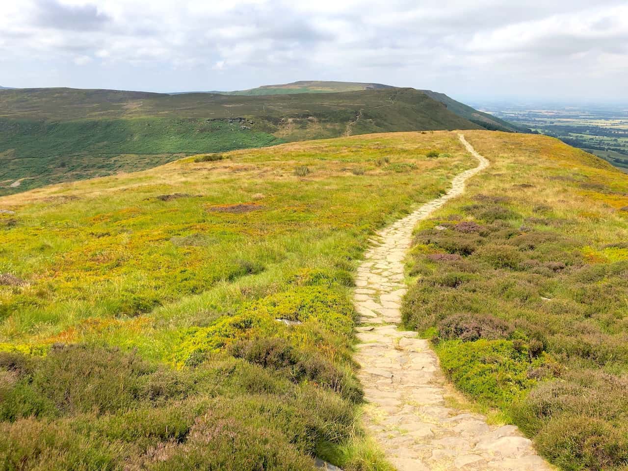
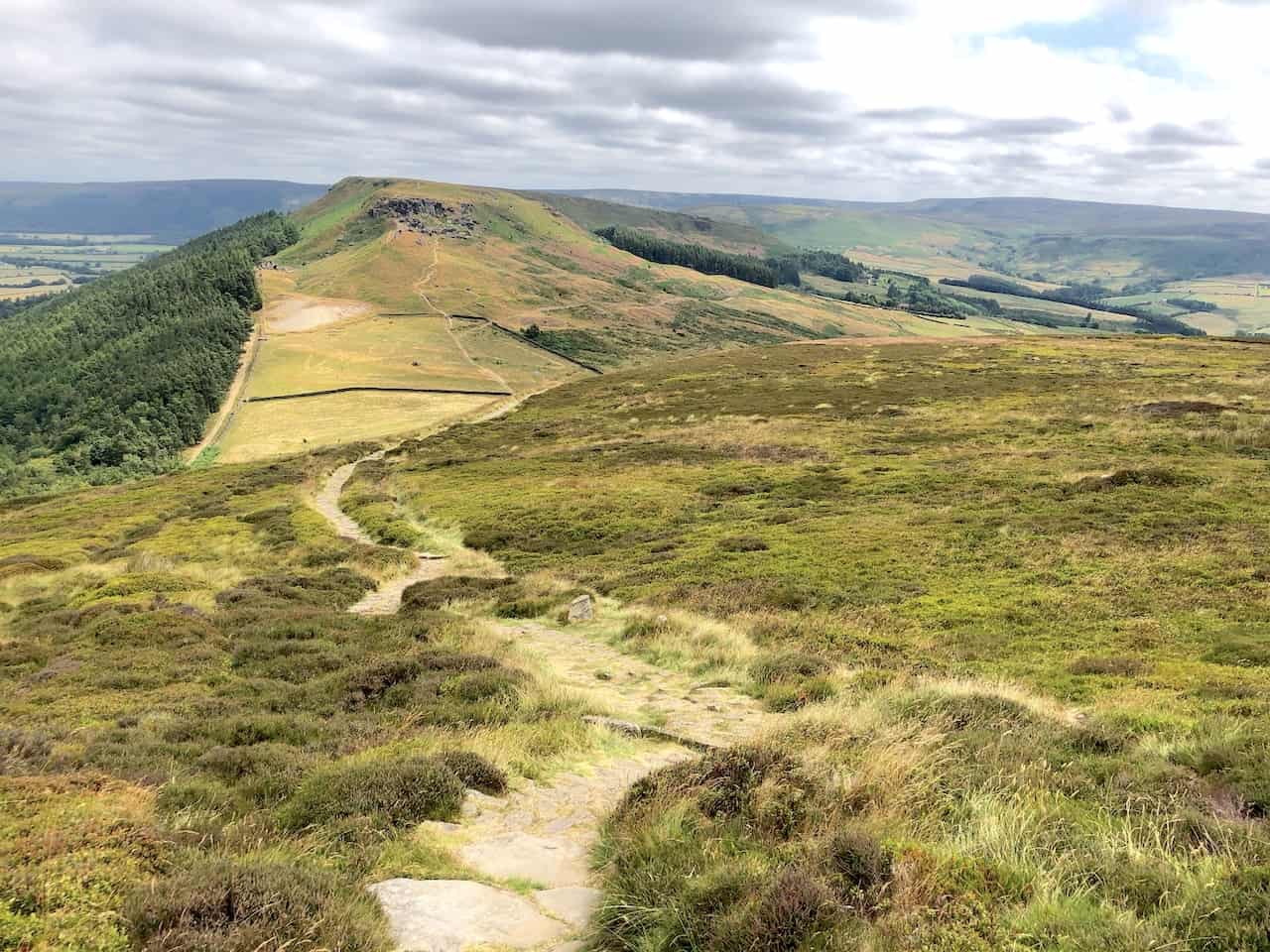
The Wainstones walk east on the Cleveland Way involves a descent to leave Hasty Bank followed by a vigorous climb to the top of Urra Moor.

Peak Bagging Wainwrights with Routes to Complete All Fells
AD This comprehensive guide offers 45 circular routes linking all 214 Wainwright fells. With maps, GPX downloads, elevation profiles, and practical advice, it provides efficient yet inspiring ways to complete this classic Lake District challenge at your own pace.
The westerly perspective towards Hasty Bank (centre) and Cold Moor (left), with Cringle Moor just peeking out behind Cold Moor, showcases the layered beauty of the landscape.
Viewing west, the arrangement of Hasty Bank, Cold Moor, and Cringle Moor unfolds in a stunning display of natural beauty.
Peak Bagging Wainwrights with Routes to Complete All Fells
AD This comprehensive guide offers 45 circular routes linking all 214 Wainwright fells. With maps, GPX downloads, elevation profiles, and practical advice, it provides efficient yet inspiring ways to complete this classic Lake District challenge at your own pace.
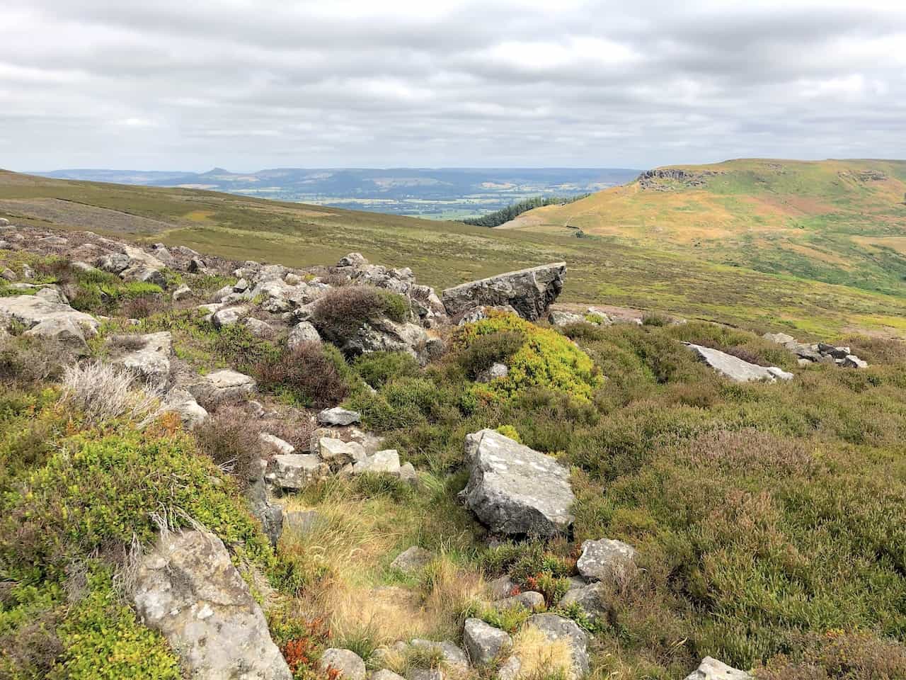
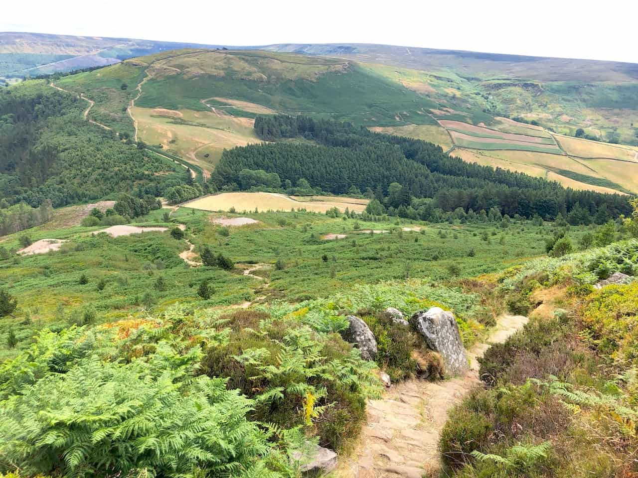
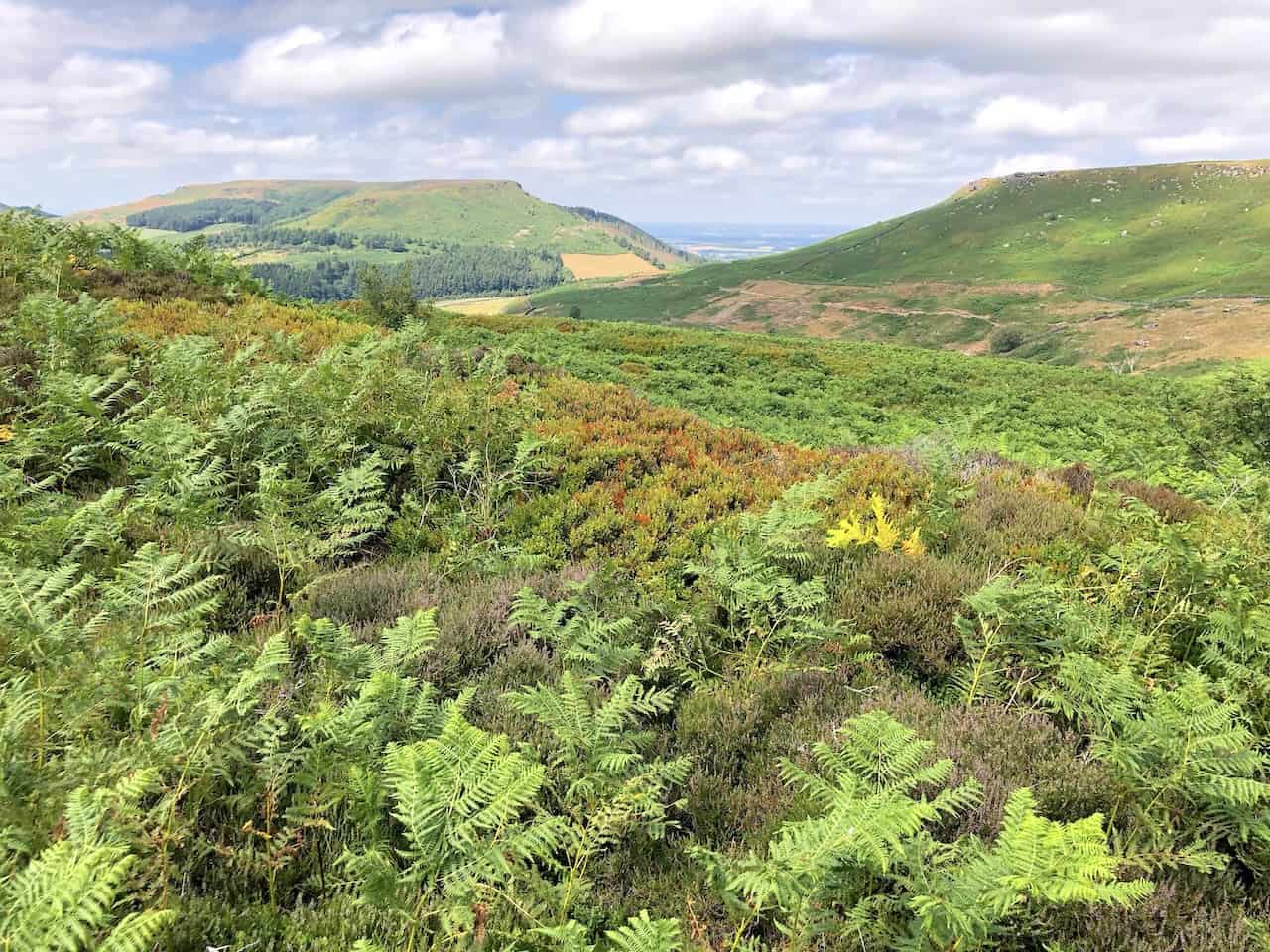
Crossing Urra Moor offers a Wainstones walk that brings you close to Round Hill, the loftiest peak in the North York Moors at 454 metres (1490 feet), a highlight of the area’s rugged terrain.


Berghaus Hillmaster II GTX Men's High Rise Hiking Boots
AD The Berghaus Hillmaster II GTX men’s hiking boots feature a waterproof, breathable GORE-TEX membrane, a memory foam tongue and collar for a personalised fit, and a Vibram sole delivering exceptional grip, stability, and shock protection for confident performance on any terrain.
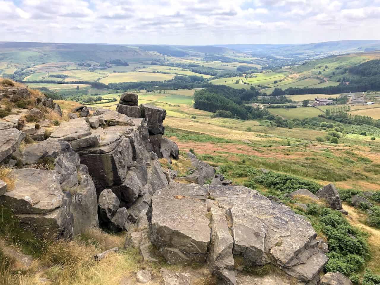
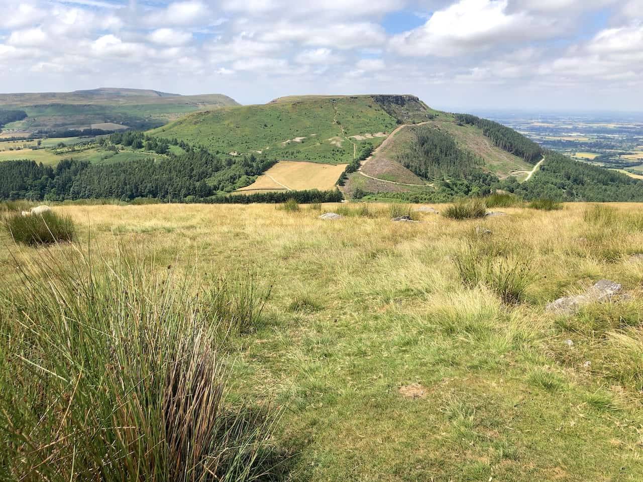
The southern aspect of Hasty Bank viewed from Urra Moor reveals the varied textures and colours of the landscape, enhancing the allure of the Wainstones walk.
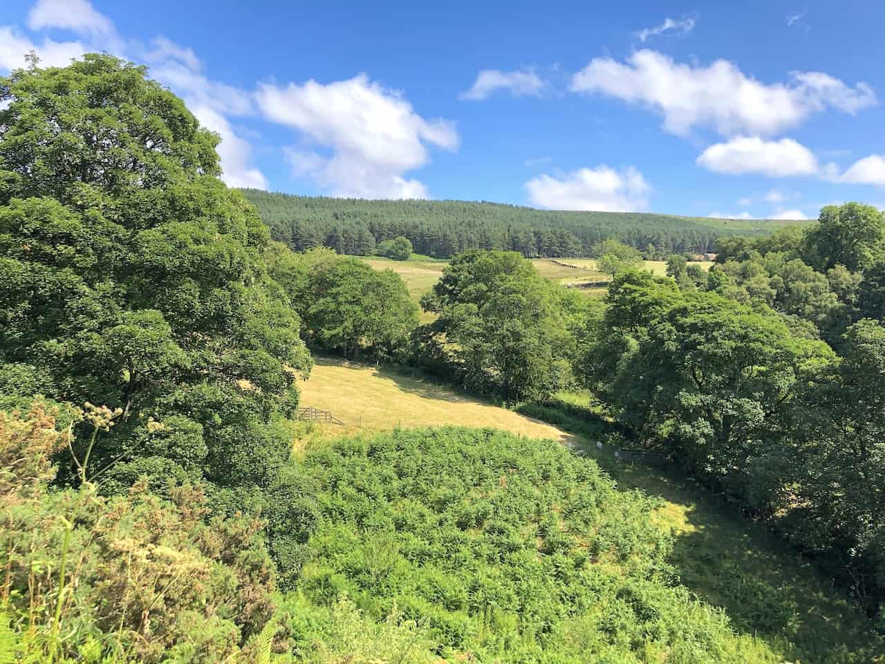
Near Bilsdale Hall, Seave Green, the scenery is simply stunning, making it a perfect spot to pause and appreciate the serene beauty of the area during your Wainstones walk.
Berghaus Hillmaster II GTX Men's High Rise Hiking Boots
AD The Berghaus Hillmaster II GTX men’s hiking boots feature a waterproof, breathable GORE-TEX membrane, a memory foam tongue and collar for a personalised fit, and a Vibram sole delivering exceptional grip, stability, and shock protection for confident performance on any terrain.