How this Place Fell Walk Offers the Best of Ullswater’s Landscape
Embark on this captivating Place Fell walk from the quaint Lake District village of Patterdale, nestled at the southern tip of Ullswater. Convenient parking is available opposite the Patterdale Hotel, on the A592. From here, stride south-east along the footpath that skirts the main road, leaving the heart of the village behind.
As you proceed, you will soon encounter a small road to your left, crossing Kirkstone Beck. Follow this road through a tiny hamlet and continue to the end where a signposted track to Boredale Hause beckons. This route ascends steeply, offering breathtaking early views of the surrounding area, despite its relatively low elevation.
Upon reaching Boredale Hause, the trail climbs sharply northwards. Your first goal is the cairn at Round Howe, followed by a trek across a flatter section leading to the summit of Place Fell. Here, prepare to be amazed by expansive views over Ullswater and the diverse Lake District landscape, encompassing valleys, hills, and distant mountains.
From the summit of Place Fell, navigate around the western and northern edges of the mountaintop, moving in a clockwise direction towards Low Moss. After this segment, a moderate ascent leads to High Dodd. Continue north-east, descending towards Sleet Fell, and then steeply down to connect with the Ullswater Way at Sandwick.
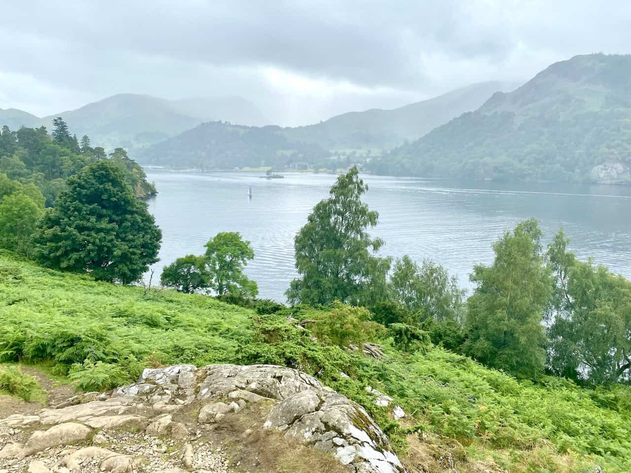
Follow the Ullswater Way south-west beneath Place Fell’s steep slopes. This section, though undulating and occasionally strenuous, is immensely rewarding with its lakeside views. The path leads you to Silver Bay and then runs south parallel to the shoreline.
Conclude your Place Fell walk by turning right at Side Farm to return to Patterdale. This enjoyable route covers just over 8½ miles, presenting a delightful contrast between high fell landscapes and serene lakeside paths. Whether you hike, walk, or simply stroll, this journey through the Lake District’s stunning scenery is sure to captivate and inspire.
Place Fell Walk: Maps and Tools
Visit either the OS Maps website or the Outdooractive website to view this walking route in greater detail. Both platforms offer a range of features, including the ability to print the route, download it to your device, and export the route as a GPX file. You can also watch a 3D fly-over and share the route on social media.
Place Fell Walk: Distance, Duration, Statistics
Distance: 8½ miles
Distance: 13¾ kilometres
Duration: 4¾ hours
Ascent: 2567 feet
Ascent: 782 metres
Type: Circular walk
About Place Fell
Geographical Setting and Paths
Place Fell stands at the intersection of the upper and middle reaches of Ullswater. Its western flanks, which are steep, overlook the villages of Glenridding and Patterdale. The fell is bordered on the north and west by Ullswater, and these sides generally drop sharply to the shore. On the lower slopes, several wooded areas are found. An exception is Silver Point, a promontory that divides the upper and middle sections of the lake. It consists of Silver Crag, an outlier separate from the main bulk of the fell. The lakeshore path running from Sandwick in the north to Patterdale in the south has been praised by Wainwright as Lakeland’s most scenic and rewarding walk. To the south of the lake, the steep slopes of Place Fell rise above Patterdale village, reaching Boredale Hause by the valley of Goldrill Beck.
Eastern Boundaries and Place Fell Walks
The eastern border of Place Fell is Boredale, one of the Martindale valleys. This side features numerous steep crags. Moving up Boredale, the valley shifts south-west, seeming to head towards Patterdale and almost cutting off the fell from its neighbouring fells. The narrow ridge at Boredale Hause connects Place Fell to the main body of the far eastern fells. A small ruin, named the ‘Chapel in the Hause’ on OS maps, is located at the top of the pass. From the hause, the ridge heads south along a well-trodden path to Angletarn Pikes, initially passing the subsidiary top of Stony Rigg. This junction also offers routes to Patterdale, Boredale, Bannerdale via Beda Fell, and Hartsop, as well as a path up Steel Edge to Place Fell’s summit.
Summit and Surrounding Features
The summit of Place Fell features a broad plateau with the highest point at the south-west corner. From here, the rocky Hart Crag ridge extends north-east for a short distance across the plateau, dotted with small tarns. Continuing in this direction, the terrain narrows as it lowers to Low Moss, followed by the secondary tops of High Dodd and Sleet Fell. Another ridge descends north from the summit, starting at The Knight, a rock outcrop notable for its peaked appearance from the north. It descends past Bleaberry Knott and Low Birk Fell, curving east above the middle reach of Ullswater. Low Birk Fell is distinguished by a prominent beacon visible from Sandwick.
Nestled between the Bleaberry Fell and High Dodd ridges lies Scalehow Beck valley, providing significant drainage for Place Fell’s northern area. The summit hosts a triangulation column and cairn, situated about ten yards apart on competing high points. The cairn, positioned above Ullswater, offers outstanding views of the valleys from Glencoyne to Kirkstone and the rugged eastern faces of the Helvellyn range.
Place Fell Ranking in Wainwright’s Guide
In Alfred Wainwright’s book, The Far Eastern Fells, published in May 1957, Place Fell is ranked as the 108th Wainwright fell in terms of its height. It stands 657 metres (2156 feet) tall and is located at Ordnance Survey grid reference NY 405 169, mapped on Explorer OL5 and Landranger 90. For more information, visit my blogs titled List of Wainwrights: Alfred Wainwright’s 214 Lake District Fells and Map of Wainwrights: Interactive Guide to All 214 Lake District Fells.
Recommended Ordnance Survey Map
The best map to use on this walk is the Ordnance Survey map of the Lake District North-Eastern Area, reference OS Explorer OL5, scale 1:25,000. It clearly displays footpaths, rights of way, open access land and vegetation on the ground, making it ideal for walking, running and hiking. The map can be purchased from Amazon in either a standard, paper version or a weatherproof, laminated version, as shown below.
Standard Version
Place Fell Walk: My Photos
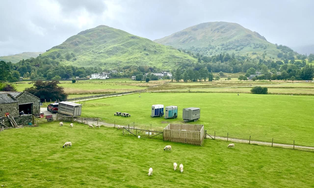
Looking over to Place Fell from the start of this Place Fell walk in Patterdale.
The view across the valley floor at Patterdale towards the hills of Glenamara Park.

Walking in the Yorkshire Dales with 43 Circular Routes
AD This Cicerone guidebook includes 43 circular walks exploring valleys, hills, and moors between Kirkby Stephen and Pateley Bridge. With OS maps, local highlights, and routes ranging from 3–11 miles, it is a year-round companion for walkers of all abilities.
Hartsop above How in the centre of the picture with Brothers Water peeping out on the left.

Grisport Unisex Adult Peaklander Hiking Boots
AD The Grisport Unisex Adult Peaklander Hiking Boots are crafted in Italy with a durable waxed leather upper, Spotex breathable lining, and a reliable Track-on rubber sole. Waterproof and weighing just 1120g, they offer comfort, resilience, and dependable performance on demanding trails.
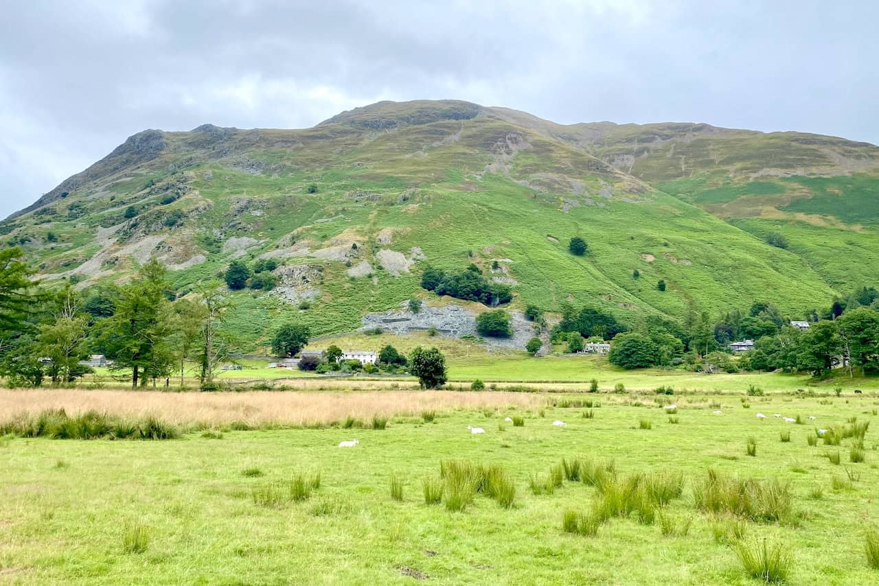
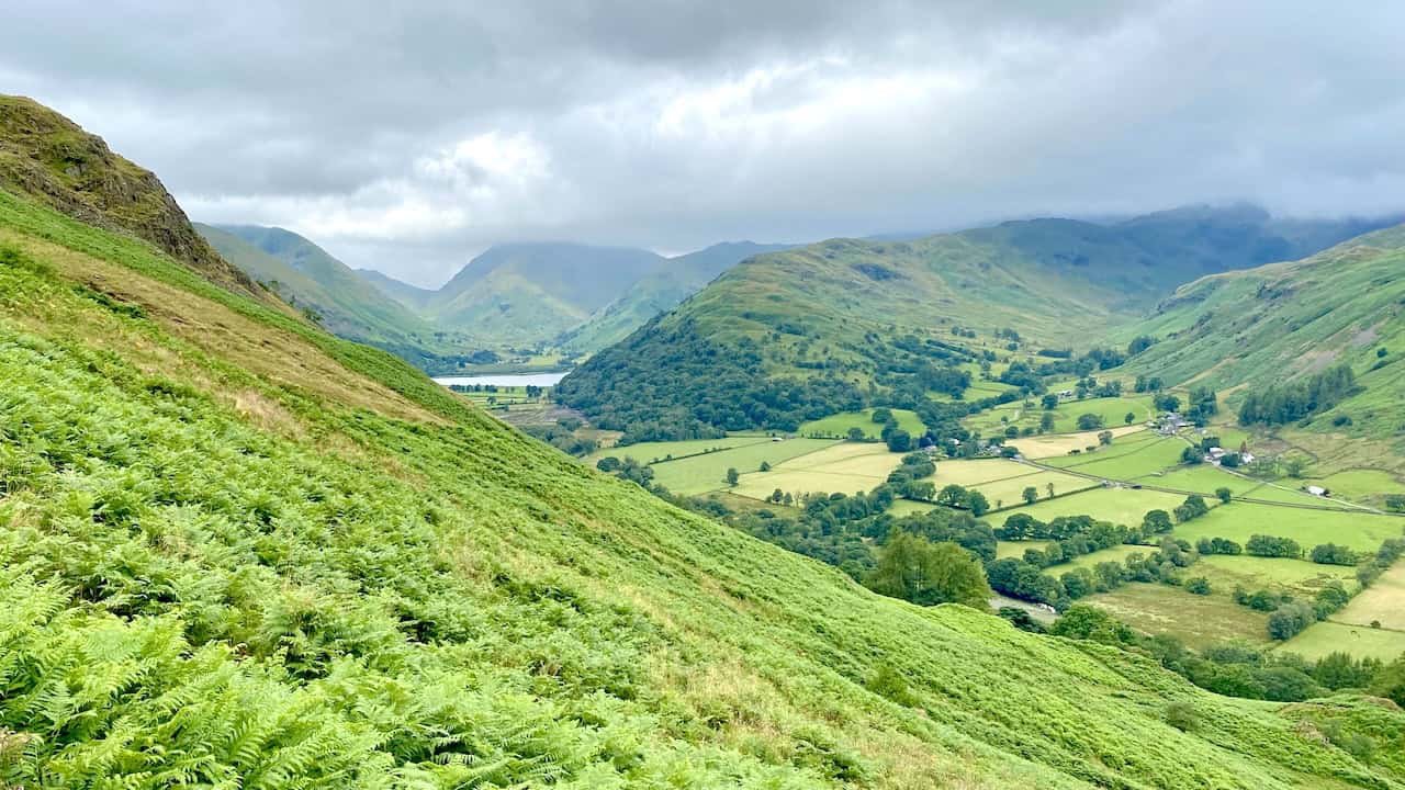
Looking back towards Glenridding and the southern tip of Ullswater during the climb to Boredale Hause.
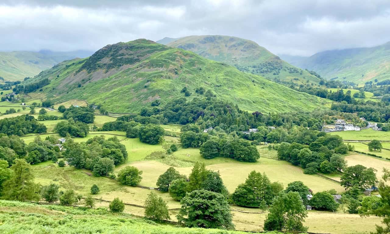
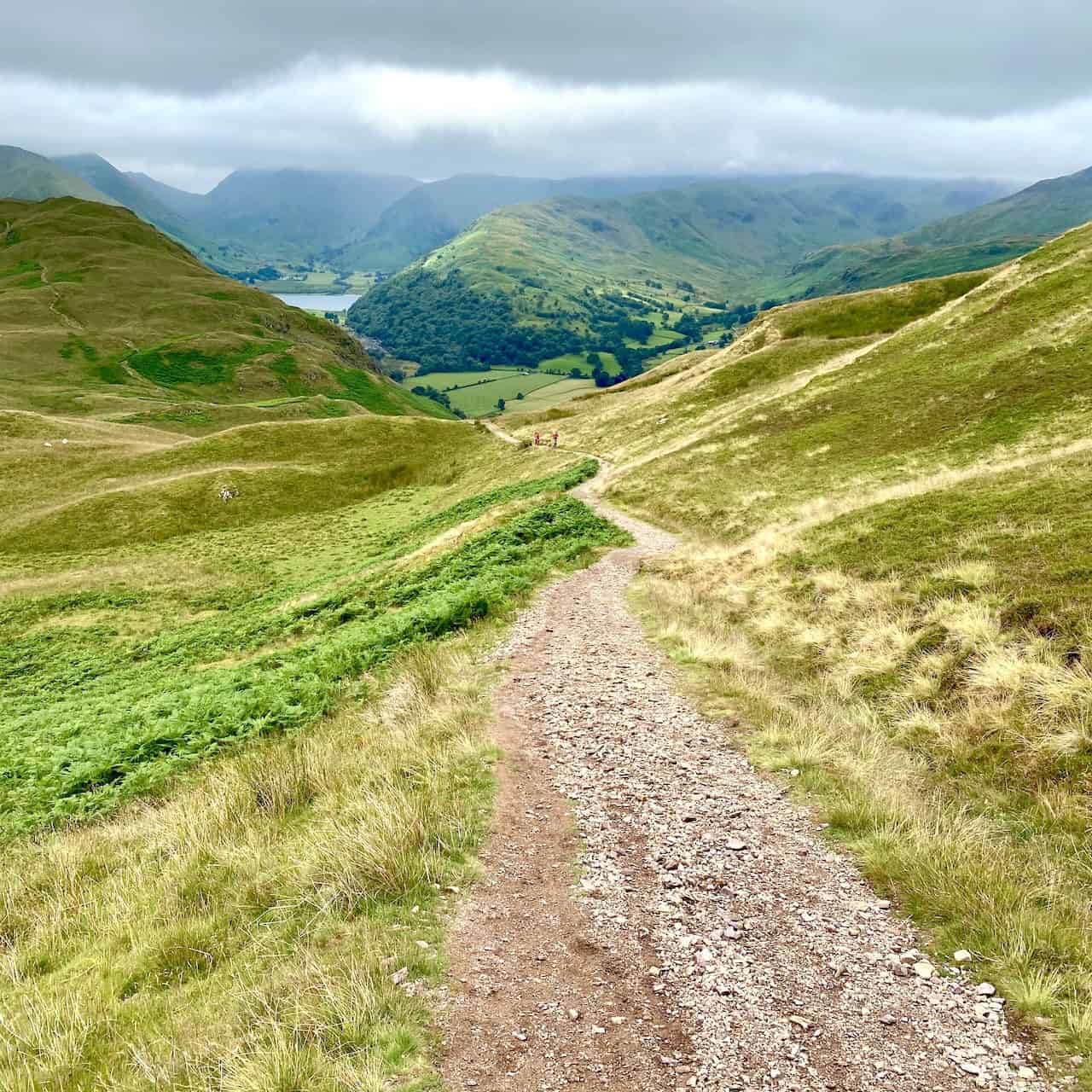
A quick look behind us as we walk up the track from Boredale Hause to Round How.
Grisport Unisex Adult Peaklander Hiking Boots
AD The Grisport Unisex Adult Peaklander Hiking Boots are crafted in Italy with a durable waxed leather upper, Spotex breathable lining, and a reliable Track-on rubber sole. Waterproof and weighing just 1120g, they offer comfort, resilience, and dependable performance on demanding trails.
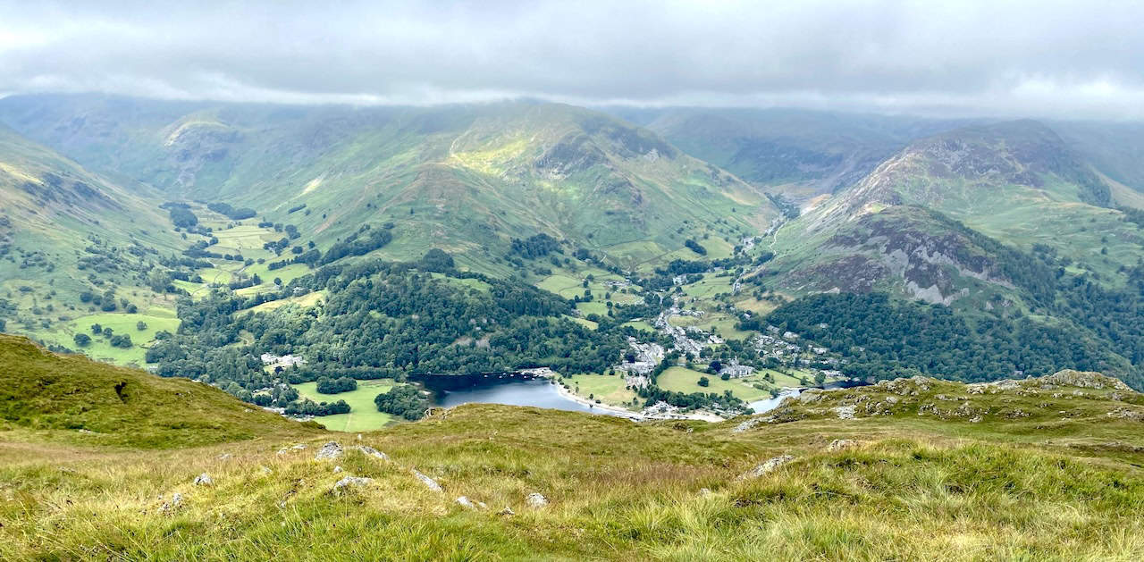
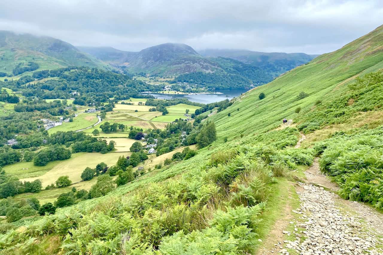
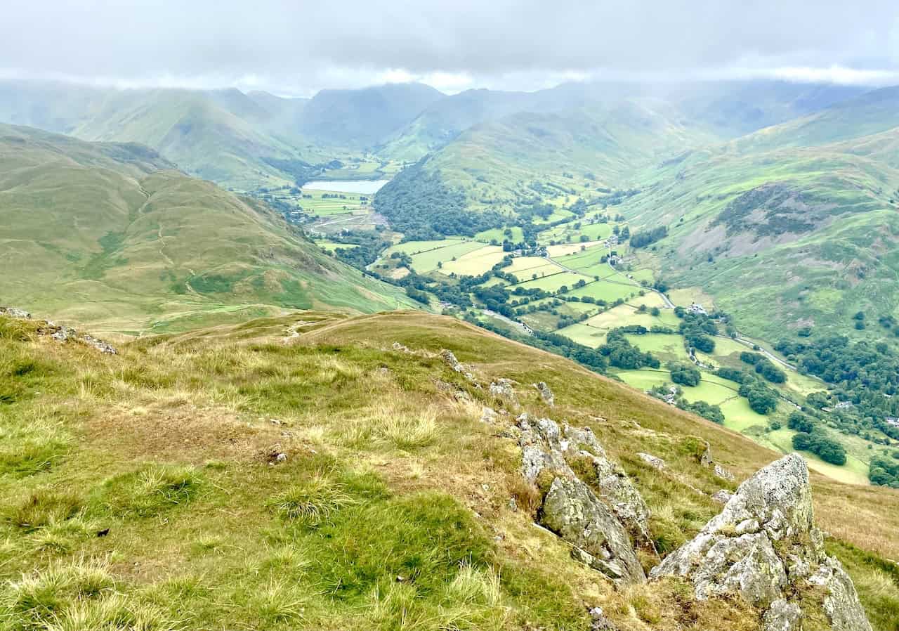
The view down to Patterdale and the Grisedale valley from Round How.
Brothers Water surrounded by the fells of Hartsop above How, High Hartsop Dodd and Hartsop Dodd.

Fifty Walks Across the Beautiful North York Moors National Park
AD Discover 50 routes across the North York Moors, from short easy strolls to challenging high-level hikes. With OS maps, route descriptions, and local highlights, it also includes the legendary 40-mile Lyke Wake Walk, described in four accessible stages.
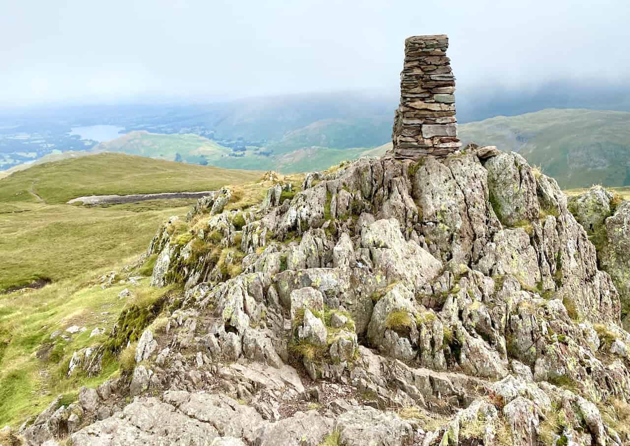
Triangulation pillar on Place Fell summit, height 657 metres (2156 feet).
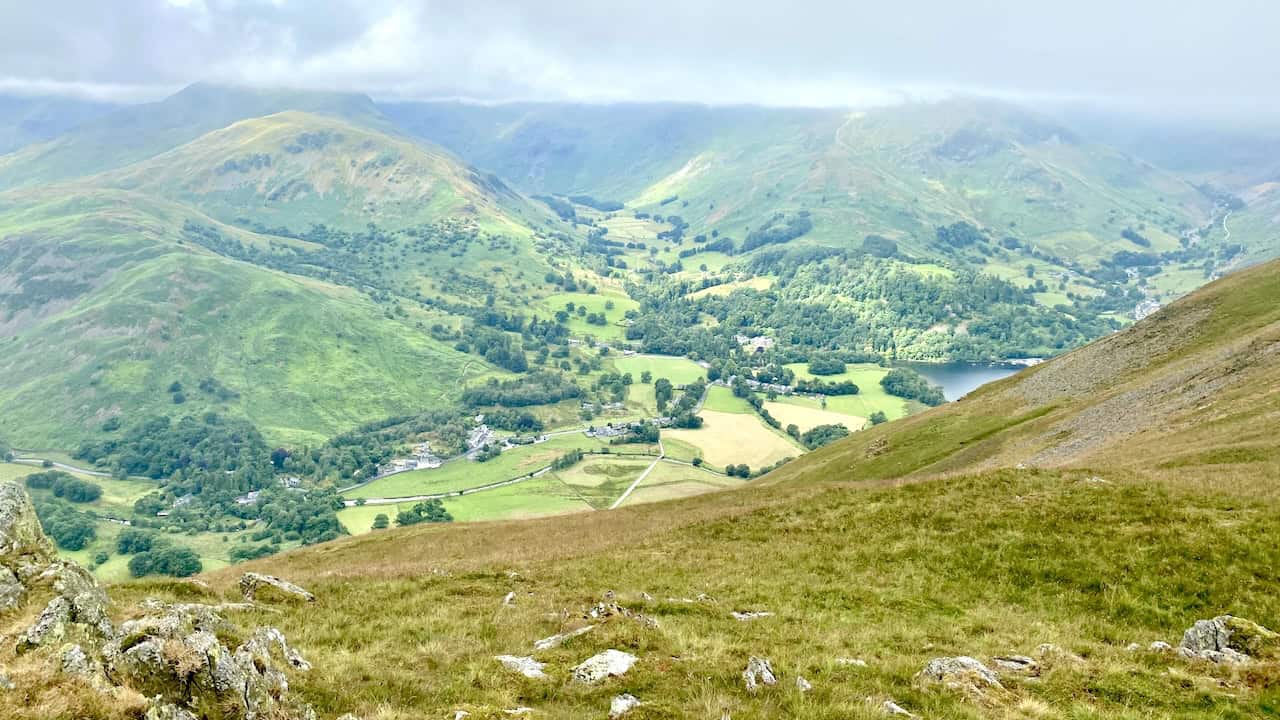
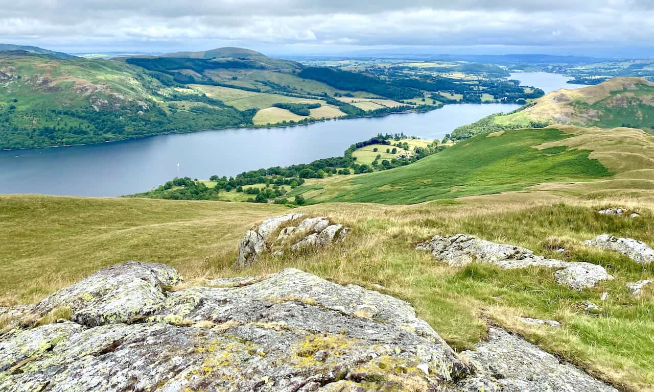
Superb views from Place Fell down to Glenridding and Ullswater. We’re about one-quarter of the way round our Place Fell walk.
Fifty Walks Across the Beautiful North York Moors National Park
AD Discover 50 routes across the North York Moors, from short easy strolls to challenging high-level hikes. With OS maps, route descriptions, and local highlights, it also includes the legendary 40-mile Lyke Wake Walk, described in four accessible stages.
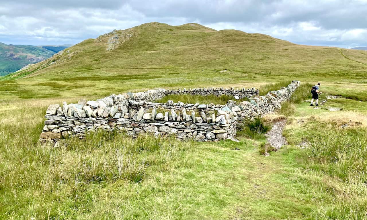
The Low Moss Sheepfold was restored by Dalemain Estates in conjunction with West Martindale Commoners Group and Natural England. Shepherds used this enclosure to manage their sheep while their flocks were out on the high fells. The Lake District, which includes Martindale, is a World Heritage site. This was awarded partly because of the pastoral heritage of farming practices which helped to shape the surrounding landscape. The Martindale Fells are still used today to graze heafed flocks.

Osprey Hikelite Unisex Backpack for Comfortable and Lightweight Hiking
AD The Osprey Hikelite backpack combines lightweight design with practical features, including a breathable mesh back panel, soft webbing straps, and stretch mesh water bottle pockets. With zipped storage and an organiser compartment, it is ideal for day hikes and outdoor use.
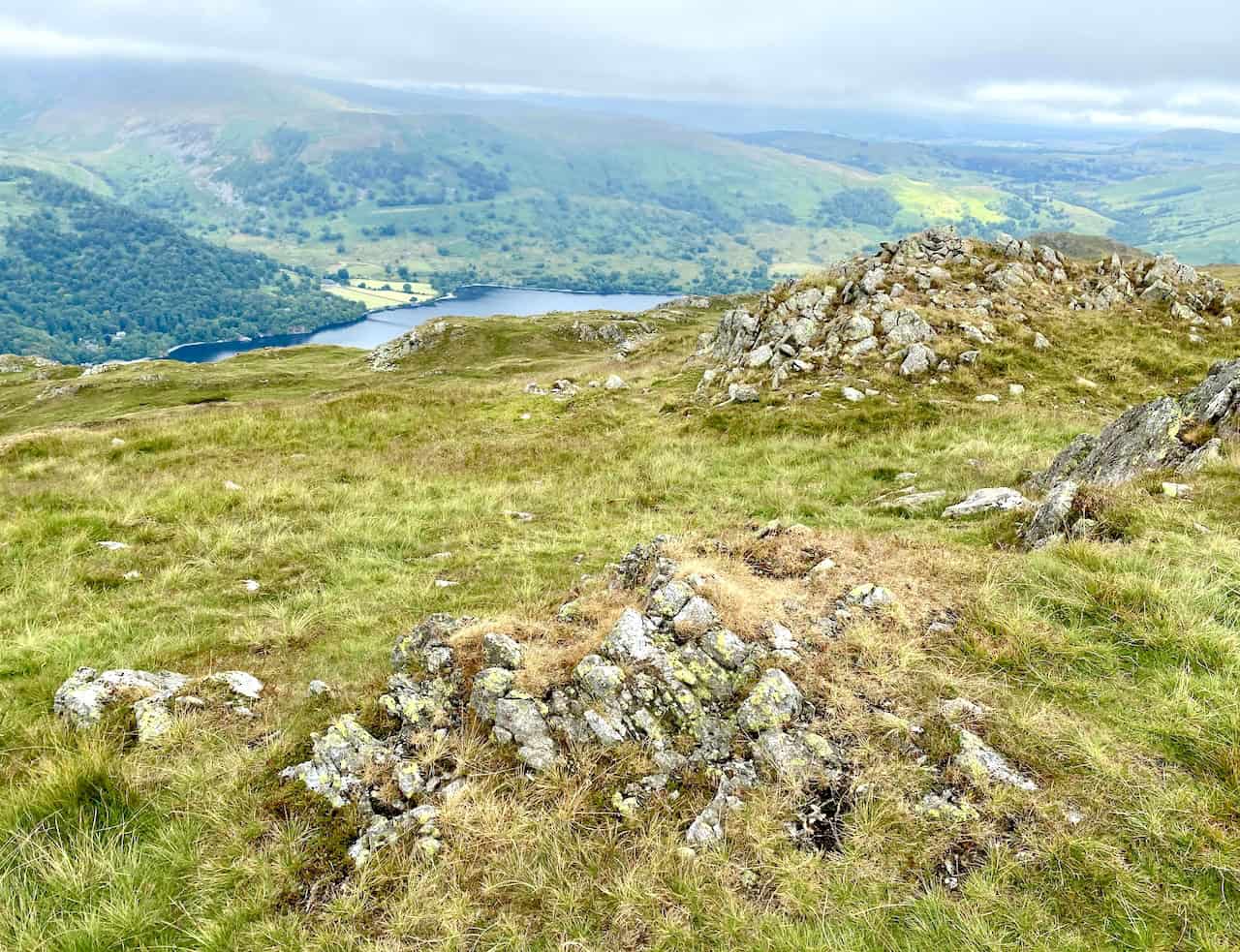
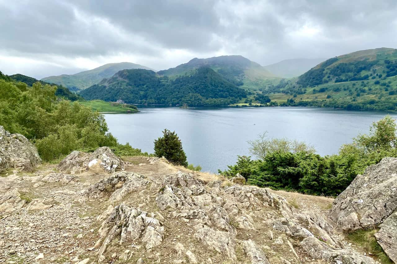
Outstanding views of Ullswater and the surrounding landscape as we cross the fell top to reach High Dodd.
Osprey Hikelite Unisex Backpack for Comfortable and Lightweight Hiking
AD The Osprey Hikelite backpack combines lightweight design with practical features, including a breathable mesh back panel, soft webbing straps, and stretch mesh water bottle pockets. With zipped storage and an organiser compartment, it is ideal for day hikes and outdoor use.
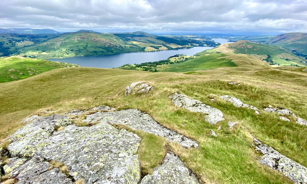
Looking north-east from High Dodd towards Hallin Fell. These views are the highlight of this Place Fell walk.
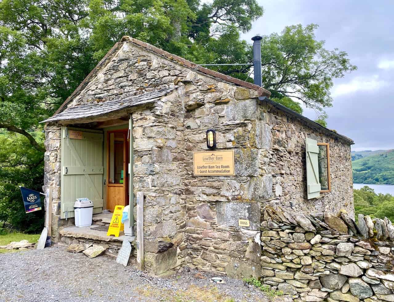
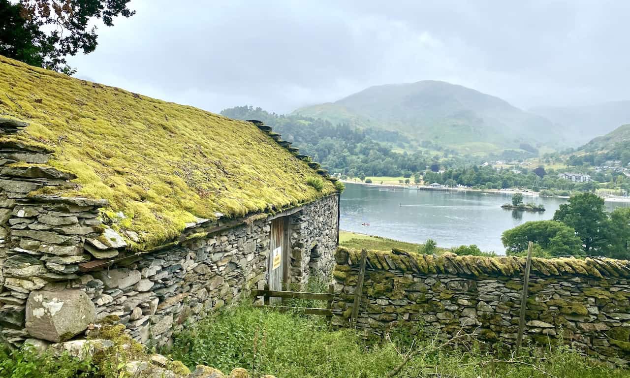
Lowther Barn by the side of the Ullswater Way bridleway.

Peak Bagging Wainwrights with Routes to Complete All Fells
AD This comprehensive guide offers 45 circular routes linking all 214 Wainwright fells. With maps, GPX downloads, elevation profiles, and practical advice, it provides efficient yet inspiring ways to complete this classic Lake District challenge at your own pace.
Views of Ullswater and the mountains on the south-west side of the lake.
Peak Bagging Wainwrights with Routes to Complete All Fells
AD This comprehensive guide offers 45 circular routes linking all 214 Wainwright fells. With maps, GPX downloads, elevation profiles, and practical advice, it provides efficient yet inspiring ways to complete this classic Lake District challenge at your own pace.
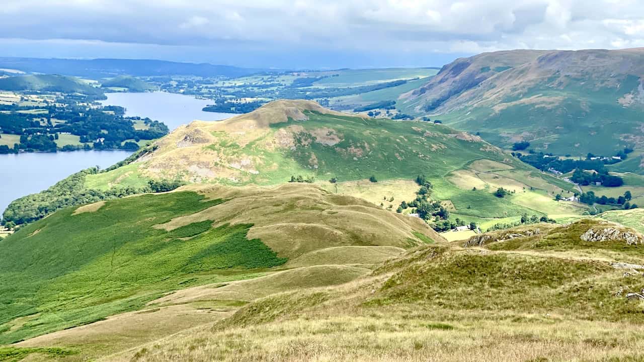
The village of Glenridding nestled beneath the tree-covered flanks of Glenridding Dodd.
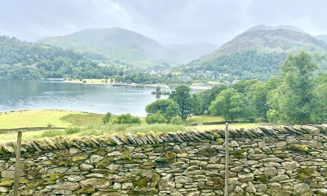
Ullswater, Glenridding and a misty Birkhouse Moor in the background.

Berghaus Hillmaster II GTX Men's High Rise Hiking Boots
AD The Berghaus Hillmaster II GTX men’s hiking boots feature a waterproof, breathable GORE-TEX membrane, a memory foam tongue and collar for a personalised fit, and a Vibram sole delivering exceptional grip, stability, and shock protection for confident performance on any terrain.
Farmland and the village of Patterdale backed by Arnison Crag (left) and Birks (right). The end of our amazing Place Fell walk is in sight.