ADVERTISEMENT
Choosing Between Two Great Whernside Walks in Upper Wharfedale
Both of my Great Whernside walks climb the mountain that closes off the eastern side of Wharfedale above Kettlewell, a long whaleback of moorland grass topped by a summit ridge strewn with gritstone boulders. I have been up it several times, and two of those days have become full route guides on this website. Each route is circular, each begins and ends at the same car park in Kettlewell, and each takes in the triangulation pillar at 704 metres along the way. What separates them is the ground they cover on the climb and, more noticeably, the way they come home.
This page brings the two walks together in one place. If you are trying to decide which one suits you, or you simply want to understand how the paths on this side of the mountain fit together, this is the place to start. Each route has its own page with full step-by-step directions, statistics, maps and photographs, and I link to both throughout.
ADVERTISEMENT
The two routes share more than their start and finish. Each leaves Kettlewell past the war memorial and the maypole, climbs to the old farmhouse at Hag Dyke, pulls up the rocky, boulder-covered flank above it to the summit, then heads north along the ridge from the top. From there the shared ground continues over the stile at Black Dike Hole, steeply down to the Kettlewell to Coverdale road near Park Rash, and onto the grassy bridleway known as Starbotton Road on the far side.
The differences come at either end of that shared middle. On the shorter walk I climb through the valley of Dowber Gill Beck to the capped entrance of Providence Pot, then take a steep and easily missed path up to the back of Hag Dyke, returning over the high ground on Top Mere Road. On the longer one I take the direct grassy path from Kettlewell straight up to Hag Dyke, then come home the long way, dropping into Starbotton on an old walled drovers’ road and following the Dales Way beside the River Wharfe. One is a hill day with a cave system on the way up. The other is a hill day with a village and a river on the way back.
Great Whernside Walks: The Mountain Behind Both Routes
Great Whernside rises to 704 metres, or 2,310 feet, directly above Kettlewell. It is the highest ground on the eastern side of the dale and one of only a handful of mountains in the Yorkshire Dales National Park to top 700 metres. Its long summit ridge forms the watershed between Wharfedale and Nidderdale, and the mountain sits on the boundary between the national park and the Nidderdale National Landscape. The River Nidd rises on its eastern slopes, above Angram Reservoir.
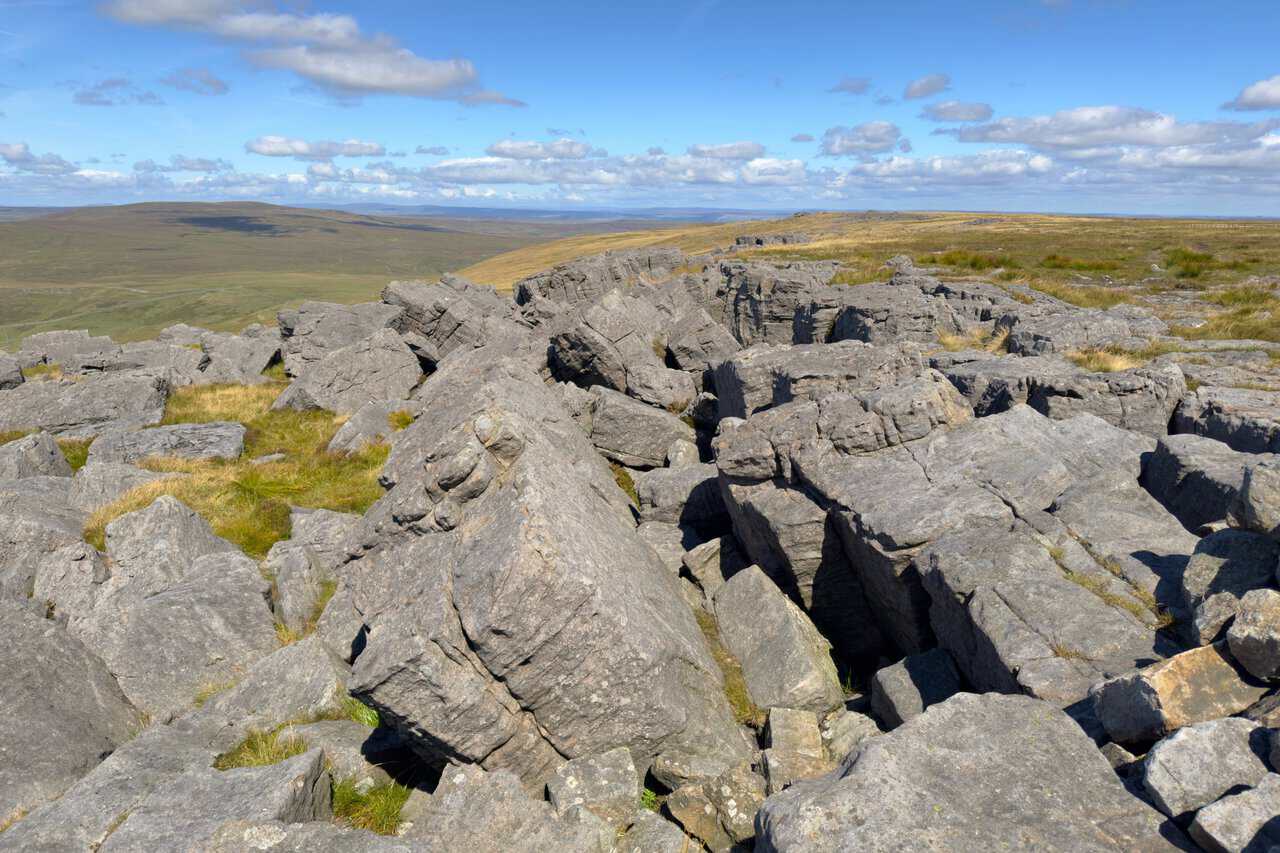
The name is much older than it looks. It was first written down in 1214 as Querneside, from Old English words for a quern, or millstone, and a hillside. It means the hillside where millstones are found, which makes complete sense the moment you reach the top and see the slabs of millstone grit lying about in every direction. Quarries once worked that stone on the Wharfedale side of the hill. Seen from Nidderdale, the same mountain was traditionally known as Blackfell, a name that survives on the map today in Blackfell Crags. The word Great was added later, first recorded in 1771, to distinguish it from neighbouring Little Whernside, which lies two and a half miles to the north-east and divides Coverdale from Nidderdale.
It is worth saying plainly that Great Whernside is not Whernside, the higher and better known peak of the Yorkshire Three Peaks, which stands around seventeen miles to the west. The two are regularly confused. On a clear day you can stand on one and pick out the other.
ADVERTISEMENT
Access to the top is a surprisingly recent story. No public right of way reached the summit at all until 1997, when two footpaths were finally registered, one climbing from Kettlewell and another running along the summit ridge. Larger areas of the fell became open access land following the Countryside and Rights of Way Act 2000. Both of my Great Whernside walks use that Kettlewell approach, which is how most walkers come. There is also a shorter and steeper option from the Park Rash road, and a longer, much quieter route from Scar House Reservoir in Nidderdale, though anyone coming in from the east should be prepared for wet ground, as those approaches stay boggy even after a long dry spell.
There is more history on these slopes than the bare moorland suggests. Tor Dike, on the north-western flank of the mountain, is an earthwork of ditch and rampart cut into the limestone, thought to have been built either by Iron Age tribes defending themselves against the Roman advance or later, during the Dark Ages. The mountain has a sombre side too, having been the site of several aircraft crashes over the years, a reminder that the weather up here can turn quickly.
Great Whernside Walk: Kettlewell to Providence Pot Circular Route
This is the shorter of my two Great Whernside walks at 8 miles, and the more varied of the pair on the way up.
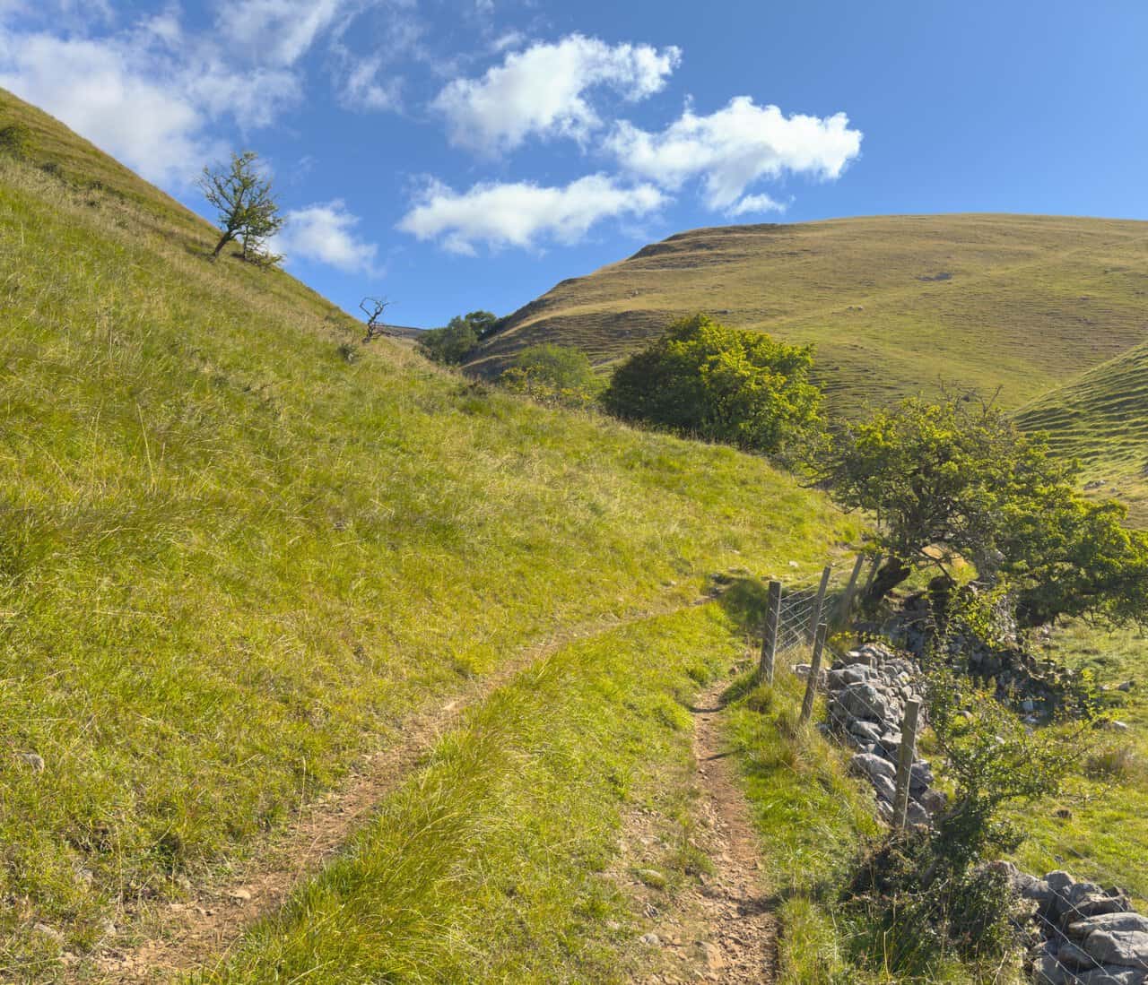
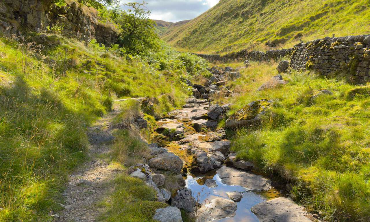
From the car park it heads through Kettlewell past the war memorial and the maypole, up past the King’s Head, and out along the tarmac lane at the edge of the village. Where the other route turns uphill for Hag Dyke, this one carries on into the valley of Dowber Gill Beck and follows the water eastwards for about a mile. The gradient is gentle here and the walking is easy, with steep grassy flanks rising on both sides and limestone slabs scattered along the valley floor. When I walked it, after weeks with little rain, the bed of the beck was almost dry, the water having disappeared underground through fissures in the rock long before it reached the valley floor.
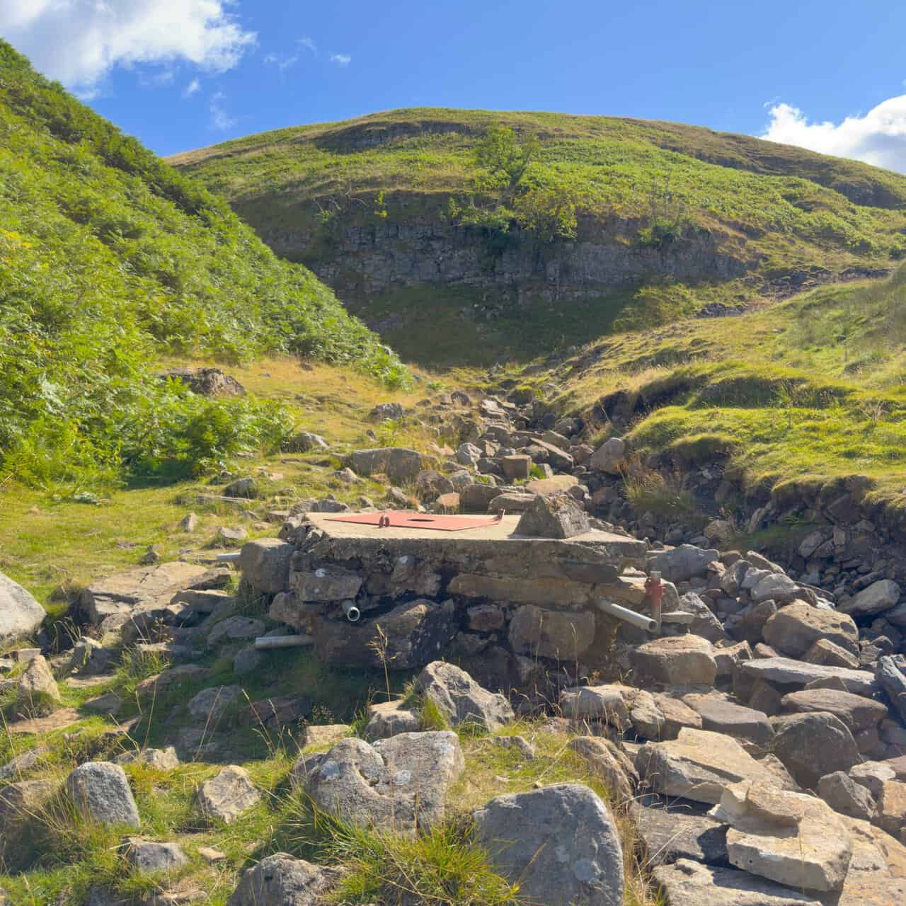
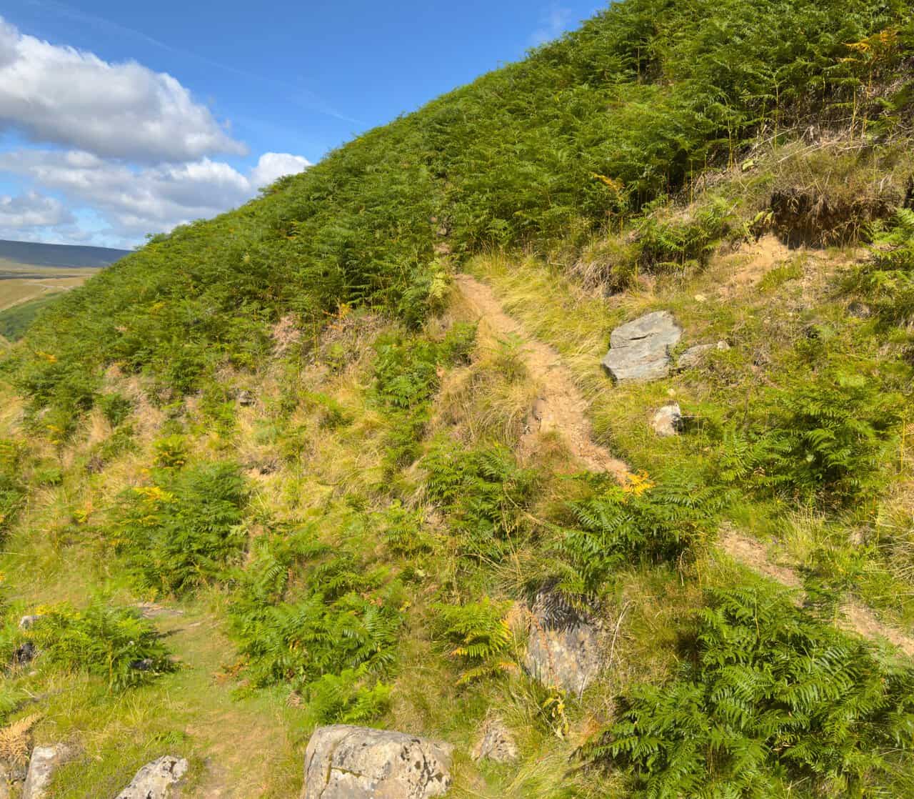
The valley ends at Providence Pot, where a concrete slab caps the entrance to one of the best known cave systems in the Dales. From there the route turns sharply uphill on a narrow path that is easy to miss from below, climbing steeply through the bracken before easing into a lovely traverse across the hillside with the whole valley falling away beneath you. It comes out at the rear of the hostel at Hag Dyke, roughly a quarter of the way round.
ADVERTISEMENT
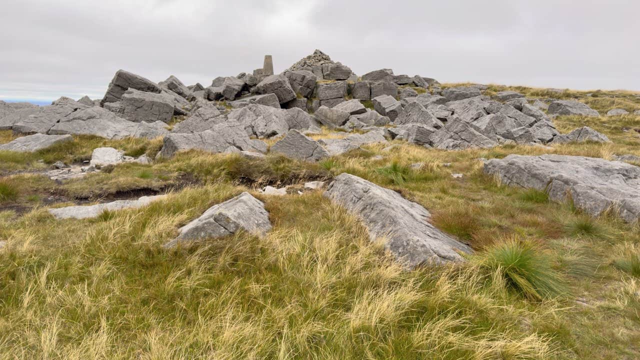
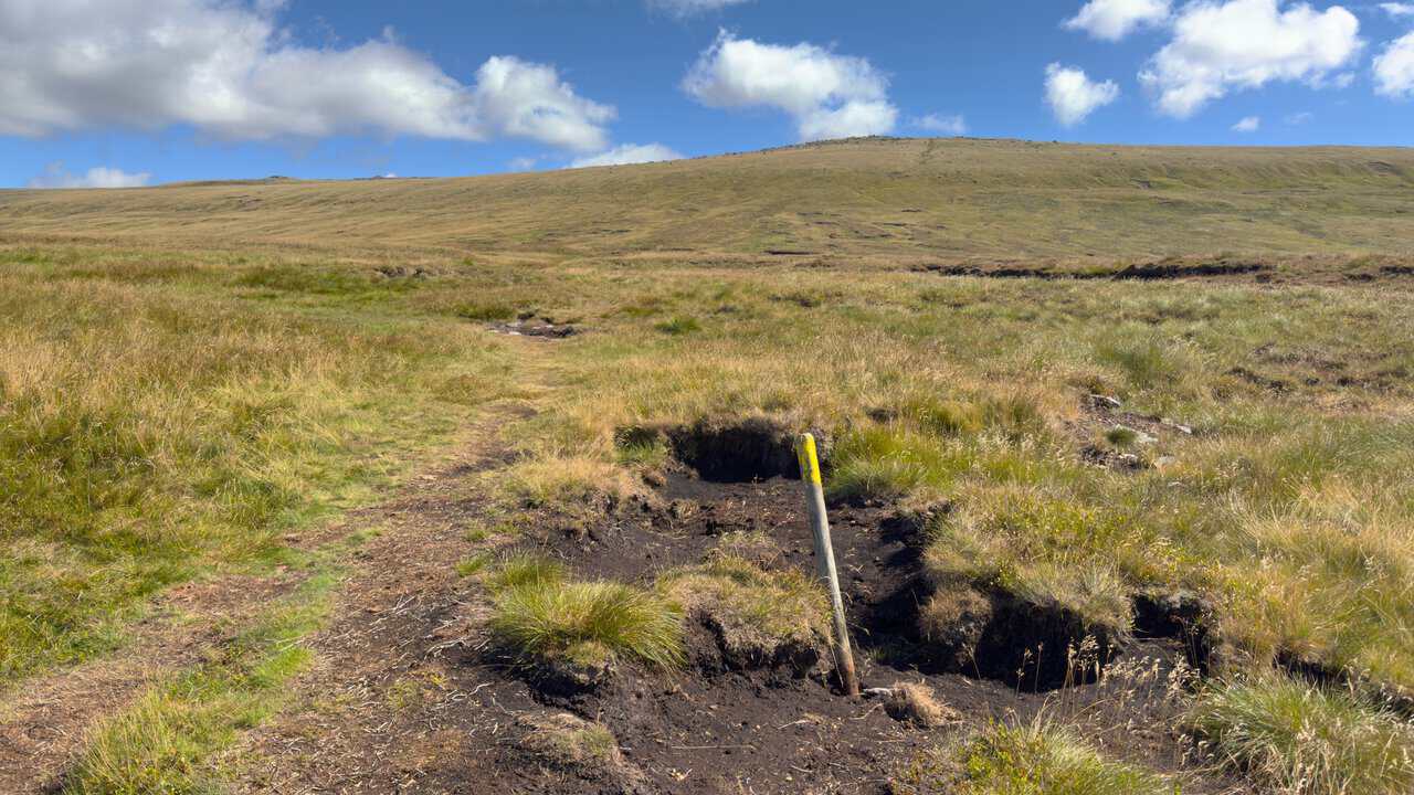
Above Hag Dyke the climb turns rocky and stony, with a dry stone wall on the left, before levelling out onto grass and peat marked by wooden posts with yellow painted tops. A final steepening leads to the triangulation pillar and its enormous cairn. From the summit the route runs north along the ridge with the fence line on the right, then drops away to the stile at Black Dike Hole and a very steep descent towards the Coverdale road.
The return is the part that gives this walk its character. After crossing the road, the path curves around the head of the valley, joins Starbotton Road, and then turns south onto Top Mere Road, an old walled green lane that runs for about one and three quarter miles high above the dale before dropping into Kettlewell. It is straightforward walking with wide views throughout, and the village stays in sight ahead of you for most of the descent.
My Great Whernside walk from Kettlewell to Providence Pot has the full route description, step by step, along with the complete set of photographs.
Great Whernside Walk: Maps and Tools
Visit either the OS Maps website or the Outdooractive website to view this walking route in greater detail. Both platforms offer a range of features, including the ability to print the route, download it to your device, and export the route as a GPX file. You can also watch a 3D fly-over and share the route on social media.
Great Whernside Walk: Distance, Duration, Statistics
Distance: 8 miles
Distance: 12¾ kilometres
Duration: 4¼ hours
Ascent: 1929 feet
Ascent: 588 metres
Type: Circular walk
Great Whernside Circular Walk: Starbotton and the River Wharfe
The longer of my two Great Whernside walks covers 9¼ miles and saves its best for the second half.
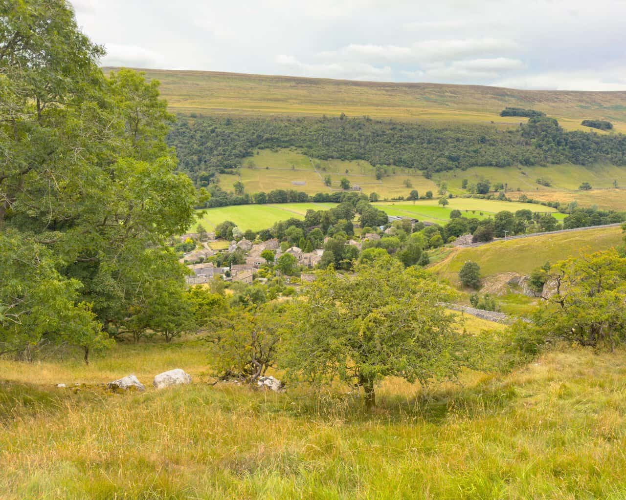
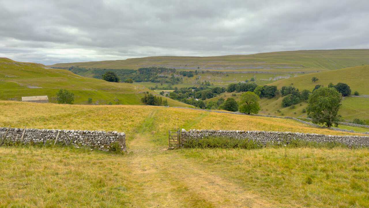
The start through Kettlewell is the same, but at the second stone bridge near Kettlewell Camping this route turns straight uphill onto the wide grassy footpath signposted to Hag Dyke. It climbs steeply at first and then steadily for about a mile, with the Dowber Gill Beck valley opening out below and to the right, and the rocky outcrop of Gate Cote Scar visible behind the village. It is a more direct ascent than the Providence Pot line, and it brings you to Hag Dyke with the bulk of the climbing still ahead.
From the hostel the route follows the same rocky ground up past the cairns on the brow of the hill, across the grass and peat marked by yellow-topped posts, and on to the summit boulders, cairn and triangulation pillar. That point comes at roughly a quarter of the way round this walk rather than close to halfway, which tells you a good deal about how the two routes are balanced. The ridge north, the stile at Black Dike Hole and the descent to the Coverdale road are all shared ground.
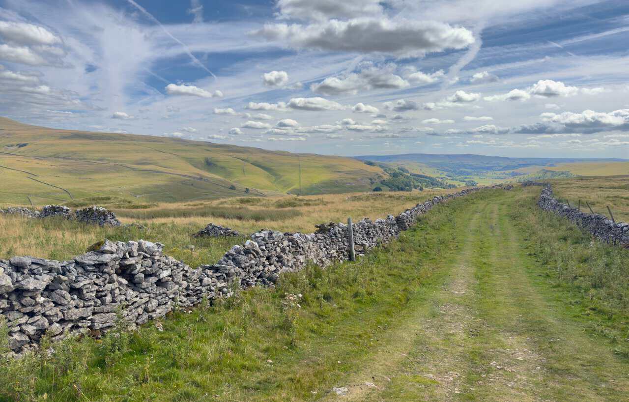
The parting of the ways comes on Starbotton Road. Instead of turning south for Kettlewell, this walk carries on around the head of the valley and takes the right-hand fork at a wooden signpost, crossing a delightful stretch of open ground called Sandy Gate with Birks Fell filling the view to the west. From there Starbotton Cam Road, a wall-enclosed old drovers’ road, zigzags down the hillside for the best part of a mile, the stony surface eventually giving way to concrete as the rooftops of Starbotton appear below.
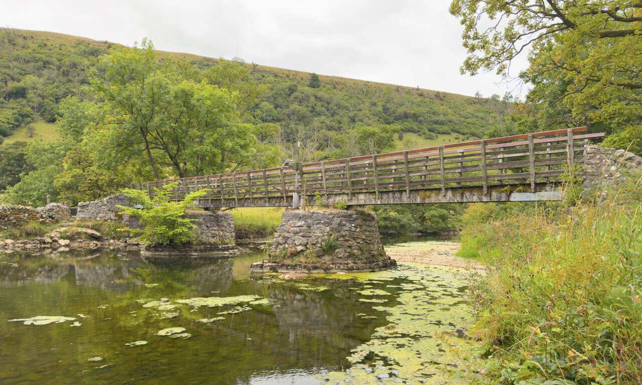
The last stage is the gentlest walking of either route. From the village, a dead straight walled bridleway leads to a wooden footbridge over the River Wharfe, and on the far bank the Dales Way runs south through the meadows for around two miles back into Kettlewell. After the climb and the crossing of the moor, it is an unhurried way to finish, with the river alongside you almost the whole way.
My Great Whernside circular walk through Starbotton has the full route description, the history of the village and the complete set of photographs.
Great Whernside Circular Walk: Maps and Tools
Visit either the OS Maps website or the Outdooractive website to view this walking route in greater detail. Both platforms offer a range of features, including the ability to print the route, download it to your device, and export the route as a GPX file. You can also watch a 3D fly-over and share the route on social media.
Great Whernside Circular Walk: Distance, Duration, Statistics
Distance: 9¼ miles
Distance: 15 kilometres
Duration: 5 hours
Ascent: 1899 feet
Ascent: 579 metres
Type: Circular walk
Which of the Two Great Whernside Walks Should You Choose?
There is no wrong answer here, and if you have the time I would happily recommend doing both, as I did, within a few days of each other. The mountain feels quite different depending on how you approach it.
| Comparison | Providence Pot Route | Starbotton Route |
|---|---|---|
| Distance | 8 miles | 9¼ miles |
| Ascent | 1,929 feet | 1,899 feet |
| Duration | 4¼ hours | 5 hours |
| Climb | Dowber Gill Beck and Providence Pot | Direct grassy path to Hag Dyke |
| Return | Top Mere Road | Starbotton and the Dales Way |
| Summit | A little before halfway | About a quarter of the way |
| Features | Caves, gills and a shorter day | Villages, the river and an easy finish |
One figure in that table catches people out. The shorter walk carries slightly more ascent than the longer one, although at thirty feet the difference is small enough to ignore on the ground. What the extra mile and a half on the Starbotton route buys you is not more climbing but more walking, nearly all of it flat, along the valley floor beside the Wharfe.
Choose the Providence Pot route if the caves and the limestone interest you, if you like a walk that climbs steadily from the start, or if you want to be back in Kettlewell earlier in the day. The steep pull out of the valley is the one section that asks for care, and it is far easier to spot going up than coming down.
Choose the Starbotton route if you want the fuller day out, if you prefer a walk that ends gently, or if the thought of the Fox and Hounds three quarters of the way round appeals. It also gives you two miles of the Dales Way beside the river, which is some of the most relaxed walking in Upper Wharfedale and a fine way to wind down after the moor.
Weather can make the decision for you. If the forecast is doubtful, the Starbotton route has the advantage that its final third is low, sheltered and easy to follow. If conditions are good and you want the most time on the tops, Top Mere Road keeps you high for far longer.
Recommended Ordnance Survey Map
The best map to use on this walk is the Ordnance Survey map of the Yorkshire Dales Northern & Central Area, reference OS Explorer OL30, scale 1:25,000. It clearly displays footpaths, rights of way, open access land and vegetation on the ground, making it ideal for walking, running and hiking. The map can be purchased from Amazon in either a standard, paper version or a weatherproof, laminated version, as shown below.
Standard Version
Yorkshire Dales Walking Guidebooks
Walking in the Yorkshire Dales: North and East, by Dennis Kelsall, describes 43 circular day walks of 3 to 12 miles across the Howgills, Mallerstang, Swaledale, Wensleydale, Coverdale and Nidderdale, with Ordnance Survey mapping and notes on parking and refreshments.
15 Short Walks in the Yorkshire Dales, by Jonathan and Lesley Williams, covers the area around Sedbergh, Kirkby Lonsdale and Ingleton. Its 15 routes of 1 to 7 miles each take under three hours, ideal for families or a relaxed half day out. Both books can be purchased from Amazon, as shown below.
Walking the Yorkshire Dales
About Kettlewell
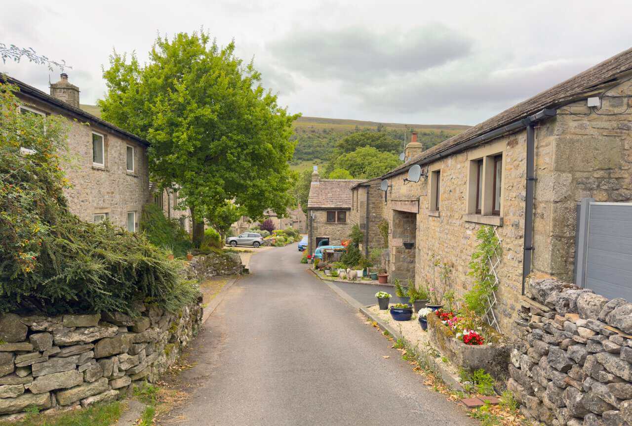
Kettlewell sits on the floor of Upper Wharfedale, where Cam Gill Beck comes down off the fells to meet the River Wharfe. It is a stone-built village of narrow lanes, bridges and old cottages, wrapped around by steep hillsides on almost every approach, and it makes an excellent base for walking. Both of my Great Whernside walks start from the Yorkshire Dales National Park pay and display car park and leave it by the main exit, turning left into the village.
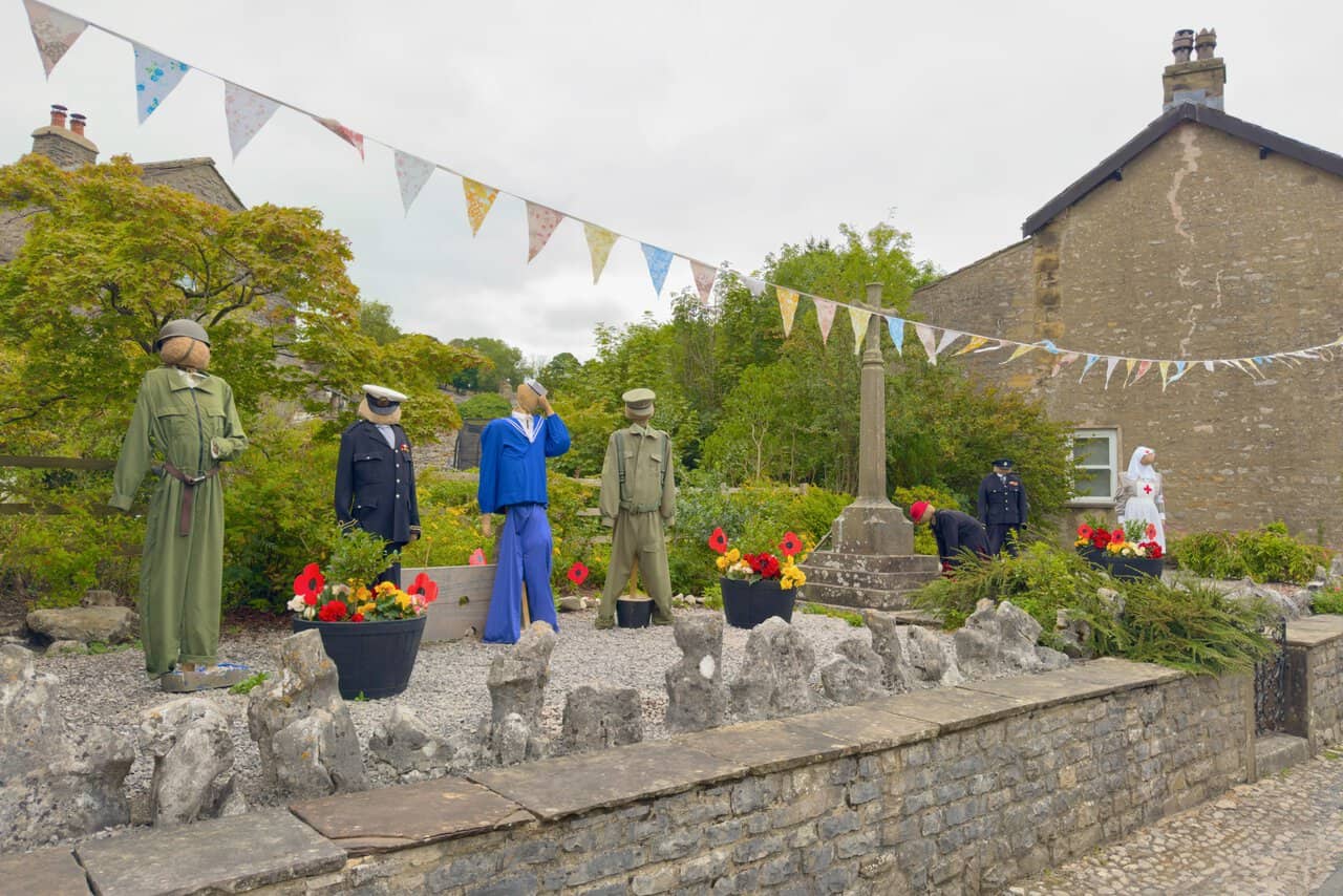
The first few hundred metres are worth taking slowly. The war memorial stands in a small garden enclosed by dry stone walls and remembers nine men of the village, six lost in the First World War and three in the Second. A little further on, the maypole marks the crossroads at the spot still known as the village green, even though the green itself has long gone. The present pole was raised by the Women’s Institute in 1953 to mark the coronation of Elizabeth II, replacing an earlier one dated 1898.
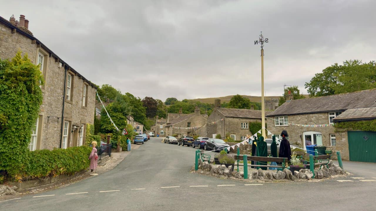
If you visit in August you may find the village transformed. The Kettlewell Scarecrow Festival has run each year since 1994, when it began as a fundraiser for the village primary school. It now supports the school, the village hall and St Mary’s Church, and brings thousands of visitors across its nine days. Both of my walks were done during the festival, which is why scarecrows turn up in so many of the photographs, and why a whole field had been given over to parking.
For practical purposes, the King’s Head stands at the top of the village on the way out towards the fells, and there is a campsite just beyond the last houses at Kettlewell Camping. The village is easy to reach on the B6160 through Wharfedale, and bus services do run, although they are limited and worth checking before you rely on them. The car park fills quickly on fine weekends and during the festival, so it pays to arrive early. Both routes return to the same place, so there is no need to arrange transport at the far end.
Hag Dyke, Providence Pot and Starbotton: Landmarks on the Great Whernside Walks
Three places give these routes their character, and between them the two walks take in all three.
Hag Dyke
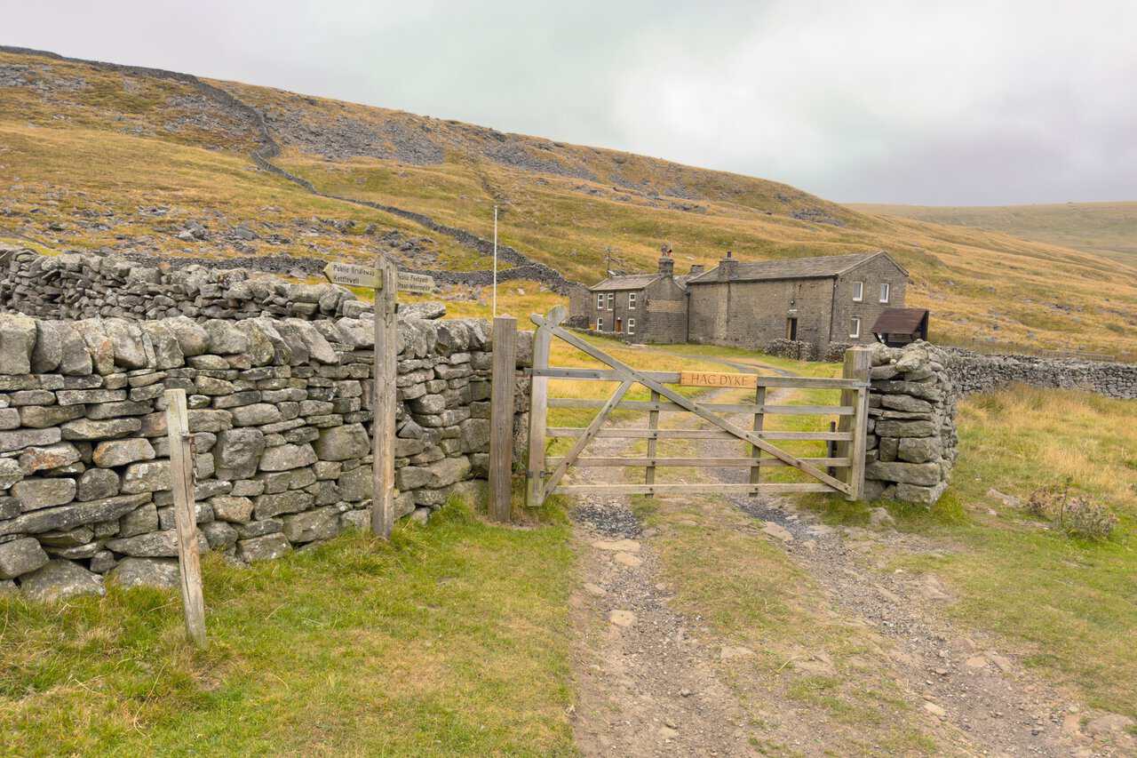
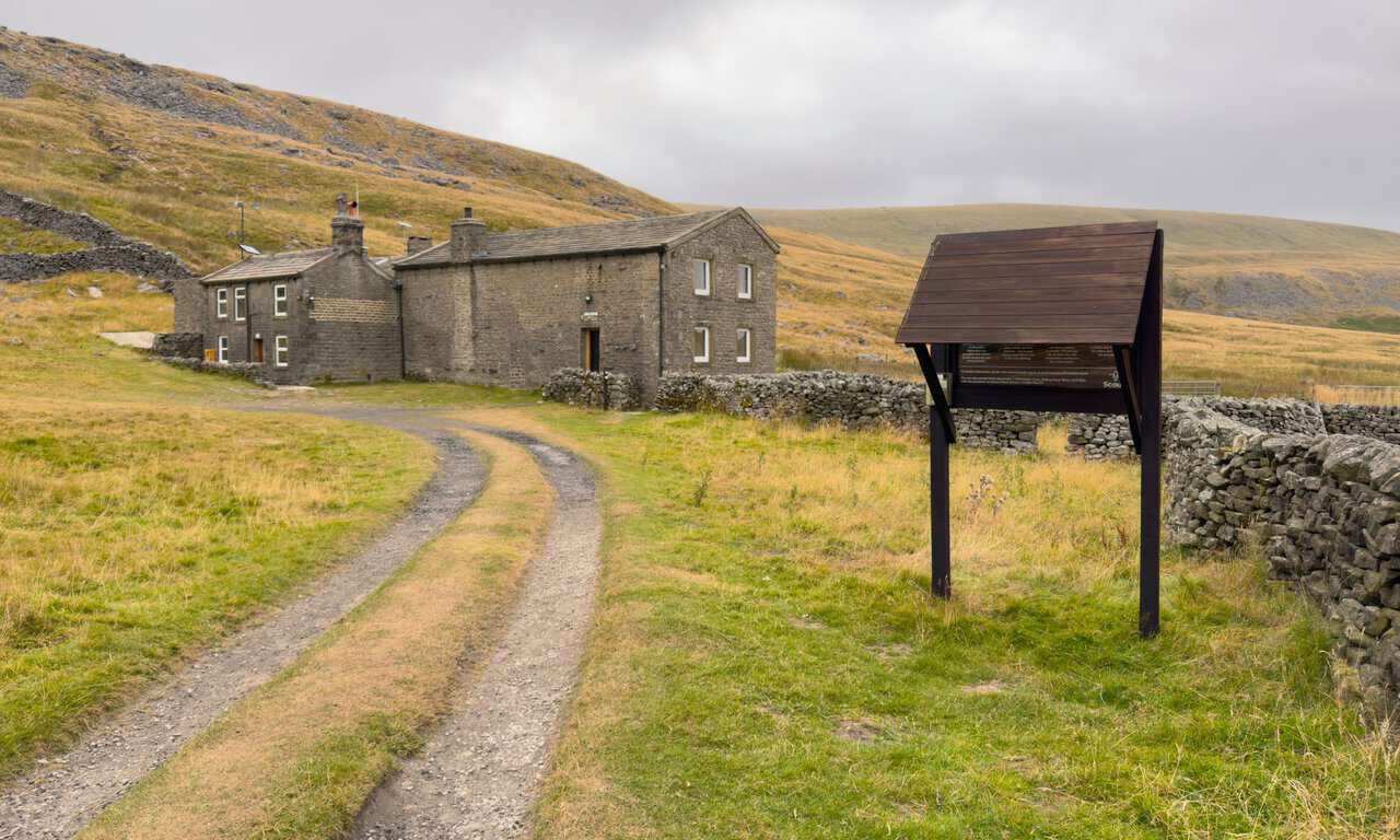
Hag Dyke stands alone on the western flank of the mountain at 1,525 feet, roughly halfway between the village and the summit, and both routes pass it. The name comes from Dales dialect, in which a dyke is a dividing wall on the fell and a hag is land taken in from the moor, so Hag Dyke is the wall separating the intake from open ground. The building was a farmhouse long before it was anything else, with occupants traced back to 1730 and probably earlier still, and it may well have sheltered men working the Dowber Gill lead mines. It was long reckoned to be the highest house in the old West Riding, reachable only on foot or by four-wheel drive.
Since 1947, when the building passed into their hands, it has been run as a hostel by the Ben Rhydding Scout and Guide Group from Ilkley, looked after ever since by a team of volunteer wardens. The farmhouse was rebuilt as a hostel in 1959 and 1960, and a chapel added in the 1950s is said to be the highest in England.
Providence Pot
Providence Pot lies at the head of the Dowber Gill Beck valley and is visited only on the shorter route. It takes its name from the Providence lead mine that once worked the ground above these sinks. Members of the Craven Pothole Club dug out the entrance in the summer of 1954, and the concrete cap now protects a scaffolded shaft dropping into the passages below.
In 1955, cavers finally linked Providence Pot with Dow Cave, further down the valley, by way of Dowbergill Passage. The passage runs in a remarkably straight line for well over a mile, and the through trip between the two entrances is still regarded as one of the toughest in Yorkshire.
Starbotton
Starbotton sits on the valley floor two miles upstream of Kettlewell and appears only on the longer route, three quarters of the way round. It has around sixty houses and fewer than fifty residents, with many of the properties now used as holiday accommodation and only two working farms remaining, one at either end of the village. The origin of the name has been debated for a long time. It appears in the Domesday Book of 1086 as Stamphotne and in the twelfth century as Stauerboten, forms that suggest an Old English word replacing a Norse one and a meaning along the lines of the place where stakes are got.
The defining event in the village’s history came in June 1686, when a violent rainstorm sent a flash flood down the hillside and swept much of Starbotton away. Rebuilding had only recently begun, the earliest dated building being from 1621, and what survived was repaired while new houses went up through the closing years of the century. Nineteen years before the flood, in July 1667, Lady Anne Clifford broke her journey up the dale here, recording in her diary that she had spent the night at John Symondson’s house. The village was designated a conservation area in 1969.
Lead has left its mark too. A smelt flue climbs from the back of the village to a chimney above Cam Gill, and collecting the white lead oxide from inside it was work given to children, which helps explain the number of young burials in Kettlewell churchyard during the eighteenth and nineteenth centuries. A small quarry beside the bridge over Cam Gill Beck supplied stone for many of the houses. Today the village has a pub, the Fox and Hounds, a Quaker burial ground restored as a Millennium Project, and the old Cam Road climbing away over the tops, now a green lane and the route by which the longer walk drops back into the dale.
Conditions and Navigation on the Great Whernside Walks
Neither of these routes is technically difficult, but both cross high, exposed ground where the weather can change quickly and there is very little shelter. A few things are worth knowing before you set off.
Boggy Ground and Underfoot Conditions
The level stretch above Hag Dyke and the flatter section below Black Dike Hole are the two places that hold water. Both were dry when I walked them, after weeks with little rain, but they can be very wet indeed and are best treated with respect after a spell of bad weather. Boots rather than trail shoes make sense here for most of the year.
Each route also has one properly steep descent, from the stile at Black Dike Hole down towards the moor. The shorter walk adds a steep climb out of the Dowber Gill Beck valley at Providence Pot. Neither needs hands, but both are hard on the knees in the wet.
Finding the Way Off the Summit
This is the one point on either route where I would suggest thinking ahead. The way off the mountain is north, which is to the left as you approach the top, and it is worth fixing that in your mind on the way up while the ground is still clear.
At the pillar, stand with your back to the views and to the way you have come, facing the gate in the fence, then look to your left beyond the large cairn. The faint path running north across the mountain top is the one you want, keeping the fence a few metres away on your right. Wooden posts with yellow painted tops then mark the line of the path, both here and on the climb, and they are a genuine help when visibility drops. Among a summit full of identical boulders, this is not somewhere to be working it out from scratch.
Weather, Kit and Common Sense
Carry OS Explorer OL30 and a compass, and know how to use them. The mountain has been the site of several aircraft crashes over the years, which says something about how quickly cloud can come down on this ridge. There is no shop and very little shelter once you leave the village, so take with you everything you are likely to need.
Great Whernside Walks: My Photos
The photographs below are drawn from both routes and follow the shape of a day on the mountain, from the village to the summit and back down into the dale. Both of my Great Whernside walks begin with the same short stretch of road towards the maypole, and during the Scarecrow Festival even the war memorial has company.
The shorter route turns east into the valley of Dowber Gill Beck, where the path runs along the northern side with a dry stone wall and a line of old hawthorns for company.
After a long dry spell the bed of the beck holds little more than shallow pools between the limestone slabs, most of the water having vanished underground.
From Providence Pot the only sensible way out of the valley is this narrow path through the bracken, which is easy to miss from below.
On the longer route the direct climb gives the first proper view of the day, back down over Kettlewell with the limestone of Gate Cote Scar rising behind the village.
Hag Dyke is where the two routes meet, a former farmhouse that has been run as a hostel since 1947.
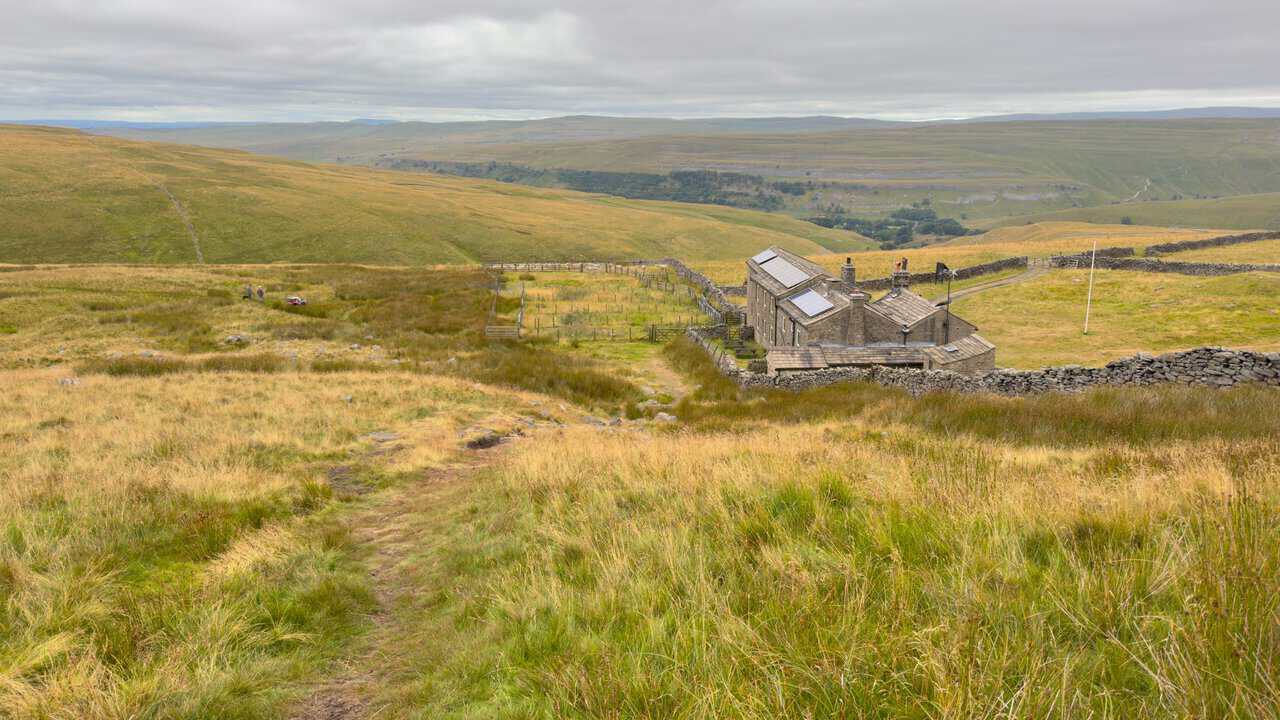
A few minutes above the hostel the view opens right out, and on a clear day the silhouette of Pendle Hill appears on the south-western horizon, roughly twenty-four miles away as the crow flies.
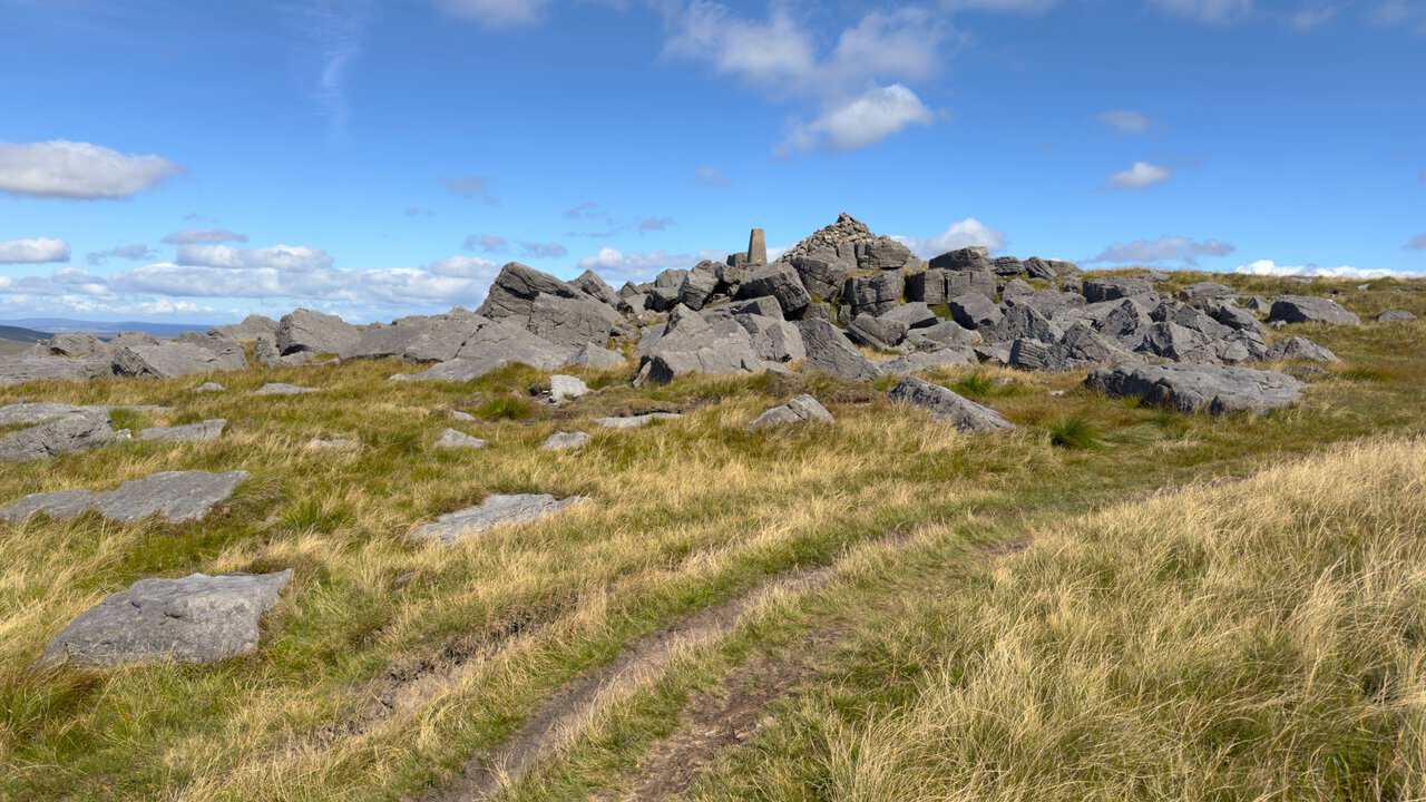
Higher up, the triangulation pillar appears among a broken sea of gritstone blocks, a welcome sight after the long pull from Hag Dyke.
The reward at the top is the western skyline, with Pen-y-ghent about ten miles off and Ingleborough and Whernside roughly sixteen. Picking out all three is one of the real rewards of both Great Whernside walks.
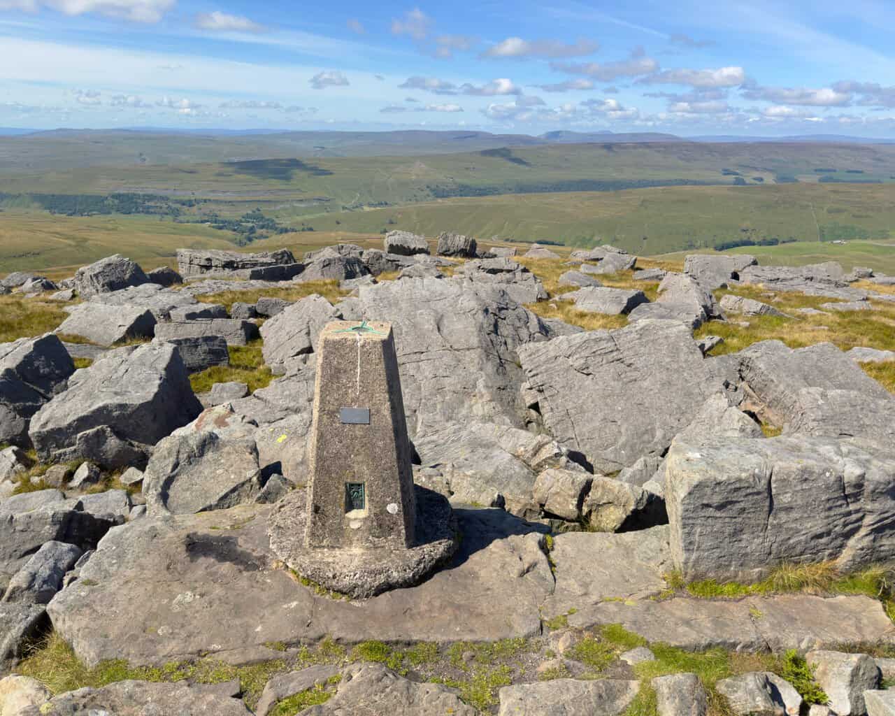
Heading north along the ridge, the boulders keep coming and so do the views.
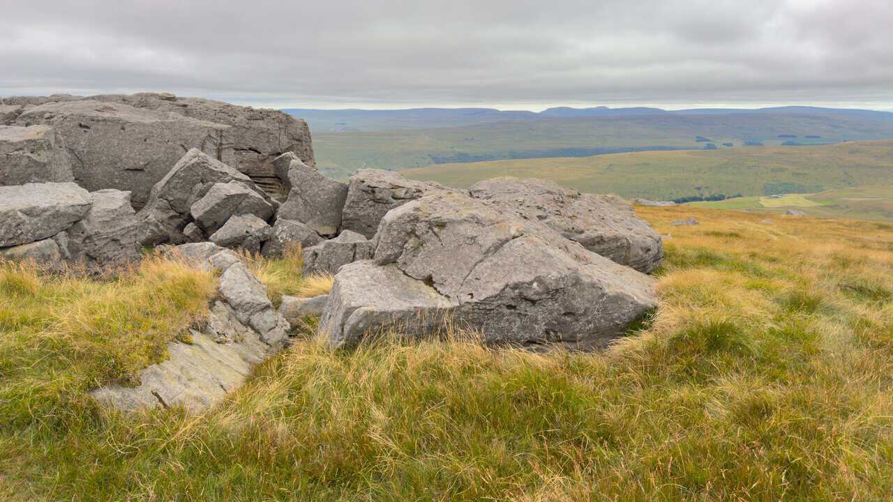
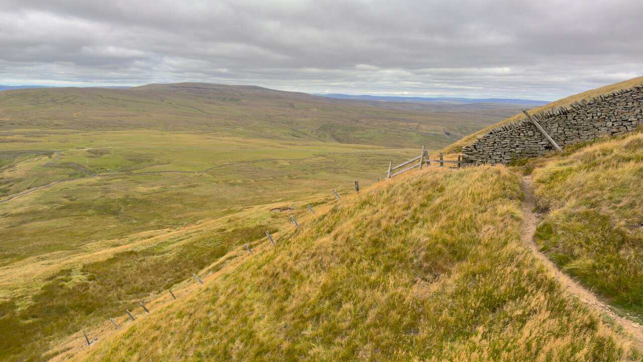
After the stile at Black Dike Hole the descent steepens sharply, with Buckden Pike rising away to the north-west.
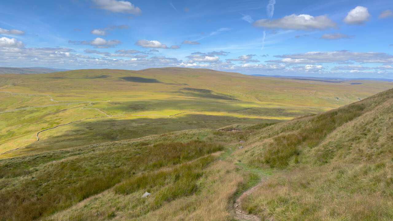
Beyond the road, the bridleway swings around the head of a fine valley. Fears Gill Beck runs down through it and becomes Cam Gill Beck, which is joined by Park Gill Beck before flowing on through Kettlewell to meet the Wharfe.
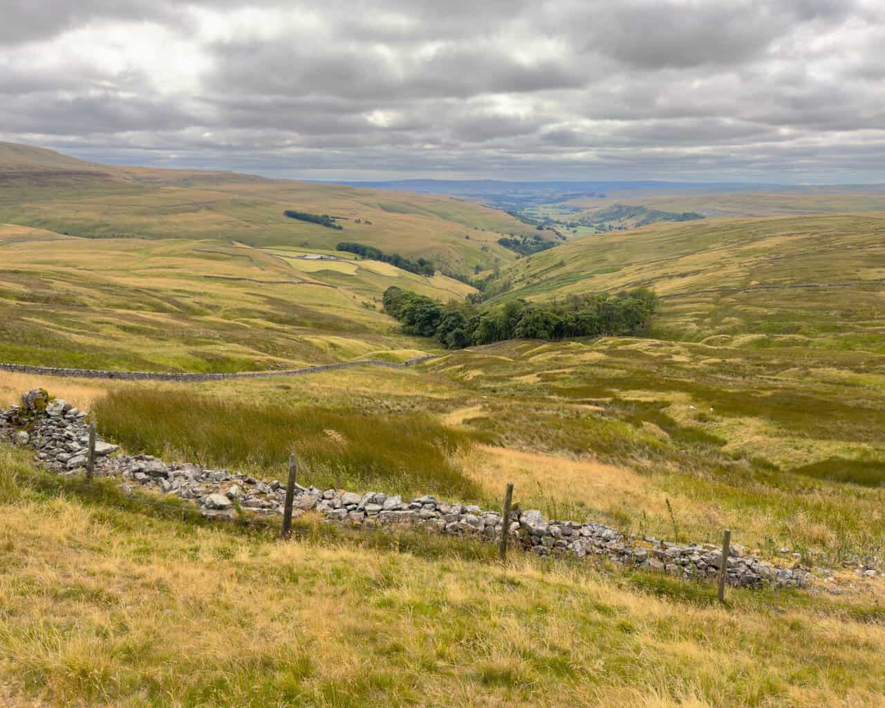
This is where the two routes part company. The longer walk crosses Sandy Gate, with Birks Fell filling the view to the west.
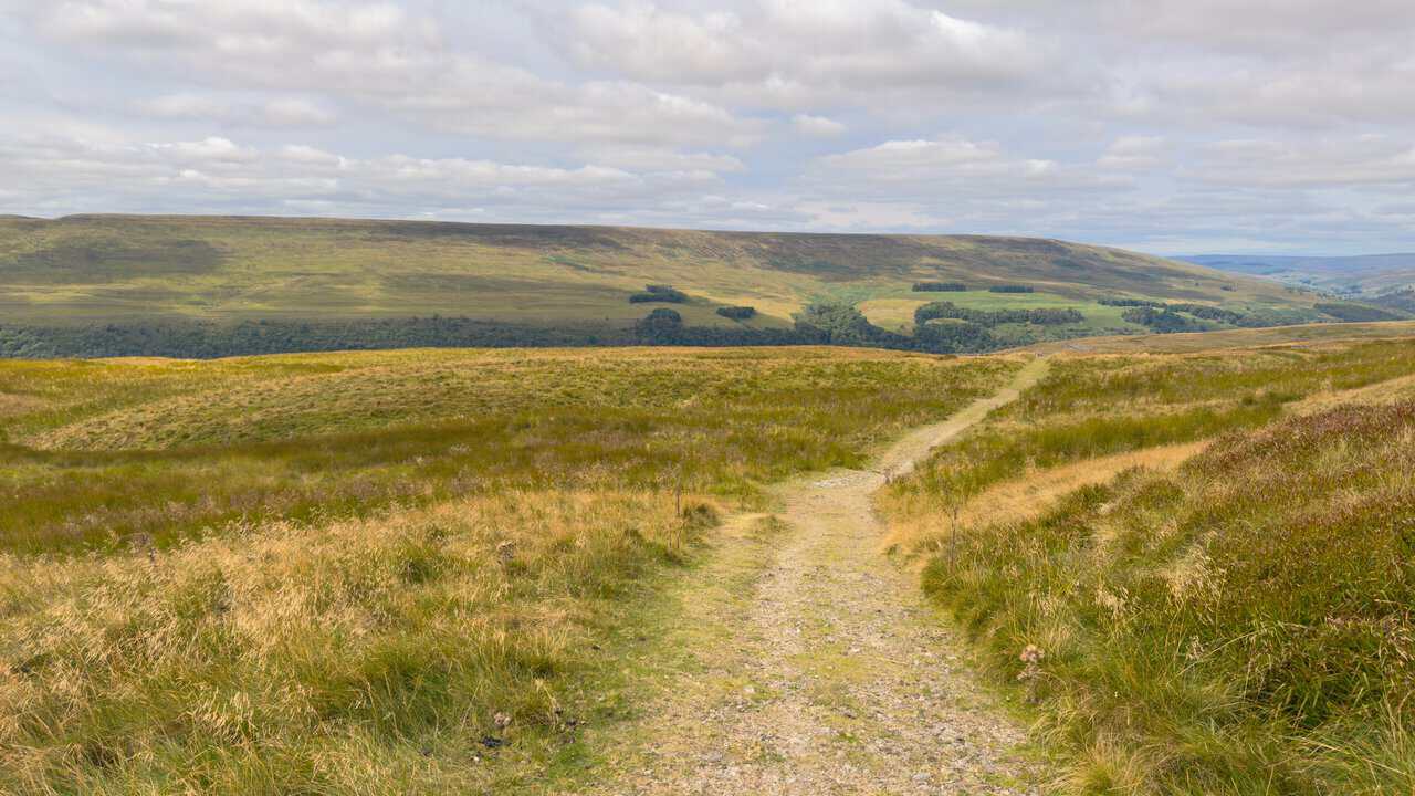
The shorter walk turns south instead, onto Top Mere Road, with Kettlewell far below in the fold of the dale.
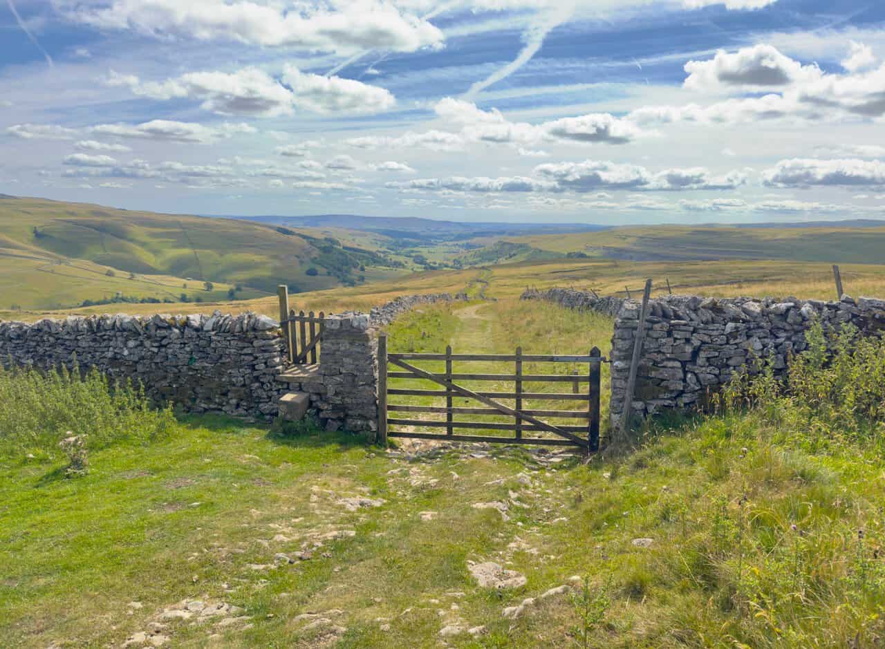
Starbotton Cam Road zigzags down the hillside, the loose stone giving way to concrete as the village comes into view.
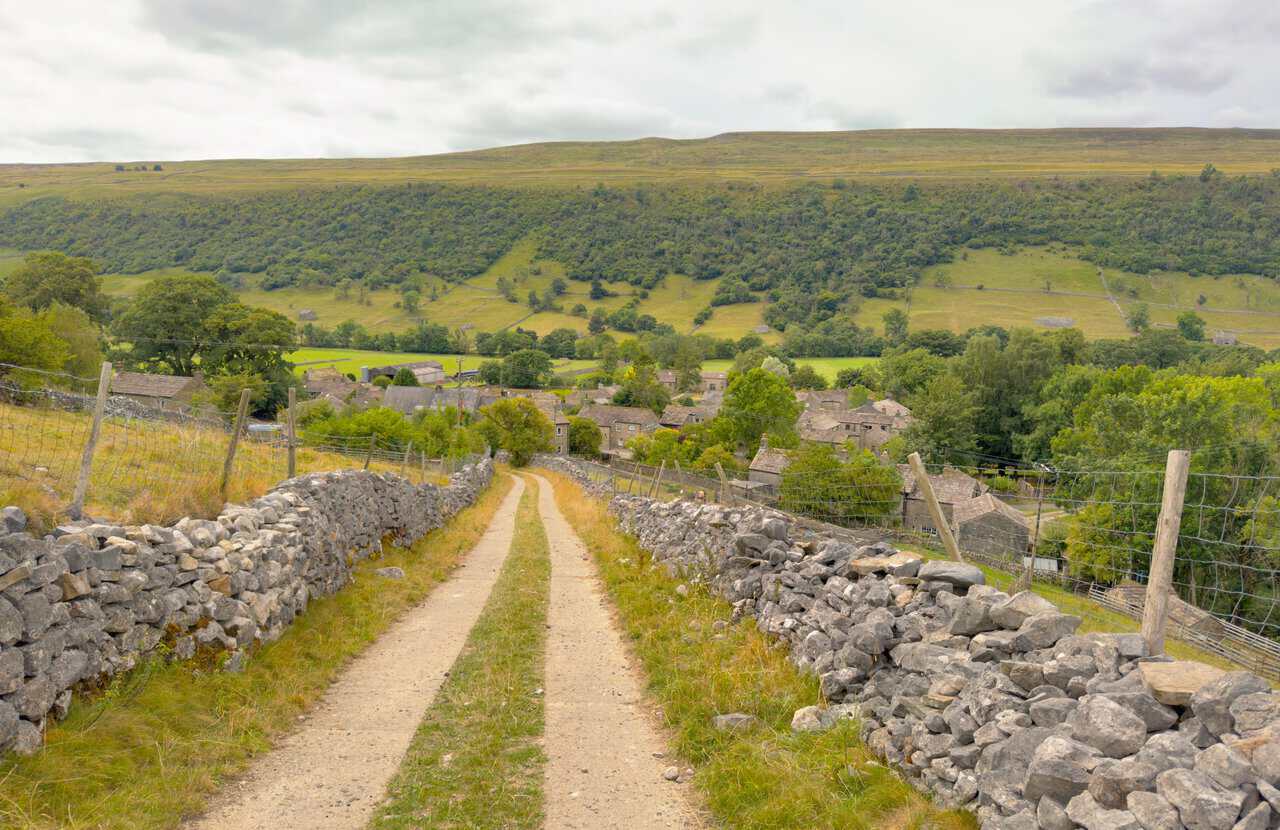
The final two miles of the longer route follow the Dales Way beside the River Wharfe, flat, easy and a gentle way to finish.
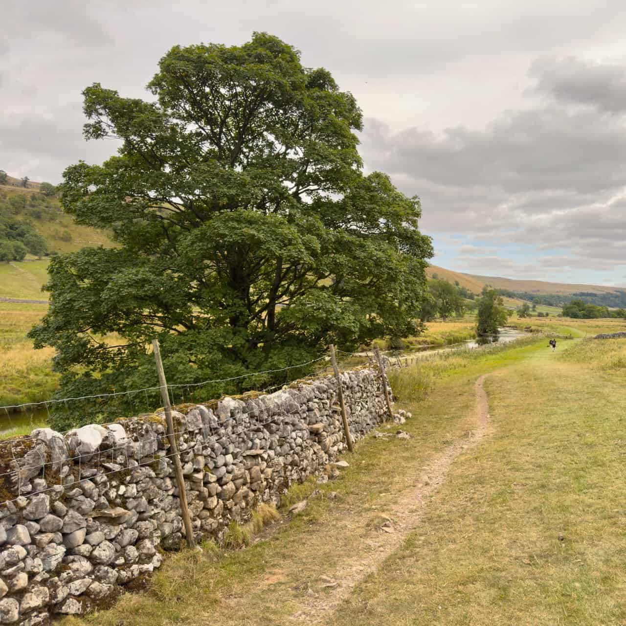
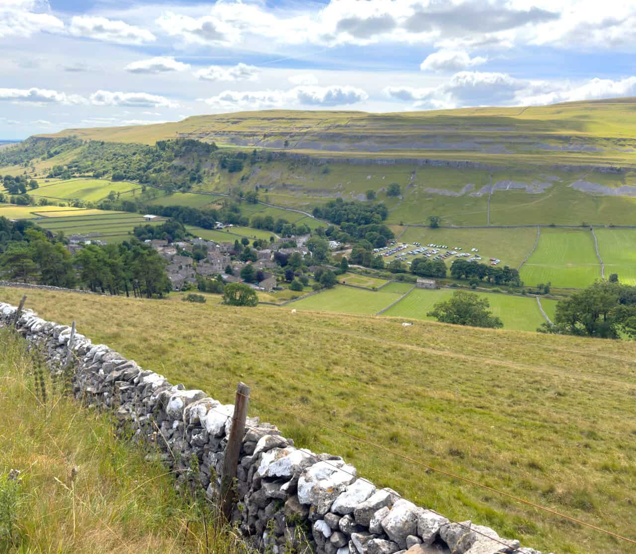
And both walks end in the same place, back in a village that was rather busier than usual on the day.
More Walks Near Great Whernside
If these Great Whernside walks appeal, there is plenty more walking within a few miles of the same car park. The Kettlewell walk crosses Old Cote Moor into Littondale and returns along the Wharfe, while the Buckden Pike walk climbs the fell opposite and visits the Polish Memorial Cross. The Wharfedale walk links Buckden, Starbotton and Kettlewell along the valley floor, and both the Buckden walk and the Yockenthwaite walk head further up the dale towards Langstrothdale and Hubberholme. For the full collection, including routes across Swaledale, Wensleydale, Ribblesdale and Dentdale, visit my guide to Yorkshire Dales walks.