Explore Waterfalls, Woodlands and Villages on These North Yorkshire Walking Routes
These North Yorkshire walking routes span some of England’s most varied landscapes, from windswept moors and peaceful forests to river valleys, waterfalls and stone-built villages rich in history. This collection of 20 classic trails showcases the region at its best, combining breathtaking scenery with well-planned routes suitable for all levels of walker.
Each entry below provides a concise scene-setter, the walk’s highlights and practical details, including distance, typical time, terrain and recommended mapping. Whether you’re planning a family outing, a challenging moorland hike or a gentle riverside stroll, you’ll find a route here to suit every taste and season.
The table on this page offers quick access to every walk: click the name to jump to its overview, tap ‘PDF’ to open the printable guide, or choose ‘Page’ to visit the dedicated walk page with extra photos and deeper context.
Scroll further to explore each route in turn. Every section includes two handy links: a printable PDF guide with clear mapping and step-by-step directions, and the dedicated walk page on my website for additional information and imagery.
From the tumbling cascades of Aysgarth Falls and the open ridges of Fremington Edge to the tranquil forests of Guisborough and the rolling fields of Wensleydale, these routes capture the essence of North Yorkshire at its finest. Take your pick, lace up your boots, and start exploring this carefully curated collection of North Yorkshire walking routes.
North Yorkshire Walking Routes Table of Contents
| Walk Name | Distance | Duration | Quick Links |
|---|---|---|---|
| Aysgarth Falls Walk | 2¾ miles | 1¼ hours | PDF | Page |
| Aysgarth Walk | 9 miles | 4¼ hours | PDF | Page |
| Bridestones Walk | 8 miles | 3¾ hours | PDF | Page |
| Cleveland 4 Peaks | 9 miles | 4¾ hours | PDF | Page |
| Cod Beck Reservoir Walk | 5 miles | 2½ hours | PDF | Page |
| Falling Foss Walk | 4¼ miles | 2¼ hours | PDF | Page |
| Falling Foss Waterfall Walk | 4½ miles | 2½ hours | PDF | Page |
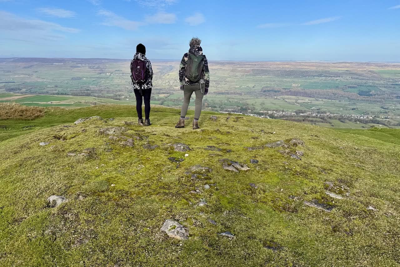
| Fremington Edge Walk | 7½ miles | 4 hours | PDF | Page |
| Guisborough Forest Walk | 7 miles | 3½ hours | PDF | Page |
| Gunnerside Gill Walk | 7 miles | 3½ hours | PDF | Page |
| High Force Walk | 8¼ miles | 4 hours | PDF | Page |
| Hole of Horcum Walk | 7¾ miles | 3¾ hours | PDF | Page |
| Hutton-le-Hole Walk | 9¼ miles | 4¼ hours | PDF | Page |
| Muker Walk | 8¼ miles | 4¼ hours | PDF | Page |
| North York Moors Walk | 8¼ miles | 3¾ hours | PDF | Page |
| Penhill Walk | 8¼ miles | 4 hours | PDF | Page |
| Rosedale Walk | 8 miles | 3¾ hours | PDF | Page |
| Sutton Bank Walk | 12 miles | 5½ hours | PDF | Page |
| Wensleydale Walk | 9¼ miles | 4¼ hours | PDF | Page |
| Yorkshire Moors Walk | 11½ miles | 5¾ hours | PDF | Page |

Walking in the Yorkshire Dales with 43 Circular Routes
AD This Cicerone guidebook includes 43 circular walks exploring valleys, hills, and moors between Kirkby Stephen and Pateley Bridge. With OS maps, local highlights, and routes ranging from 3–11 miles, it is a year-round companion for walkers of all abilities.
Aysgarth Falls Walk
Waterfalls, Woodlands and Family-Friendly Trails
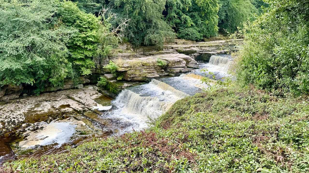
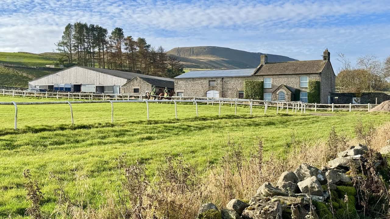
This easy circular walk explores one of the most scenic spots in Wensleydale, combining spectacular waterfalls, peaceful woodland paths and fascinating local landmarks. Starting from the car park on Church Bank beside the Aysgarth Falls Hotel, the route leads past St Andrew’s Church and Yore Mill before crossing Yore Bridge for views of the Upper Falls. It then continues to the Middle and Lower Falls, winds through Freeholders’ Wood and St Joseph’s Wood, and returns via Hollins House and the Yorkshire Dales National Park Visitor Centre. The well-maintained paths and short woodland climbs make this a delightful and accessible family adventure.
Why This is a Highlight of North Yorkshire Walking Routes
The PDF describes a 2¾-mile circular route, taking about 1¼ hours on well-signposted woodland and riverside paths. Highlights include the dramatic cascades of the River Ure at the Upper, Middle and Lower Falls, the historic Yore Mill, and St Andrew’s Church with its medieval rood screen from Jervaulx Abbey. The paths are mostly easy, with a few steps and uneven sections, and can be muddy after rain. Parking is at the Church Bank car park beside the Aysgarth Falls Hotel, and the recommended map is OS Explorer OL30. Perfect for families or anyone exploring North Yorkshire walking routes, this short loop captures the essence of the Dales in a single outing.

Grisport Unisex Adult Peaklander Hiking Boots
AD The Grisport Unisex Adult Peaklander Hiking Boots are crafted in Italy with a durable waxed leather upper, Spotex breathable lining, and a reliable Track-on rubber sole. Waterproof and weighing just 1120g, they offer comfort, resilience, and dependable performance on demanding trails.
Aysgarth Walk
Waterfalls, Castle Bolton and Wensleydale Views
This superb route links two of Wensleydale’s best-loved landmarks, Aysgarth Falls and Castle Bolton, while weaving through peaceful farmland, woodland and traditional Dales villages. Starting from Aysgarth village, the trail visits the famous stepped waterfalls of the River Ure before continuing through Freeholders’ and St Joseph’s Woods to Hollins House. From there, it heads north-east across open countryside to the historic stronghold of Bolton Castle, loops along Ellerlands Edge with fine views towards Penhill, then descends via Carperby to finish back in Aysgarth. It’s a wonderfully varied walk combining natural beauty with fascinating heritage.
An Inspiring Addition to North Yorkshire Walking Routes
The PDF outlines a 9-mile circular route taking around 4¼ hours, following field paths, farm tracks and well-defined bridleways. It’s moderate in difficulty, with gentle climbs, several gates and stiles, and a short road section near Castle Bolton where care is required. Highlights include the tumbling cascades of Aysgarth Falls, the atmospheric ruins of Bolton Castle, views of Penhill, and the charming villages of Carperby and Aysgarth. Parking is available along the A684 in Aysgarth village, and the recommended map is OS Explorer OL30. Ideal for walkers exploring North Yorkshire walking routes, this trail captures the timeless beauty of Wensleydale.

Bridestones Walk
Ancient Rock Formations and Moorland Scenery
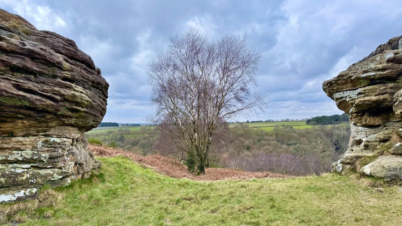
This circular walk from the Saltergate car park beside the A169 explores the dramatic landscape of the Bridestones Nature Reserve. Following Old Wife’s Way across Newgate Brow into the reserve, the route visits High Bride Stones, Needle Point and Dove Dale before looping around Staindale Lake and returning past Low Bride Stones. Along the way, you’ll enjoy sweeping moorland views, sculpted sandstone formations and tranquil wooded valleys, all within the heart of the North York Moors National Park. Expect varied walking terrain and constant interest throughout this classic circuit.
A Standout Option among North Yorkshire Walking Routes
The PDF details an 8-mile route taking around 3¾ hours on moorland tracks, grassy paths, woodland trails and short cobbled sections. Graded moderate, it offers a rewarding mix of open moor, ancient rock formations and shaded woodland. Highlights include High and Low Bride Stones, the ridge of Needle Point, views to Blakey Topping and the peaceful circuit of Staindale Lake. Parking is at Saltergate car park on the A169 opposite the Hole of Horcum, with mapping on OS Explorer OL27. For those seeking North Yorkshire walking routes that blend natural drama with geological intrigue, this one is hard to beat.
Grisport Unisex Adult Peaklander Hiking Boots
AD The Grisport Unisex Adult Peaklander Hiking Boots are crafted in Italy with a durable waxed leather upper, Spotex breathable lining, and a reliable Track-on rubber sole. Waterproof and weighing just 1120g, they offer comfort, resilience, and dependable performance on demanding trails.
Cleveland 4 Peaks
Four Summits on the Cleveland Way
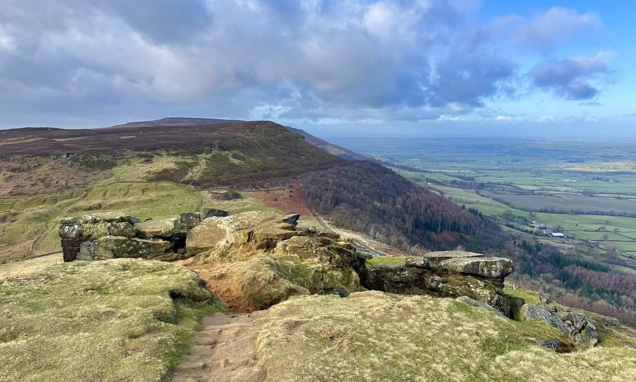
This exhilarating route in the north-western corner of the North York Moors links the four peaks of White Hill, Cold Moor, Cringle Moor and Carlton Bank. Beginning at the Forestry England car park at Clay Bank on the B1257, the trail follows the Cleveland Way across a spectacular succession of moorland ridges and rocky slopes. You’ll pass the dramatic Wain Stones, enjoy sweeping views from Cringle Moor’s Drake Howe cairn, and reach the trig point on Carlton Bank before looping back through woodland and open hillside. It’s a rewarding circuit that captures the rugged beauty and challenge of the Cleveland Hills.
An Exhilarating Choice among North Yorkshire Walking Routes
The PDF outlines a 9-mile circular route taking roughly 4¾ hours, graded moderate to challenging with steep ascents, cobbled sections and uneven moorland paths. Expect a total ascent of about 636 metres, with panoramic views across the Tees Valley, the North Sea coast and deep into the Moors. Key highlights include Wain Stones, Green Bank viewpoint, Lordstones Country Park, and the summit cairns marking each of the four peaks. Parking is available at Clay Bank car park beside the B1257 between Great Broughton and Chop Gate, and the recommended map is OS Explorer OL26. For walkers seeking North Yorkshire walking routes that combine history, geology and physical challenge, this one truly delivers.
Cod Beck Reservoir Walk
Reservoir Trails and Woodland Views
This peaceful circular walk starts in the attractive village of Osmotherley and combines village charm with reservoir scenery and open moorland. From the village cross, the route climbs gently along North End towards Cote Ghyll, where it passes a pretty waterfall and continues through woodland to reach Cod Beck Reservoir. The trail loops around the water’s edge, crosses the dam, and then rises over Scarth Wood Moor and Beacon Hill for sweeping views across the Tees Valley and the Hambleton Hills before returning to Osmotherley. It’s a relaxed, varied route ideal for a half-day outing in the North York Moors.
A Peaceful Choice among North Yorkshire Walking Routes
The PDF describes a 5-mile circuit taking about 2½ hours, following lanes, woodland paths, and moorland bridleways. Graded easy to moderate, it includes steady climbs to Scarth Wood Moor and Beacon Hill but remains straightforward throughout. Highlights include the stepped waterfall at Cote Ghyll, the mirrored surface of Cod Beck Reservoir, and the flagged path over the moor with panoramic views towards Black Hambleton. Parking is available in Osmotherley village centre, with toilets nearby, and the recommended map is OS Explorer OL26. For those exploring North Yorkshire walking routes that balance tranquillity and scenery, this one is a perfect fit.


Fifty Walks Across the Beautiful North York Moors National Park
AD Discover 50 routes across the North York Moors, from short easy strolls to challenging high-level hikes. With OS maps, route descriptions, and local highlights, it also includes the legendary 40-mile Lyke Wake Walk, described in four accessible stages.
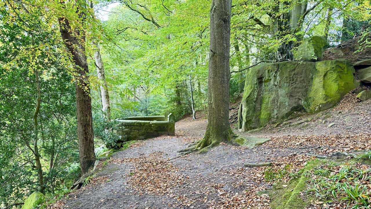
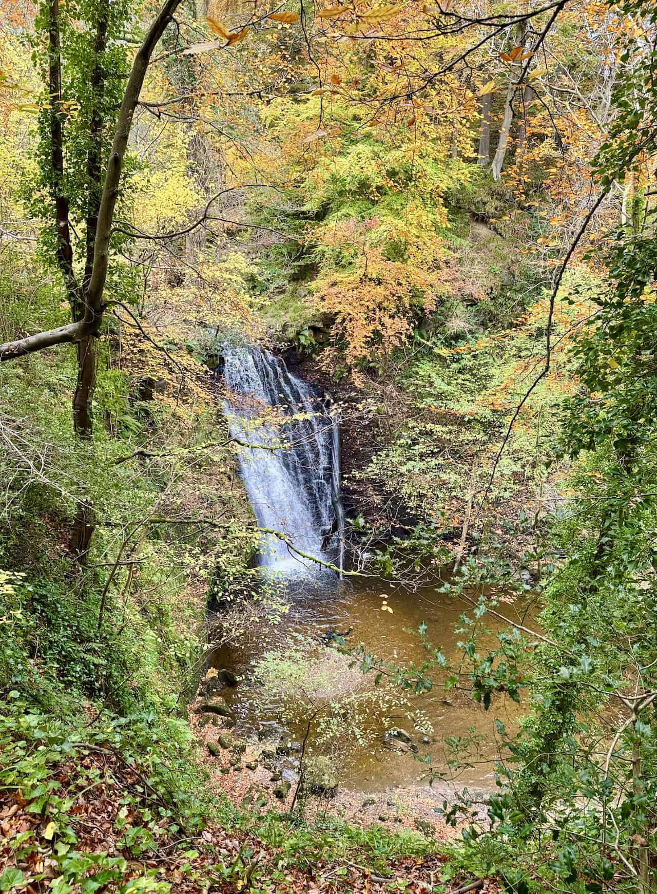
Falling Foss Walk
Waterfalls, Woodlands and Littlebeck
This family-friendly walk begins at May Beck Car Park and explores one of the North York Moors’ most enchanting wooded valleys. From the start, the route follows May Beck through quiet forest, crossing an arched stone bridge and passing Midge Hall to reach the lovely Falling Foss waterfall, where water plunges into a tranquil pool below. Continue north past The Hermitage, a unique sandstone chamber carved in 1790, and through Little Beck Wood Nature Reserve to the peaceful hamlet of Littlebeck with its ford and Methodist Chapel. Retrace your steps to return, enjoying a fresh perspective on this beautiful route.
A Family Favourite among North Yorkshire Walking Routes
The PDF sets out a 4¼-mile linear route, taking around 2¼ hours, mainly along well-maintained woodland paths and clear waymarked tracks. Graded easy, the walk is suitable for families, with pram-friendly paths up to The Hermitage and gentle gradients beyond. Highlights include the picturesque bridge near Midge Hall, the spectacular Falling Foss waterfall, and the peaceful return through Little Beck Wood. Parking is at May Beck Car Park, signposted from the B1416, and the recommended map is OS Explorer OL27. For anyone seeking North Yorkshire walking routes that combine natural beauty with accessibility, this is a perfect choice.
Falling Foss Waterfall Walk
Woodland Trails and Waterfall Views
This scenic circular trail from May Beck Car Park offers a wonderful introduction to the North York Moors, blending peaceful woodland with open countryside and the impressive Falling Foss waterfall. From May Beck, the route follows the stream through tranquil forest, passing Midge Hall and The Hermitage before entering Little Beck Wood Nature Reserve and the hamlet of Littlebeck. From there, you cross fields beside Great Wood to reach Leas Head Farm and Foss Farm, then return via the stone bridge near Midge Hall to complete the circuit. It’s a varied walk rich in natural charm and gentle beauty.
A Gentle Gem among North Yorkshire Walking Routes
The PDF outlines a 4½-mile circular route, taking about 2½ hours on mostly well-maintained woodland and countryside paths. Graded easy to moderate, it features a few short climbs and muddy spots near Little Beck Wood but remains accessible for most walkers. Highlights include the photogenic Falling Foss waterfall, the intriguing 18th-century Hermitage, boardwalks through shady woodland, and the tranquil return past Leas Head and Foss farms. Parking is available at May Beck Car Park, signposted from the B1416, and the recommended map is OS Explorer OL27. Among North Yorkshire walking routes, this one perfectly balances scenery, serenity, and accessibility.
Fifty Walks Across the Beautiful North York Moors National Park
AD Discover 50 routes across the North York Moors, from short easy strolls to challenging high-level hikes. With OS maps, route descriptions, and local highlights, it also includes the legendary 40-mile Lyke Wake Walk, described in four accessible stages.
Fremington Edge Walk
Sweeping Views over Arkengarthdale and Calver Hill
Starting in the heart of Reeth, this rewarding circular route explores the long ridge of Fremington Edge, offering magnificent panoramas across Arkengarthdale and Calver Hill. The trail begins on quiet village lanes before climbing steadily through Intake Wood to reach open moorland. Once on the ridge, a grassy path follows the escarpment’s edge, leading past a tall cairn at Fell End and through a landscape shaped by lead and chert mining. The descent passes Heggs House and Castle Farm, returning to Reeth through green pastures and stone-walled fields. It’s a walk full of variety, history and open skies.
A Classic Choice among North Yorkshire Walking Routes
The PDF outlines a 7½-mile circular walk taking around 4 hours, graded moderate with one steep climb onto Fremington Edge and a zigzag descent through old mining ground. Terrain includes tarmac lanes, stony tracks, grassy paths and bridleways, with gates, stiles and uneven sections along the way. Landmarks include the cairn at Fell End, Storthwaite Hall, Heggs House and the mining remains below the escarpment. Parking is available in Reeth village centre near the green, and the recommended map is OS Explorer OL30. Among North Yorkshire walking routes, this one stands out for its ridge-top drama, industrial heritage and ever-changing views across Swaledale.

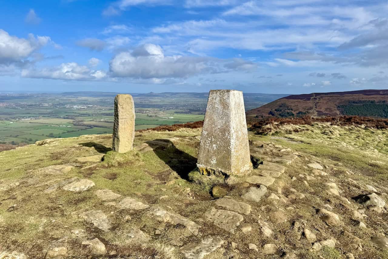
Guisborough Forest Walk
Forest Trails and Roseberry Topping Views
This scenic circular route from the Guisborough Forest & Walkway Visitor Centre in Pinchinthorpe explores some of the most varied landscapes in the north-western North York Moors. Starting along a disused railway line, the trail climbs gradually through Bousdale Wood and High Bousdale Wood before emerging onto Roseberry Common. Here, wide views open across Teesside and the North Sea, and there’s an option to climb the iconic Roseberry Topping for a truly memorable panorama. The route continues via Hanging Stone, with dramatic views of Guisborough, before descending through peaceful woodland and returning along the railway path to the visitor centre.
A Varied Adventure among North Yorkshire Walking Routes
The PDF describes a 7-mile circular route, taking around 3½ hours on forest tracks, moorland paths and sections of the Cleveland Way. Graded moderate, it includes steady woodland climbs and a short but steep ascent of Roseberry Topping for those choosing the optional detour. Highlights include Hanging Stone viewpoint, Little Roseberry, woodland sculptures along the walkway and the friendly Branch Walkway Café at the finish. Parking is at the Guisborough Forest & Walkway Visitor Centre in Pinchinthorpe (pay-and-display), and the recommended map is OS Explorer OL26. For walkers looking for North Yorkshire walking routes that combine forest, hill and coast views, this is an outstanding choice.

Osprey Hikelite Unisex Backpack for Comfortable and Lightweight Hiking
AD The Osprey Hikelite backpack combines lightweight design with practical features, including a breathable mesh back panel, soft webbing straps, and stretch mesh water bottle pockets. With zipped storage and an organiser compartment, it is ideal for day hikes and outdoor use.
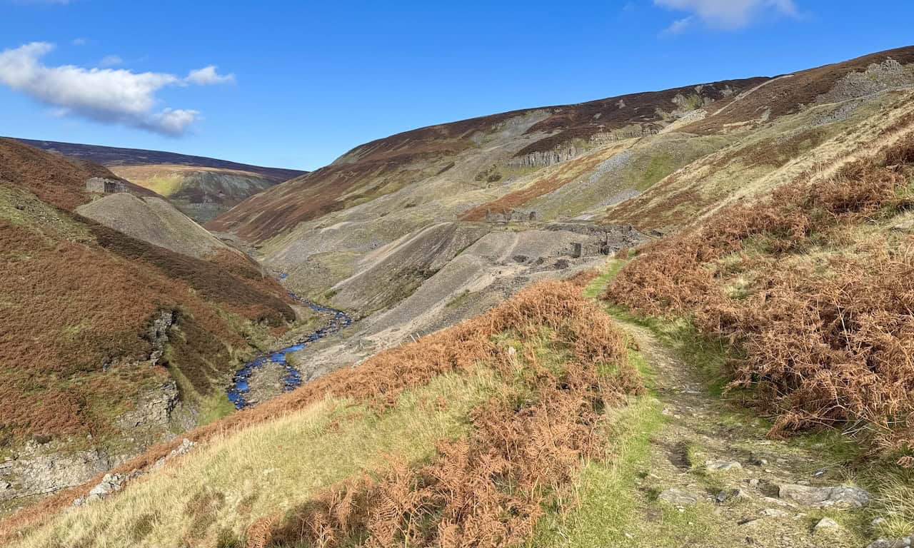
Gunnerside Gill Walk
Mining Heritage and Dales Scenery
This fascinating circular walk begins in the Swaledale village of Gunnerside and explores the historic valley of Gunnerside Gill, once a thriving centre of lead mining. Following Gunnerside Beck north through woodland and open fields, the route visits the remains of the Sir Francis Dressing Floor, Bunting Mine and Blakethwaite Smelt Mill before looping south via Ivelet and quiet farmland. Along the way, you’ll discover hushes, spoil heaps and old smelting structures, all set amid some of the most dramatic scenery in the Yorkshire Dales. The return offers broad views across the valley and a gentle descent into the village.
A Historic Highlight among North Yorkshire Walking Routes
The PDF outlines a 7-mile circular route taking about 3½ hours, graded moderate with a steady valley ascent, a short steep descent and occasional uneven ground. The paths range from riverside tracks to moorland edges, with grassy sections, steps and short lanes. Key sights include the Sir Francis Dressing Floor, Blakethwaite Smelt Mill, Silver Hill, Jingle Pot Edge and the peaceful hamlet of Ivelet. Parking is available in the centre of Gunnerside near the King’s Head pub, and the recommended map is OS Explorer OL30. For walkers interested in industrial history and timeless Dales landscapes, this is one of the most rewarding North Yorkshire walking routes.
High Force Walk
Low Force, High Force and Bleabeck Force Circuit
Begin at Bowlees Visitor Centre and cross Wynch Bridge to join the Pennine Way beside the River Tees. Follow the well-made path past sandstone sheep sculptures to Low Force, then continue upstream for grand views of High Force as the river drops 21 metres into its plunge pool. Keep west on the Pennine Way to Bleabeck Force, climb Bracken Rigg and descend towards Cronkley for the footbridge crossing to the north bank. A quiet lane leads back past Dirt Pit to Bowlees, rounding off a superb loop of Teesdale’s finest waterfalls with wide moorland views and easy navigation throughout.
A Waterfall Classic among North Yorkshire Walking Routes
The route is 8¼ miles and about 4 hours on riverside footpaths, flagged sections, stone tracks and short lanes, with steps, a steady climb over Bracken Rigg and occasional muddy patches after rain. Highlights include Low Force, High Force, Bleabeck Force, Dine Holm Scar and the airy stretch above the Tees. Start and park at Bowlees Visitor Centre (facilities on site). The recommended map is OS Explorer OL31 (North Pennines). For anyone comparing North Yorkshire walking routes with nearby Teesdale days out, this circuit combines big scenery, simple wayfinding and waterfall drama in one go.

Osprey Hikelite Unisex Backpack for Comfortable and Lightweight Hiking
AD The Osprey Hikelite backpack combines lightweight design with practical features, including a breathable mesh back panel, soft webbing straps, and stretch mesh water bottle pockets. With zipped storage and an organiser compartment, it is ideal for day hikes and outdoor use.
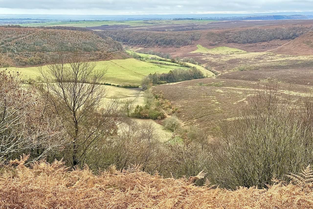
Hole of Horcum Walk
Skelton Tower, Levisham Moor and the Devil’s Punchbowl
This classic circular route begins at the North York Moors National Park car park at Saltergate and descends into the vast amphitheatre of the Hole of Horcum, one of the most spectacular natural features in the park. The trail passes the stone barn at Low Horcum, crosses the valley floor, and climbs steeply through Dundale Griff to reach the village of Levisham. From there, it follows Braygate Lane out onto the open moor towards Skelton Tower, perched high above Newton Dale. The return journey runs north-east across Levisham Bottoms beneath West Side Brow, where sweeping moorland views accompany you back to Saltergate.
A Dramatic Landmark among North Yorkshire Walking Routes
The PDF outlines a 7¾-mile circular walk taking about 3¾ hours, graded moderate with two steeper sections: the climb through Dundale Griff and the final ascent to Saltergate. The paths range from grassy and gravel tracks to firm lanes and moorland bridleways, with occasional muddy stretches after rain. Highlights include the views into the Devil’s Punchbowl, the landmark at Low Horcum, Levisham’s Horseshoe Inn and St John’s Church, and the magnificent panorama from Skelton Tower over the North Yorkshire Moors Railway. Parking is at the Saltergate car park beside the A169, and the recommended map is OS Explorer OL27. Among North Yorkshire walking routes, this one stands out for its drama, variety and geological story.
Hutton-le-Hole Walk
Lastingham, Spaunton and Appleton-le-Moors Circuit
This rewarding circular walk starts from the National Park car park in Hutton-le-Hole, one of the most picturesque villages in the North York Moors. The route winds through meadows, woodlands and quiet lanes to visit Lastingham, Spaunton and Appleton-le-Moors, three historic villages steeped in character. You’ll pass Jennie’s Bridge over Hole Beck, explore the ancient crypt at St Mary’s Church in Lastingham, and enjoy peaceful sections on moorland tracks such as Spauntons Lane and Lingmoor Lane. With rolling farmland, heather moor and timeless stone villages, the walk showcases a rich cross-section of North York Moors scenery.
A Picturesque Journey among North Yorkshire Walking Routes
The PDF outlines a 9¼-mile circular walk taking around 4¼ hours, graded moderate with gentle gradients and one steeper climb through Hagg Wood. Terrain includes meadow and woodland paths, bridleways, stone farm tracks and quiet roads with grassy verges. Points of interest include the Ryedale Folk Museum, the pewter-lined bar of The Blacksmiths Arms, and Lastingham’s medieval church crypt. Parking is available in the National Park car park at Hutton-le-Hole, which also offers toilets and easy access to cafés and shops. The recommended map is OS Explorer OL26. Among North Yorkshire walking routes, this one combines heritage, village charm and scenic variety in perfect balance.


Peak Bagging Wainwrights with Routes to Complete All Fells
AD This comprehensive guide offers 45 circular routes linking all 214 Wainwright fells. With maps, GPX downloads, elevation profiles, and practical advice, it provides efficient yet inspiring ways to complete this classic Lake District challenge at your own pace.
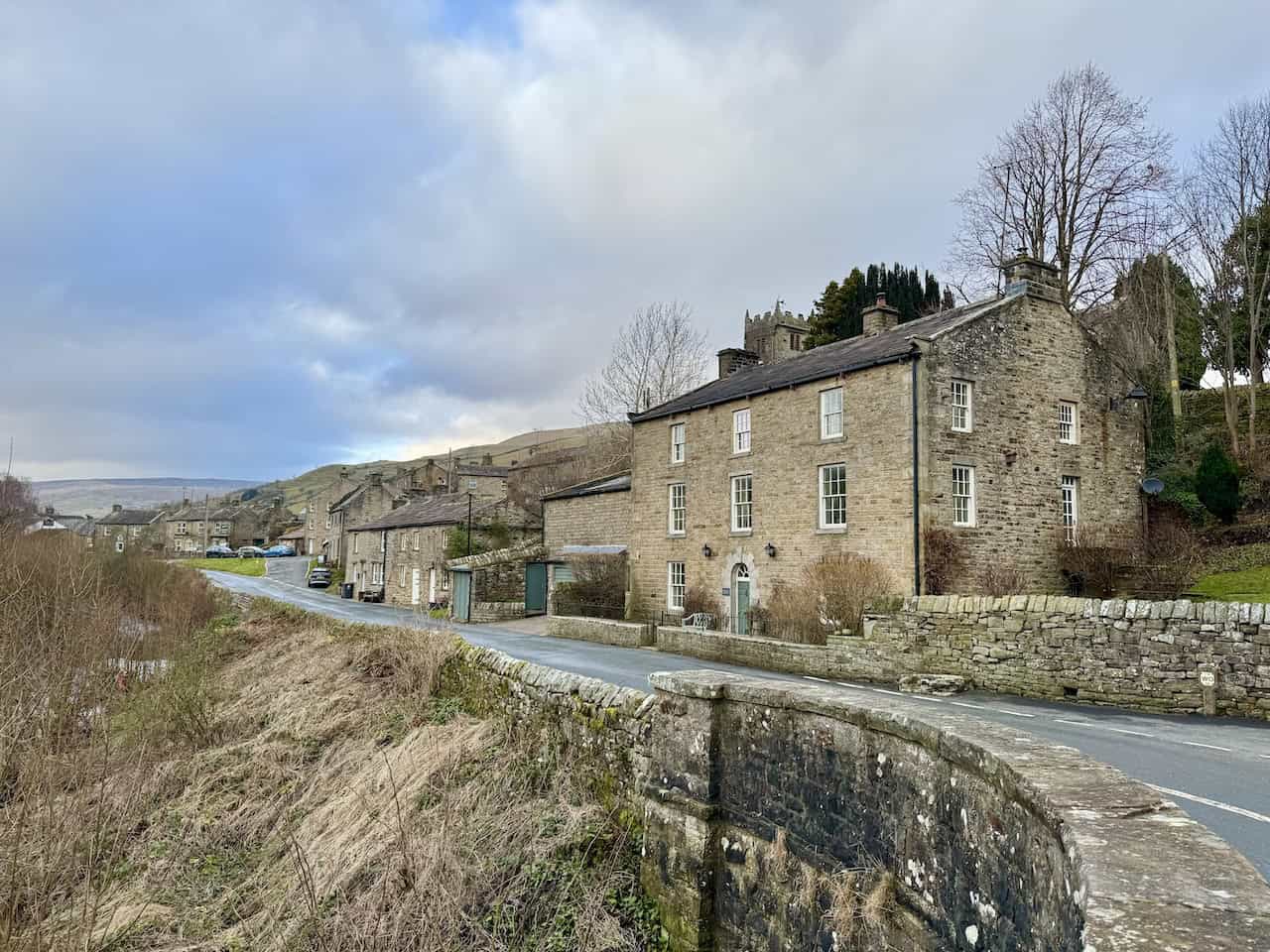
Muker Walk
Waterfalls, Valley Views and Swaledale Heritage
This outstanding circular route explores the beautiful Swaledale landscape from Muker, linking a series of spectacular waterfalls with classic Dales scenery. From the village car park beside Straw Beck, the path climbs the slopes of Kisdon, joining the Pennine Way towards Keld. Along the way, you’ll visit East Gill Force, Currack Force and Wain Wath Force, with an optional detour to the twin falls of Kisdon Force. The return follows the peaceful woodland of Rukin Wood and the flagged meadow paths along the River Swale, offering a perfect balance of riverside charm, open moorland and traditional stone barns.
A Dales Favourite among North Yorkshire Walking Routes
The PDF outlines an 8¼-mile circular route taking around 4¼ hours, graded moderate with steady climbs and optional steep descents near the waterfalls. Terrain includes grassy field paths, cobbled lanes, stone tracks and flagged meadow paths that can be muddy in places. Highlights include the East Gill, Currack and Wain Wath waterfalls, the secluded woodland of Rukin Wood, and sweeping views of the River Swale valley. Parking is available in Muker village car park on Gunning Lane (B6270), with toilets and nearby refreshments. The recommended map is OS Explorer OL30. Among North Yorkshire walking routes, this one showcases the very best of Swaledale’s drama, tranquillity and timeless charm.
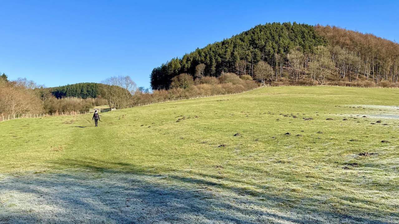
North York Moors Walk
Whisper Dales, Broxa Forest and Hackness
This rewarding circular walk from Hackness explores the peaceful valleys and forests of the eastern North York Moors. Starting near the village school and crossing Lowdales Beck, the route follows quiet country lanes to Low Dales and Whisper Dales, where grassy bridleways trace the course of Whisperdales Beck. It then climbs steadily into Broxa Forest, a tranquil woodland of pines and birches, before reaching Barns Cliff End for stunning views across Harwood Dale. The return leg descends via High Dales and Lowdales Farm, finishing with a gentle stroll back into Hackness beside the beck and village church.
A Tranquil Adventure among North Yorkshire Walking Routes
The PDF outlines an 8¼-mile circular walk taking around 3¾ hours, graded moderate with a steady ascent through Broxa Forest. Terrain includes grassy valley paths, forest tracks and quiet lanes, with occasional muddy spots near Lowdales Farm. Highlights include the peaceful valleys of Whisper Dales, views from Barns Cliff End, and historic landmarks such as St Peter’s Church and Hackness Hall. Parking is available roadside in Hackness opposite the village school, and the recommended map is OS Explorer OL27. Among North Yorkshire walking routes, this one offers a perfect mix of woodland, moorland and rural tranquillity just a few miles west of Scarborough.
Peak Bagging Wainwrights with Routes to Complete All Fells
AD This comprehensive guide offers 45 circular routes linking all 214 Wainwright fells. With maps, GPX downloads, elevation profiles, and practical advice, it provides efficient yet inspiring ways to complete this classic Lake District challenge at your own pace.
Penhill Walk
Penhill Beacon and the Historic Preceptory
This superb circular route from the village of West Witton explores the dramatic slopes of Penhill, one of Wensleydale’s most distinctive landmarks. From the roadside parking area on the A684, the trail climbs through open fields towards Capplebank Plantation and ascends the steep stone steps to Penhill Farm. The route continues up a bridleway to the summit, where a stone shelter and Penhill Beacon offer sweeping views across Wensleydale and Coverdale. The descent passes through old quarry workings before looping past the atmospheric ruins of the Penhill Preceptory, founded by the Knights Templar in the early 13th century.
A Historic Highpoint among North Yorkshire Walking Routes
The PDF describes an 8¼-mile circular walk taking around 4 hours, graded moderate to challenging with several steep sections on the ascent and descent of Penhill. Terrain includes grassy field paths, bridleways, stone steps, tarmac lanes and stony tracks, with some uneven and muddy areas after rain. Highlights include Penhill Beacon, the stone summit shelter, the zigzag descent through Penhill Quarry and the medieval remains of the Penhill Preceptory. Parking is on the A684 at the eastern side of West Witton, and the recommended map is OS Explorer OL30. Among North Yorkshire walking routes, this one blends stunning views with historical intrigue for a truly memorable Dales experience.
Rosedale Walk
Industrial Remains, Railway Views and Daleside Paths
This fascinating circular walk begins at the green in Rosedale Abbey, a picturesque village in the heart of the North York Moors. The route explores a mix of pastoral scenery and remarkable industrial heritage, heading through the churchyard of St Mary and St Lawrence before climbing towards Low Bell End Farm and the old Rosedale Railway. The trail passes the dramatic Stone Kilns and Iron Kilns, remnants of the area’s ironstone mining era, then descends through woodland to Dale Head Farm Tea Garden for a well-earned break. The return follows peaceful paths beside the River Seven and through the hamlet of Thorgill, offering a fine blend of history, views and tranquillity.
A Historic Gem among North Yorkshire Walking Routes
The PDF outlines an 8-mile circular route taking about 3¾ hours, graded moderate with steady gradients and a short, steeper descent near Dale Head. Terrain includes stone farm tracks, grassy field paths, boardwalks, and sections of the old railway embankment. Highlights include the church and priory remains in Rosedale Abbey, the restored industrial relics at the Stone and Iron Kilns, and refreshments at Dale Head Farm Tea Garden. Parking is available around the village green, and the recommended map is OS Explorer OL26. Among North Yorkshire walking routes, this one stands out for its rich industrial heritage, scenic diversity and timeless charm in the heart of the moors.


Berghaus Hillmaster II GTX Men's High Rise Hiking Boots
AD The Berghaus Hillmaster II GTX men’s hiking boots feature a waterproof, breathable GORE-TEX membrane, a memory foam tongue and collar for a personalised fit, and a Vibram sole delivering exceptional grip, stability, and shock protection for confident performance on any terrain.
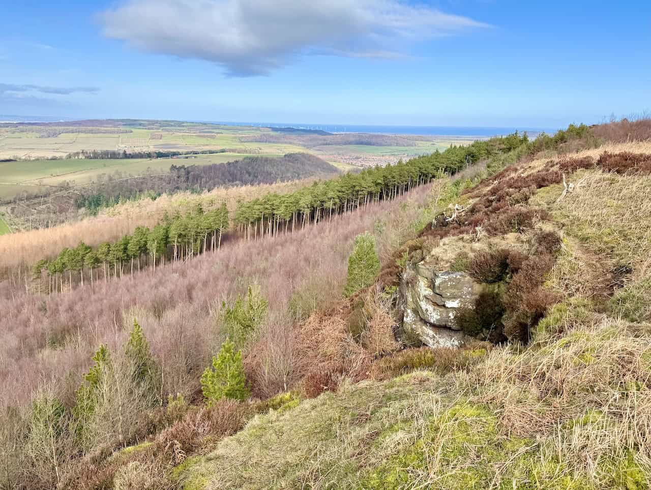
Sutton Bank Walk
From the Kilburn White Horse to High Paradise
This scenic linear walk follows the Cleveland Way along the dramatic escarpment of Sutton Bank, linking some of the finest viewpoints in the North York Moors. Beginning at the car park on Low Town Bank Road near the Yorkshire Gliding Club, the route passes above the famous Kilburn White Horse before continuing north past Ivy Scar, Roulston Scar and the Sutton Bank Visitor Centre. The ridge offers vast panoramas across the Vale of Mowbray, glimpses of gliders overhead, and a chance to visit historic landmarks such as the Iron Age hillfort on Roulston Scar. The trail then leads through Boltby Forest to the peaceful hamlet of High Paradise, where walkers can rest before returning the same way.
An Elevated Favourite among North Yorkshire Walking Routes
The PDF describes a 12-mile there-and-back route taking around 5½ hours, graded easy to moderate with gentle gradients and excellent waymarking throughout. Terrain includes well-maintained National Trail paths of compact gravel and stone, with some narrow or exposed sections near the escarpment edge. Highlights include Ivy Scar, Roulston Scar, the Sutton Bank toposcope, Whitestone Cliff, Sneck Yate and Boltby Forest. Parking is available at the Low Town Bank Road car park near the gliding club, with an alternative start at the White Horse car park below the hill. The recommended map is OS Explorer OL26. Among North Yorkshire walking routes, this one is renowned for its big skies, grand viewpoints and peaceful moorland atmosphere.

Wensleydale Walk
Redmire Force, Bolton Estate and River Ure Circuit
This delightful circular route begins in the picturesque village of Wensley beside the River Ure. From the roadside car park near Wensley Bridge, the trail leads through Wensley Park on the Bolton Estate before passing the old Keldheads Lane Smelt Mill and climbing gently to Preston-under-Scar. Crossing rolling farmland, the walk continues towards Redmire, where St Mary’s Church and the peaceful village green mark a perfect rest stop. From there, a permissive path leads through woodland to Redmire Force, a hidden gem of cascades on the River Ure. The return journey follows the river, passes Bolton Hall, and winds back through Wensley Park to complete the loop.
A Charming Riverside Option among North Yorkshire Walking Routes
The PDF outlines a 9¼-mile circular route taking roughly 4¼ hours, graded moderate with a mix of field paths, woodland trails and village lanes. Expect fine scenery, gentle gradients and occasional muddy patches near the riverside. Highlights include Holy Trinity Church in Wensley, views of Penhill, the industrial remains at Keldheads Smelt Mill, Redmire’s stone-built charm and the cascades of Redmire Force. Parking is beside Wensley Bridge on the A684 at the village’s southern edge, and the recommended map is OS Explorer OL30. Among North Yorkshire walking routes, this one stands out for its classic Dales scenery, riverside tranquillity and rich local history.

Berghaus Hillmaster II GTX Men's High Rise Hiking Boots
AD The Berghaus Hillmaster II GTX men’s hiking boots feature a waterproof, breathable GORE-TEX membrane, a memory foam tongue and collar for a personalised fit, and a Vibram sole delivering exceptional grip, stability, and shock protection for confident performance on any terrain.
Yorkshire Moors Walk
Masham Moor, Dale Edge and Colsterdale
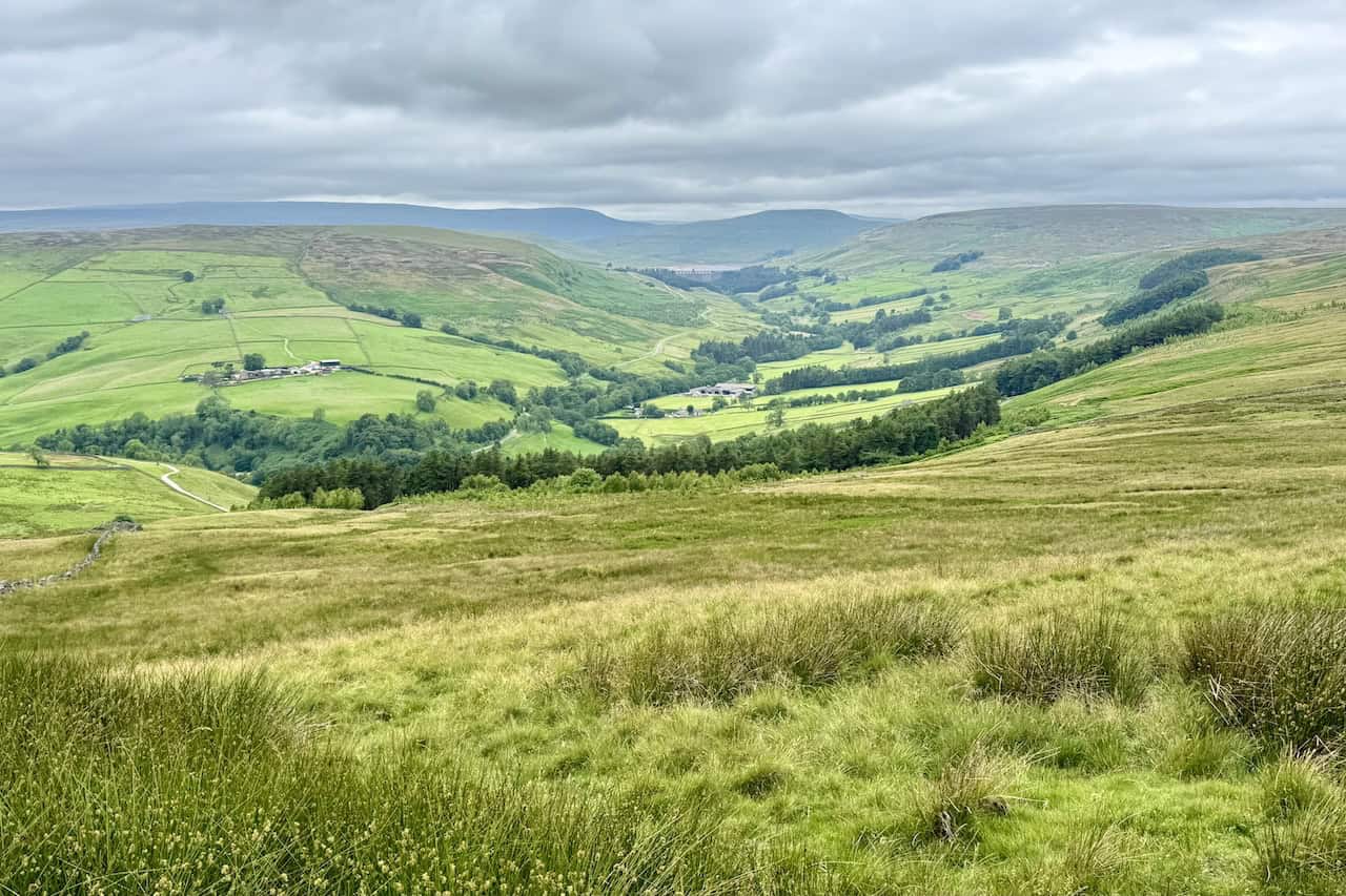
Starting from the small car park at Gollinglith Foot beside the River Burn, this superb upland circuit links big-sky moorland with quiet valley tracks. A steady climb reaches the long bridleway on Dale Edge for far-reaching views towards Nidderdale and the high Dales, before turning across the open moor towards South Haw. The route then drops into peaceful Colsterdale to meet Coal Road, an easy grassy track that guides you back towards the valley. A final footbridge crossing of the Burn returns you to the start, rounding off a day of wide horizons, heather moor and timeless rural scenery.
A Big-Sky Classic among North Yorkshire Walking Routes
The PDF sets out an 11½-mile circular walk taking around 5¾ hours, mainly on clear bridleways, moorland tracks and quiet lanes with some boggy patches after rain. Highlights include the airy traverse of Dale Edge, the cross-moor link towards South Haw, the gentle return along Coal Road and the pretty footbridge over the River Burn at the finish. Parking is at Gollinglith Foot, and the recommended mapping is OS Explorer 298 (Nidderdale). For anyone comparing North Yorkshire walking routes that deliver remoteness without tricky navigation, this one is a standout.
Related Post: Best Walks in the North York Moors
Experience the best walks in the North York Moors with this ultimate directory