ADVERTISEMENT
Fall in Love With England on These Yorkshire Dales Walks
Explore the magnificent Yorkshire Dales with my comprehensive guide to a fine collection of Yorkshire Dales walks. The majority of the Yorkshire Dales National Park, which covers 841 square miles, lies in North Yorkshire, with a sizeable area in Cumbria and a small part in Lancashire. The national park was designated in 1954, and the westward extension into Cumbria and Lancashire followed in 2016.
The Yorkshire Dales is famous for its outstanding scenery, unspoilt countryside, diverse wildlife habitats and rich cultural heritage. It includes some of the finest limestone scenery in the UK, along with remote heather moorland tops, picturesque stone-built villages and traditional farming landscapes of field barns, dry stone walls and flower-rich hay meadows. Visit Yorkshire Dales Online and Yorkshire Dales National Park to find out more.
Below, I highlight three of my favourite Yorkshire Dales walks, each showcasing a different corner of this remarkable national park. Remember, these are just a taste of the walks available, with the full list detailed further down the page.
ADVERTISEMENT
Yorkshire Dales Walks: My Three Favourites
My first highlight among these Yorkshire Dales walks is the Ingleborough walk, a 10½-mile circular route starting from the village of Clapham. The path heads north through a limestone valley to Ingleborough Cave, then climbs through the dramatic ravine of Trow Gill, with a short detour to the vast pothole of Gaping Gill. From there it ascends Little Ingleborough and continues to the flat-topped summit of Ingleborough, the second-highest peak in the Yorkshire Dales and one of the famous Three Peaks. The return follows the Dales High Way across Simon Fell Breast, crosses an expanse of limestone pavement near Nick Pot and heads back along Long Lane and Thwaite Lane, passing through the Clapham tunnels to finish in the village. It is a varied and rewarding walk, full of geological interest and dramatic mountain scenery.
My second pick of these Yorkshire Dales walks, the Kettlewell walk, is a 9-mile circuit linking the valleys of Littondale and Wharfedale. From Kettlewell, the route climbs through woodland and open meadow before descending into Littondale at the hamlet of Hawkswick. A lovely riverside path then follows the River Skirfare to Arncliffe, the village used as a filming location for All Creatures Great and Small. After crossing Cowside Beck and the River Skirfare, the trail climbs steeply over Old Cote Moor past Brayshaw Scar before dropping back into Wharfedale near Starbotton. A gentle stretch of the Dales Way alongside the River Wharfe leads back to Kettlewell. It is a walk through two contrasting dales, with riverside paths, quiet villages and a strong sense of history.
Rounding off my top three Yorkshire Dales walks is the Muker walk, an 8¼-mile circular route through the heart of Swaledale. From the village of Muker, the path climbs the slopes of Kisdon and skirts its southern and western flanks before descending to Keld. Here the route takes in a string of waterfalls, including East Gill Falls, Currack Force, Wain Wath Force and the hidden Kisdon Force, set within its protected woodland. The return passes through the ancient woodland of Rukin Wood and follows the River Swale southwards, finishing along the stone-flagged paths of the celebrated Muker hay meadows. It is a route rich in waterfalls, far-reaching views and traditional Dales scenery.
These three Yorkshire Dales walks reveal just a fraction of the adventures waiting in this magnificent national park. Whether you are drawn to limestone peaks, riverside paths, tumbling waterfalls or quiet stone-built villages, the Yorkshire Dales has a trail to suit every walker. For more detailed descriptions and a wider selection of routes, please explore the full list below.
A Journey Through the Yorkshire Dales’ Footpaths
Aysgarth Falls Walk: A Family-Friendly Circular Walk in Yorkshire
2.8 miles | 4.4 kilometres | 1¼ hours
Aysgarth Walk: Exploring Aysgarth Falls and Historic Castle Bolton
8.9 miles | 14.3 kilometres | 4¼ hours
Barden Moor: Walk to Cracoe War Memorial and Rylstone Cross
11.7 miles | 18.7 kilometres | 5½ hours
Bolton Castle Walk: Explore Wensleydale’s Moorland and Villages
9.4 miles | 15.1 kilometres | 4½ hours
Buckden Pike Walk: A Complete Guide to This Classic Dales Hike
8.1 miles | 13.0 kilometres | 4¼ hours
Buckden Walk: Visit Birks Fell, Yockenthwaite, and Hubberholme
11.2 miles | 17.9 kilometres | 5¾ hours
Dent Walk: Explore the Stunning Beauty of Flinter Gill and Dentdale
4.7 miles | 7.6 kilometres | 2½ hours
Dentdale Walk: Dent Head Viaduct to Cowgill and Bleamoor Tunnel
10.9 miles | 17.5 kilometres | 5½ hours
Fremington Edge Walk: Discover the Best Route Starting in Reeth
7.6 miles | 12.2 kilometres | 4 hours
Fremington Edge: Walk from Reeth to Langthwaite via Scenic Trails
9.5 miles | 15.2 kilometres | 4¾ hours
Grassington Walk: Explore Linton Falls, Hebden, and Grassington
8.4 miles | 13.5 kilometres | 4 hours
Great Coum: Walk Featuring Flinter Gill, Crag Hill and Dent Village
9.0 miles | 14.5 kilometres | 4¼ hours
Gunnerside Gill Walk: 7 Miles of Stunning Yorkshire Dales Scenery
7.0 miles | 11.2 kilometres | 3¼ hours
Hawes Mosaic Walk: Seek Out 20 Mosaics in the Yorkshire Dales
10.8 miles | 17.3 kilometres | 5 hours
Hawes Walk: A Delightful Trek from Hawes to Bainbridge and Back
12.2 miles | 19.7 kilometres | 5¾ hours
Hebden Circular Walk: Grassington, Linton Falls and River Wharfe
4.7 miles | 7.5 kilometres | 2¼ hours
Hebden Walk: Grassington, Grass Wood and Linton Falls Circular
8.4 miles | 13.5 kilometres | 3¾ hours
Ingleborough Walk: From Clapham via Trow Gill and Gaping Gill
10.4 miles | 16.6 kilometres | 5½ hours
Kettlewell Walk: Explore Scenic Littondale and Wharfedale Valleys
8.9 miles | 14.4 kilometres | 4¾ hours
Linton Walk: Visit Linton Falls, Thorpe, and Cracoe War Memorial
10.8 miles | 17.4 kilometres | 5¼ hours
Malham Tarn Walk: Beautiful Route from Arncliffe to Malham Tarn
11.9 miles | 19.0 kilometres | 5¾ hours
Muker to Keld Walk: A Stunning 6-Mile Trek Through Swaledale
6.2 miles | 9.9 kilometres | 3¼ hours
Muker Walk: Best Swaledale Hiking Route for Waterfalls & Views
8.1 miles | 13.1 kilometres | 4¼ hours
Pen-y-ghent Walk: Classic Dales Route from Horton in Ribblesdale
7.6 miles | 12.2 kilometres | 4 hours
Penhill Walk: Stunning Views and the Historic Penhill Preceptory
8.2 miles | 13.2 kilometres | 4 hours
Semer Water Walk: From Bainbridge Plus Marsett and Wether Fell
12.3 miles | 19.8 kilometres | 6 hours
Simon’s Seat Walk: Hike Barden Fell and the Valley of Desolation
10.7 miles | 17.2 kilometres | 5½ hours
Swaledale Walk: Moorland and Riverside Circular Trail from Reeth
10.4 miles | 16.6 kilometres | 5 hours
Wensleydale: Walk from West Witton to Aysgarth and West Burton
10.4 miles | 16.7 kilometres | 5 hours
Wharfedale Walk: From Buckden, Explore Starbotton and Kettlewell
9.4 miles | 15.1 kilometres | 4½ hours
Whernside Circular Walk: Explore the Trail from Ribblehead Viaduct
8.0 miles | 12.9 kilometres | 4¼ hours
Whernside Walk: A Step-by-Step Route from Ribblehead Viaduct
10.1 miles | 16.2 kilometres | 5¼ hours
Wild Boar Fell Walk: Hellgill Force Waterfall and Swarth Fell Views
10.5 miles | 16.9 kilometres | 5½ hours
Yockenthwaite Walk: From Buckden, Visit Cray and Hubberholme
7.0 miles | 11.3 kilometres | 3¼ hours
About the Yorkshire Dales
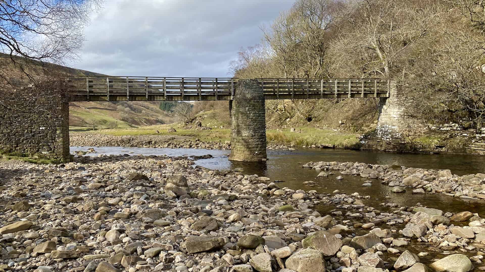
The Yorkshire Dales is one of England’s most distinctive upland landscapes, known for its broad green valleys, high moorland, limestone scars, waterfalls, caves, field barns and dry stone walls. It is a place shaped by both nature and people, where glacial valleys, traditional farming and centuries-old tracks have created a landscape that feels open, historic and deeply rural. For walkers, this variety is what makes Yorkshire Dales walks so rewarding, with routes ranging from gentle riverside strolls to high-level hikes across some of the best-known hills in northern England.
The character of the Dales changes from one valley to the next. Wharfedale, Wensleydale, Swaledale, Ribblesdale, Dentdale, Littondale and Malhamdale all have their own atmosphere, shaped by different rivers, villages, rock formations and farming traditions. Some walks follow quiet lanes and meadow paths between stone-built settlements, while others climb onto exposed fells, cross open moorland or pass through dramatic limestone scenery.

ADVERTISEMENT
Geography and Landscape
The Yorkshire Dales National Park landscape is defined by its valleys, known locally as dales, many of which were enlarged and shaped by ice during the last glaciation. The result is a mixture of broad U-shaped valleys, narrower side valleys, steep slopes and high plateaus. Rivers and streams run through the dales, creating a landscape of meadows, pastures, waterfalls and wooded gills.
The National Park includes some of the finest limestone scenery in Britain. In places such as Malhamdale, Ribblesdale and the Ingleborough area, the landscape is marked by limestone pavements, scars, gorges and underground cave systems. Elsewhere, heather moorland and rough grazing dominate the higher ground, giving the Dales their open, spacious character.
This variety makes the area especially appealing for walkers. Many Yorkshire Dales walks combine several landscapes in one route, moving from valley-bottom paths to limestone terraces, upland farms, open fell and quiet villages. The scenery often changes quickly, so even a moderate circular walk can feel rich and varied from start to finish.

ADVERTISEMENT
Dales, Rivers and Villages
The dales themselves are among the great pleasures of the area. Wharfedale follows the River Wharfe through well-loved villages such as Kettlewell, Starbotton, Buckden, Grassington and Burnsall. Wensleydale, one of the few dales not named after its river, is associated with the River Ure and includes places such as Hawes, Bainbridge, Askrigg, Aysgarth and Middleham. Swaledale, further north, is famous for its stone barns, hay meadows and the River Swale, which flows through Muker, Keld, Gunnerside, Reeth and Richmond.
Many of the villages are built from local stone and sit naturally within the surrounding landscape. Their narrow lanes, village greens, bridges, churches, pubs and old farm buildings help give the Dales their strong sense of place. They also make excellent starting points for Yorkshire Dales walks, with footpaths often leading directly from the village into meadows, woodland, riverside paths or the open fell above.
The rivers are central to the character of the Dales. The Wharfe, Swale, Ure, Ribble, Aire and Lune all help shape the valleys they pass through. Along their banks, walkers will find stepping stones, packhorse bridges, waterfalls, old mills and peaceful stretches of meadow. These riverside paths provide some of the most accessible and atmospheric walking in the national park.

ADVERTISEMENT
Limestone, Caves and Waterfalls
Limestone is one of the defining features of the Yorkshire Dales. Over millions of years, water has shaped the rock into pavements, cliffs, potholes, caves and underground streams. Limestone pavements are especially distinctive, with flat blocks known as clints separated by deep cracks called grykes. These sheltered crevices support a range of plants, including ferns and wildflowers, while the surrounding open limestone grassland creates a very different habitat.
Some of the most dramatic limestone scenery can be found around Malham, where Malham Cove, Gordale Scar and Janet’s Foss form one of the best-known walking areas in the Dales. In Ribblesdale and around Ingleborough, the landscape becomes wilder and more expansive, with caves, potholes and high limestone scars forming part of several memorable Yorkshire Dales walks.
The area is also famous for its waterfalls. Aysgarth Falls, Hardraw Force, Janet’s Foss, Ingleton Falls and the waterfalls around Keld are among the best known, but many smaller falls and cascades can be found throughout the dales. These features add movement, sound and drama to the landscape, especially after rain when streams and rivers are in full flow.

Wildlife and Nature
The Yorkshire Dales supports a rich variety of habitats, from hay meadows and limestone pavement to blanket bog, heather moorland, woodland, rivers and upland pasture. Flower-rich hay meadows are one of the great seasonal highlights, particularly in places such as Swaledale, Langstrothdale, Ribblesdale and upper Wharfedale. In late spring and early summer, these meadows can be full of colour, with traditional farming helping to maintain their biodiversity.
The moorlands and upland pastures are important for birds such as curlew, lapwing, golden plover, redshank and skylark. Black grouse can also be found in some areas, while peregrines, buzzards and red kites may be seen overhead. Along rivers and streams, walkers may spot dippers, grey wagtails and herons, with woodland and hedgerows supporting a wide range of smaller birds and mammals.
The Yorkshire Dales National Park is also recognised for its dark skies. Away from towns and major roads, the lack of light pollution makes the area one of the best places in England for stargazing. This adds another dimension to the landscape, especially in autumn and winter when clear nights can reveal bright stars, planets and the Milky Way.

ADVERTISEMENT
Walking Routes and Trails
Walking is one of the best ways to experience the Yorkshire Dales. The National Park has an extensive network of public footpaths, bridleways, lanes and open access land, allowing walkers to explore both the famous places and the quieter corners of the region. Many Yorkshire Dales walks are circular, making use of old tracks, riverside paths, field paths and moorland routes.
The Yorkshire Three Peaks are among the most famous walking challenges in the area. Pen-y-ghent, Ingleborough and Whernside can each be climbed as individual walks, while the full Three Peaks route links all three in a demanding 24-mile circuit. These hills form some of the most recognisable skylines in the Dales and attract walkers from across the country.
Several long-distance trails also pass through the Yorkshire Dales. The Pennine Way crosses the national park on its journey from the Peak District to the Scottish Borders, passing places such as Malham, Horton in Ribblesdale, Hawes and Keld. The Dales Way runs from Ilkley to Bowness-on-Windermere, following riverside paths through Wharfedale and beyond. Other routes, including the Pennine Bridleway, Dales High Way, Lady Anne’s Way and Coast to Coast Path, add to the area’s strong walking tradition.

Heritage, Farming and Culture
The Yorkshire Dales is a living landscape, shaped over many centuries by farming, mining, quarrying, religion, trade and rural settlement. Dry stone walls and field barns are among its most recognisable features, creating the patchwork pattern seen across many hillsides and valley floors. In Upper Swaledale, the pattern of barns and walls is considered one of the most distinctive agricultural landscapes in western Europe.
Farming remains central to the identity of the Dales. Sheep and cattle grazing, hay making and traditional meadow management all help maintain the character of the countryside. Local breeds such as Swaledale sheep are closely associated with the area, while Wensleydale has a long connection with cheese making. Agricultural shows, livestock marts and village events continue to play an important role in local life.
The Dales also has a rich industrial and social history. Lead mining, lime burning, quarrying, textile production and railway building have all left traces in the landscape. Old mine workings, lime kilns, packhorse routes, bridges, viaducts and former railway lines can still be seen on many Yorkshire Dales walks. Together, these features tell the story of a landscape that is not only beautiful, but also deeply connected to the people who have lived and worked here for generations.

ADVERTISEMENT
ADVERTISEMENT